Free Printable Map Download Archive
Find printable maps for countries, regions, and administrative areas around the world. Green Map provides color maps, black and white maps, and outline maps for classroom use, presentations, blog graphics, infographic projects, and editing work.
Africa Maps
Recently added printable map resources in the Africa category.
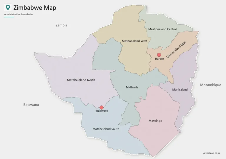
Printable Zimbabwe Map Files for Education and Presentations
A Zimbabwe map download is useful when you need a clear visual reference for southern Africa, inland country...
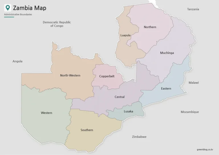
Printable Zambia Map Collection for Classrooms and Presentations
A Zambia map download is useful when you need a clear visual reference for southern Africa, inland country...
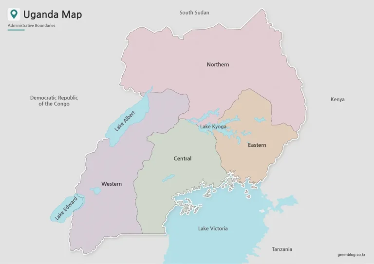
Uganda Map Collection – Color, Black and White, Outline
The Uganda map in this collection was prepared for users who need a clear printable reference for East...
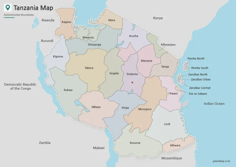
Tanzania Map with Regional Boundaries – High Resolution A3 Layout
The Tanzania map collection was prepared as a practical printable resource for users who need a clear visual...
Asia Maps
Recently added printable map resources in the Asia category.
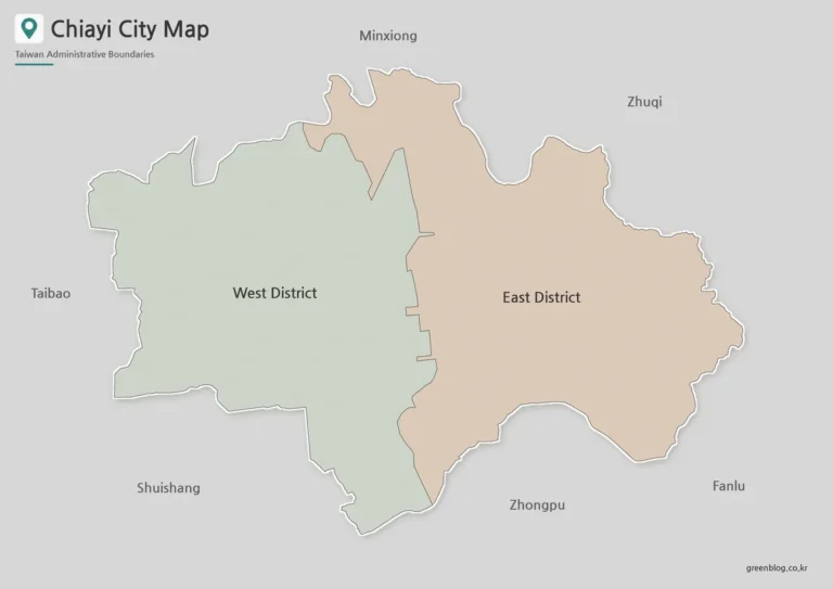
Printable Chiayi City Map in Color, Black and White, and Outline
A Chiayi City map is especially useful when comparing Chiayi City with the much larger Chiayi County that...
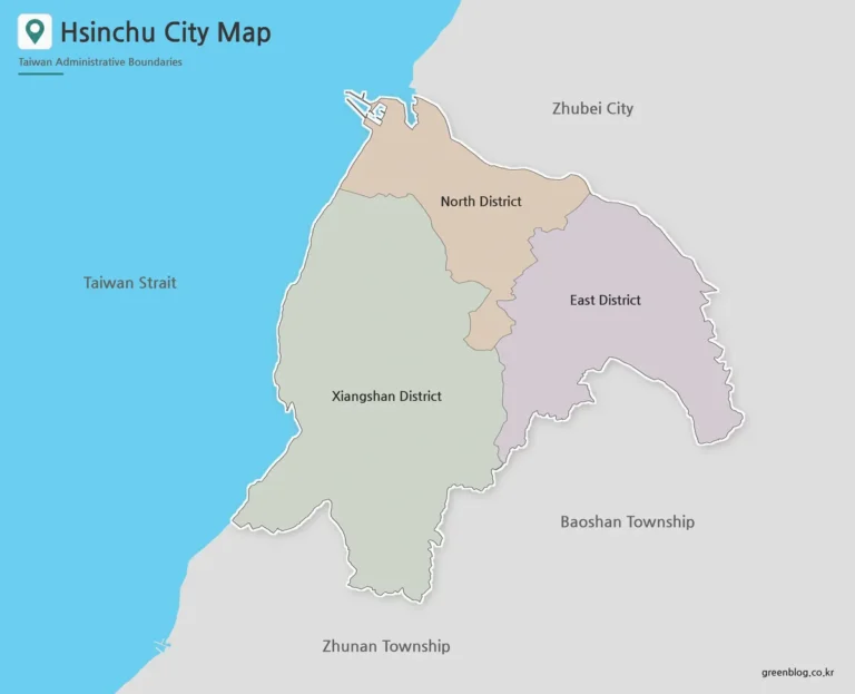
Hsinchu City Map: Printable District Maps and Outline Versions
The Hsinchu City map collection is designed for readers who need a clear view of the city’s three...
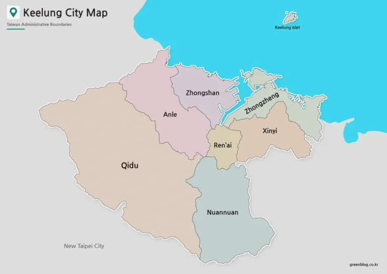
Keelung City Map|Seven Districts, Harbor Layout, and Keelung Islet
A Keelung City map is useful when you need more than a simple location marker for northern Taiwan....
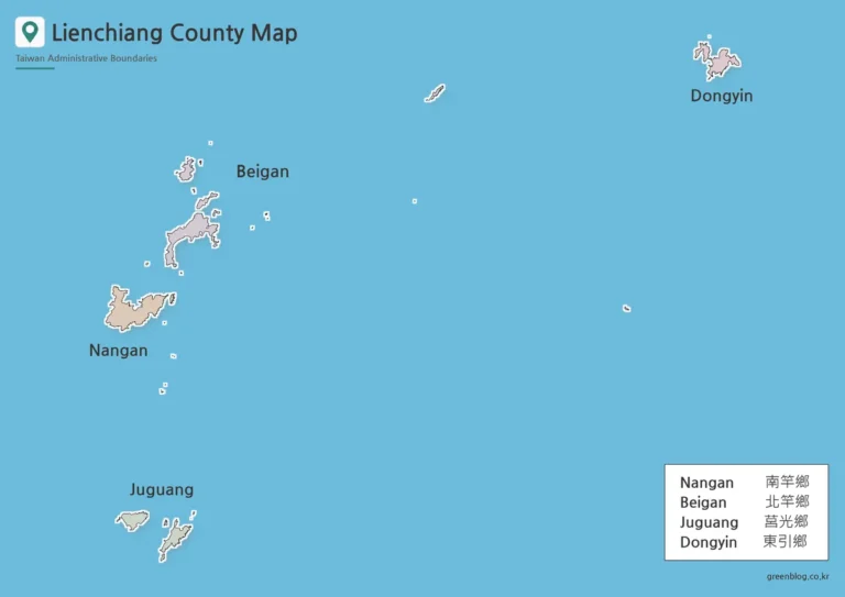
Lienchiang County Map|Printable Matsu Islands Collection
A Lienchiang County map is especially useful when you need to explain a part of Taiwan that does...
Europe Maps
Recently added printable map resources in the Europe category.
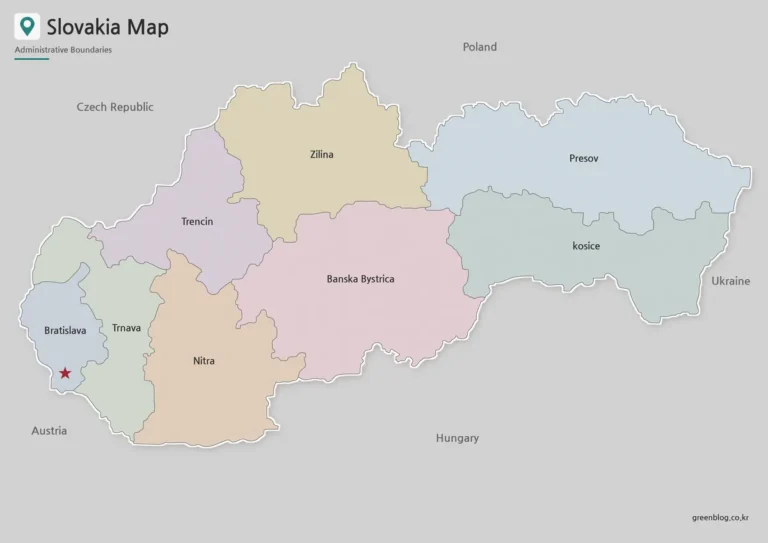
Printable Slovakia Map Collection for Classroom and Design Use
A Slovakia Map is useful when you need a clean visual reference for this landlocked country in Central...

Serbia Map Download – Printable Color, Black and White, and Outline Maps
A Serbia Map is useful when you need a clear visual reference for the central Balkan region rather...
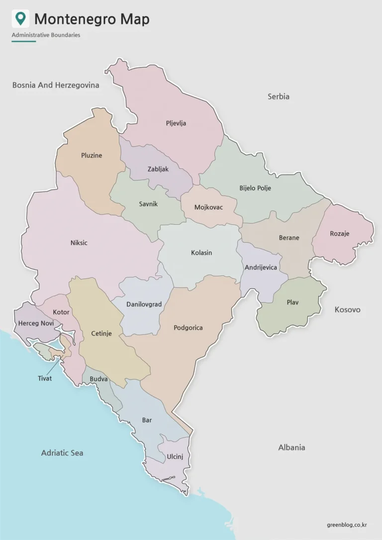
Montenegro Map Download – Labeled, Basic, and Blank Outline Maps
This Montenegro Map collection includes color, black and white, and outline versions created for printing, classroom reference, presentation...
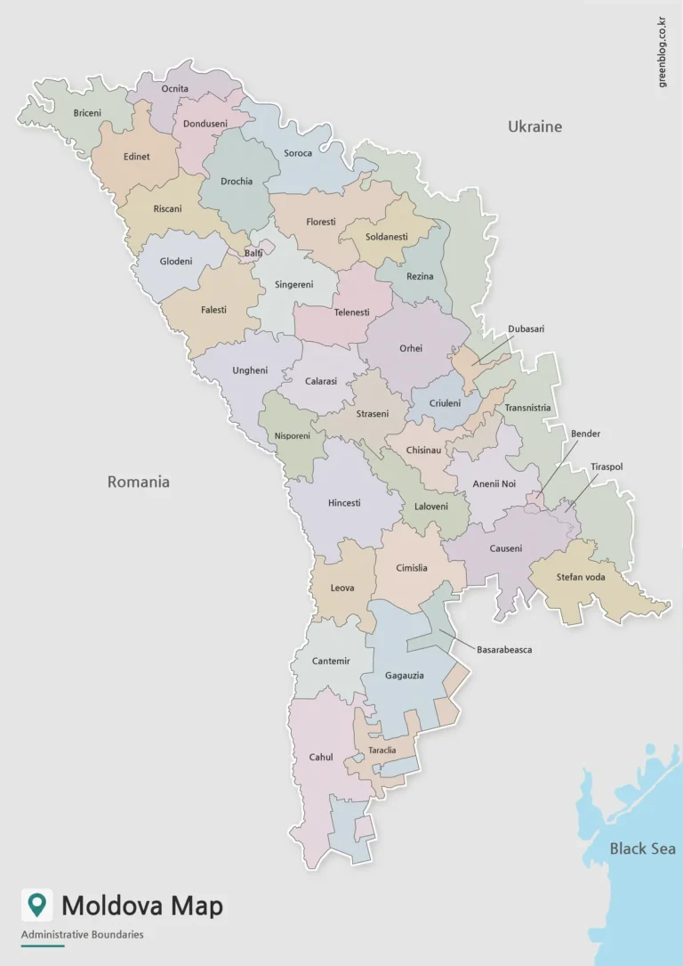
Moldova Map Download – Printable Country Map Collection
A Moldova Map is useful when you need more than a small country outline on a general Europe...
North America Maps
Recently added printable map resources in the North America category.
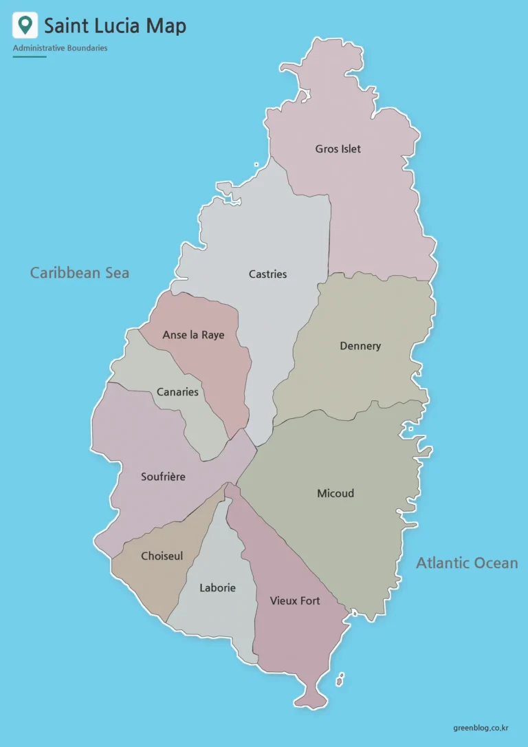
Saint Lucia Map – Printable District and Outline Maps
Saint Lucia Map files are useful when a simple island location graphic is not enough. Saint Lucia is...
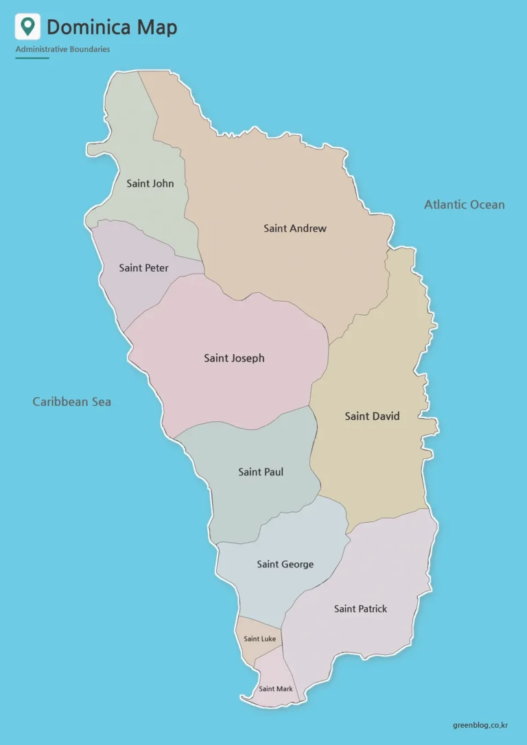
Dominica Map: Printable Administrative Maps and Flag
The Dominica map collection is designed for readers who need a clear view of this small Caribbean island...
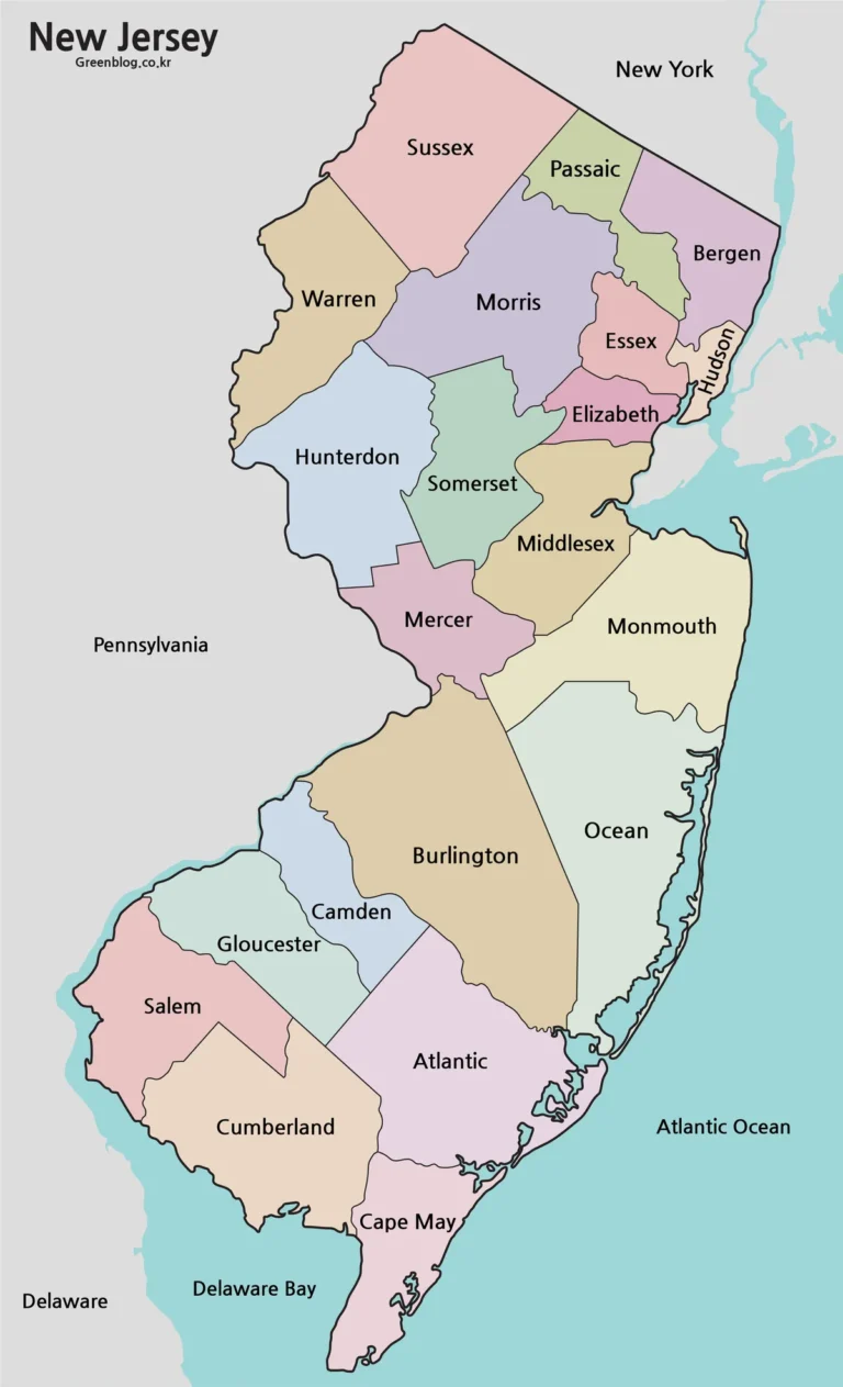
New Jersey Map Download: Printable County Maps in Three Styles
A New Jersey map is especially useful when explaining the dense urban corridor between New York City and...
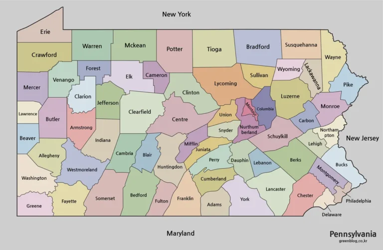
Pennsylvania Map Collection for A3 Printing and Presentations
A Pennsylvania map is often more useful than a full United States map when the goal is to...
Oceania Maps
Recently added printable map resources in the Oceania category.
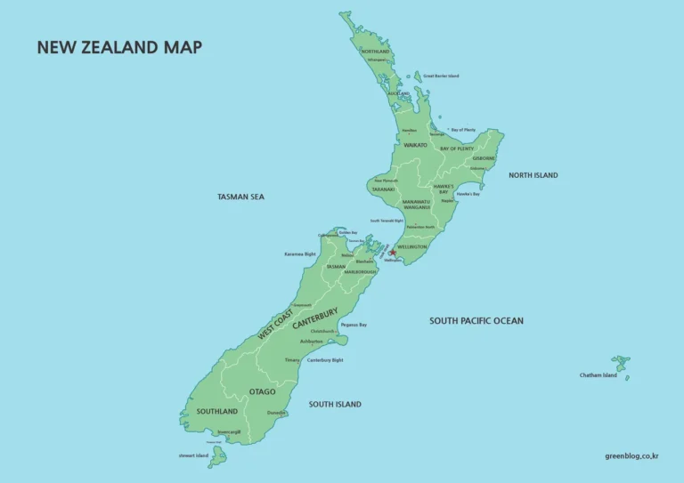
New Zealand Maps Download Collection Featuring 3 Distinct Visual Styles
Explaining New Zealand through text alone often leaves gaps. With two main islands and several surrounding islands, it...
South America Maps
Recently added printable map resources in the South America category.
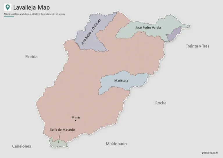
Lavalleja Map – Printable Municipal and Outline Maps
Lavalleja Map files are useful when a simple location marker is not enough to explain how this inland...
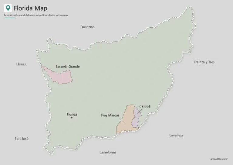
Florida Department Map | Printable Uruguay Map
A Florida Department Map helps explain a part of Uruguay that is difficult to understand from place names...
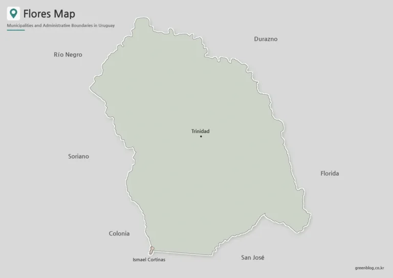
Flores Department Map with Trinidad and Ismael Cortinas
A Flores Department Map is more useful when it shows more than the department outline. Flores lies in...
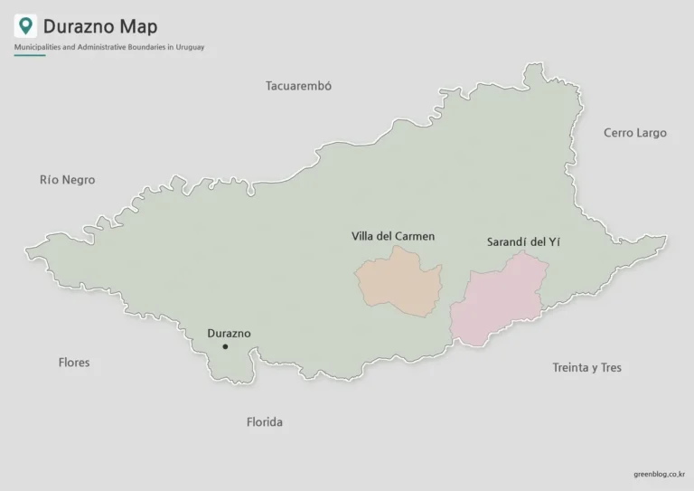
Durazno Map with Municipal Boundaries and Nearby Departmen
The Durazno Map in this collection is designed to make the department’s central position in Uruguay easier to...
How to Use These Map Resources
Green Map provides printable map resources for classroom materials, presentation slides, blog graphics, travel content, administrative area explanations, and graphic editing projects. Color maps are useful for visual regional comparison, black and white maps work well for documents and printing, and outline maps are suitable for custom editing, coloring, and infographic work.