A Korean version of this map page is available. View Korean Page
This Montenegro Map collection includes color, black and white, and outline versions created for printing, classroom reference, presentation slides, blog graphics, and editable map projects. The maps are arranged in a clean vertical layout to match Montenegro’s long north–south shape, making it easier to read the country’s administrative structure without crowding the page.
Montenegro is a small country in southeastern Europe, located on the Balkan Peninsula along the Adriatic Sea. It borders Bosnia and Herzegovina, Serbia, Kosovo, and Albania, which makes a clear map especially useful when explaining regional relationships in the western Balkans. A simple location description is often not enough, because the country’s shape, coastal edge, inland mountain areas, and neighboring borders all affect how the map is understood visually.
While preparing this map collection, the layout was simplified to focus on administrative boundaries and the overall national form. Roads, detailed terrain, and small map elements were intentionally left out so the final image would remain clean for printing and presentation use. The map was designed in Illustrator, with color adjustment completed in Photoshop. Extra attention was given to label readability, boundary visibility, and the vertical balance of the A3 layout.
The included versions are intended for different types of users. Teachers can use the labeled map in geography lessons, students can print the basic version for assignments, bloggers can add it to travel or regional articles, and designers can use the outline map as a base for infographic work. Each version keeps the structure simple enough to scan quickly while still showing the shape and administrative layout of Montenegro clearly.
Table of Contents
Montenegro Map Overview
The Montenegro Map is designed as a practical visual reference rather than a detailed road or tourism map. It focuses on the country’s outer shape, administrative divisions, surrounding countries, and readable labeling. Because Montenegro is relatively narrow and vertically shaped, the map works better in a portrait-style layout than a wide horizontal layout.
Neighboring countries such as Albania, Kosovo, Serbia, and Bosnia and Herzegovina are shown in a simplified way so users can understand Montenegro’s location without making the image visually crowded. This helps when the map is used in regional comparison materials, Balkan travel presentations, European geography worksheets, or blog articles that need a clean country reference image.
Included Map Versions
This printable map set includes three main versions:
- Color administrative map
- Black and white basic map
- Blank outline map
Each version was created for a different purpose. The color map is better for quick regional recognition, the black and white map is better for printed documents, and the outline map works well as a base for editing, coloring, or adding custom information.
Color Montenegro Administrative Map
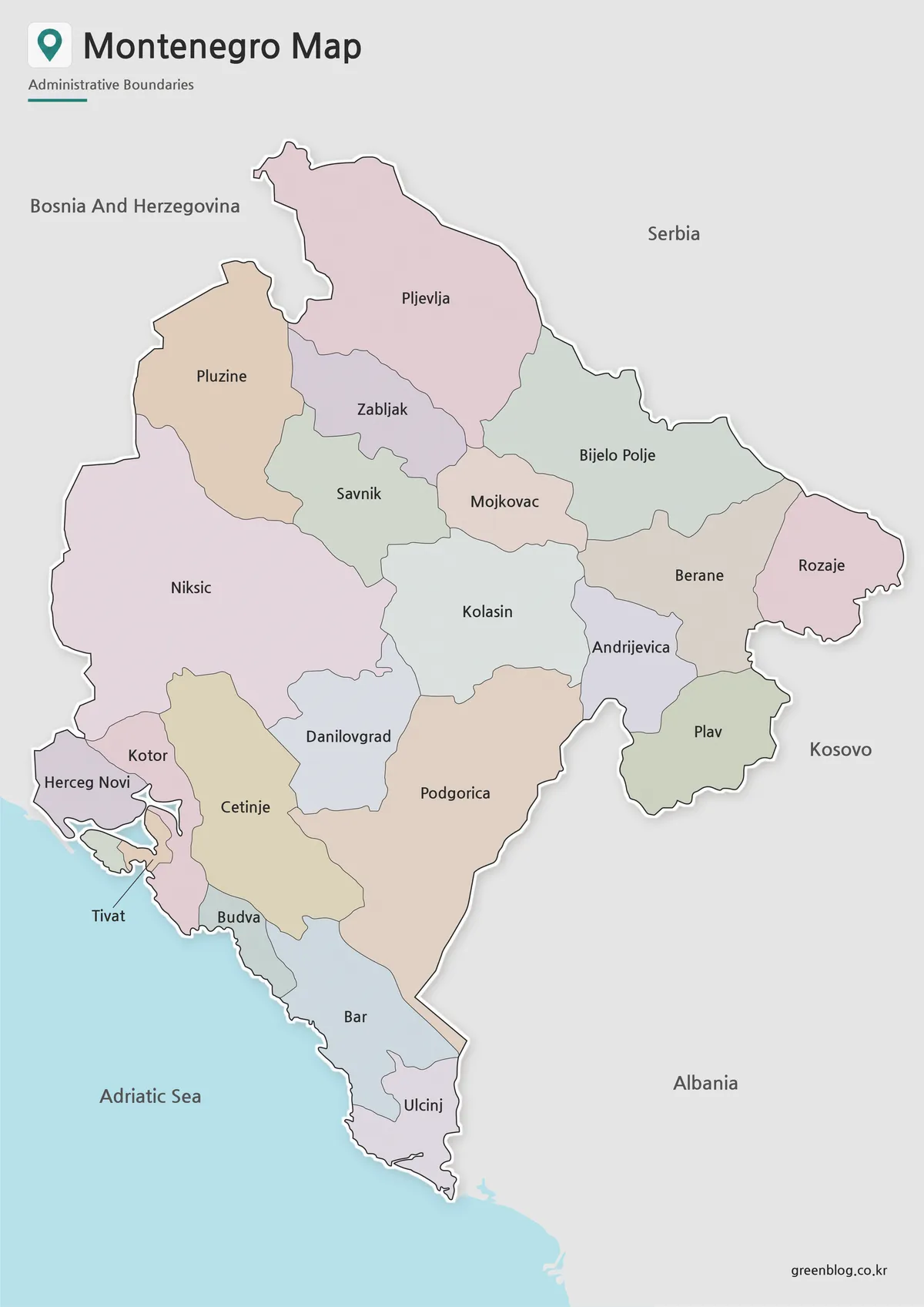
The color Montenegro Map helps readers understand the country’s administrative layout at a glance. Because Montenegro has a narrow vertical shape with both coastal and inland areas, the color separation makes each region easier to compare without making the map feel crowded.
This version works well for presentation slides, classroom geography materials, travel blog graphics, and regional comparison posts. The surrounding country names are kept simple so that Montenegro remains the main focus, while still giving enough context to understand its position in the Balkans.
The color map is especially helpful when explaining Montenegro together with Albania, Serbia, Kosovo, or Bosnia and Herzegovina. Instead of showing every small geographic detail, the map keeps attention on the administrative structure and national outline.
Black and White Printable Version
The black and white version removes the regional color fills and keeps the layout cleaner for printing. This makes it easier to use in reports, worksheets, handouts, and documents where strong colors may distract from the labels or increase ink use.
Because Montenegro’s map is vertically arranged, label spacing and boundary contrast matter more than decorative design. The simplified layout helps the names remain readable when printed on A3 paper or inserted into a document. It is also a good option for users who want a more neutral visual style for school materials, reference sheets, or printed study resources.
This version can also be used as a base map when users want to highlight only a few locations manually. For example, a teacher may mark the capital city, a student may add neighboring country notes, or a designer may add route lines for a travel-related graphic.
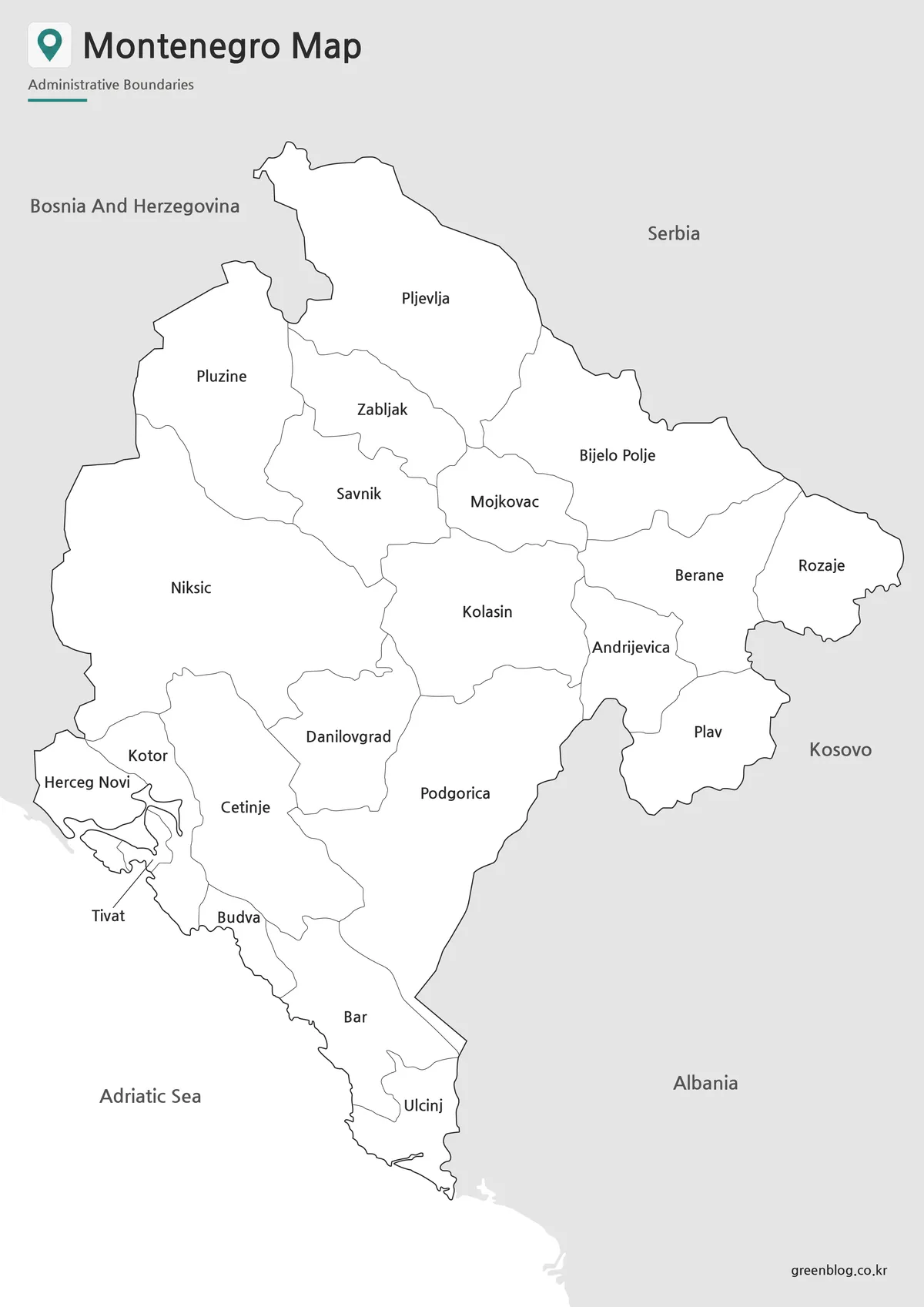
Blank Montenegro Outline Map for Editing
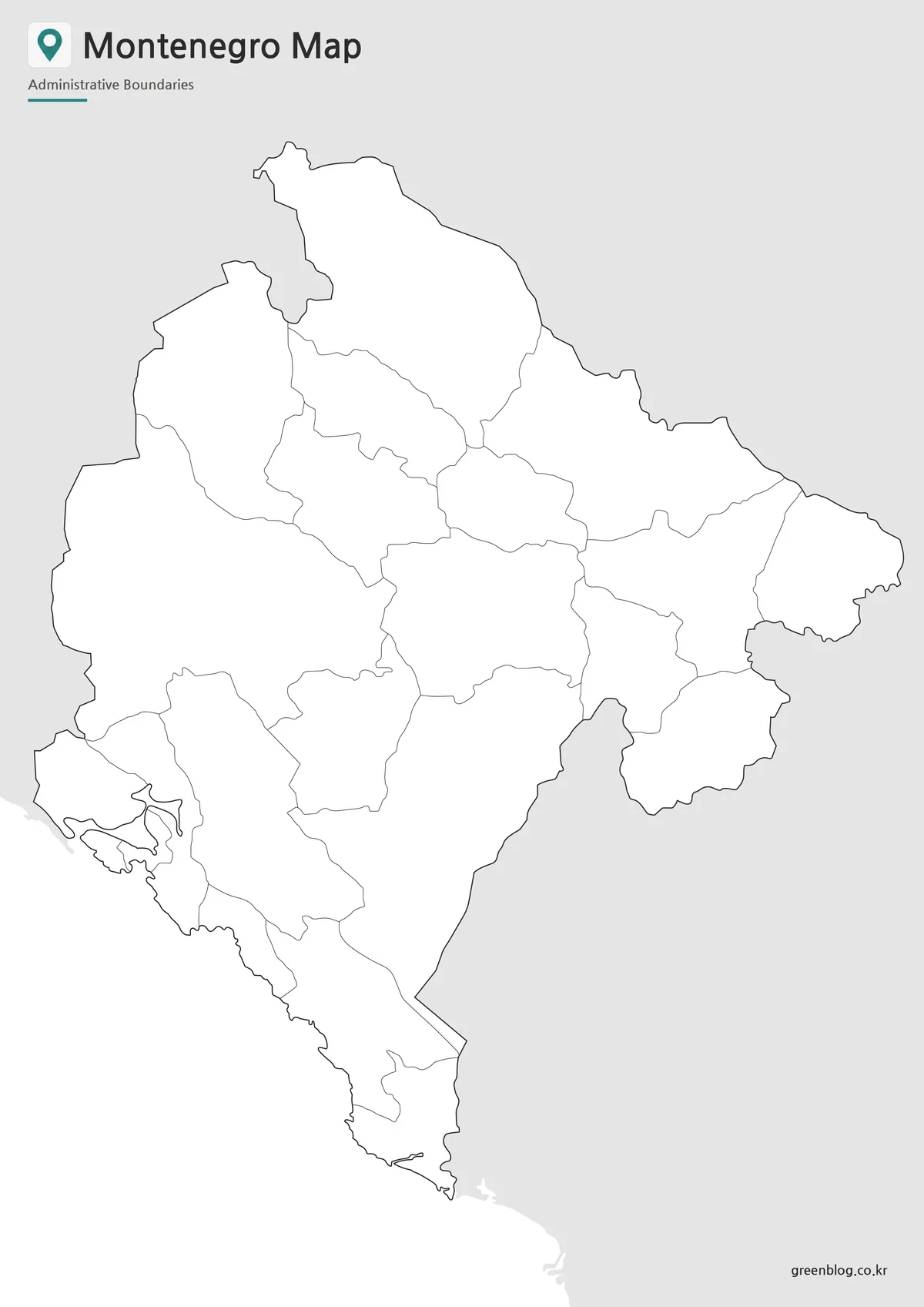
The outline map removes both color and text, leaving only the boundary structure. This makes it the most flexible version in the set. It can be used for graphic editing, classroom coloring activities, infographic layouts, regional comparison projects, or custom presentation visuals.
Users can add markers for Podgorica, coastal travel routes, tourism points, population notes, or regional data. The blank structure is also useful when creating educational worksheets where students need to identify regions or label neighboring countries themselves.
The outline version was checked so that the boundary lines remain clean and easy to follow. Since it is prepared at A3 size, it can be enlarged for editing or printed as a worksheet without losing the basic clarity of the lines.
Montenegro Flag
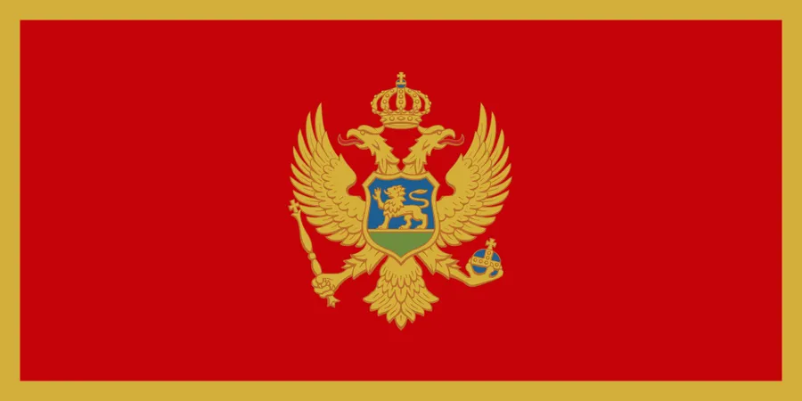
A Montenegro flag image can be used together with the map when creating country comparison materials, classroom slides, or travel-related graphics. Pairing a map with a national flag makes the country easier to identify at a glance, especially when several Balkan countries are shown in the same project.
For blog thumbnails, presentation covers, or educational cards, the flag can work as a small visual element beside the map. It helps users connect the country name with a recognizable symbol while keeping the main focus on the map itself.
Practical Uses for This Montenegro Map
This Montenegro Map collection can be used in many types of visual and educational projects. For classroom use, the labeled version is suitable for geography lessons, country reports, and Balkan Peninsula study materials. The black and white version works well for printed handouts, while the outline version can be used for coloring, labeling, or map-based exercises.
For bloggers and content creators, the maps are useful when writing about Montenegro travel, Adriatic coast destinations, Balkan geography, or European country comparisons. Designers can use the blank outline version as a base for infographics, route maps, regional highlights, or simple presentation graphics.
The map is not intended to replace a detailed navigation service. Instead, it is designed as a clear printable reference for users who need to explain the country’s shape, administrative divisions, and surrounding location in a simple visual format.
Frequently Asked Questions
Is this Montenegro Map suitable for A3 printing?
Yes. This Montenegro Map was prepared with A3 printing in mind, so it works well for classroom materials, presentation boards, and printed reference sheets.
Does the Montenegro Map include roads or tourist attractions?
No. The map focuses on the country shape and administrative boundaries. Leaving out roads and detailed tourism markers keeps the design cleaner and easier to use for general reference.
Which version is best for classroom use?
The black and white version is usually best for printed handouts, while the outline version works well for coloring activities, labeling exercises, and geography worksheets.
Can I use the outline map for editing?
Yes. The blank outline version is designed for adding custom labels, colors, routes, city markers, or infographic data.
Why is the map arranged vertically?
Montenegro has a long north–south shape, so a vertical layout helps show the full country more naturally and improves readability on an A3 page.
Download Information
Choose the version that fits your project. The collection includes color, black and white, and outline map styles, so you can use the file for printing, classroom materials, presentation slides, or editing work.
Download Montenegro Map
This download includes printable Montenegro map versions for educational use, presentation design, document printing, and editable graphic projects.
- Included Versions: Color map, black and white map, outline map
- Printable Size: A3 layout
- File Type: Image files
- Intended Use: Classroom handouts, presentations, blog graphics, infographic editing, and printable reference materials
Related Maps
- Moldova Map Download – Printable Country Map Collection
- Estonia Map Download for Printing, Classroom Use, and Graphic Editing
- Free Norway Map Collection with Color, Labeled and Outline Versions
- Greece Map Download Pack – Printable Regional and Outline Maps
Additional Resources
- Geoportal Montenegro – National Geoportal : Montenegro’s official geoportal provides interactive spatial data and map-related information from national institutions.
Green Map creates custom-edited map images using open geographic data sources such as geoBoundaries, Natural Earth, OpenStreetMap, and government open data.
These maps are edited visual materials, not raw data files, and are provided for education, documents, presentations, and graphic reference.