A Korean version of this map page is available. View Korean Page
A Montana State Map is useful when you need to explain one of the largest and most visually distinctive states in the northwestern United States. Montana borders Idaho to the west, Wyoming to the south, North Dakota and South Dakota to the east, and Canada to the north. Because the state stretches widely from the Rocky Mountain region in the west to open plains in the east, a simple location marker is often not enough for classroom materials, travel content, or regional comparison projects.
This printable Montana State Map collection includes three versions: a color map, a basic labeled map, and a blank outline map. The files are prepared in JPG, PNG, and ZIP formats and designed around an A3 high-resolution layout. They can be used for classroom handouts, presentation slides, blog graphics, travel planning materials, printable worksheets, and editable design projects.
Montana covers about 380,000 square kilometers, making it one of the largest states in the United States by area. Its population is relatively small compared with its land size, so the state map has a very different feel from compact urban states. Billings is an important economic center, while Glacier National Park and the Rocky Mountains make the western part of the state especially familiar in travel and geography content.
During the map design process, the horizontal layout was important. Montana spreads widely from east to west, so a landscape-style map gives a more natural view of the state’s full shape. County boundaries, neighboring states, and the Canada border were arranged to help users understand both the internal county layout and the wider regional position.
Table of Contents
Montana State Map Overview
This Montana State Map is designed as a practical reference map rather than a road map. It focuses on county boundaries, labels, and the overall state shape, making it useful for education, printing, presentations, and graphic editing.
Included versions:
- Color Montana State Map
- Basic labeled Montana State Map
- Blank Montana outline map
- JPG / PNG / ZIP files
- A3 high-resolution layout
The color version is best for quick visual comparison. The basic version works well for printing and reports. The outline version gives users a clean base for adding their own colors, routes, labels, or data points.
Color Montana State Map for Regional Comparison
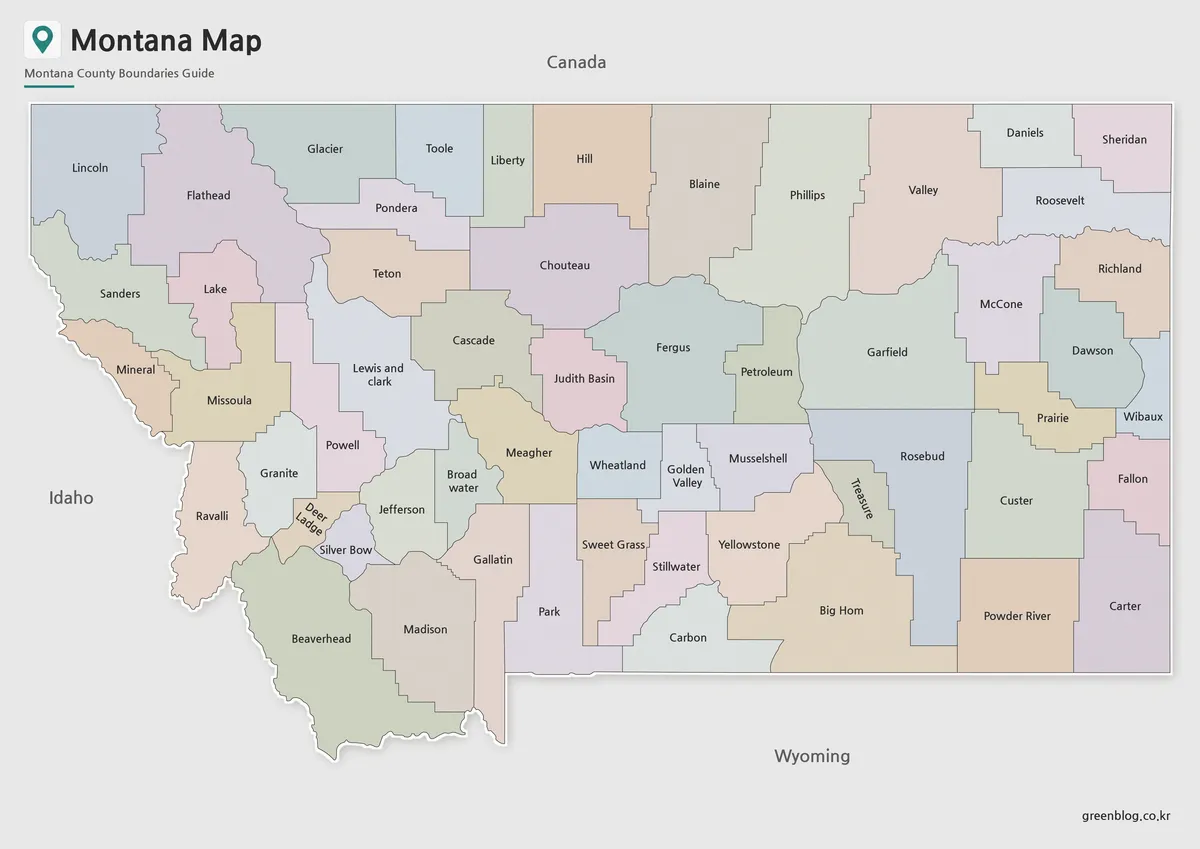
Montana’s wide east-west shape makes color separation especially helpful. County boundaries cover a broad area, and without color contrast the state can look visually flat, especially in printed materials or presentation slides.
The color Montana State Map was prepared to make county areas easier to compare across the state. Western Montana, with its mountain and national park context, has a different visual role from the more open eastern plains, so the color version helps readers separate regions quickly. Neighboring states and the Canada border are also included as reference points, which makes the map more useful for U.S. regional comparison materials.
While preparing the map, the color balance was adjusted so labels would remain readable. Very strong colors can make county names harder to see, so the final layout keeps the map clear enough for both screen viewing and larger print use.
Basic Montana State Map for Printing
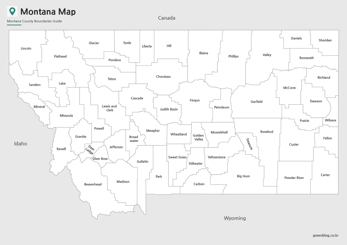
For reports, study sheets, and classroom handouts, the basic map gives a cleaner look than the full color version. County names and boundary lines remain the main focus, making it easier to place the map beside text, charts, or assignment instructions.
This version is especially useful when users want to mark locations by hand. Travel routes, park areas, county comparisons, or selected regions can be added without competing against background colors. Because Montana has a large land area, the simplified layout also works well for printed reference sheets and presentation boards.
The label size was checked with A3 printing in mind. County names need enough room to remain readable across the wide state shape, so the map was arranged to avoid unnecessary crowding.
Blank Montana Outline Map for Editing
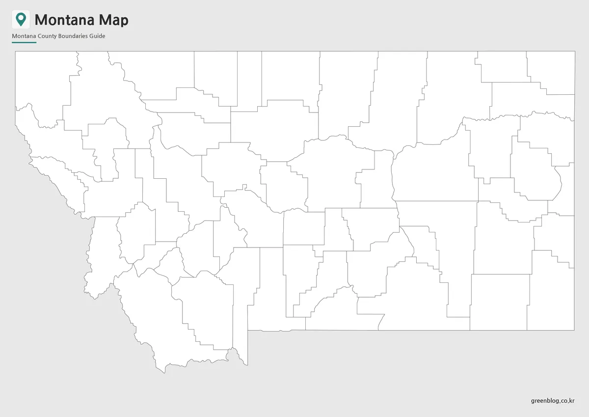
The blank outline version removes color fills and labels, leaving a clean working base map. It is the most flexible option for users who want to build their own custom visual material.
Teachers can use it for classroom coloring activities or U.S. state geography worksheets. Designers can add county colors, arrows, icons, population data, tourism points, or regional highlights. Travel writers can mark Glacier National Park, Rocky Mountain areas, or route ideas without needing to erase existing labels.
Because Montana is often used in geography lessons about large western states, the outline map works well for comparing land area, population density, natural regions, and neighboring states. It gives enough structure to show the state shape while leaving room for custom editing.
When a Montana State Map Is Useful
A Montana State Map is helpful in more situations than simple state identification. Teachers may use it to explain U.S. western geography, students may include it in state reports, and bloggers can use it when writing about national parks, road trips, or rural regions.
It is also useful for comparing Montana with nearby states such as Idaho, Wyoming, North Dakota, and South Dakota. Because the state is large but sparsely populated, the map can help explain why distance, landscape, and regional layout matter when discussing Montana.
For travel and outdoor content, the map gives readers a quick way to understand where mountain areas, plains, and border regions sit in relation to one another. For education and infographic projects, the outline and basic versions are easier to customize than a finished decorative map.
Frequently Asked Questions
What is included in this Montana State Map collection?
The collection includes a color map, a basic labeled map, and a blank outline map of Montana.
Is this Montana State Map suitable for A3 printing?
Yes. The map was prepared around an A3 high-resolution layout, making it suitable for classroom handouts, reports, and presentation materials.
Which version is best for editing?
The blank outline map is the best choice for editing. It gives users a clean base for adding colors, labels, routes, markers, or data.
Why is the Montana map shown in a horizontal layout?
Montana extends widely from east to west, so a horizontal layout shows the state shape more naturally than a vertical format.
Can I use the map for travel content?
Yes. The map works well for travel articles, national park references, road trip planning, and regional explanation pages.
Montana State Map Download
Download the Montana State Map collection with color, basic, and outline versions. The files are prepared for printing, classroom reference, travel planning, presentation slides, blog graphics, and editing projects.
- File Format: JPG / PNG / ZIP
- Included Versions: Color Map / Basic Map / Outline Map
- Printable Size: A3 high-resolution layout
- Intended Use: Classroom materials, presentations, travel content, blog images, infographic editing
Additional Resources
- State of Montana Official Website : A useful official starting point for Montana state information, public services, and map-related resources.
Related Maps
- Kansas Map Download – Printable County Map Collection
- High Resolution North Dakota Map for Classroom, Presentation and Design Projects
- Arkansas Map Collection: Printable County Maps in Color, Labeled, and Outline Formats
- Arizona State Map Download Collection (Color, Labeled & Outline Maps)
Green Map creates custom-edited map images using open geographic data sources such as geoBoundaries, Natural Earth, OpenStreetMap, and government open data.
These maps are edited visual materials, not raw data files, and are provided for education, documents, presentations, and graphic reference.