This Arizona State Map turns a familiar southwestern silhouette into a county-by-county reference. Arizona appears nearly rectangular along its northern and eastern edges, but the Colorado River shapes much of the western side and the international boundary runs diagonally along the south. Those features make the state easy to recognize even before any county name is read.
The supplied labeled artwork identifies all 15 counties, from Mohave in the northwest to Cochise in the southeast. It is an administrative map rather than a city or physical map: there is no point for Phoenix, no county seats, roads, rivers, terrain shading, scale bar, or north arrow. That narrow scope is useful when the task is to compare county shapes without competing symbols.
The collection provides three portrait images: a pastel county reference, a black-and-white labeled sheet, and an unlabeled boundary version. Each Arizona State Map preview is approximately 1200 × 1696 pixels and uses the same geometry, so a completed reference can sit beside a blank exercise without the county positions changing. The downloadable archive groups the versions for A3 printing, lessons, reports, and custom visual work.
Table of Contents
Map Collection Overview
The northern tier contains Mohave, Coconino, Navajo, and Apache counties. Coconino occupies the broad north-central area, while Navajo and Apache form tall blocks toward the east. Yavapai sits below Coconino, and the slim western county of La Paz follows the lower side of Mohave. These unusually large northern shapes contrast with the tighter pattern found farther south.
Central Arizona is organized around Maricopa, Pinal, and Gila. Maricopa has a broad, irregular outline west of Gila, and Pinal stretches beneath both. Graham and the narrow north–south shape of Greenlee continue the sequence toward the eastern edge. The Arizona State Map shows their boundaries and names, but it does not place Phoenix inside Maricopa or identify any other municipality.
Yuma occupies the southwest corner, Pima spans much of the south-central border area, and Cochise anchors the southeast. Small Santa Cruz sits between Pima and Cochise along Mexico. The contrast between compact Santa Cruz and expansive Coconino is one of the clearest county-size comparisons on the page, although the map supplies no area statistics.
Utah, Nevada, and Mexico are named outside the state. California also appears west of Arizona, but the label in both completed versions is visibly misspelled as “Colifornia.” New Mexico shares Arizona’s eastern border yet is not labeled. These are properties of the supplied artwork, so accompanying text should use the correct spelling and should not imply that every neighboring jurisdiction is named.
Regional Color Map
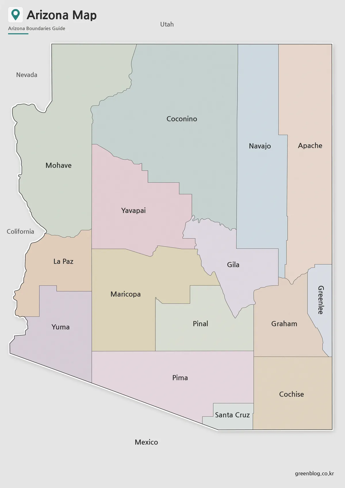
The color Arizona State Map gives every county a pastel fill, making shared boundaries easier to trace. Coconino’s peach area, Mohave’s pale green shape, and the four differently colored counties across the northeast can be separated at a glance. The central cluster is also easier to follow where Maricopa, Yavapai, Gila, and Pinal meet.
The palette is categorical only. It does not encode population, elevation, political results, climate, or any other measurement, and no statistical legend is included. For a presentation, the colors work best as visual separators; any data layer added later needs its own source, date, color key, and explanatory title.
Best Uses
- Introducing the positions of Arizona’s 15 counties
- Comparing the broad northern counties with smaller southern units
- Building a county reference slide or report figure
- Preparing a visual answer key for a labeling activity
Black and White Printable Version
The monochrome Arizona State Map retains every county label and the surrounding place names while replacing the pastel fills with white interiors. Dark county lines remain distinct from the lighter gray land outside Arizona. This version is a practical reference when a printer, photocopier, or report template does not need color.
Because the labels are already present, the sheet can serve as a study guide or answer key rather than a blank test. Users can still circle counties, add numbers, or shade selected regions by hand. On a reduced print, check the narrow Greenlee label and compact Santa Cruz area first, as those are the places most likely to lose legibility.
Ideal For
- Low-color classroom handouts and answer sheets
- County-name review before a blank-map exercise
- Reports that require a neutral administrative reference
- Manual highlighting of one or more counties
Arizona State Map Outline Version for Editing
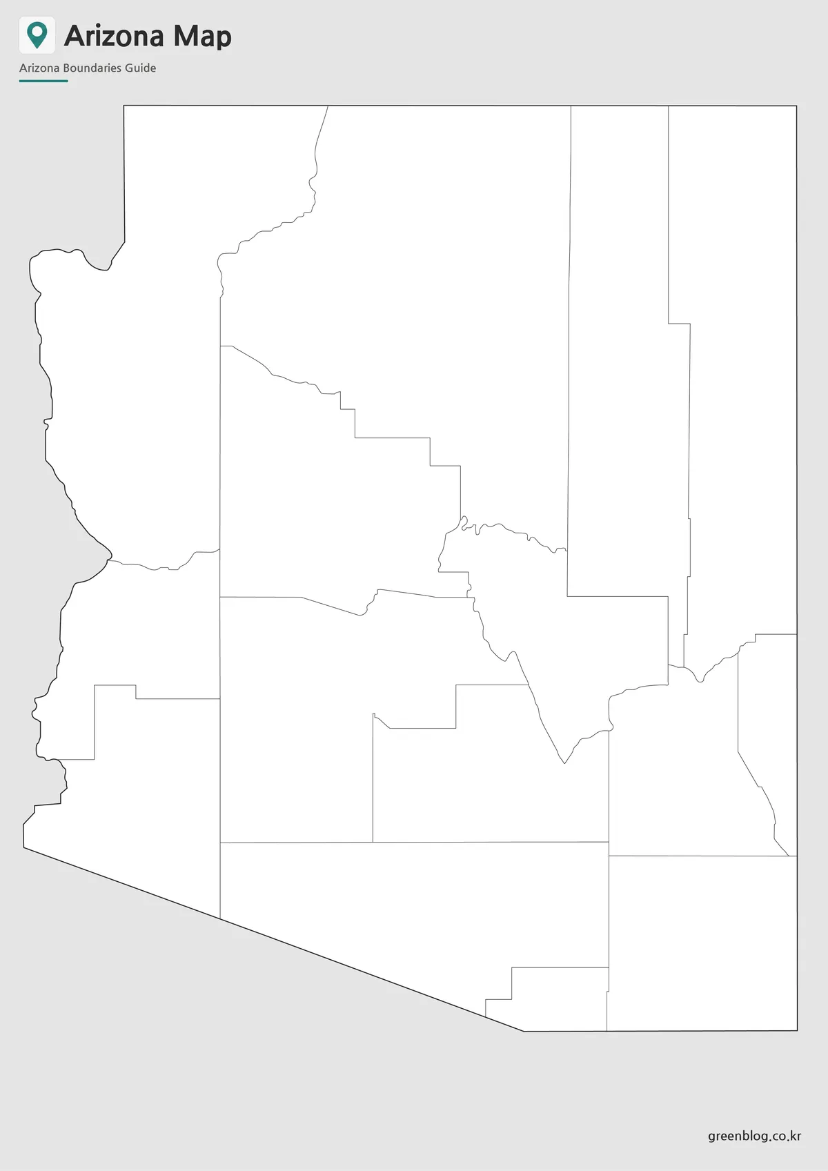
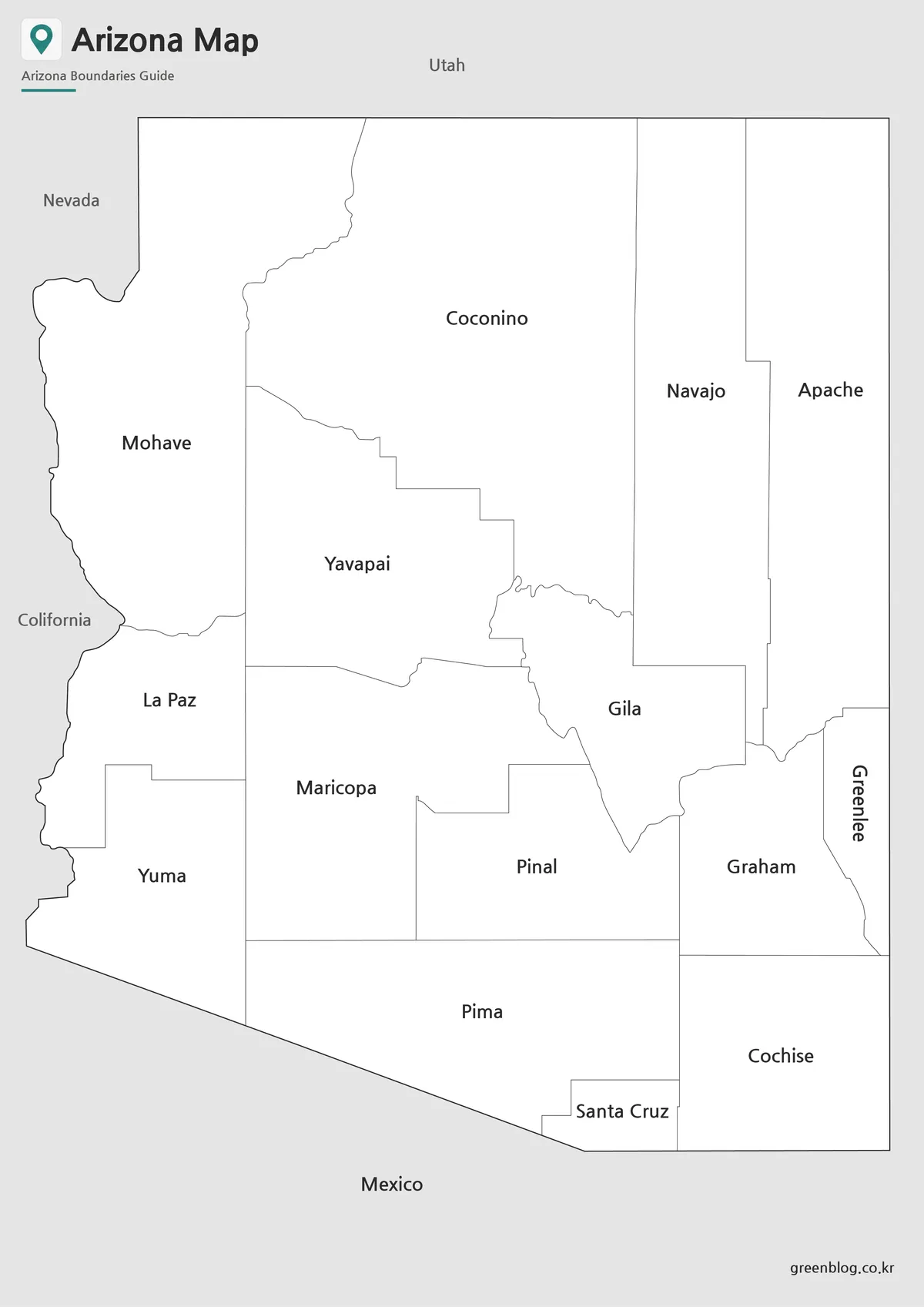
The outline version of the Arizona State Map removes county names and all surrounding jurisdiction labels. It keeps the state title, subtitle, county lines, gray neighboring land, and the site mark, so it is blank in an instructional sense rather than a bare border-only graphic. Learners can identify the 15 shapes without answers appearing on the page.
This is the most flexible starting point for custom categories. A teacher might number the northern row from west to east, ask students to locate the four counties touching Mexico, or provide a separate word bank. A designer can add a verified data layer, but the supplied WebP should not be described as a vector or GIS file.
Common Uses
- County labeling and recall activities
- Custom color keys for sourced county data
- Annotated slides and regional project graphics
- Tracing exercises that compare county shapes
Designed for Printing and Presentation Use
Use portrait orientation to preserve the supplied proportions and leave enough room for the long labels across Coconino, Maricopa, and the eastern counties. The files were prepared for high-resolution A3 printing, but a test page is still worthwhile before producing a class set. Scaling to a much smaller sheet may make Santa Cruz, Greenlee, and the close central boundaries harder to distinguish.
Choose the color version when adjacent shapes need immediate visual separation, the monochrome version when names and economical printing matter, and the outline when the reader should supply information. Each Arizona State Map has the same portrait framework, so the three can be used as a reference, worksheet, and completed comparison set. None should substitute for a current legal boundary survey or a navigation map.
For polished public material, correct “Colifornia” in any accompanying caption and explain that New Mexico is present geographically even though its name is omitted. Do not add claims about Phoenix, Tucson, the Grand Canyon, highways, or rivers unless those elements are separately sourced and placed in a new overlay. The value of this collection is its restrained county focus.
Frequently Asked Questions
Can I print the Arizona State Map in A3 size?
Yes. The files were prepared for high-resolution A3 printing.
Which version is best for classroom use?
The black and white version is usually the easiest for students to annotate and study.
Is the outline version editable?
Yes. The outline map is intended for graphic editing, annotations, and custom design work.
Which version works best for presentations?
The color map provides the clearest visual distinction between counties and regions.
Map File Information
The archive contains the three Arizona county views displayed above for printing, reference, labeling, and custom graphics.
- Included Versions: Color labeled, black-and-white labeled, and blank outline maps
- Printable Size: A3 high resolution
- File Type: Image files in a ZIP archive
- Intended Use: Lessons, reports, slides, annotations, and design projects
Related Maps
Additional Resources
The Arizona State Library’s Arizona Counties Timeline explains how the county system developed and confirms that Arizona currently has 15 counties.
Green Map creates custom-edited map images using open geographic data sources such as geoBoundaries, Natural Earth, OpenStreetMap, and government open data.
These maps are edited visual materials, not raw data files, and are provided for education, documents, presentations, and graphic reference.