A Korean version of this map page is available. View Korean Page
A Printable New Mexico map is useful when you need more than a simple location image of the American Southwest. New Mexico sits between Arizona and Texas, with Colorado to the north and an international border with Mexico to the south. Because the state covers a wide area with desert landscapes, high plateaus, rural counties, and major cities such as Albuquerque and Santa Fe, a county-based map makes it much easier to explain how the region is organized.
This printable New Mexico map collection includes three versions: a color map, a black and white map, and a blank outline map. The files are prepared as image files and are designed for A3-size printing, classroom handouts, regional comparison materials, blog graphics, presentation slides, and editable visual projects. Instead of focusing on roads or facility locations, the map keeps attention on county boundaries and the overall state structure.
New Mexico can be difficult to explain with text alone, especially for readers who are more familiar with nearby states such as Texas, California, Colorado, or Arizona. The state is large in area but not densely populated, so many counties cover broad spaces. A clear labeled or outline map helps students, teachers, bloggers, and designers compare the central, northern, southern, and border-side parts of the state more easily.
While preparing this map set, the main focus was readability. County boundaries were kept clear enough for large-format printing, and the simpler versions were organized so users can add their own notes, labels, colors, or data without too much visual clutter. This makes the collection useful not only as a reference image, but also as a working base for educational worksheets and infographic projects.
Table of Contents
New Mexico Map Overview
This map collection is designed around practical use. The color version helps users quickly compare counties across the wide state area, while the black and white version works well for printing and document insertion. The outline version is the most flexible choice when users want to add custom information.
Included file information:
- File format: JPG image files
- Image size: 3508 × 3881
- Included versions: color map, black and white map, outline map
- Printable size: A3 layout
- Main use: printing, education, presentation design, blog graphics, and editing work
For a first look at the state structure, the color map is usually the easiest version to read. For printed handouts or reports, the black and white version is more practical. For custom editing, the outline map gives the cleanest starting point.
Printable New Mexico Map Versions Included
The three versions are not simply decorative variations. Each one is intended for a different type of project. New Mexico’s wide geographic layout, county divisions, and border position make it useful to have more than one map style available.
A teacher may prefer the black and white version for worksheets. A blogger may use the color version as a visual explanation image. A designer may start with the outline map and add regional labels, travel routes, population data, or county highlights.
Color New Mexico County Map
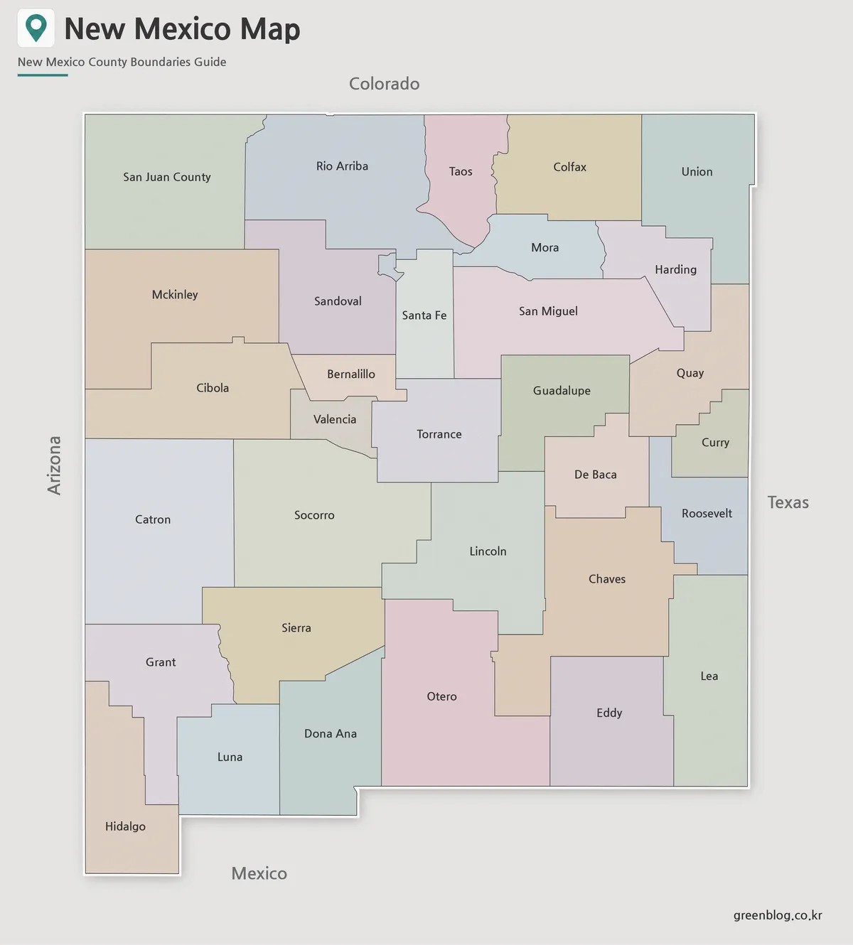
The color map is the easiest version to use when explaining New Mexico’s county layout at a glance. Since many parts of the state include wide rural areas, color separation helps readers compare large county shapes without relying only on thin boundary lines.
This version works especially well for classroom geography lessons, regional comparison articles, travel-related presentations, and visual blog content. When New Mexico is shown alongside Arizona, Colorado, Texas, or Oklahoma, the color-coded county layout helps viewers understand where the state sits within the broader Southwest.
The color version is also useful for presentation slides because the county divisions remain visually clear even when the map is reduced to fit a slide or graphic layout.
Black and White New Mexico Map for Printing
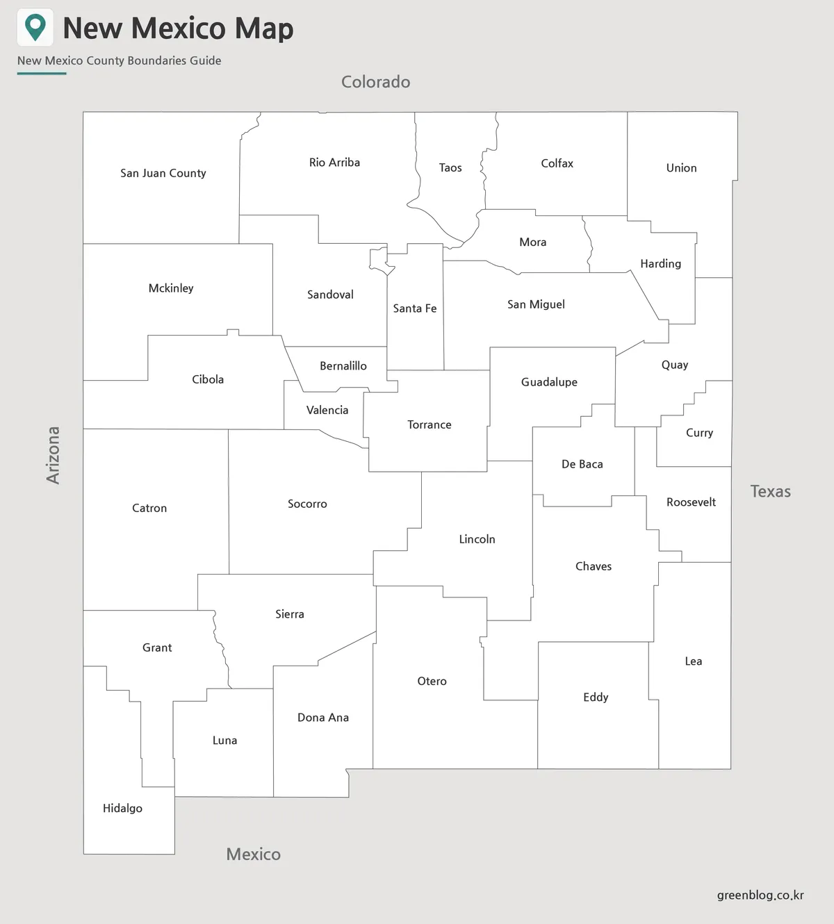
The black and white version is designed for users who need a cleaner printable reference. It keeps the county boundaries and labels while removing color, making it suitable for reports, school assignments, handouts, and document layouts.
Because New Mexico has a broad state shape rather than a compact urban layout, a simple black and white style helps the map remain readable on paper. It is also a practical choice when printing multiple copies, especially for classroom use or worksheet distribution.
This version can be used as a labeled New Mexico county map when users need to identify county positions without the stronger visual weight of color. It also works well as a neutral base image inside PDF-style documents, study materials, or presentation notes.
Blank New Mexico Outline Map for Editing
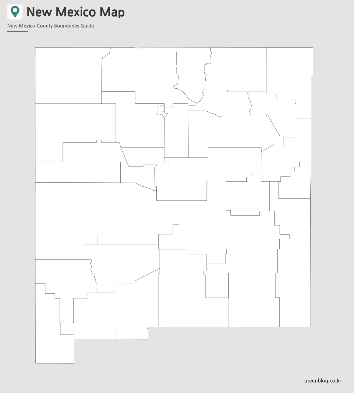
The outline map removes colors and labels, leaving only the county boundary structure. This makes it the most flexible version for editing and custom design work.
Users can add their own county names, mark Albuquerque or Santa Fe, highlight border counties, show regional groupings, create classroom coloring activities, or place data points for population, tourism, energy resources, or travel routes. For infographic projects, the blank layout gives enough structure to stay accurate while leaving room for custom labels and visual elements.
The boundary lines were prepared to remain clear when enlarged, so the outline version can be used as a working base for both digital editing and printed activities.
Practical Uses for This New Mexico Map Collection
A printable New Mexico map can be used in many situations where a simple state outline is not enough. Teachers can use it to explain county divisions and neighboring states. Students can include it in geography assignments or regional study projects. Bloggers can use it when writing about the American Southwest, road trip planning, or state-by-state comparisons.
Designers and content creators may also find the outline version useful for infographics, custom map graphics, and presentation backgrounds. Because the map focuses on administrative boundaries rather than roads or detailed facilities, it stays visually clean and easy to adapt.
Frequently Asked Questions
What is included in this Printable New Mexico map collection?
The collection includes a color map, a black and white map, and a blank outline map of New Mexico.
Can I print the map in A3 size?
Yes. The map files were prepared for A3-size printing and high-resolution use.
Which version is best for classroom handouts?
The black and white map is usually the best choice for printed classroom handouts, worksheets, and reports.
Is the outline map good for editing?
Yes. The outline version is useful for adding custom labels, county highlights, travel routes, data points, or infographic elements.
Does the map show roads or tourist facilities?
No. This map focuses on New Mexico county boundaries and regional structure rather than road networks or facility locations.
Map File Information
This download includes printable New Mexico map versions for educational use, presentation design, document printing, and editable graphic projects.
- Included Versions: Color map, black and white map, outline map
- Printable Size: A3 layout
- File Type: Image files
- Intended Use: Classroom handouts, presentations, blog graphics, infographic editing, and printable reference materials
Additional Resources
- New Mexico Department of Transportation Maps : Official transportation and state map resources that may help users compare roads, regions, and statewide reference layouts.
Related Maps
- Printable Nebraska Map Collection with County Outline Version
- Montana State Map Download – Printable County Boundary Map
- Kansas Map Download – Printable County Map Collection
- High Resolution North Dakota Map for Classroom, Presentation and Design Projects
Green Map creates custom-edited map images using open geographic data sources such as geoBoundaries, Natural Earth, OpenStreetMap, and government open data.
These maps are edited visual materials, not raw data files, and are provided for education, documents, presentations, and graphic reference.