A Korean version of this map page is available. View Korean Page
A Kansas Map is useful when you need to explain the central United States in a clear visual way. Kansas sits in the middle of the country, bordered by Nebraska to the north, Oklahoma to the south, Colorado to the west, and Missouri to the east. Because of this location, the state often appears in regional comparison materials, classroom geography lessons, transportation discussions, agricultural maps, and presentation slides about the Great Plains.
This printable Kansas Map collection includes three practical versions: a color county map, a black and white labeled map, and a blank outline map. The files are prepared for A3 high-resolution printing and can be used in school projects, blog graphics, infographic layouts, presentation materials, worksheets, and simple editing projects. The map files are provided in JPG format, with additional download options arranged for convenient use.
Kansas covers a large land area of about 213,100 square kilometers, but its population is relatively small compared with many coastal states. This wide, open layout makes a map more useful than a short written description. County boundaries, neighboring state connections, and the broad east-west structure of Kansas are much easier to understand when shown visually. For students or readers who are less familiar with the central United States, a clean map helps place Kansas between the Rocky Mountain region and the Missouri-side Midwest.
While preparing this map set, the main goal was not to create a road map or a detailed transportation chart. Instead, the layout was organized to show county structure, regional spacing, and overall shape in a simple way. Extra attention was given to keeping county lines readable at larger print sizes, especially because Kansas has many counties spread across a wide rectangular state outline.
Table of Contents
Kansas Map Overview
This Kansas Map set is designed as a printable and editable resource rather than a simple location image. It works well for users who need a clean state map without unnecessary visual clutter.
Included map versions:
- Color Kansas county map
- Black and white Kansas Map
- Blank Kansas outline map
- JPG file format
- A3 high-resolution layout
- Suitable for printing, classroom use, documents, and editing projects
The color map is best for quickly understanding county divisions across the state. The black and white version is better for printed reports and handouts. The outline version is useful when you want to add your own labels, color groups, statistics, routes, or presentation notes.
Included Kansas Map Versions
Kansas has a wide and mostly rectangular shape, which can look simple at first glance. However, the large number of counties makes the internal layout more detailed than a basic state outline suggests. Having separate map versions makes it easier to choose the right visual style for each project.
For example, a classroom handout may need a labeled black and white map, while an infographic about agriculture or population distribution may work better with a blank outline map. A blog post or presentation slide may benefit from the color version because the county divisions are easier to separate visually.
Color Kansas County Map
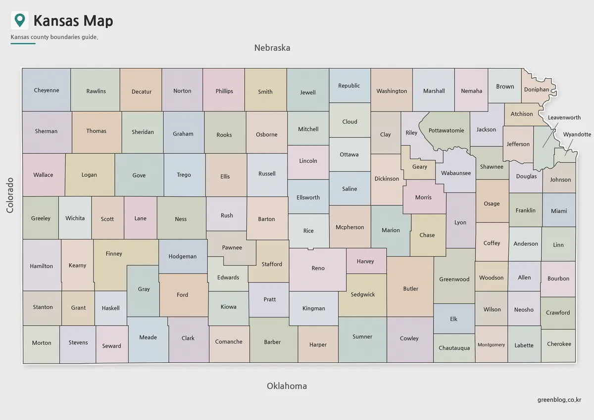
The color Kansas Map is designed to make county boundaries easier to compare across the state. Since Kansas stretches widely from the Colorado border in the west to Missouri in the east, color separation helps readers follow the county layout without losing track of regional placement.
This version is especially helpful when explaining Kansas as part of the Great Plains or when comparing it with nearby states such as Nebraska, Oklahoma, Colorado, and Missouri. The color-coded layout gives the map a stronger visual structure, which works well for presentations, educational materials, blog images, and regional comparison graphics.
Recommended uses include:
- US geography lessons
- State comparison materials
- Blog graphics
- Regional overview slides
- Classroom reference pages
- Infographic projects
Black and White Kansas Map for Printing
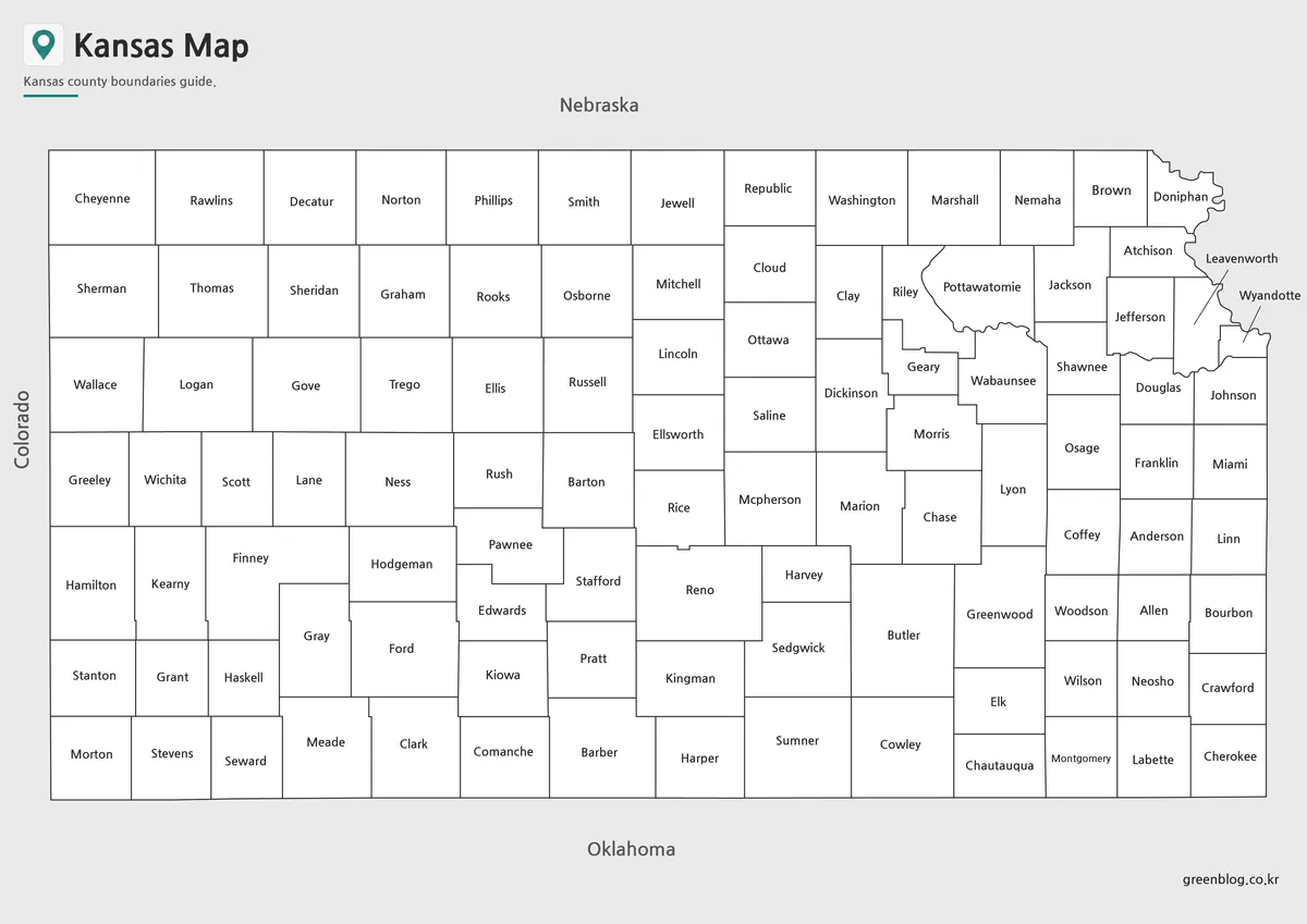
The black and white Kansas Map keeps county names and boundary lines while removing color. This makes it a practical option for documents, worksheets, and printed reference sheets. When many copies need to be printed, the cleaner style is easier to use than a full-color map.
Because Kansas contains many counties, label clarity matters. The black and white layout was reviewed with printing in mind so that county lines and names remain readable without relying on color. It is a good choice for teachers, students, report writers, and anyone preparing printed materials about the central United States.
This version works well for:
- Classroom handouts
- School assignments
- Printed reports
- Presentation reference sheets
- Regional comparison documents
- Study materials
Blank Kansas Outline Map for Editing
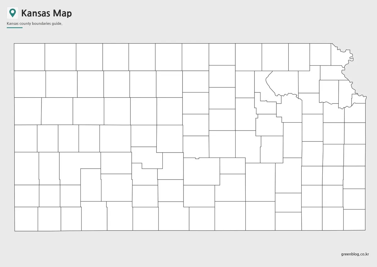
The blank outline Kansas Map removes colors and labels, leaving only the county boundary structure. This gives users a flexible base map for editing, marking, coloring, or adding custom information.
For Kansas, the outline version is especially useful when showing agricultural areas, population distribution, travel routes, county groupings, or regional patterns across the Great Plains. Teachers can use it for coloring activities or geography worksheets, while designers can add markers, icons, statistics, or highlighted counties for infographic layouts.
Possible editing uses:
- Add county-level data
- Mark major cities or travel routes
- Create classroom coloring worksheets
- Highlight agricultural regions
- Build custom presentation graphics
- Add population or regional comparison notes
The simplified boundary layout also makes it easier to combine the map with other design elements without the page feeling crowded.
Built for Classroom and Presentation Use
A Kansas Map is often needed when explaining the central United States because Kansas connects several different regional ideas. It is part of the Great Plains, close to the Midwest, and positioned between western and eastern state networks. A written explanation can describe this location, but a map makes the relationship much easier to understand.
This collection is useful for:
- Teachers preparing geography lessons
- Students making school reports
- Bloggers writing about US states
- Designers creating map graphics
- Presentation creators explaining regional layouts
- Users comparing neighboring states
The A3 layout also makes the map suitable for larger printed materials. When enlarged, the county structure remains easier to follow than small web images that only show the state outline.
Practical Notes on Map Readability
During the map preparation process, the main focus was county separation and print readability. Kansas does not have a complicated coastline or island structure, but the number of counties creates its own layout challenge. If the boundary lines are too thin, the map becomes difficult to read. If the labels are too crowded, the map feels heavy.
For that reason, each version was arranged with a different purpose. The color map supports quick visual reading. The black and white map is better for printed text-based materials. The outline map gives users a clean working base for their own projects.
Frequently Asked Questions
What is included in this Kansas Map collection?
The collection includes a color county map, a black and white labeled map, and a blank outline map. Each version is designed for printing, education, presentations, or editing work.
Can I print the Kansas Map in A3 size?
Yes. The files were prepared with A3 high-resolution printing in mind, making them suitable for classroom materials, reports, and presentation handouts.
Which Kansas Map version is best for classroom use?
The black and white map is usually the most practical for worksheets and printed handouts. The color map is better for slides or visual explanations.
Is the outline map editable?
Yes. The blank outline version can be used as a base map for adding colors, labels, county data, travel routes, or infographic elements.
Kansas Map Download
Download the printable Kansas Map collection and choose the version that fits your project. Color, black and white, and outline map files are included for printing, classroom use, presentations, and editing.
Image Size: A3 high-resolution layout
Intended Usage: Printing, education, presentations, worksheets, and graphic editing
Related Maps
- West Virginia Map Download – Printable County Map Collection
- Virginia Map Collection | Printable County and Independent City Maps
- Arizona State Map Download Collection (Color, Labeled & Outline Maps)
- Arkansas Map Collection: Printable County Maps in Color, Labeled, and Outline Formats
Additional Resources
- Kansas Geological Survey – Maps and GIS : Interactive Kansas geology maps and GIS resources useful for comparing landforms, geological regions, and state map data.
Green Map creates custom-edited map images using open geographic data sources such as geoBoundaries, Natural Earth, OpenStreetMap, and government open data.
These maps are edited visual materials, not raw data files, and are provided for education, documents, presentations, and graphic reference.