
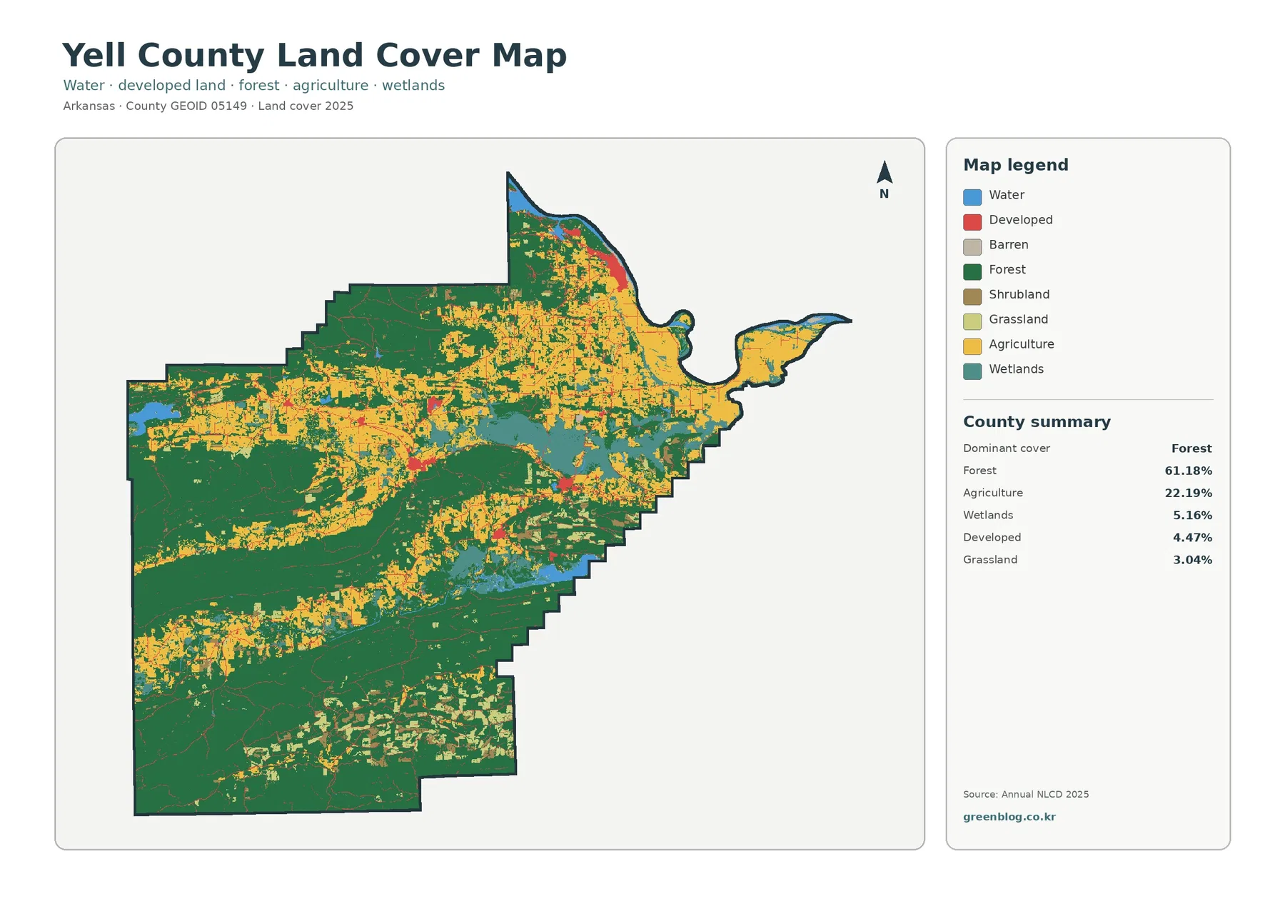
Yell County Arkansas Land Cover Map | 61.18% Forest, 22.19% Agriculture & Dardanelle Footprint
Yell County’s 2025 land-cover pattern is defined by a strong forest majority, but the county is not uniformly wooded. Forest […]
Yell County’s 2025 land-cover pattern is defined by a strong forest majority, but the county is not uniformly wooded. Forest […]
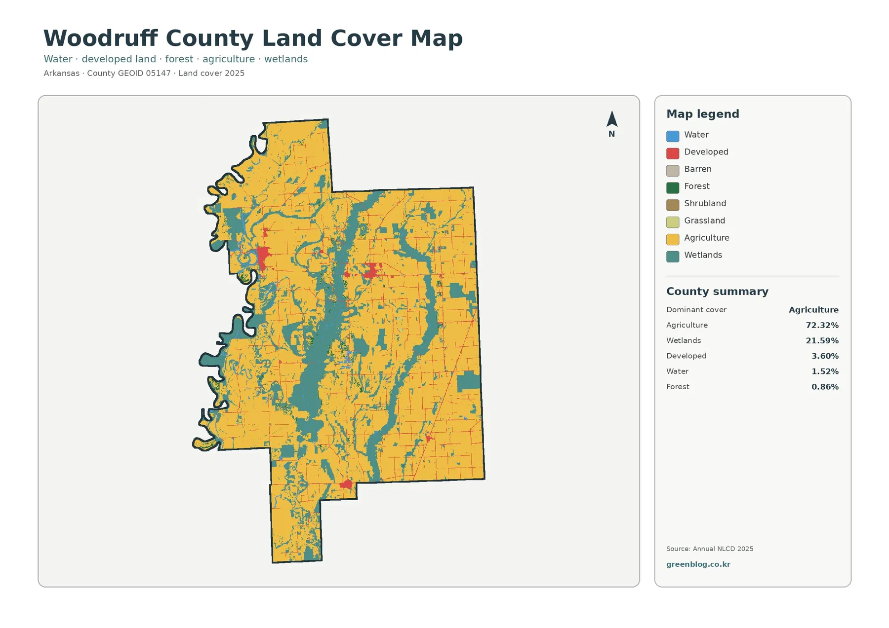
Woodruff County is dominated by two land-cover settings that are easy to recognize on the 2025 map: broad agricultural ground
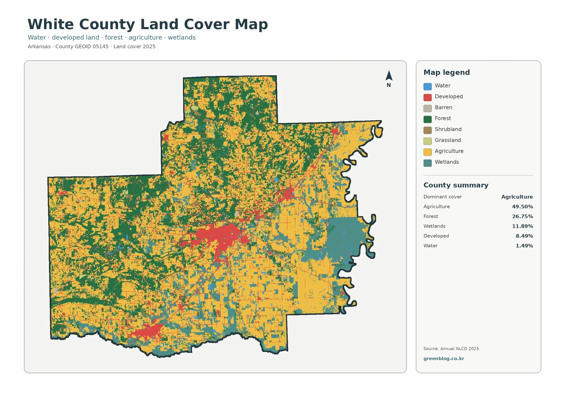
White County has one of the clearest east-west land-cover contrasts in this Arkansas map set. Agriculture accounts for 49.50% of
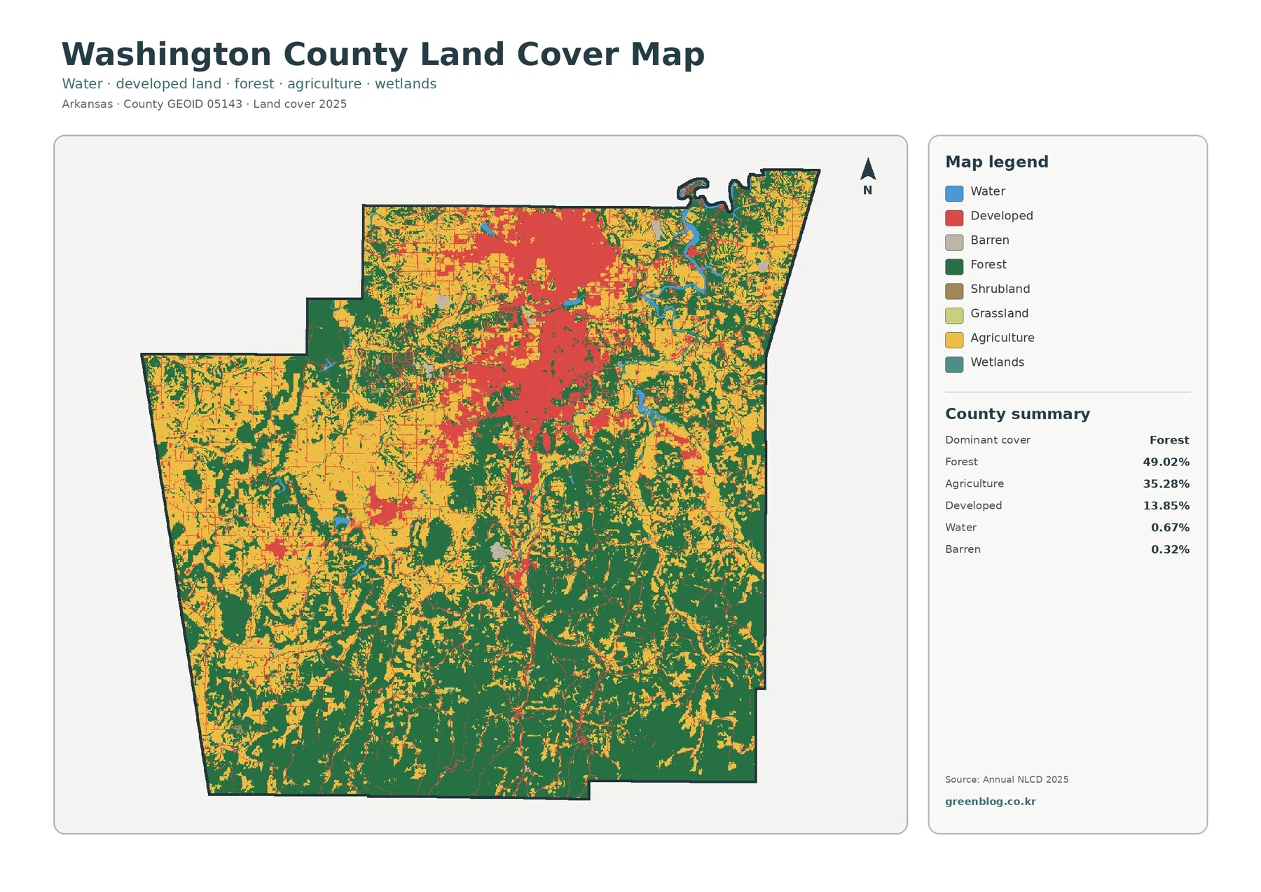
Washington County is one of the clearer examples in Arkansas of forest, farmland, and urban development sharing the same county
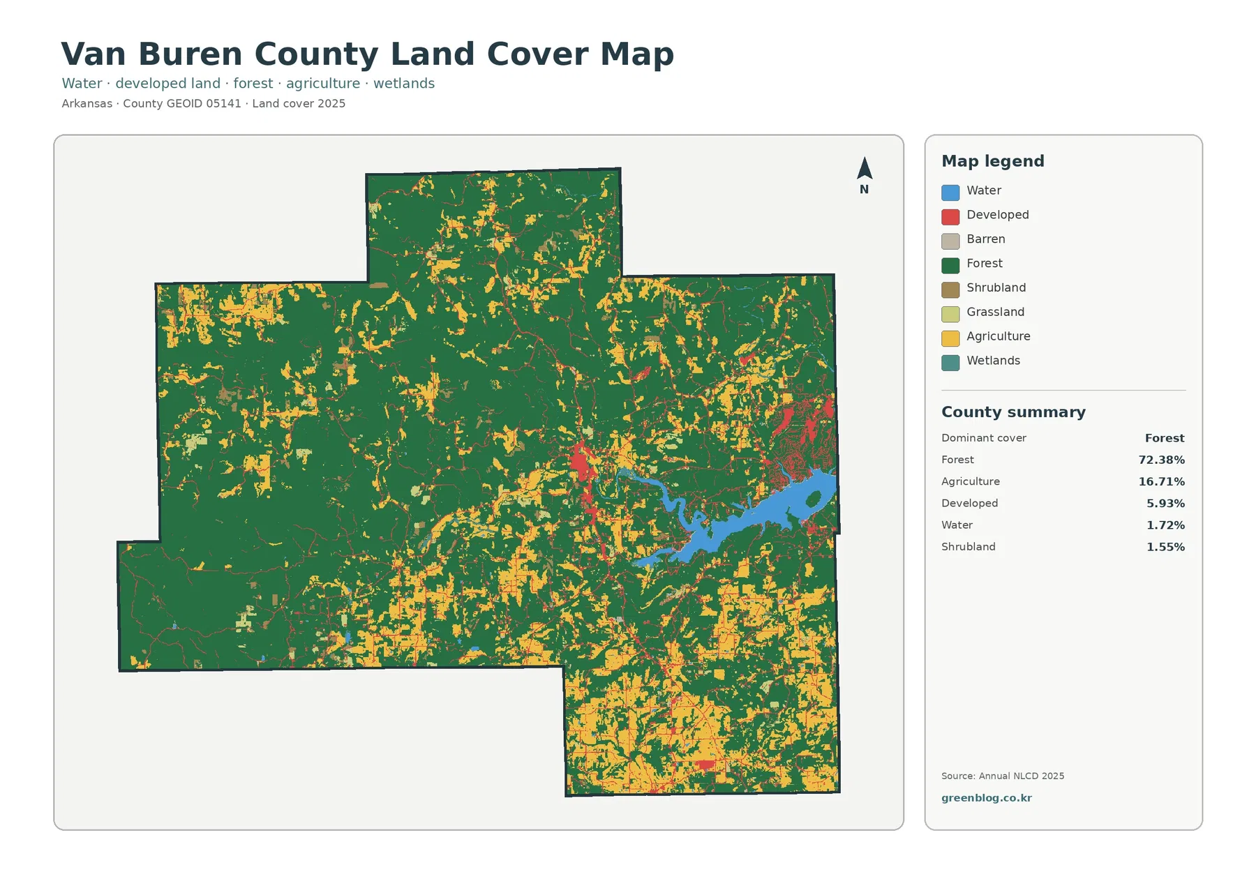
Forest is the clearest feature on the supplied 2025 land-cover view of Van Buren County, covering 72.38 percent of the
Van Buren County Arkansas Land Cover Map | Forest Openings, Clinton, and the Lake Shore Read More »
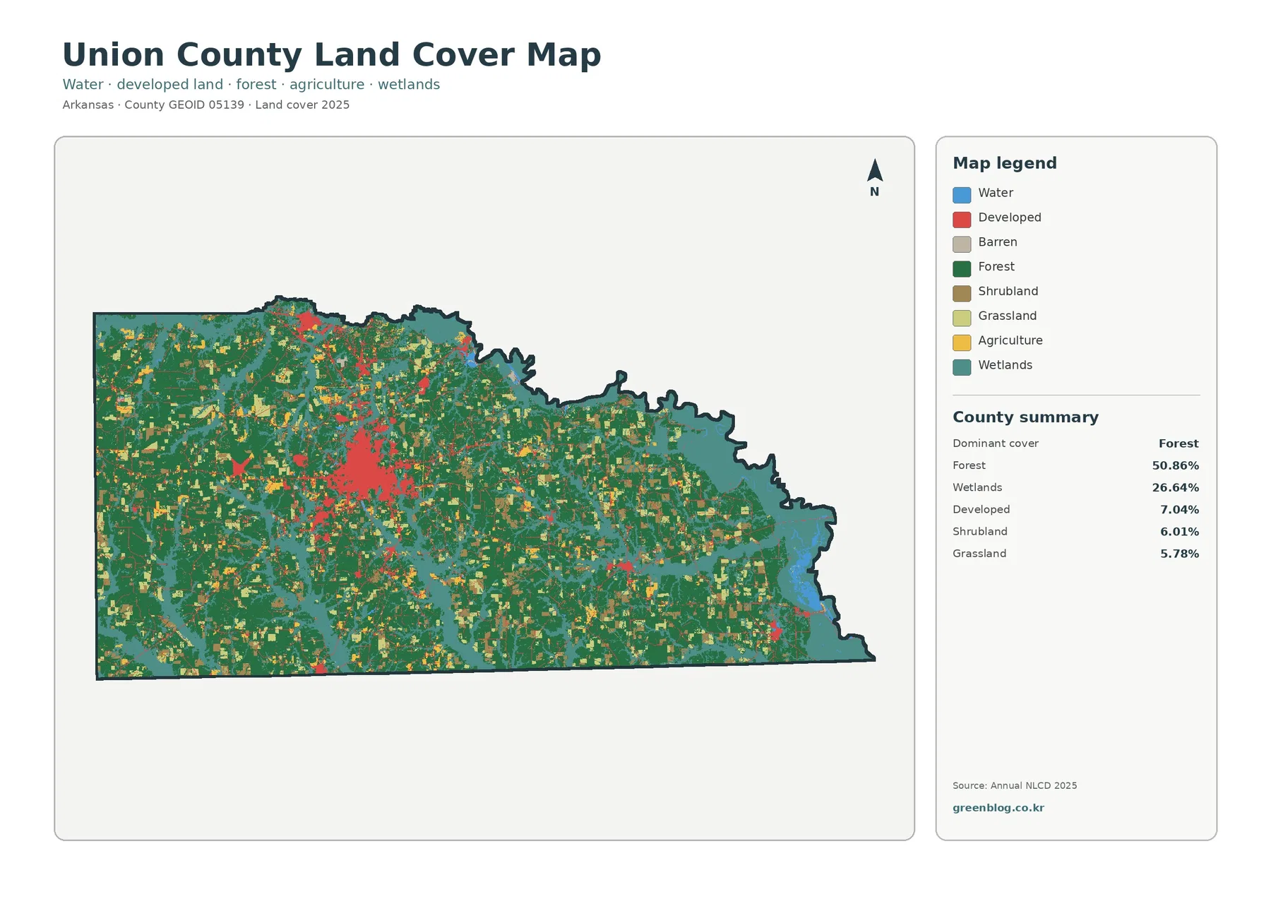
Union County sits on Arkansas’s south-central border, and its 2025 land-cover pattern is defined by two large categories rather than
Union County Arkansas Land Cover Map | Why Forest and Wetlands Dominate Beyond El Dorado Read More »
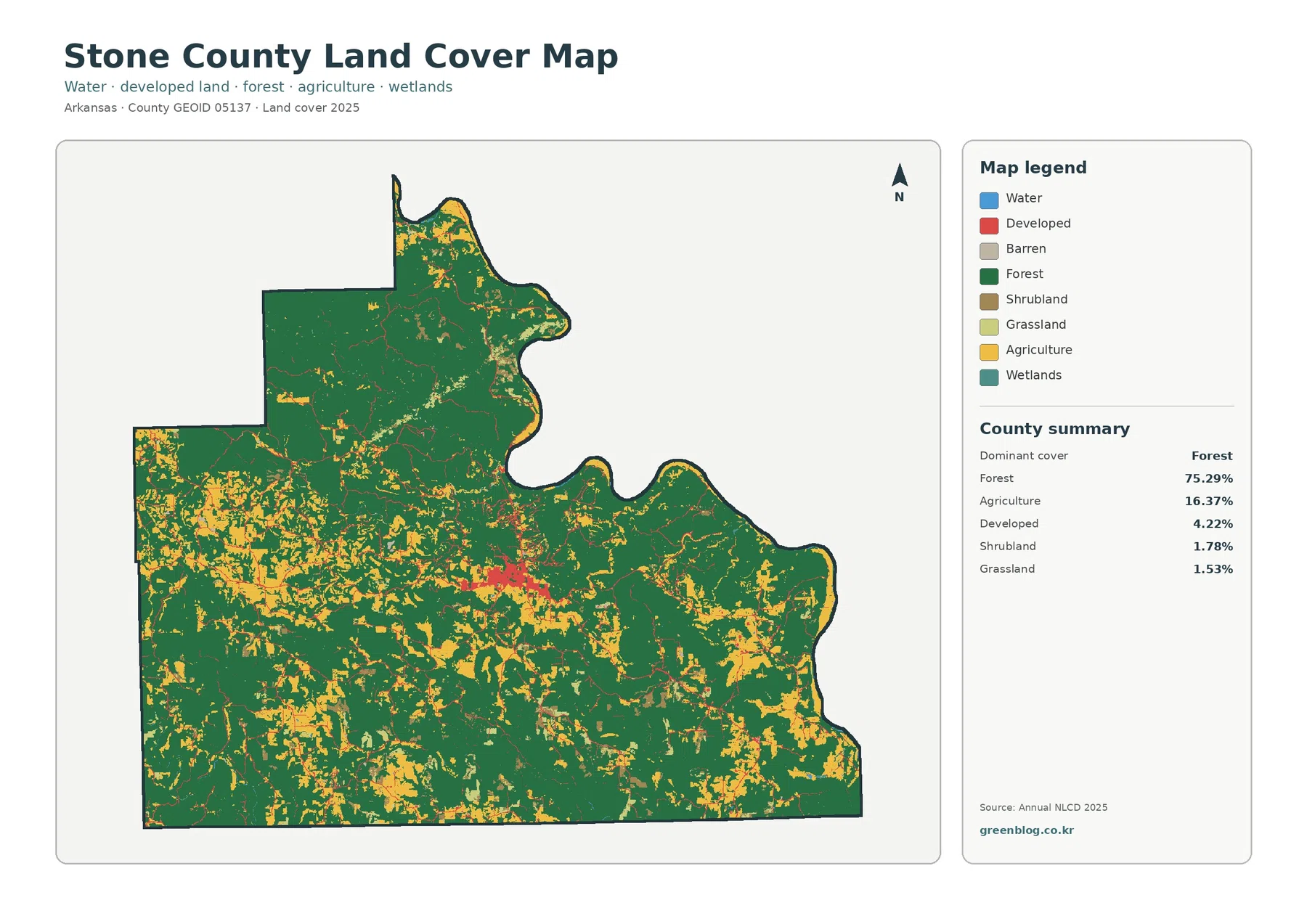
Stone County sits in north-central Arkansas, where the 2025 land-cover map is dominated by one unmistakable pattern: forest covers most
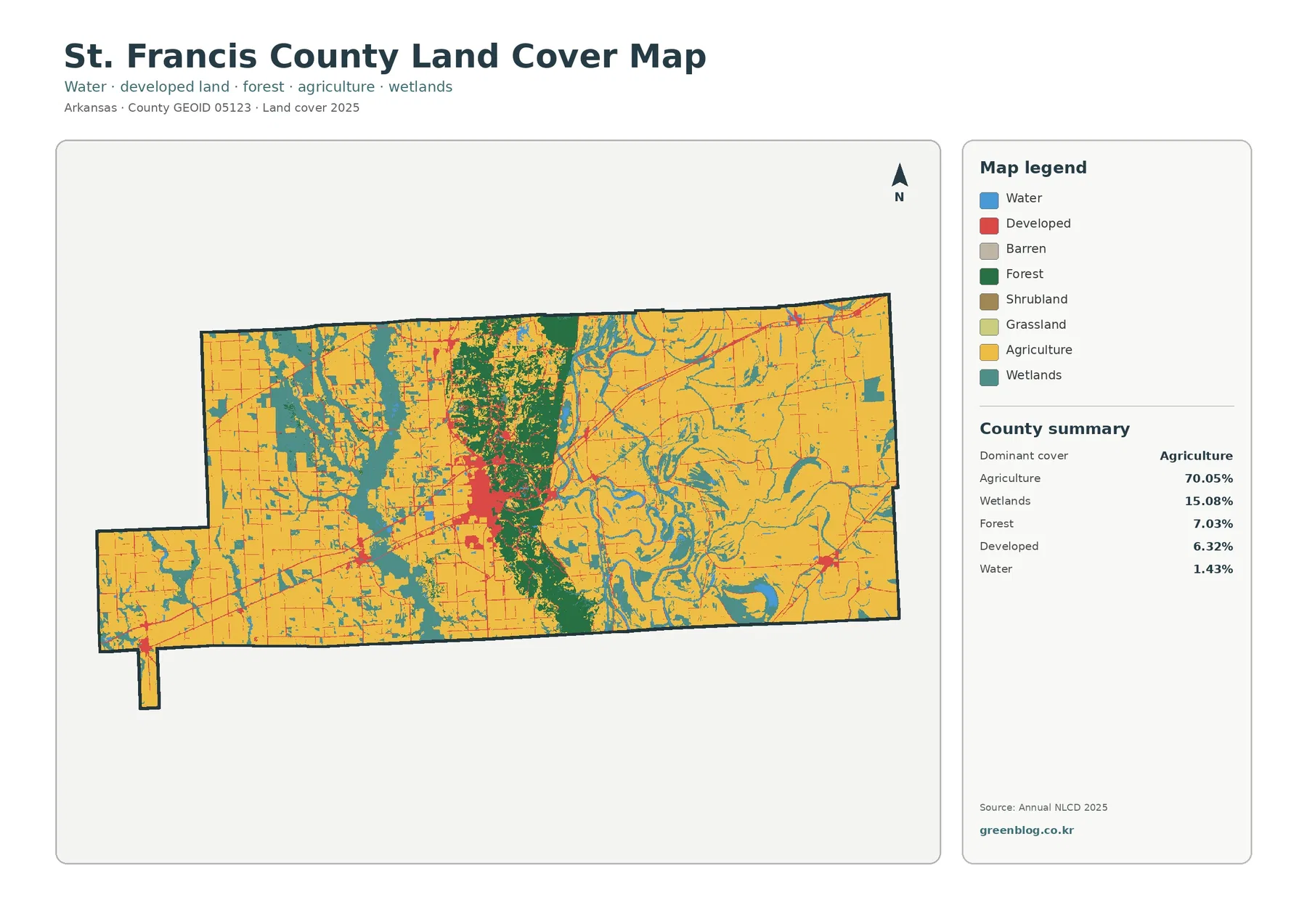
St. Francis County has one of the clearest farm–ridge–wetland contrasts in this Arkansas map set. Agriculture covers 70.05% in 2025,
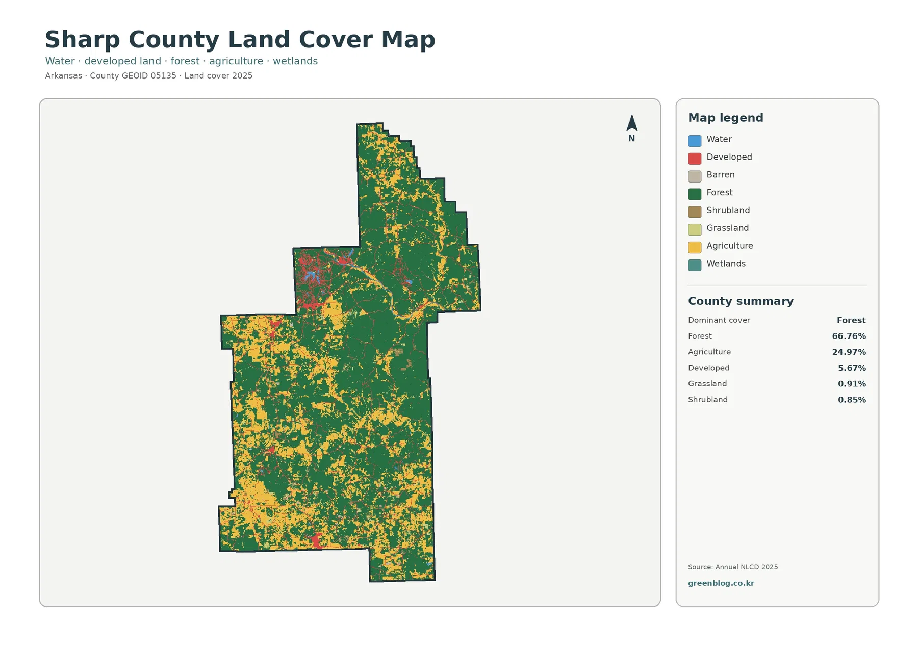
Sharp County’s 2025 map combines a strong forest majority with a substantial open-rural component. Forest covers 66.76%, agriculture 24.97%, and