
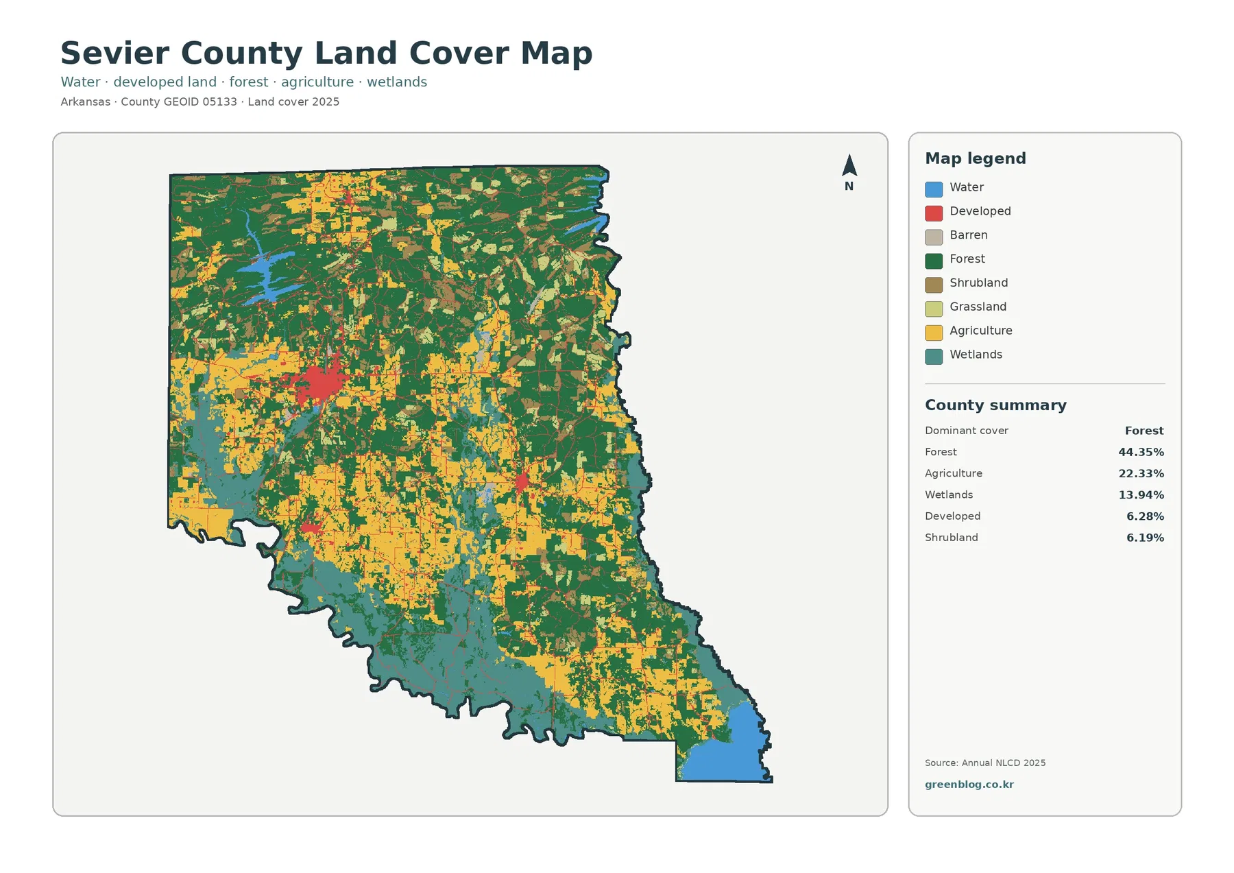
Sevier County Arkansas Land Cover Map — De Queen, Wetland-Rich South & Forest-Farm Mosaic
Sevier County stands out because forest, agriculture, wetlands, and developed land all occupy meaningful portions of the 2025 map. Forest […]
Sevier County stands out because forest, agriculture, wetlands, and developed land all occupy meaningful portions of the 2025 map. Forest […]
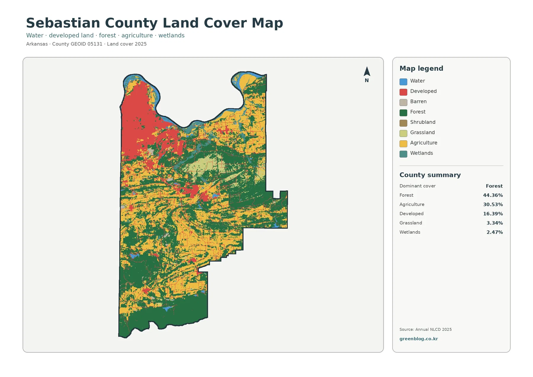
Sebastian County is one of the more varied land-cover counties in this Arkansas map series. Forest is the largest 2025
Sebastian County Arkansas Land Cover Map | Fort Smith Urban Footprint and Forested South Read More »
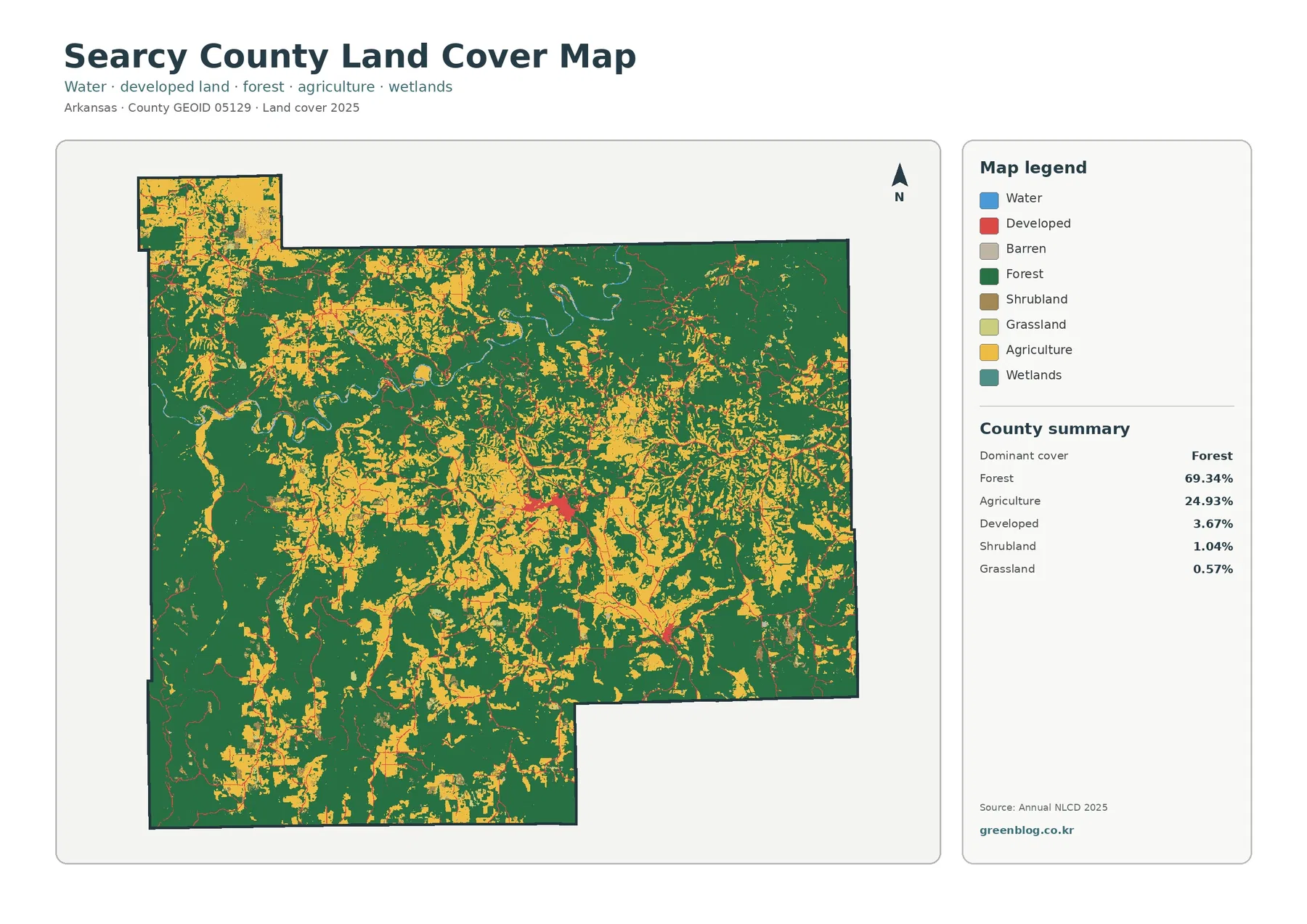
Searcy County’s 2025 land-cover map is dominated by forest, which accounts for 69.34% of the county. Agriculture is still substantial
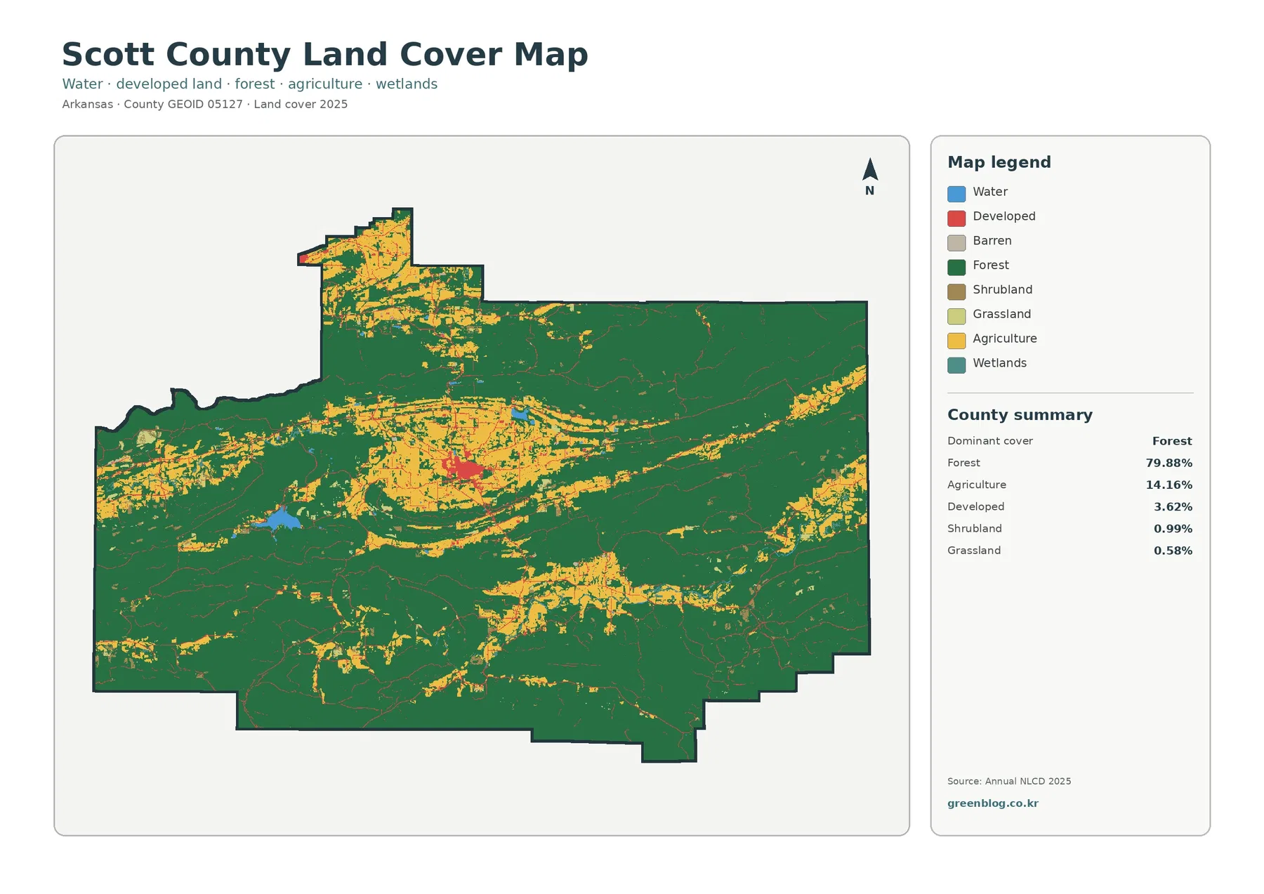
Scott County’s 2025 land-cover map is overwhelmingly green: forest accounts for 79.88% of the county. The pattern is not featureless,
Scott County Arkansas Land Cover Map — 79.88% Forest, Waldron Core & Scattered Open Land Read More »
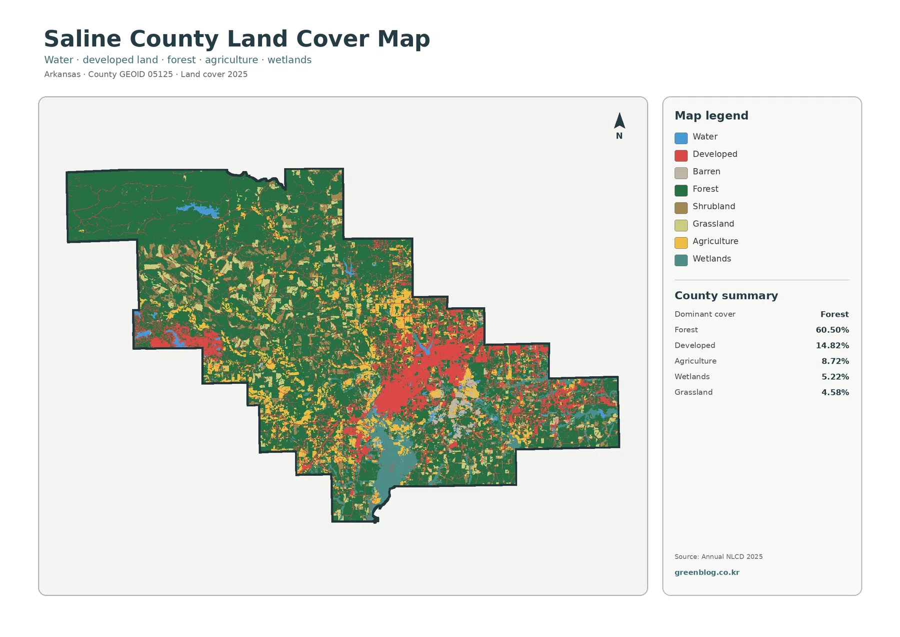
Saline County sits in central Arkansas, and its 2025 land-cover pattern is defined by a strong contrast between a heavily
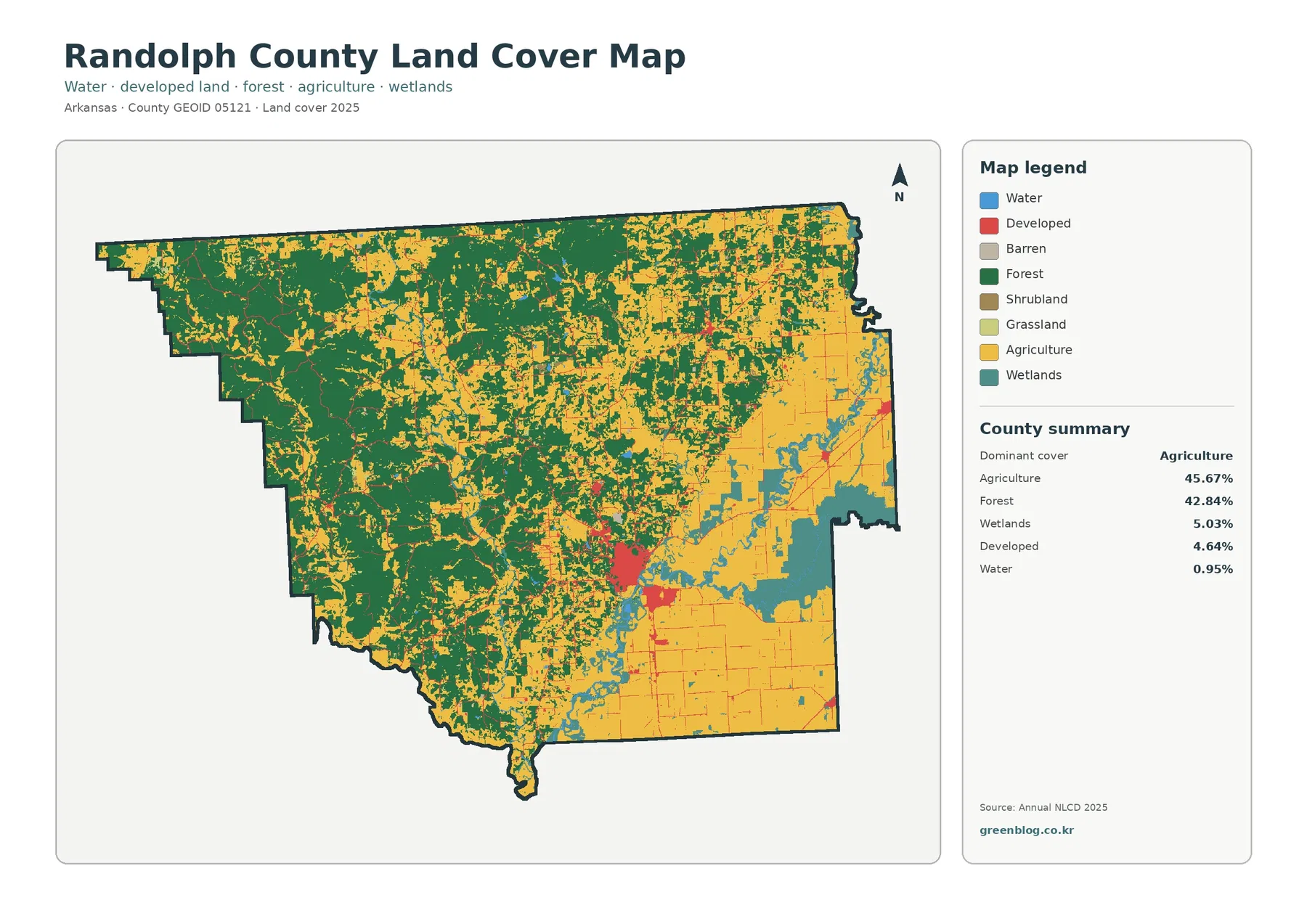
Randolph County has one of the more balanced 2025 land-cover summaries in this Arkansas series: agriculture accounts for 45.67% of
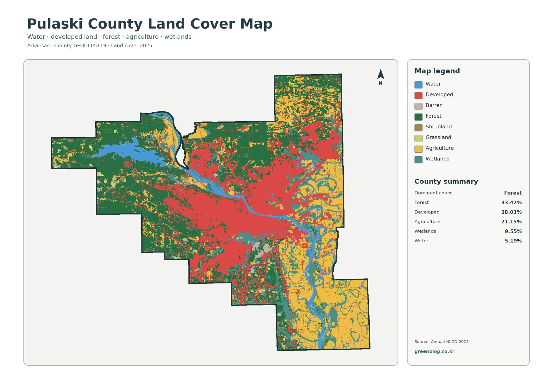
Pulaski County has one of the most mixed land-cover profiles in this Arkansas series. The 2025 summary is led by
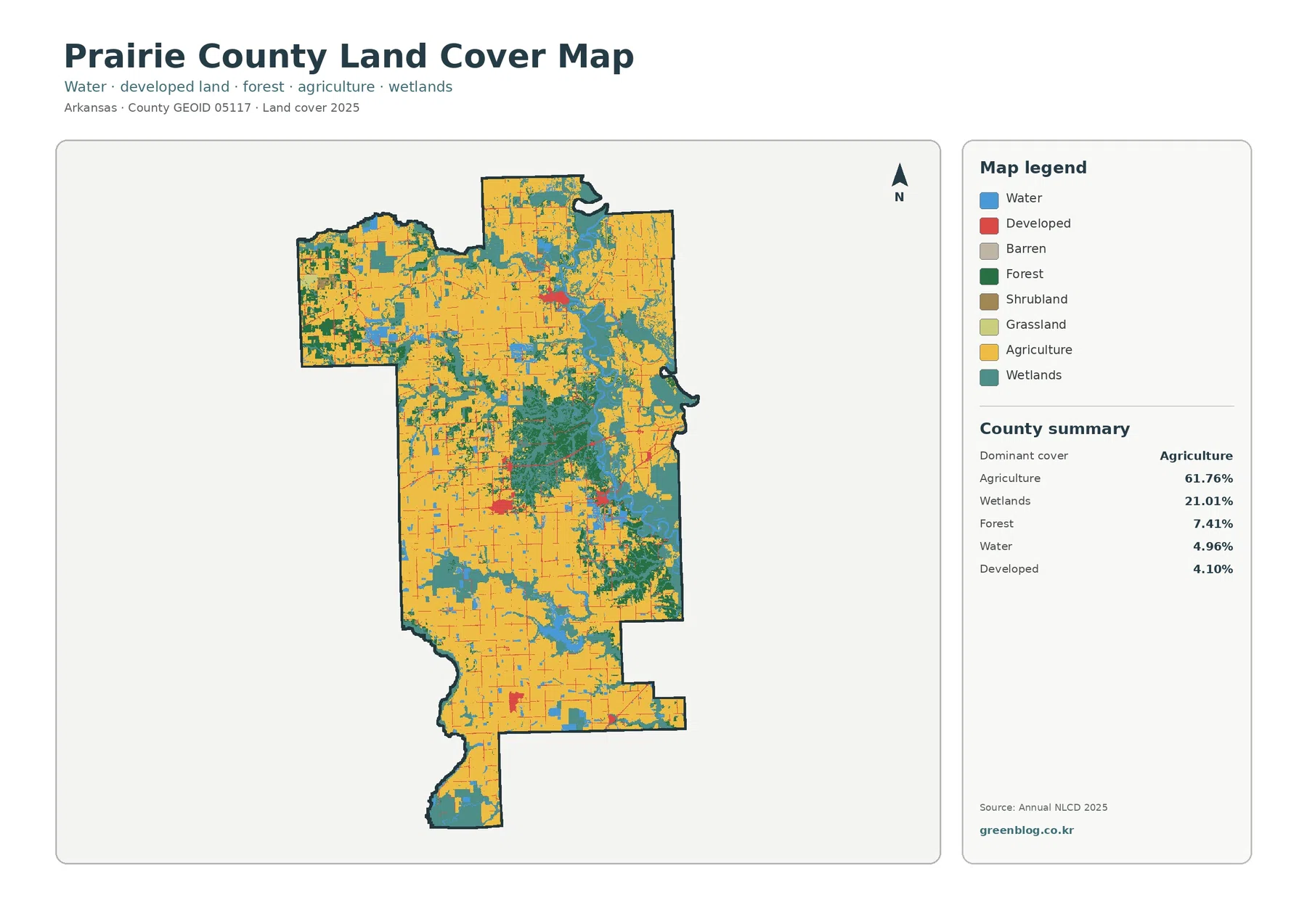
Prairie County has a distinctly agricultural 2025 land-cover pattern, but the county is not one uninterrupted block of fields. Agriculture
Prairie County Arkansas Land Cover Map: 61.76% Agriculture Across a Wetland-Rich Plain Read More »
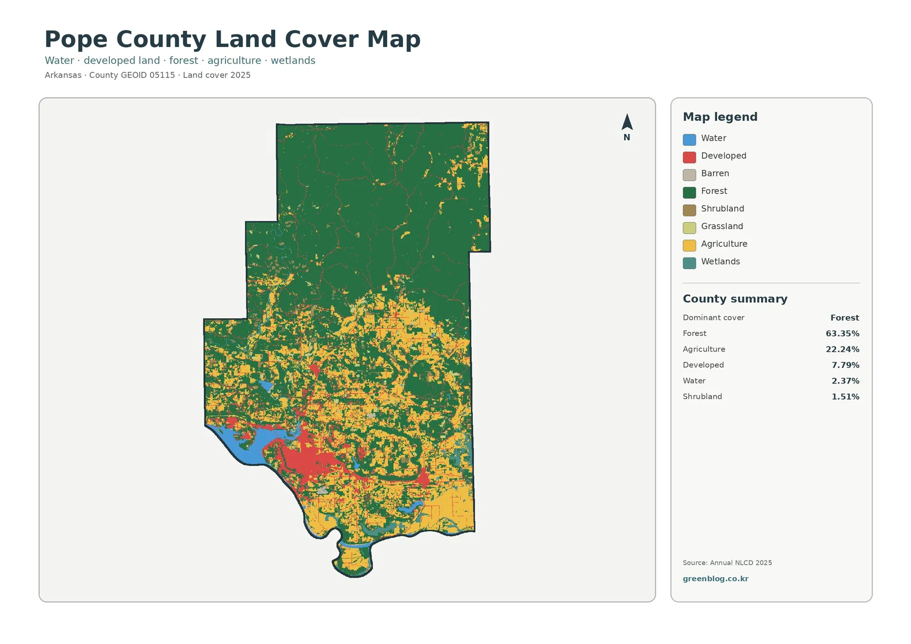
Pope County shows a clear north-to-south land-cover contrast. Forest covers 63.35% of the county in the 2025 summary and forms
Pope County Arkansas Land Cover Map — Ozark Forests, River Valley Farms & Russellville Read More »