A West Virginia Map is useful when you need more than a simple location reference in the eastern United States. West Virginia has a distinctive Appalachian layout, with mountain ranges, valleys, rivers, and county boundaries shaping how different parts of the state connect. For students, teachers, bloggers, designers, and presentation creators, a clear county map can make the state much easier to explain visually.
West Virginia borders Pennsylvania, Maryland, Virginia, Kentucky, and Ohio, giving it a strong regional connection to both the Mid-Atlantic and Appalachian areas. The state covers about 62,700 square kilometers and has a population of roughly 1.77 million people. Charleston is the state capital, while Huntington, Morgantown, Parkersburg, and Wheeling are also important cities for regional comparison and map-based projects.
This printable West Virginia Map collection includes three versions: a color county map, a black and white labeled map, and a blank outline map. The files are prepared in JPG format and designed for A3 high-resolution printing. They work well for classroom handouts, presentation slides, blog graphics, regional comparison materials, infographic layouts, and editable map projects.
West Virginia is especially suited to county-based mapping because its regional structure is not always easy to understand from a basic state outline. The northern panhandle, central mountain areas, and southern coalfield region each have different geographic and economic patterns. A well-organized county map helps make those differences visible without requiring a long written explanation.
Table of Contents
West Virginia Map Overview
This map set was created for users who need a clean and practical visual reference. Instead of relying on a single map style, the collection separates the state into different formats so users can choose the version that fits their project.
Included versions:
- Color county map
- Black and white labeled map
- Blank outline map
- JPG file format
- A3 high-resolution print layout
During preparation, extra attention was given to county boundary clarity. West Virginia has many curved and uneven county lines because of its mountain geography, so the map layout was adjusted to keep the regions easier to read when printed or enlarged.
Color County Map for Regional Comparison
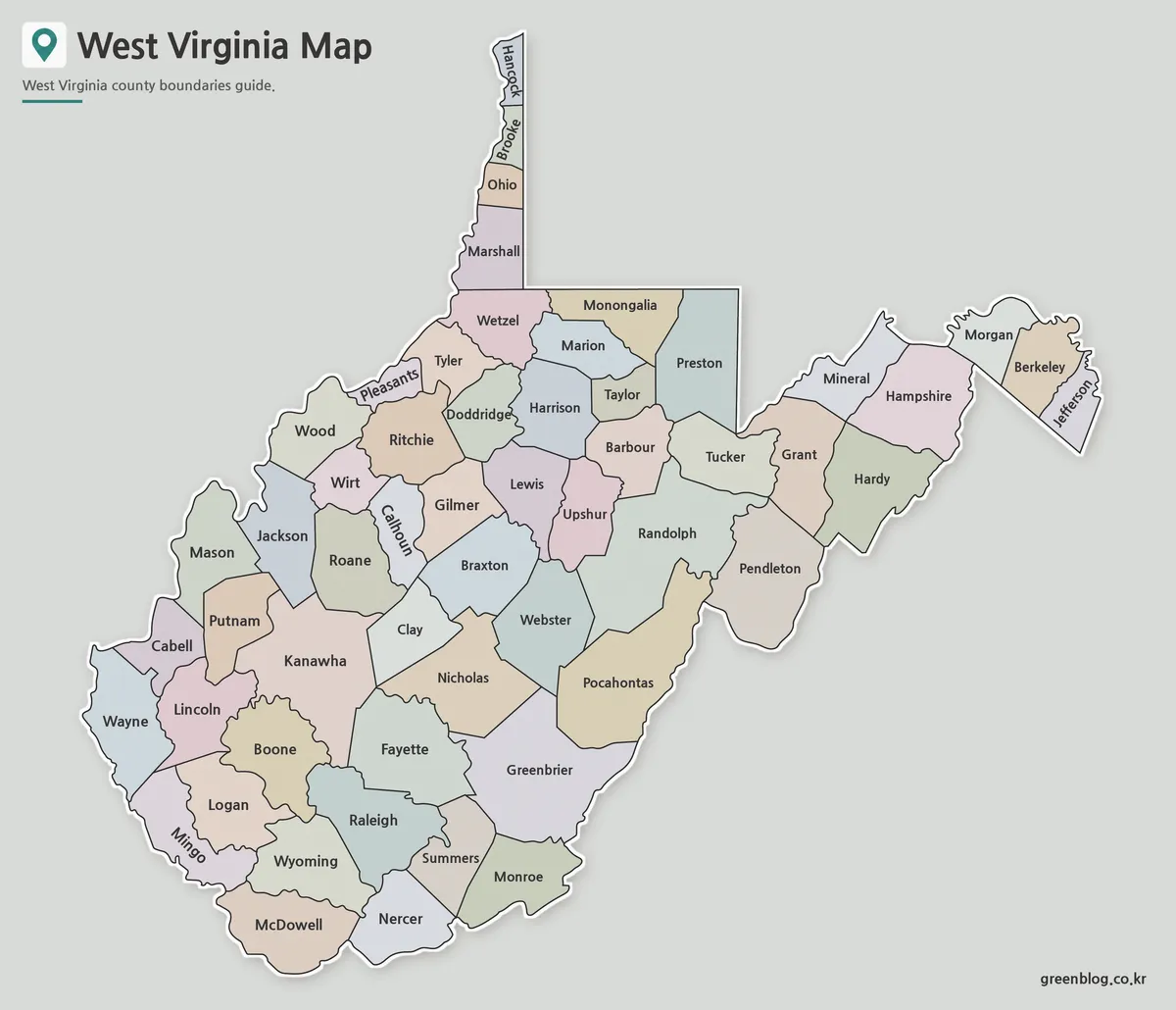
The color version is designed for quick visual comparison. Each county is separated with color, making it easier to identify neighboring areas and explain regional differences across the state.
This version works well for:
- classroom geography lessons
- county comparison projects
- presentation slides
- regional population visuals
- blog graphics and infographic layouts
Because West Virginia includes mountain communities, river valleys, and separated regional corridors, color coding helps users quickly follow the shape of each county. It is especially useful when explaining areas around Charleston, Morgantown, Huntington, Parkersburg, and Wheeling.
Black and White Printable Version
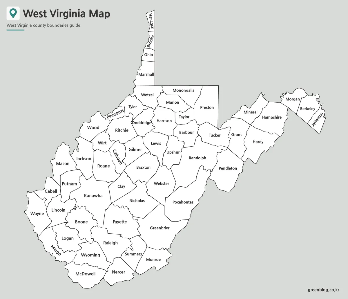
The black and white West Virginia Map focuses on labels and boundary lines. It is useful when color is not needed or when the map will be inserted into documents, reports, worksheets, or printed study materials.
This version was checked with printing in mind. The boundary lines were kept clean, and the label layout was reviewed so that major city and county references remain readable in larger print formats.
Teachers may prefer this version for handouts, while report writers may use it as a neutral reference map. It also works well when users need a simple county map without strong visual colors.
Blank Outline Map for Editing
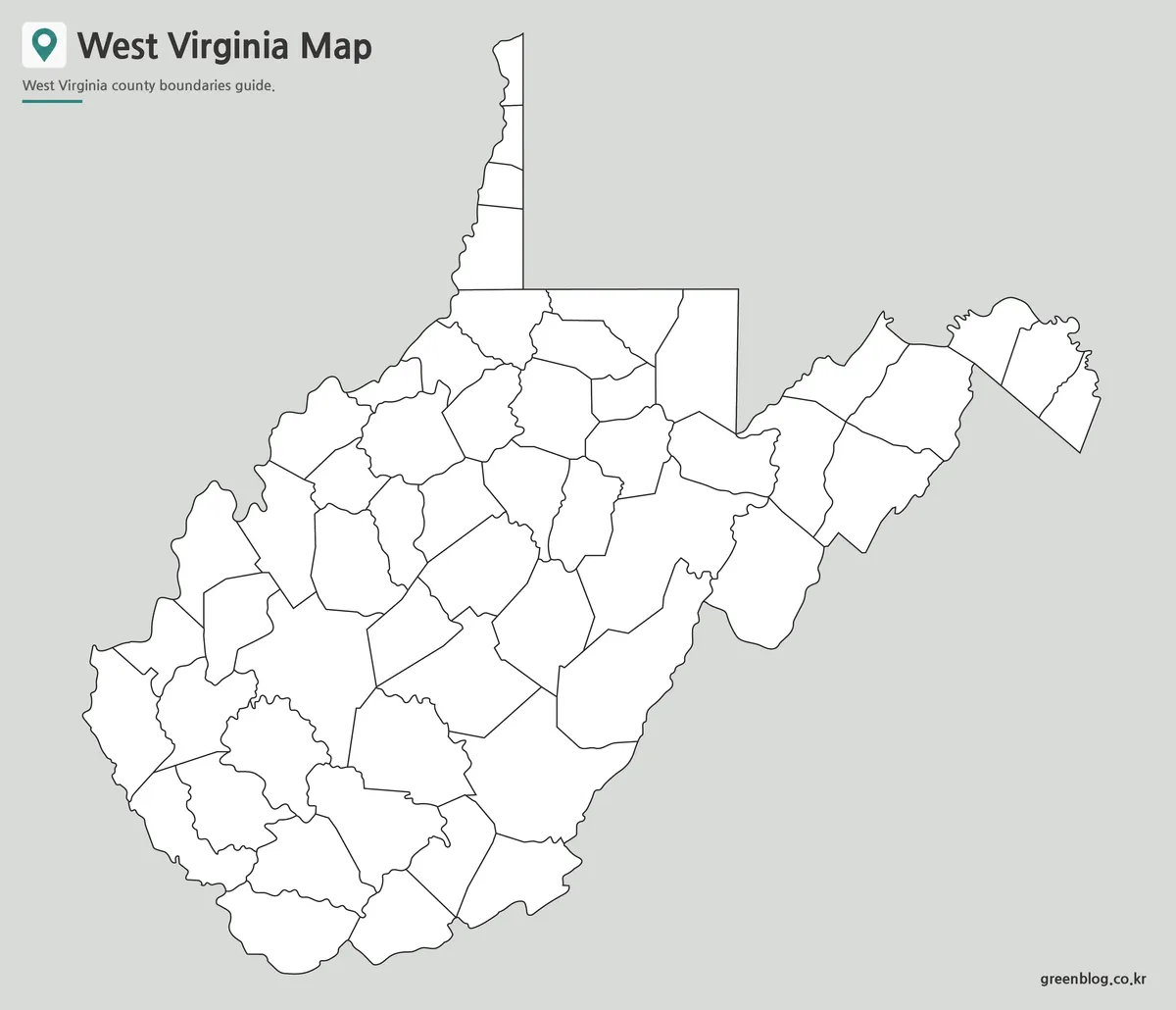
The outline version removes color and labels, leaving only the county boundary structure. This makes it useful for editing, coloring, annotation, and custom data visualization.
The blank map is a good choice for:
- educational worksheets
- editable graphics
- infographic projects
- regional data mapping
- travel route planning
- presentation background visuals
Users can add icons, numbers, color fills, arrows, or text labels depending on the purpose. For example, the outline version can be used to mark tourism areas such as New River Gorge National Park, Harpers Ferry, or Blackwater Falls, or to show regional patterns such as energy, mining, transportation, or population distribution.
Why West Virginia Needs a Clear County Map
West Virginia is one of the most mountainous states in the United States. Unlike flatter states where counties may appear easier to compare, West Virginia’s regional layout is shaped by the Appalachian Mountains, river systems, and valley-based communities.
A county map helps explain how different areas relate to one another. The northern panhandle reaches between Ohio and Pennsylvania, the eastern areas connect toward Maryland and Virginia, and the southern part of the state has a strong connection to Appalachian coalfield geography. Without a clear map, these regional relationships can be difficult to describe in a short classroom or presentation setting.
For map users, this means the county boundaries are not just decorative lines. They help show how geography, settlement patterns, transportation routes, and local identity are connected.
Built for Printing, Slides, and Visual Projects
The files were prepared with practical use in mind. A3 size gives enough space for county boundaries and labels to remain readable, while the different map types allow the same state to be used in several kinds of projects.
The color map is better for quick recognition. The black and white version is better for printing and documents. The outline version is better for editing and custom graphics.
This makes the collection useful for teachers, students, bloggers, presentation designers, and anyone preparing visual material about West Virginia or the Appalachian region.
FAQ
What is included in this West Virginia Map collection?
The collection includes a color county map, a black and white labeled map, and a blank outline map.
Can I print the maps?
Yes. The maps are designed for A3 high-resolution printing.
Is the outline map editable?
Yes. The outline version is suitable for adding colors, labels, icons, and custom data.
What is the best version for classroom use?
The black and white map is best for handouts, while the outline map works well for worksheets.
Does the West Virginia Map include county boundaries?
Yes. The map collection is based on county boundaries.
West Virginia Map Download
Choose the West Virginia map version that fits your project. The collection includes printable, labeled, and outline versions for education, presentation, and editing work.
- File Format: JPG
- Image Size: A3 high resolution
- Intended Use: Printing · Classroom reference · Presentation slides · Editing projects
Related Maps
- Massachusetts Map Collection | Printable County Maps in High Resolution
- South Carolina Map Download | Printable County Map Collection
- Mississippi Map Download | Printable County Map Collection
- Alabama Map Download | Printable County Map Collection
Additional Resources
- USGS National Map – Recommended for users who need official U.S. map and geographic reference data.
Green Map creates custom-edited map images using open geographic data sources such as geoBoundaries, Natural Earth, OpenStreetMap, and government open data.
These maps are edited visual materials, not raw data files, and are provided for education, documents, presentations, and graphic reference.