A Korean version of this map page is available. View Korean Page
A Honduras Map is useful when a simple location image is not enough. Many small map graphics only show where Honduras is located in Central America, but they do not provide enough detail for classroom handouts, presentation slides, regional comparison pages, or blog graphics. When you need to explain the country’s administrative layout, neighboring countries, or the position of Tegucigalpa, a clearer printable map becomes much more practical.
Honduras is located in Central America, with the Caribbean Sea to the north and borders shared with Guatemala, El Salvador, and Nicaragua. Its shape, coastline, and inland administrative divisions make the country easier to understand visually than through text alone. For students, teachers, bloggers, and infographic creators, a labeled Honduras Map can help explain how the country connects with nearby Central American regions.
This printable Honduras Map collection includes three main versions: a color map, a black and white map, and a blank outline map. The files are prepared for high-resolution use and are suitable for A3 printing, classroom reference, blog posts, educational worksheets, presentation visuals, and graphic editing projects. JPG, PNG, and ZIP file formats are included, so users can choose the version that best fits their project.
While preparing this map collection, extra attention was given to label placement, boundary visibility, and print readability. Honduras has a detailed coastal outline and multiple administrative regions, so the map was adjusted to keep place names readable when enlarged. The capital city, Tegucigalpa, is also marked clearly, making the map useful for country introduction pages and regional study materials.
Table of Contents
Honduras Map Collection Overview
This Honduras Map set was created for users who need more than a basic country outline. The collection works well for educational content, presentation slides, printable geography materials, travel-related explanations, and visual comparison projects about Central America.
Instead of using one map style for every purpose, the files are divided into three practical formats. The color version is better for quick visual recognition, the black and white version is easier to print and annotate, and the outline version gives designers and teachers a clean base for custom editing.
Included Map Versions
The Honduras Map collection includes:
- Color administrative map
- Black and white labeled map
- Blank outline map
- Honduras flag image
- JPG, PNG, and ZIP file options
Each version has a different purpose. This makes the collection easier to use in real projects, whether the goal is printing a worksheet, building an infographic, preparing a school report, or adding a clean map image to a blog article.
Color Honduras Map for Regional Comparison
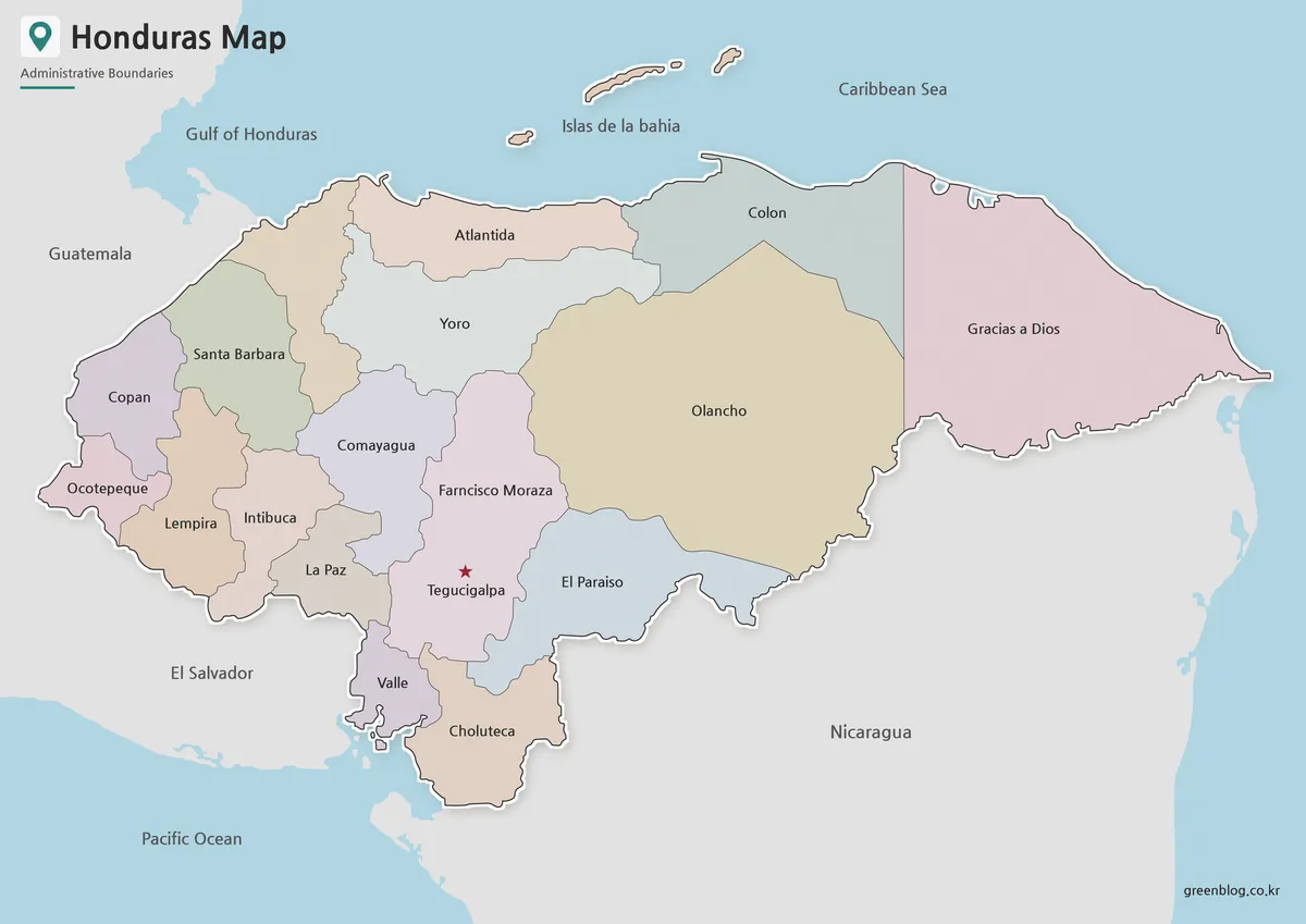
The color Honduras Map is designed to make administrative regions easier to separate at a glance. Because Honduras sits between Guatemala, El Salvador, and Nicaragua while also facing the Caribbean Sea, color separation helps readers quickly understand the country’s position within Central America.
This version works especially well for presentation slides, country profile pages, blog images, and visual study materials. The use of color makes it easier to compare inland areas with coastal regions and helps users follow the national outline without losing the administrative structure.
For educational use, the color map can be placed beside maps of Guatemala, Nicaragua, or El Salvador to explain regional connections. It is also useful for bloggers who need a more polished visual than a simple country locator map.
Black and White Printable Honduras Map
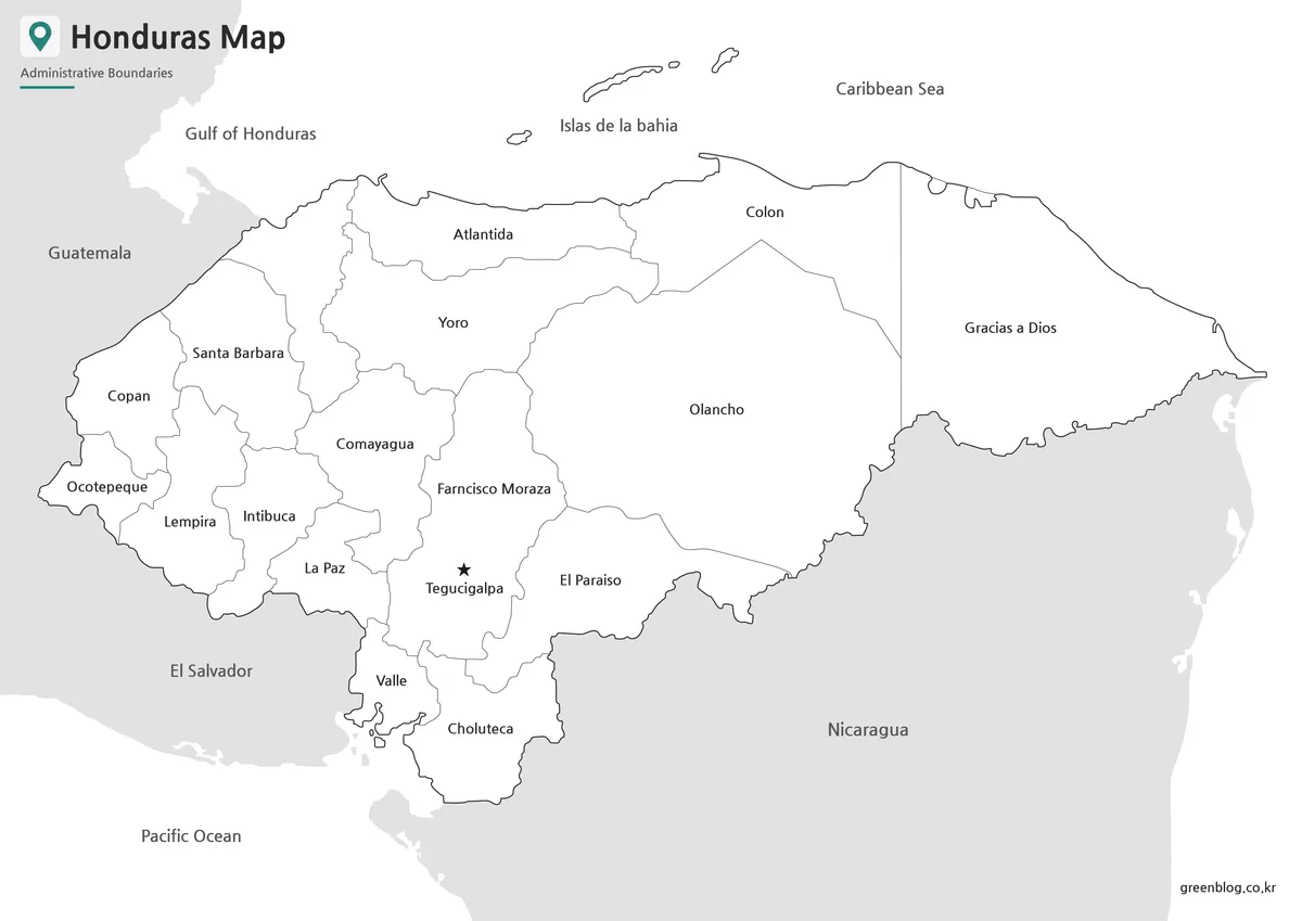
For printed documents, the black and white Honduras Map is often the most practical choice. It keeps the administrative boundaries and labels visible without relying on color, which makes it suitable for reports, school assignments, classroom handouts, and reference sheets.
The cleaner style is helpful when users want to add notes, highlight Tegucigalpa, mark neighboring countries, or compare Honduras with other Central American maps. Since the map is designed for A3-size printing, the label spacing and boundary lines were checked to remain readable when enlarged.
This version is also a good option for worksheets. Teachers can use it as a base map for geography activities, while students can mark the capital, surrounding countries, coastal areas, or selected regions.
Blank Honduras Outline Map for Editing
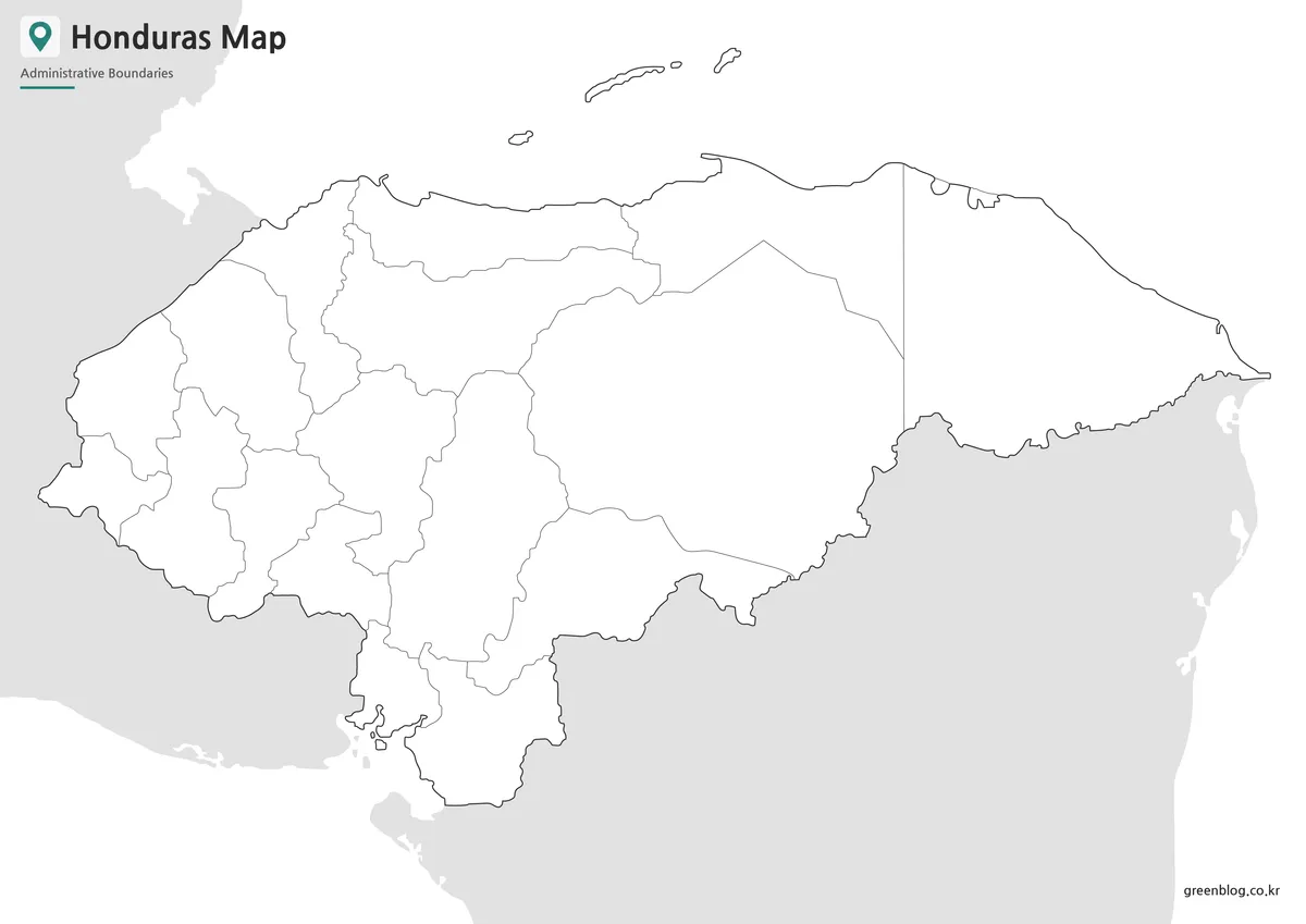
The blank outline map removes color and labels, leaving only the boundary structure. This makes it a flexible working base for users who want to create their own custom Honduras Map.
Designers can add colors, icons, arrows, statistics, travel routes, or regional data. Teachers can use the outline map for classroom coloring activities, country identification exercises, or map labeling worksheets. Bloggers and presentation creators can also use it to highlight specific locations without visual clutter.
Because the outline map keeps the administrative boundary lines visible, it is useful for infographic projects that require custom styling. Users can add population data, route markers, tourism points, or regional comparison notes depending on the purpose of the final material.
Honduras Flag Image
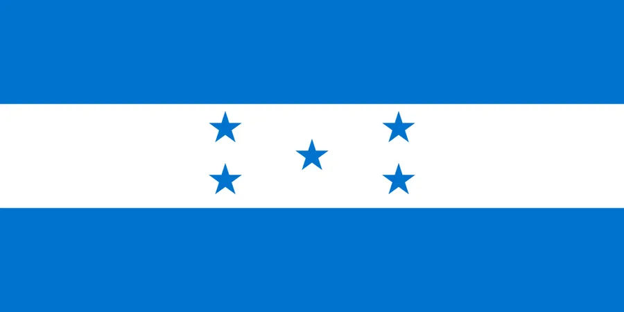
A Honduras flag image is also included for users who want to combine the map with national symbols. The flag features blue and white horizontal stripes with five stars in the center. When used together with the Honduras Map, it can support classroom country profiles, educational posters, and regional reference pages.
This is especially useful when creating a country introduction graphic. The map explains location and administrative structure, while the flag gives the page a clear national identity.
Practical Uses for This Honduras Map
A printable Honduras Map can be used in many situations where a small location image is not detailed enough. It is suitable for geography lessons, Central America comparison materials, travel route explanations, country profile pages, blog graphics, and presentation slides.
The map is also useful for visual projects that need a clean regional reference. For example, users can compare Honduras with Nicaragua, Guatemala, El Salvador, and other nearby countries. The outline version can also become a base for custom data visualization, making it useful for infographic creators and educational designers.
Why This Map Format Is Useful
Honduras has both coastal and inland geography, and its surrounding countries are important for understanding its regional position. A labeled and printable Honduras Map helps users explain this layout more clearly than text alone.
The three-map format also gives users more flexibility. A color map is better for visual presentation, a black and white map is better for printing, and a blank outline map is better for editing. This makes the collection useful for both quick reference and more customized projects.
FAQ
What does the Honduras Map include?
The Honduras Map includes administrative boundaries, regional labels, the capital city location, and neighboring country context.
Can I print this Honduras Map?
Yes. The files are prepared for high-resolution printing and are suitable for A3-size output.
Which version is best for classroom use?
The black and white map works well for handouts and worksheets. The outline map is better for labeling or coloring activities.
Is the outline map editable?
Yes. The blank outline version can be edited in design software or used as a base for custom map projects.
Honduras Map Download
Download the Honduras Map collection and choose the version that fits your project. Color, black and white, and outline map files are included for printing, classroom use, presentations, and editing work.
- File Format: JPG / PNG / ZIP
- Image Size: A3 high-resolution format
- Intended Usage: Printing, classroom materials, reports, presentations, blog graphics, and editing projects
Files are provided in a ZIP archive. After downloading, extract the archive and select the map version you want to use.
Additional Resources
- Perry-Castañeda Library Map Collection – Honduras Maps : Historical and reference maps of Honduras useful for comparing country location, regional layouts, and map styles.
Related Maps
- Printable Guatemala Map Collection for Education, Travel, and Design
- High Resolution North Dakota Map for Classroom, Presentation and Design Projects
- Nevada Map Download | Printable County Maps in Color, Black and White & Outline
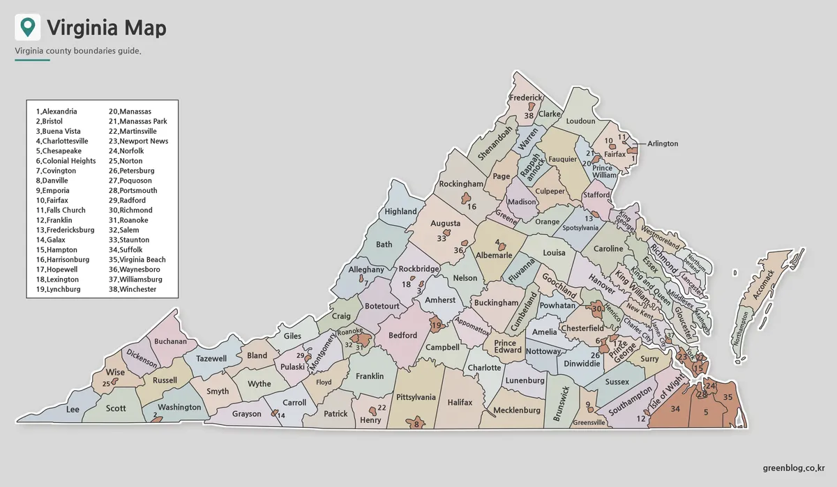
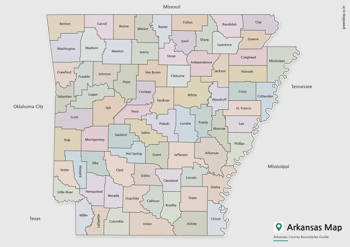
- Arkansas Map Collection: Printable County Maps in Color, Labeled, and Outline Formats
Green Map creates custom-edited map images using open geographic data sources such as geoBoundaries, Natural Earth, OpenStreetMap, and government open data.
These maps are edited visual materials, not raw data files, and are provided for education, documents, presentations, and graphic reference.