A Korean version of this map page is available. View Korean Page
A Guinea Map is useful when you need to explain the country’s location in West Africa, its connection to neighboring countries, and the placement of Conakry along the Atlantic coast. Guinea borders several countries, including Guinea-Bissau, Senegal, Mali, Côte d’Ivoire, Liberia, and Sierra Leone, so a clear regional map helps readers understand how the country fits into the western part of the African continent. It is also easy to confuse Guinea with Equatorial Guinea because of the similar English names, but the two countries are located in completely different parts of Africa. A labeled Guinea Map can help avoid that confusion in educational materials and visual explanations.
This printable Guinea Map collection includes three versions: a color regional map, a black and white printable map, and a blank outline map. The files are prepared in JPG format and arranged for A3-size use, making them suitable for classroom handouts, reports, blog graphics, presentation slides, geography worksheets, and simple editing projects. Each version has a different purpose. The color map is best for quick visual reference, the black and white version is easier to print, and the outline map works well when users want to add their own labels or data.
For teachers and students, this map can support lessons about West Africa, neighboring countries, natural resources, regional comparison, or national geography. Bloggers and presentation creators can use it when introducing Guinea, comparing African countries, or explaining the difference between Guinea, Guinea-Bissau, and Equatorial Guinea. Designers may prefer the outline version because it gives them a clean base for custom infographic work.
During the map preparation process, the boundary structure was organized in Illustrator, while the final color adjustment was completed in Photoshop. The capital, Conakry, was marked clearly with a star icon so it can be recognized quickly. The regional labels were reviewed for readability on both screen and print, especially because Guinea’s shape stretches from the Atlantic coast toward inland West Africa.
Table of Contents
Guinea Map Overview
This Guinea Map set was created as a printable and editable visual resource rather than a long country profile. The focus is on map usability: regional boundaries, capital placement, neighboring-country context, and clean layout for practical use.
Guinea is located in West Africa and has access to the Atlantic Ocean. Its capital, Conakry, sits along the coast, while the country extends inland toward Mali and Côte d’Ivoire. Because the country touches several neighboring states, a map is often more effective than text when explaining location and regional relationships.
The collection includes:
- map versions for printing, editing, and presentation use
- color regional map
- black and white printable map
- blank outline map
- JPG file format
- A3-size layout
- labeled regional boundaries
- capital city marking
Printable Map Styles Included
The three map styles were designed for different types of projects. Some users may need a finished visual map for a blog post or presentation, while others may want a clean worksheet-style map or an editable base for custom graphics.
Regional Color Map
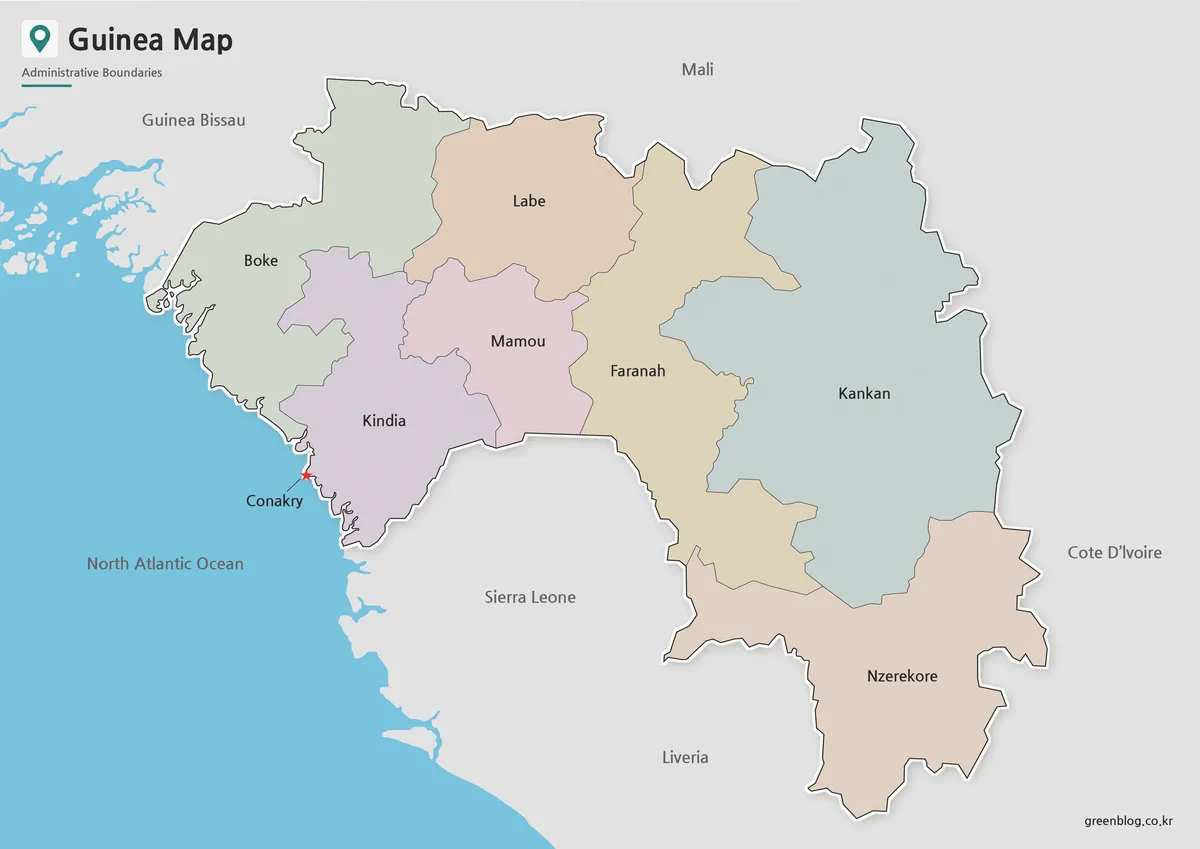
Designed with color-coded administrative areas, the regional color map helps separate Guinea’s internal divisions while keeping the overall layout easy to read. This is useful for a country like Guinea because the map needs to show both the coastal capital area and the long inland structure extending toward Mali and Côte d’Ivoire.
Conakry is marked with a star icon so users can immediately find the capital. Neighboring countries such as Guinea-Bissau, Sierra Leone, Liberia, Côte d’Ivoire, Mali, and Senegal are included as name references without adding unnecessary boundary clutter. This keeps the focus on Guinea while still giving enough regional context for West Africa comparison materials.
The color palette was kept soft rather than overly bright, so labels remain visible when the map is used in presentation slides or printed as a reference sheet. This version works well for blog images, classroom displays, country introduction pages, and visual geography explanations.
Black and White Printable Map
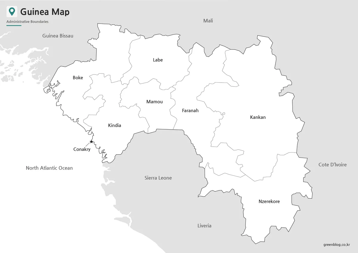
For printed materials, the black and white Guinea Map provides a cleaner layout without color fill. This is helpful when preparing worksheets, reports, or handouts where ink use and label clarity matter more than visual decoration.
Because Guinea includes several neighboring country labels and a coastal capital area, the map can feel crowded if too much color is added. The simplified black and white layout makes the regional names and boundary lines easier to follow. It also works well when users want to mark specific locations, draw arrows, or add notes after printing.
This version is suitable for:
- classroom handouts
- student assignments
- printed reports
- reference sheets
- document inserts
- simple travel or country explanation materials
The black and white style also makes it easier to combine this Guinea Map with other African country maps in the same printed packet.
Blank Outline Map for Editing
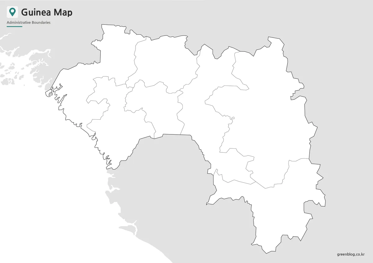
The blank outline version removes both labels and color, leaving only the boundary structure. This makes it the most flexible option for users who want to customize the map.
Teachers can use the outline map for geography quizzes, coloring activities, or exercises where students label Conakry, neighboring countries, or selected regions. Designers can add custom colors, icons, routes, resource markers, or data layers. For example, the map can be used to show bauxite-related regions, transportation routes, regional comparison data, or simplified West Africa infographic content.
The line structure was kept clean so users can add their own information without first removing existing text or color. For editing in Photoshop, Illustrator, or other graphic tools, this blank Guinea outline map works as a practical base layer.
Why This Map Is Useful
A written description can explain that Guinea is located in West Africa, but a visual map makes the regional structure much easier to understand. The country’s Atlantic coast, Conakry’s position, and the long inland stretch toward Mali and Côte d’Ivoire are clearer when shown together.
The map is also useful because of the name confusion between Guinea, Guinea-Bissau, and Equatorial Guinea. When creating educational materials or country comparison graphics, placing Guinea on a map helps readers understand that these are separate countries in different locations.
A3-size preparation gives the map enough room for labels and boundaries to remain clear when printed or enlarged. This is especially helpful for classroom posters, slide decks, and downloadable reference pages where small labels often become difficult to read.
Practical Uses for the Guinea Map
The color version is a good choice for blog posts, presentations, and visual country introductions because it gives readers an immediate sense of the regional layout. It can also be paired with maps of Guinea-Bissau, Sierra Leone, Liberia, or Côte d’Ivoire for West Africa comparison content.
The black and white version works better for printed documents and student materials. It gives enough geographic detail without using unnecessary color, making it easier to annotate or include in reports.
The outline version is best for custom work. It can be used as a blank map for geography exercises, regional data visualization, infographic projects, or design layouts where the user needs full control over colors and labels.
Frequently Asked Questions
What is included in this Guinea Map collection?
The collection includes a color regional map, a black and white printable map, and a blank outline map.
Can I print the Guinea Map in A3 size?
Yes. The layout was prepared with A3-size printing in mind.
Which version is best for classroom handouts?
The black and white map is usually the best choice for worksheets, reports, and printed study materials.
Is the outline map editable?
Yes. The blank outline version is suitable for coloring, labeling, annotations, and infographic editing.
Download Information
Choose the version that fits your project. Use the color map for visual explanation, the black and white map for printing, and the outline map for editing or worksheet activities.
The files are provided in JPG format and can be used for classroom materials, blog graphics, presentation slides, study resources, and basic design projects.
Guinea Map Download
Download the printable Guinea Map collection with color, black and white, and outline versions for education, presentations, worksheets, and editing projects.
Image Size: A3-size layout
Included Versions: Color Map, Black and White Map, Outline Map
Intended Usage: Printing, classroom materials, blog graphics, presentation slides, and infographic editing
Related Maps
- Guinea-Bissau Map Download – Printable Regional Map Set
- Ghana Map Download – Printable Ghana Map in 3 Versions
- High Resolution Ethiopia Map Set with Color and Blank Versions
- Gabon Map for Classroom, Presentation and Design Projects
Additional Resources
- HDX – Guinea Subnational Administrative Boundaries : Administrative boundary dataset for Guinea, useful for checking regional divisions and map boundary references.
Green Map creates custom-edited map images using open geographic data sources such as geoBoundaries, Natural Earth, OpenStreetMap, and government open data.
These maps are edited visual materials, not raw data files, and are provided for education, documents, presentations, and graphic reference.