An Ethiopia Map needs a date note when its internal lines reflect an earlier administrative system. The three supplied images share one 1,200 × 848-pixel landscape composition: a pastel labeled edition, a black-and-white labeled edition, and a blank boundary outline. They provide a consistent A3-oriented resource for lessons, reports, slides, and map-marking activities, but their regional framework should not be mistaken for Ethiopia’s present first-level divisions.
The labeled maps place Ethiopia between Sudan, South Sudan, Kenya, and Somalia, then extend the frame northeast to the Red Sea, Gulf of Aden, and Yemen. That wider setting is helpful because Ethiopia is landlocked. However, Eritrea and Djibouti—both direct neighbors between Ethiopia and the named waters—appear as surrounding land shapes without labels. A complete border exercise therefore requires those two names to be added.
Inside the country, the artwork still prints “Southern Nations, Nationalities and Peoples” across one broad southern area. It does not separate Sidama, South West Ethiopia Peoples’, Central Ethiopia, or South Ethiopia. Those later regional states are central to understanding the current system, so this collection is most reliable as a legacy-boundary reference, a comparison exercise, or an editable starting point with an explicit limitation statement.
Table of Contents
Ethiopia Map Collection Overview
The labels on the color and monochrome maps identify Tigray, Amhara, Afar, Benishangul-Gumuz, Gambela, Oromia, Somali, and the former southern region. They also show Addis Abeba, Dire Dawa, and Harar in small central-eastern areas. These names describe what is printed, not necessarily the preferred current English terminology. Addis Ababa is the usual English spelling of the federal capital, Harari is the name of the regional state, and Gambella is a common official English form.
Ethiopia’s present top-level structure consists of 12 regional states and two city administrations. The regional states are Afar, Amhara, Benishangul-Gumuz, Central Ethiopia, Gambella, Harari, Oromia, Sidama, Somali, South Ethiopia, South West Ethiopia Peoples’, and Tigray; Addis Ababa and Dire Dawa have city-administration status. Sidama became a separate regional state after its referendum, South West Ethiopia followed in 2021, and Central and South Ethiopia were established in 2023.
That sequence explains the principal mismatch in the files. A reader cannot create the four newer southern regions merely by replacing one label, because new first-level boundary lines are also required. For any current administrative graphic, obtain a recent authoritative boundary layer. For a historical comparison, retain the original image and state that it depicts the former SNNP-based arrangement.
The map’s broad spatial relationships remain easy to study. Tigray sits in the north; Amhara occupies much of the northwest and center; Afar descends along the northeast; and Somali reaches far across the east and southeast. Oromia spans a large central and southern arc around Addis Ababa, while Benishangul-Gumuz and Gambela lie along the western side. Roads, rivers, relief, elevations, city networks, coordinates, and a distance scale are not included.
Included Ethiopia Map Versions
The package changes visual treatment while holding the geographic frame and old boundary geometry constant. This makes the three files easy to use as a sequence, but it also means none of them independently updates the administrative content.
- Color labeled: pastel fills distinguish adjoining legacy regions at a glance.
- Black and white labeled: names and lines remain visible without categorical color.
- Blank outline: text and fill are removed for labeling or custom overlays.
Select by task rather than appearance alone. Color supports immediate comparison, monochrome fits text-heavy or photocopied pages, and the blank version asks the reader to supply information. If current regional administration is the task, update the geometry before choosing a style.
Regional Color Ethiopia Map
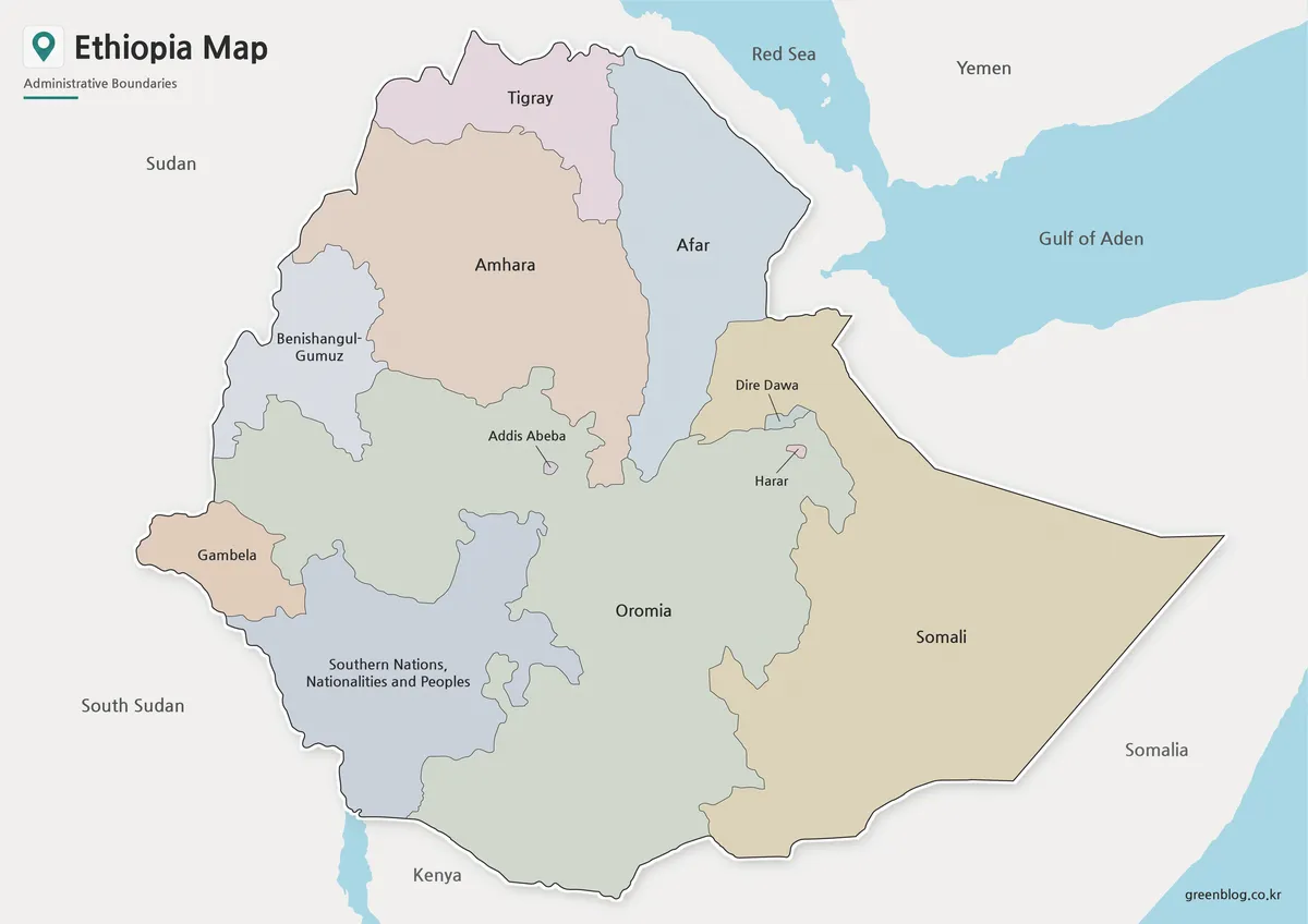
Muted fills separate the large internal areas without overwhelming their labels. The contrast is particularly helpful where Amhara meets Tigray, Afar, Benishangul-Gumuz, and Oromia, and where the long Somali area borders Oromia and Afar. Small spaces around Addis Abeba, Harar, and Dire Dawa depend more on outlines and label placement than on fill color.
The palette is purely categorical. It does not represent population, language shares, rainfall, elevation, political control, or any ranked measurement. If the map becomes the base of an infographic, use a separate documented legend for new data and do not let the original pastel tones appear to be part of that scale.
Blue water and the Yemen label pull the eye toward the northeastern regional setting. Since the two unlabeled coastal neighbors separate Ethiopia from both named seas, a caption should make the landlocked relationship explicit. This edition is strongest for a presentation or introductory comparison where color assists orientation and the legacy date is visible beside the image.
Black and White Printable Ethiopia Map
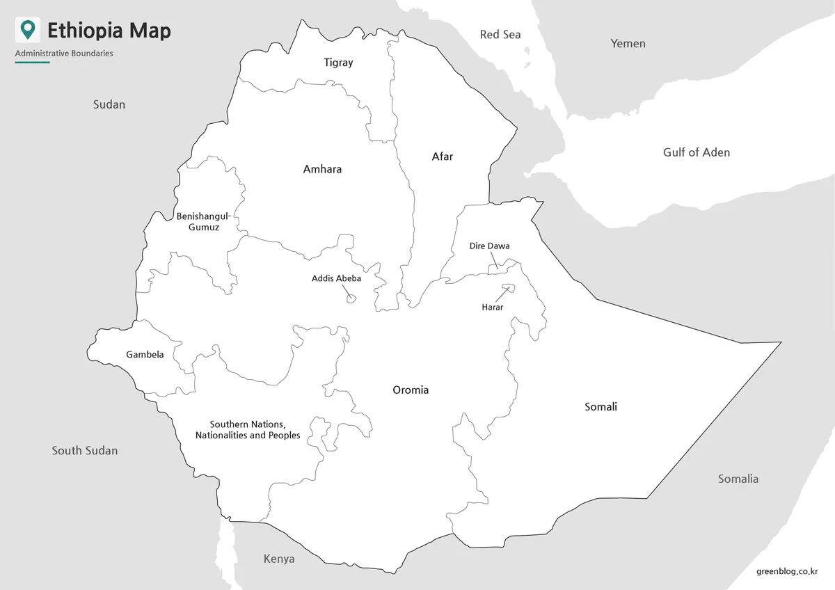
The monochrome file preserves the same names, outer context, and internal lines while removing pastel fills. It can sit beside prose, tables, or student questions without competing for attention. It also gives readers room to underline labels, draw arrows, or mark which parts of the former southern region later became separate states.
Reduction should be conservative. The broad labels remain readable at smaller sizes, but Addis Abeba, Harar, and Dire Dawa occupy a crowded portion of the map. Preserve the landscape ratio, avoid stretching, and test one copy before making a large print run. A note beneath the image is preferable to squeezing several correction labels into the same small area.
This version does not become more current because it looks more technical. Every regional boundary and spelling follows the color source. Use it for a historical handout, a comparison sheet, or a labeled answer key only when readers are told which administrative system it represents.
Blank Ethiopia Outline Map for Editing
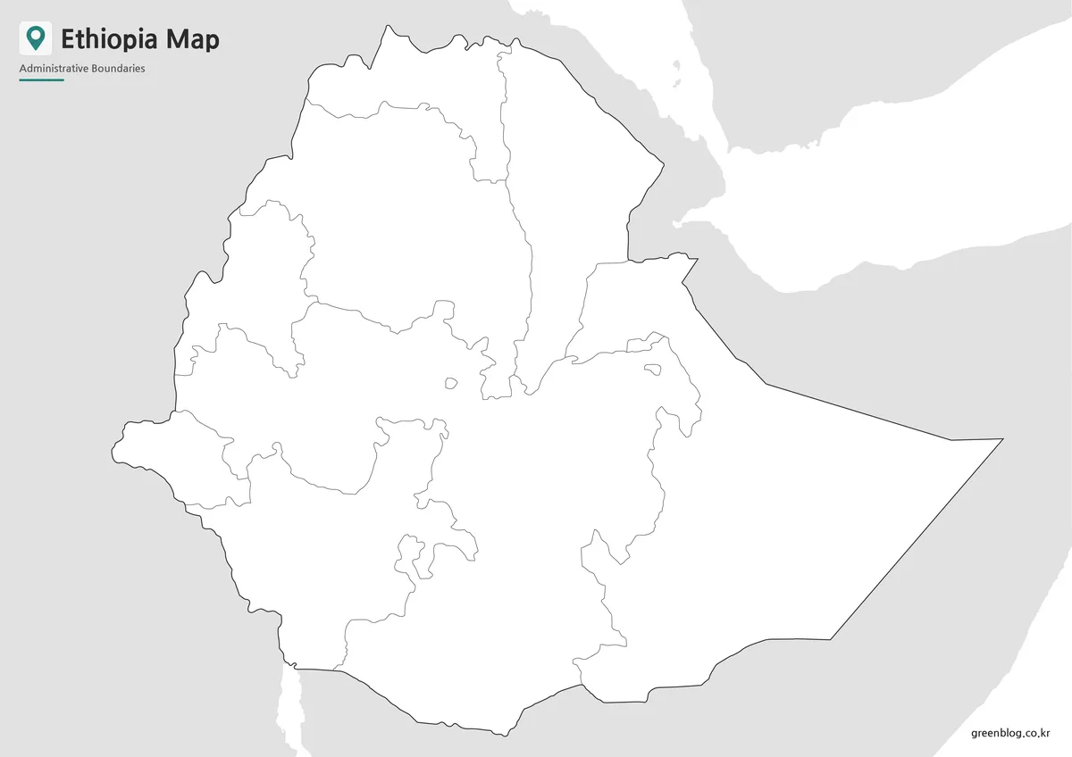
The outline edition removes country names, regional labels, water text, and all categorical fill. It retains the national silhouette, surrounding land-and-water shapes, and the same older internal divisions. That combination is valuable for recall exercises because students cannot copy answers directly from the page.
One assignment can ask learners to reproduce the labels exactly as represented and then compare the result with a current map. Another can focus on neighboring geography: add Eritrea and Djibouti, identify the countries already implied by the frame, and explain why the Red Sea and Gulf of Aden do not form Ethiopian coastlines. The blank page also accommodates city symbols, movement arrows, or sourced thematic values.
Keep the original file unchanged and edit a duplicate. Every added symbol needs a legend, and every statistical overlay needs a reference year and source. If the project claims to show current regions, replace the southern boundary network rather than tracing or guessing from this simplified legacy image.
Built for Printing, Slides, and Visual Projects
Each preview measures 1,200 × 848 pixels, an aspect ratio of roughly 1.42:1. The files were prepared around an A3 layout, but print clarity still depends on the software, printer, scaling, and margins used. Fit the image proportionally inside the page rather than forcing it to the paper edges. Cropping the northeast may remove the water context; cropping the west or south may remove neighboring-country labels.
For a slide, place the administrative-date note close enough to remain visible when the map is projected. For a worksheet, reserve a separate answer area so corrections do not obscure small central-eastern divisions. For a report, select monochrome unless the pastel colors serve a specific explanatory role. These choices preserve readability without implying that the graphic contains detail it does not provide.
The files have no scale bar, coordinate grid, projection statement, route network, terrain layer, or surveyed boundary precision. They should not be used to calculate distances, navigate, settle border questions, or place infrastructure. Their purpose is visual orientation and structured annotation at a simplified first-level scale.
Practical Uses for the Ethiopia Map
The strongest use is a boundary-change lesson. Begin with the labeled color image, ask students to find the former southern unit, and then introduce the creation of Sidama, South West Ethiopia Peoples’, Central Ethiopia, and South Ethiopia. The outline can become a comparison worksheet, while the monochrome file can serve as the legacy answer key.
A second activity can examine regional context rather than administration. Readers identify Sudan, South Sudan, Kenya, and Somalia from the printed names, add Eritrea and Djibouti, and locate Yemen across the water. This turns two apparent omissions into a useful map-reading task and reinforces Ethiopia’s landlocked position within the Horn of Africa.
- Compare the former SNNP framework with today’s southern regional states.
- Practice the regional and city-administration names shown in the artwork.
- Correct Addis Abeba, Harar, and Gambela for a chosen naming standard.
- Add missing neighbor labels and explain the two named seas.
- Build a dated thematic graphic from verified external data.
Editors should match every claim to what is visible. The images show broad regional divisions and surrounding geographic context; they do not show lower-level zones or woredas, transport, terrain, waterways inside the country, or a full city network. A concise caption stating “legacy regional boundaries” prevents an attractive illustration from being read as a current legal or statistical base.
FAQ
What is included in this Ethiopia Map collection?
The collection includes a color Ethiopia Map, a black and white labeled map, and a blank outline map.
Can I print the Ethiopia Map in A3 size?
Yes. The files were prepared for high-resolution A3-size use, making them suitable for classroom printing, reports, and presentation materials.
Is the Ethiopia outline map editable?
Yes. The blank outline version is useful for adding labels, colors, markers, routes, regional data, or infographic elements.
Which Ethiopia Map version is best for classroom use?
The black and white map is best for printed handouts, while the outline map works well for worksheets and student activities.
Can I use the Ethiopia Map for presentations?
Yes. The color map is useful for presentation slides because the regional divisions are easier to compare visually.
Current-boundary note: The protected answers accurately describe the three supplied styles, but their references to regional divisions apply to the older geometry visible in every file. Pair the package with a current authoritative source whenever present-day administration is the subject.
Map File Information
The ZIP archive contains matching color, black-and-white, and blank outline images using one legacy regional boundary framework.
- Included Versions: Color labeled, black-and-white labeled, and blank outline
- Printable Size: Prepared for an A3 layout
- File Type: Image files in a ZIP archive
Related Maps
Additional Resources
- Ethiopian News Agency: Central and Southern Regions: read the official August 2023 report on the establishment of Central Ethiopia and South Ethiopia.
Green Map creates custom-edited map images using open geographic data sources such as geoBoundaries, Natural Earth, OpenStreetMap, and government open data.
These maps are edited visual materials, not raw data files, and are provided for education, documents, presentations, and graphic reference.