A Korean version of this map page is available. View Korean Page
A Ghana Map is useful when you need more than a simple country outline of West Africa. Ghana sits along the Gulf of Guinea, bordered by Côte d’Ivoire to the west, Burkina Faso to the north, and Togo to the east. Because the country has a clear coastal edge, an inland regional structure, and the large Lake Volta cutting through the eastern side, a labeled and printable map makes the layout much easier to understand.
This printable Ghana Map collection includes three versions: a color regional map, a black and white labeled map, and a blank outline map. The files are prepared for high-resolution use and are suitable for classroom handouts, geography worksheets, blog graphics, travel presentations, infographic projects, and editable design work. The collection is arranged so users can choose a version based on how they plan to use the map rather than relying on one general-purpose image.
For students and teachers, the labeled Ghana Map helps explain the country’s location in West Africa and its relationship with neighboring countries. For bloggers and presentation creators, the color version works well as a visual reference when discussing Ghana, cocoa production, regional geography, travel routes, or West African comparison materials. Designers may prefer the outline version because it provides a clean boundary base without extra labels or colors.
While preparing this map set, extra attention was given to keeping the layout readable at larger print sizes. Accra is marked clearly as the capital, Lake Volta is included because it is too important to omit from the country’s visual structure, and surrounding countries are shown in a simplified way to avoid making the map look crowded. The goal was to create a practical Ghana Map resource that can work both as a printable reference and as a flexible editing base.
Table of Contents
Printable Ghana Map Collection
This Ghana Map set was created for users who need a clean visual resource rather than a long country description. The main focus is on map usability, regional readability, and flexible use across different projects.
The collection includes:
- Color Ghana Map with regional boundaries
- Black and white Ghana Map for printing
- Blank Ghana outline map for editing
- Capital city marker for Accra
- Lake Volta included as a major geographic feature
- Neighboring country names shown for location context
The maps are designed to support both print and digital use. They can be added to reports, presentation slides, educational materials, travel content, printable study resources, and custom infographic layouts.
Easy-to-Read Regional Layout
Ghana’s shape is fairly compact compared with some larger African countries, but its map still benefits from clear regional separation. The southern coastline, central inland areas, northern regions, and the Lake Volta area each create a different visual structure. Without color or boundary lines, these differences can be difficult to explain in a short article or presentation.
The Ghana Map layout keeps the surrounding countries simple while preserving the main internal structure. This makes it easier to compare Ghana with nearby West African countries or to explain where Accra is located in relation to the coast.
Color Ghana Map for Regional Reference
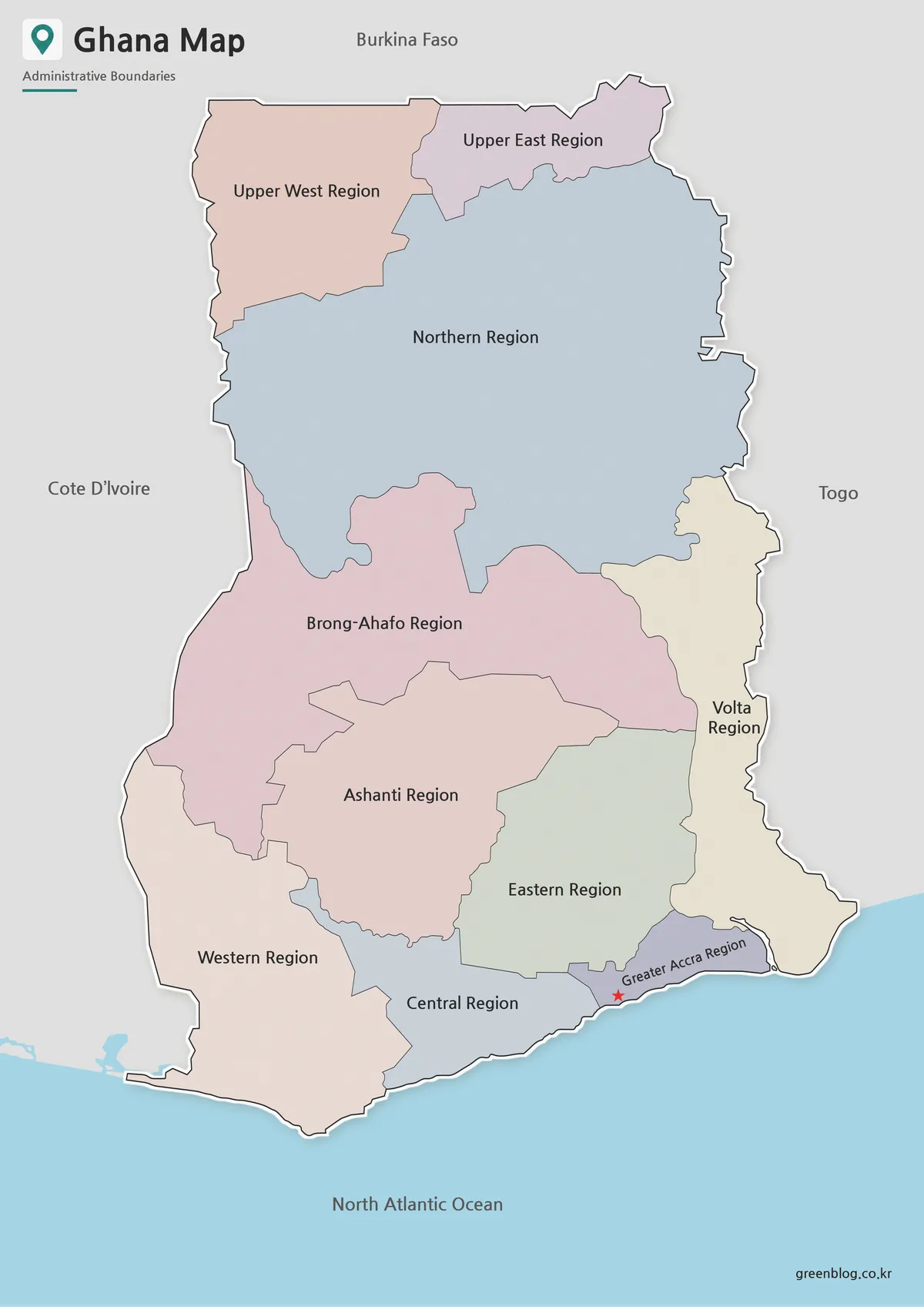
The color version is designed for quick visual reading. Each region is separated by color so viewers can understand the administrative layout without studying every boundary line closely. This is especially helpful when Ghana is used in classroom materials, regional comparison slides, or blog posts about West Africa.
Accra is marked with a clear capital symbol, making it easy to identify the country’s main urban center. Lake Volta is also included because it strongly affects the visual balance of the map. In a Ghana Map, leaving out Lake Volta would make the eastern and central areas feel less accurate as a geographic reference.
This version works well for:
- West Africa geography lessons
- presentation slides about Ghana
- blog graphics and travel articles
- regional comparison materials
- educational posters or handouts
The color map is the best starting point when you want readers to understand the overall structure quickly.
Black and White Ghana Map for Printing
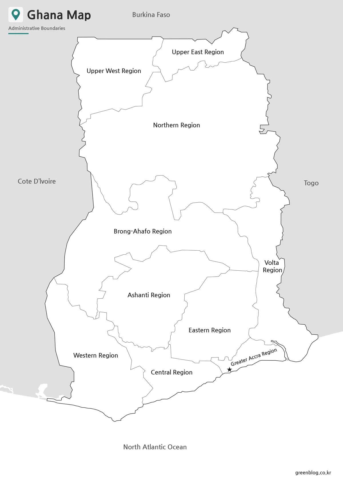
For printed documents, a cleaner map is often more useful than a fully colored one. The black and white Ghana Map reduces visual weight while keeping the regional boundaries and labels easy to read. This makes it suitable for worksheets, reports, classroom packets, and documents where users may want to write notes directly on the page.
The simplified style also helps when the map is printed on standard office printers. Since Ghana includes coastline, inland boundaries, and Lake Volta, keeping the design uncluttered helps the labels remain readable. This version is also useful when you want to add your own highlights, routes, or symbols without removing existing colors first.
The black and white map is a good choice for:
- classroom printing
- geography worksheets
- report inserts
- study materials
- simple presentation reference pages
If the color version is best for visual comparison, the black and white version is better for practical printing and note-taking.
Blank Ghana Outline Map for Editing
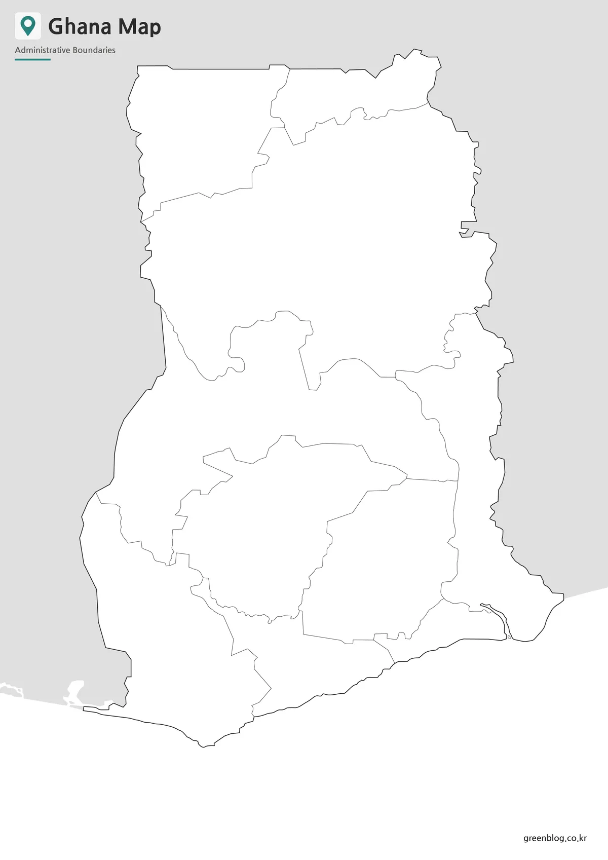
The outline version removes labels and colors, leaving only the main boundary structure. This makes it a flexible base map for custom projects. Teachers can use it for coloring activities or location quizzes, while designers can add their own region colors, arrows, icons, or data points.
A blank Ghana outline map is especially useful when creating infographic content. For example, users can mark cocoa-producing areas, travel routes, city locations, population distribution, regional comparison data, or presentation highlights. Because the map does not include extra visual elements, it can be adapted to many different topics without looking crowded.
The outline map works well for:
- infographic design
- classroom map activities
- editable presentation graphics
- custom regional coloring
- travel route marking
- data visualization projects
For users working in graphic software, the clean boundary structure makes the editing process easier.
Built for Classroom, Blog, and Presentation Use
Different users need a Ghana Map for different reasons. A teacher may need a printable map for a West Africa lesson, while a blogger may want a clear image to explain Ghana’s location next to Côte d’Ivoire, Burkina Faso, and Togo. A designer may need a blank base map for a custom infographic or a presentation creator may want a simple labeled reference slide.
This collection was arranged with those practical uses in mind. The color version gives a quick overview, the black and white version supports printing, and the outline version allows editing. Instead of using one map for every situation, users can choose the format that fits the project.
Practical Uses for This Ghana Map
A Ghana Map can be used in many types of visual content. In education, it can help students understand Ghana’s position along the Atlantic coast and its connection to nearby West African countries. In presentations, it can be used to introduce the country before discussing trade, agriculture, travel, culture, or regional geography.
For blog posts and online resources, the map provides a clearer visual reference than text alone. When writing about Ghana’s capital, coastline, Lake Volta, cocoa production, or West African location, a clean map helps readers understand the context more quickly.
For design projects, the outline version can act as a base layer. Users can add markers, labels, shaded regions, arrows, icons, or custom colors depending on the topic.
Frequently Asked Questions
Does this Ghana Map include Lake Volta?
Yes. Lake Volta is included because it is one of the most important geographic features in Ghana and helps explain the country’s internal layout.
Can I use the Ghana Map for classroom materials?
Yes. The black and white and outline versions are especially useful for worksheets, handouts, and student activities.
Which version should I use for presentations?
The color Ghana Map is usually best for presentation slides because the regional boundaries are easier to distinguish visually.
Is the outline map editable?
Yes. The blank outline map is intended for editing, coloring, labeling, infographic design, and custom annotations.
Is this Ghana Map suitable for printing?
Yes. The maps are prepared as high-resolution resources and are suitable for printable reference use.
Ghana Map Download
Download the printable Ghana Map collection with color, black and white, and outline versions for education, presentations, printing, and graphic editing.
Included Maps: Color map, black and white map, outline map
Intended Usage: Classroom materials, reports, presentations, blog graphics, infographic projects
Additional Resources
- Natural Earth – Free vector and raster map data Helpful for creating country-level reference maps, regional comparison maps, and simplified geographic layouts.
- Humanitarian Data Exchange – Ghana administrative boundary datasets Useful for users who need GIS-based administrative boundary data for Ghana.
Related Maps
- High Resolution Ethiopia Map Set with Color and Blank Versions
- Democratic Republic of the Congo Map Download – Printable Color, Black and White, and Outline Maps
- Gabon Map for Classroom, Presentation and Design Projects
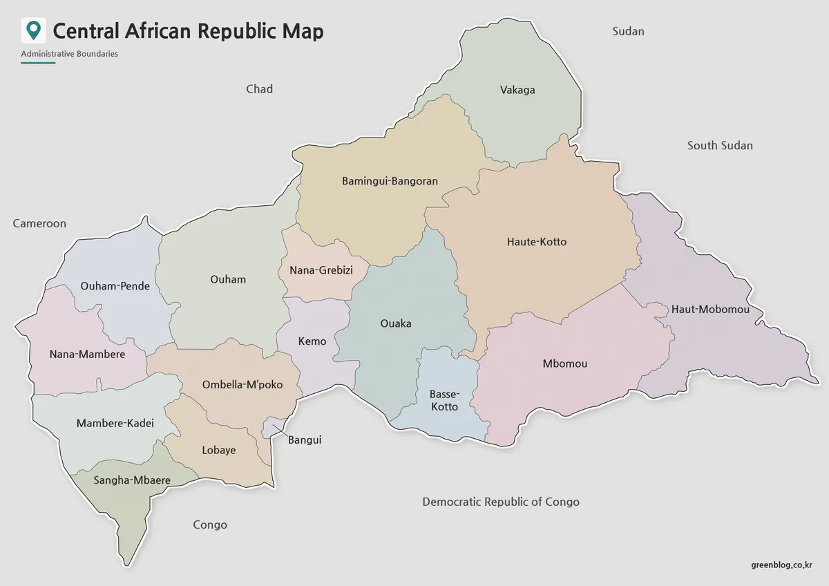
- Central African Republic Map Download | Printable Administrative Map Collection
Green Map creates custom-edited map images using open geographic data sources such as geoBoundaries, Natural Earth, OpenStreetMap, and government open data.
These maps are edited visual materials, not raw data files, and are provided for education, documents, presentations, and graphic reference.