A Gabon Map in this collection separates nine provinces while keeping the Atlantic coastline and three neighboring countries visible. Woleu-Ntem forms the broad northern section, Nyanga reaches the southern coast, and five provinces named for the Ogooué system occupy much of the center, east, and west. The tall page shape leaves room for both the national outline and the surrounding geographic context.
The labeled maps identify Estuaire, Haut-Ogooué, Moyen-Ogooué, Ngounié, Nyanga, Ogooué-Ivindo, Ogooué-Lolo, Ogooué-Maritime, and Woleu-Ntem. The artwork uses simplified spellings without several French accents, such as Ogooue and Ngounie, and prints Ogooue Lolo without the usual hyphen. Readers copying names into a report may therefore want to use the accented forms shown in this article.
Cameroon is labeled above Gabon, Equatorial Guinea lies beside the northwest, and “Congo” appears along the south and southeast. In this context, Congo means the Republic of the Congo, not the Democratic Republic of the Congo. The Atlantic Ocean is named twice in the left margin, once as Atlantic Ocean and again farther south as South Atlantic Ocean.
Three matching versions are supplied: a pastel province map, a labeled monochrome map, and an unlabeled outline. Each preview measures 1200 × 1697 pixels and uses the same province geometry. The files concentrate on first-level administrative boundaries; they do not show departments, roads, rivers, terrain, national parks, ports, or city locations.
Table of Contents
Printable Gabon Map Collection
The color and black-and-white versions contain the same nine province names and neighboring-country labels. The outline removes all words and fills but retains the country silhouette and provincial lines. This consistency allows one image to serve as a reference while another becomes a labeling or color-coding exercise.
An unusual small polygon appears inside Estuaire on all three images. It is not named in the supplied artwork, so it should not be counted as a tenth province or described as a confirmed city boundary. Gabon still has nine provinces on this page, and any interpretation of that inner shape requires a separate, current administrative source.
The maps also omit Libreville, the national capital, along with other cities. Estuaire helps orient readers toward the northwestern coast, but the province label is not a city marker. For projects that require Libreville, Port-Gentil, Franceville, or Oyem, place those locations only after consulting a dependable city or reference map.
Color Gabon Map
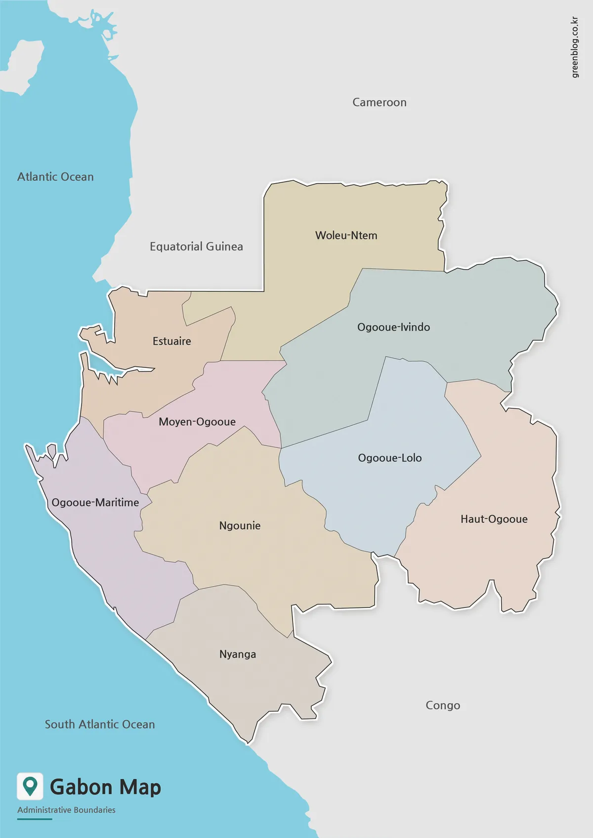
The color version uses a different muted fill for adjoining provinces. Woleu-Ntem occupies the rectangular north, Ogooué-Ivindo spans a broad northeastern area, and Haut-Ogooué reaches the southeastern frontier. Across the west, Estuaire and Ogooué-Maritime meet the Atlantic, while Nyanga forms the southern coastal end.
Moyen-Ogooué sits between Estuaire, Ogooué-Maritime, Ngounié, and the central-eastern provinces. Ogooué-Lolo is landlocked between Ogooué-Ivindo, Haut-Ogooué, and Ngounié. These relative positions are easier to compare in color, especially where several boundaries converge near the center of the country.
The palette has no statistical meaning. It does not encode forest cover, population, language, elevation, mineral resources, or election results. The blue ocean and gray neighboring territory provide geographic separation, while the province fills function only as visual categories. Any thematic use needs a new legend and a cited data source.
Black and White Gabon Map for Printing
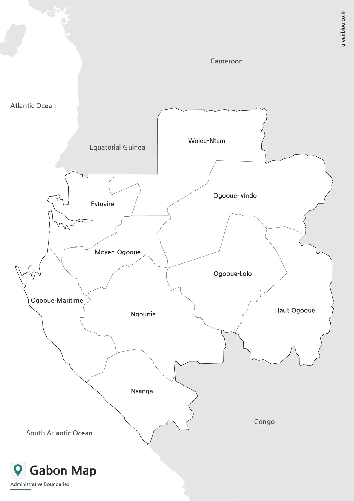
The monochrome version replaces the pastel areas with white while keeping every province name and surrounding label. It is suitable for low-ink handouts, report appendices, and answer sheets. Readers can shade selected provinces by hand without first removing an existing color scheme.
Line weight becomes the main visual guide in this version. The national border is darker than the provincial divisions, helping distinguish Gabon from the gray neighboring areas. Coastal indentations around Estuaire and Ogooué-Maritime remain visible, as does the straighter southern shoreline of Nyanga.
This map works well as the labeled counterpart to the blank activity. Students can transfer the nine names, identify provinces with Atlantic frontage, or find those touching Cameroon or Equatorial Guinea. It is not a road or physical map, so it should not be used to infer travel routes, river courses, or relief.
Blank Gabon Outline Map for Editing
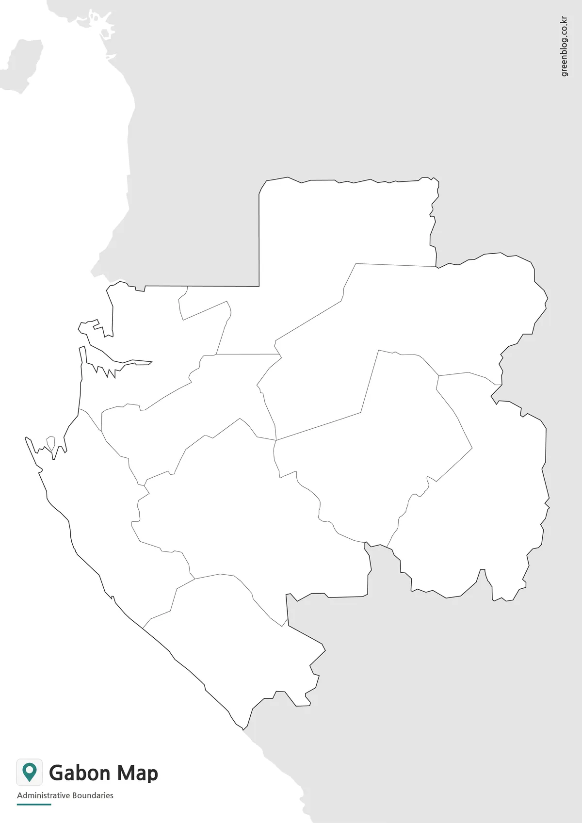
The blank version removes province names, neighboring countries, ocean text, and all color. It retains nine principal province areas plus the small unnamed polygon within Estuaire. Anyone assigning a labeling exercise should explain that the inner polygon is not an additional province and provide the labeled map for comparison.
A practical labeling sequence begins with Woleu-Ntem at the top and Nyanga at the bottom. Estuaire and Ogooué-Maritime can then be placed along the coast, followed by Haut-Ogooué on the southeast. The remaining four central provinces fit between those anchors, reducing confusion among the several names containing Ogooué.
The outline can support classroom quizzes, presentation overlays, regional statistics, and custom color schemes. It is a raster image rather than a confirmed layered vector file, so digital annotations should be added on a separate layer or in a document program. Boundary-sensitive publication work should be checked against a current authoritative map.
Practical Uses for This Gabon Map
Choose the color version when province separation must be immediate, the monochrome version when names must remain available in a printable document, and the outline when the reader will supply labels or sourced information. Because all three share the same geometry, they can be used together as reference, activity, and answer-sheet views.
The 1200 × 1697 proportions suit a portrait page. Use print preview to keep the Cameroon label, the southern Congo label, and the title panel away from hardware margins. A fit-to-page setting preserves the complete surrounding context, while a test print helps confirm that accented province names added by the user remain readable.
For an introductory lesson, ask which provinces reach the Atlantic, which share an international border, and why “Congo” must be interpreted carefully. For a report, use the labeled version as a location reference and add cities only from a separate source. This keeps the simple province artwork useful without claiming information it does not display.
Frequently Asked Questions
What is included in this Gabon Map collection?
The collection includes a color map, a black and white labeled map, and a blank outline map. Each version is designed for a different use, from printing to editing.
Can I use the Gabon Map for classroom materials?
Yes. The printable Gabon Map versions are suitable for handouts, geography lessons, student reports, and educational worksheets.
Which version is best for editing?
The blank outline map is the best choice for editing. It has only boundary lines, so you can add colors, labels, routes, or custom information.
Is the black and white version good for printing?
Yes. The black and white Gabon Map was prepared for cleaner printing and works well when color output is not needed.
Map File Information
Download three matching Gabon province maps for labeled reference, monochrome printing, or custom annotation.
- Included Versions: Color labeled, black-and-white labeled, and blank outline maps
- File Type: Image files / ZIP
- Intended Use: Lessons, reports, presentations, and province-labeling activities
Related Maps
Additional Resources
- United Nations Geospatial: Gabon — Consult a UN reference map for geographic orientation and administrative context.
Green Map creates custom-edited map images using open geographic data sources such as geoBoundaries, Natural Earth, OpenStreetMap, and government open data.
These maps are edited visual materials, not raw data files, and are provided for education, documents, presentations, and graphic reference.