A Korean version of this map page is available. View Korean Page
A Sudan map is useful when you need to explain the country’s large land area, state divisions, and position in northeastern Africa in a clear visual format. Sudan is bordered by several countries, including Egypt, Libya, Chad, South Sudan, Ethiopia, and Eritrea, and it also has access to the Red Sea on the eastern side. Because of this wide border structure, a labeled map is often more helpful than a simple country outline when preparing regional comparison materials or classroom resources.
This printable Sudan map collection includes color, basic, and outline versions designed for different types of work. The files are prepared in an A3 layout, making them suitable for educational handouts, presentation slides, blog graphics, regional reports, and editable map-based projects. The color version helps separate Sudan’s state divisions more clearly, while the basic version works well for printing and reading labels without heavy color use. The outline version gives users a blank working base for adding custom data, routes, markers, or regional highlights.
During the map preparation process, extra attention was given to Sudan’s administrative structure. Some regions, such as Darfur and Kordofan, can appear differently depending on the reference source or map style, so the state layout was organized carefully for practical reading. Neighboring country names were also added without overloading the map with extra border detail, allowing users to understand Sudan’s position in Africa without making the image visually crowded.
For students, teachers, bloggers, and presentation creators, this Sudan map can be used as a practical visual reference. It works well for explaining African geography, comparing neighboring countries, introducing the Nile region, or preparing materials about regional divisions. Instead of focusing on complex physical terrain, this collection emphasizes clean state boundaries, readable labels, and flexible use across print and digital projects.
Table of Contents
Sudan Map Overview
Sudan is one of the larger countries in Africa and sits between North Africa, the Nile region, the Sahel, and the Red Sea area. Its location makes it useful for regional comparison maps because it connects with several neighboring countries across different directions. Egypt lies to the north, Chad to the west, South Sudan to the south, Ethiopia and Eritrea to the southeast and east, and the Red Sea forms part of the eastern edge.
The country is divided into state-level administrative areas. This structure is important for map users because Sudan is not a compact country where all regions can be understood at a glance. Areas such as Darfur, Kordofan, the Nile corridor, Khartoum, and the Red Sea region are easier to compare when state boundaries are shown clearly.
Included Map Versions
The Sudan map files were prepared with practical use in mind rather than decorative detail.
- Printable Size: A3 layout
- Included Versions: Color map, basic map, outline map
- File Type: Image files
- Main Uses: Classroom reference, printed reports, blog graphics, presentations, infographic editing, and regional comparison materials
Each map version has a different purpose. The color map is best for quick regional reading, the basic map is better for printing and document use, and the outline map is useful when users want to add their own information.
Sudan Color State Map
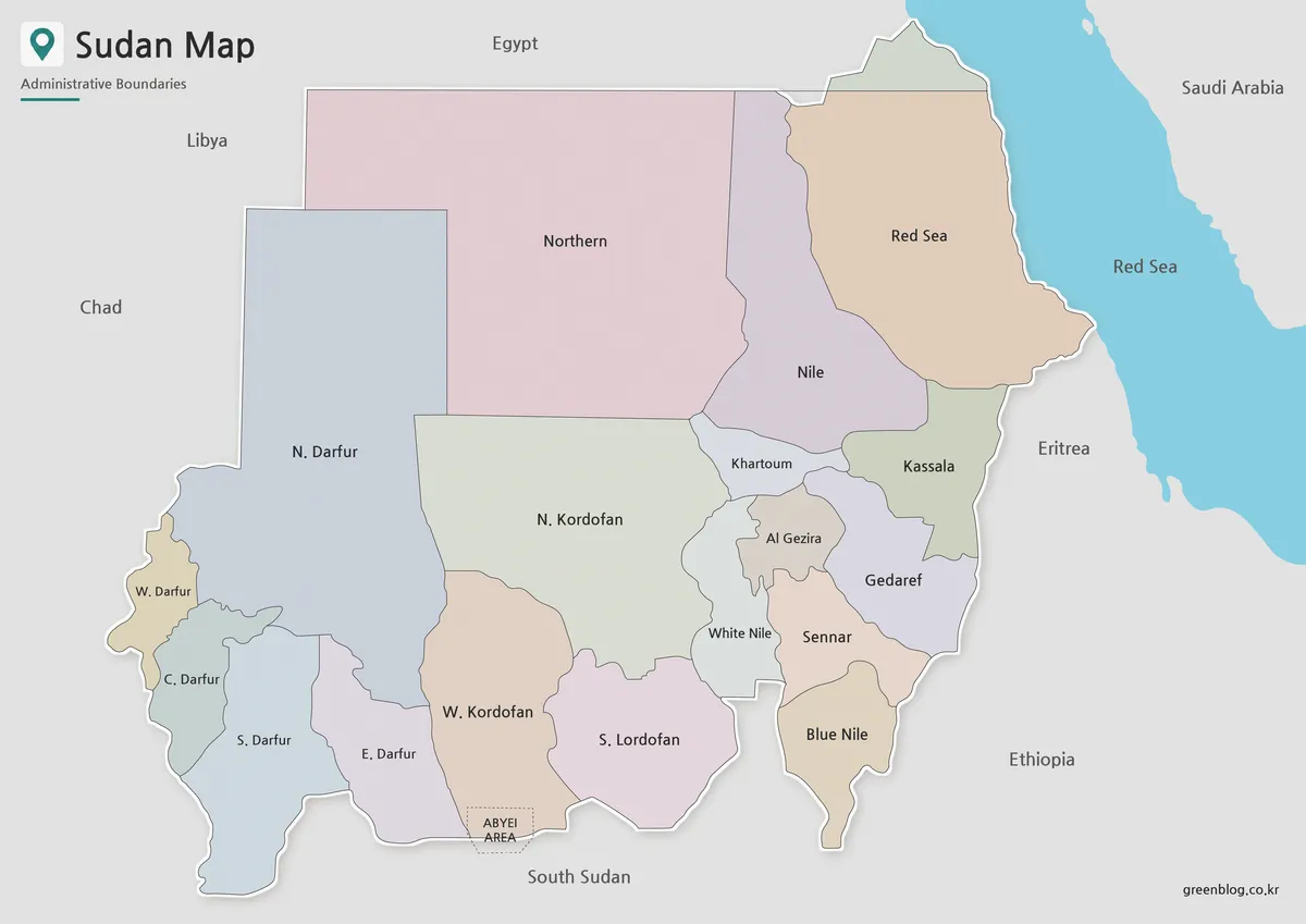
Designed with state-level divisions, the color map makes Sudan’s internal structure easier to read. This is especially helpful because Sudan covers a wide area and includes regions that are often discussed separately, such as Darfur, Kordofan, Khartoum, the Nile region, and the Red Sea area. Color separation allows readers to compare these regions without needing to study every boundary line closely.
The map includes both Korean and English place names in the original layout, making it useful for bilingual educational resources or Korean-language map pages prepared with English reference value. Neighboring countries such as Egypt, Libya, Chad, South Sudan, Ethiopia, Eritrea, and the Red Sea area are indicated by name so that Sudan’s regional position is easier to understand.
This version works well for blog posts, presentation slides, wall reference images, and introductory geography materials. When a reader needs to understand Sudan’s overall layout quickly, the color map is the most visual option.
Basic Sudan Map for Printing
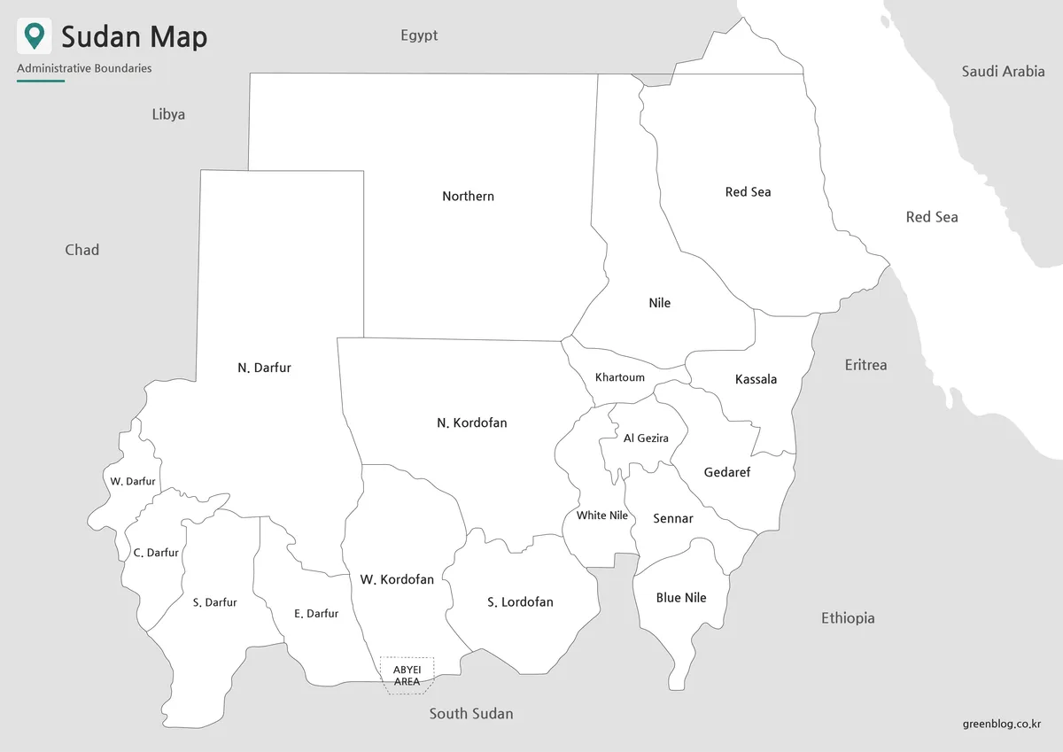
For printed materials, the basic Sudan map provides a cleaner view. By removing the color fill, the map reduces visual weight and makes labels and state boundaries easier to read in reports, handouts, and study materials. This is useful when the map needs to be placed inside a document with text, tables, or explanatory notes.
Sudan’s large land area means that state labels and boundary lines need enough space to remain readable. The basic version keeps the layout simple so users can add notes, highlight a specific state, or mark an area without competing against background colors. It is a practical choice for classroom worksheets, printed reference pages, and document-based country introductions.
For users who want to customize the map lightly, the basic version also works as a flexible middle option. You can add color to one region, draw arrows, or mark Khartoum and nearby areas while still keeping the original labels visible.
Blank Sudan Outline Map for Editing
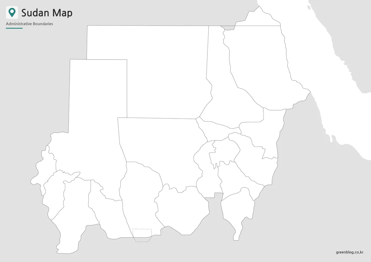
The Sudan outline map removes both color and text, leaving only the boundary structure. This blank format is useful for users who want to build their own map-based material from scratch. It can be used for regional data visualization, classroom coloring activities, custom labeling, presentation highlights, or infographic projects.
Because Sudan has several large regional blocks, the outline version works especially well when comparing areas visually. Users can shade Darfur, Kordofan, Khartoum, the Nile region, or eastern Sudan according to a project theme. It can also be used to mark river-related information, population distribution, travel routes, conflict-related study areas, or administrative groupings.
The A3 layout gives enough space for editing and printing. When enlarged, the boundary lines remain useful as a working base for custom graphics or educational worksheets.
Sudan Flag Image
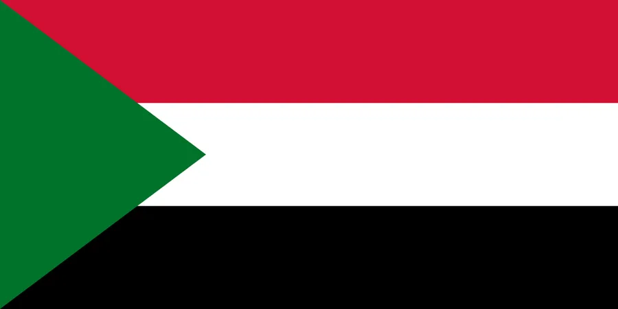
A Sudan flag image is also included for users who want to create a complete country reference layout. The flag can be placed near the map in presentations, blog posts, worksheets, and country profile materials. When used together, the flag and map help readers connect the country name with both its national symbol and geographic location.
This is especially useful for classroom materials, African country comparison pages, and printable study resources where visual recognition matters.
Practical Uses for the Sudan Map Collection
The Sudan map collection can be used in several practical ways. Teachers may use the basic or outline version for geography worksheets, while students can mark neighboring countries, state names, or regional features. Bloggers and content creators can use the color version as a visual reference in articles about Africa, the Nile region, the Red Sea area, or Sudan’s administrative layout.
For infographic projects, the blank outline map is the most flexible option. It allows users to add custom colors, data labels, arrows, location markers, or regional notes without having to remove existing text. Presentation creators may prefer the color version for quick visual explanation, especially when introducing Sudan’s position between North Africa, East Africa, and the Sahel region.
Frequently Asked Questions
What does this Sudan map collection include?
It includes a color Sudan map, a basic map, and a blank outline map. A Sudan flag image is also included for country reference materials.
Is the Sudan map suitable for printing?
Yes. The files are prepared in an A3 layout, making them suitable for classroom handouts, reports, worksheets, and presentation materials.
Which Sudan map version is best for reports?
The basic map is the best option for reports because it keeps labels and boundaries clear without using heavy background color.
Can I use the Sudan outline map for editing?
Yes. The outline version works well for adding custom labels, regional colors, data markers, routes, or infographic elements.
Why are Sudan’s regional divisions important on a map?
Sudan is a large country with several major regional areas, including Darfur, Kordofan, Khartoum, the Nile region, and the Red Sea area. Showing state boundaries makes these areas easier to compare.
Map File Information
This download includes printable Sudan map versions for educational use, presentation design, document printing, and editable graphic projects.
- Included Versions: Color map, black and white map, outline map
- Printable Size: A3 layout
- File Type: Image files
- Intended Use: Classroom handouts, presentations, blog graphics, infographic editing, and printable reference materials
Additional Resources
- Humanitarian Data Exchange – Sudan Administrative Boundaries : Provides administrative boundary datasets for Sudan that can be useful when checking state-level map structure and regional boundary references.
Related Maps
- South Africa Map Download – Printable Administrative Maps
- Sierra Leone Map for Presentations, Worksheets, and Infographic Projects
- Rwanda Map Download – Printable Administrative Maps
- Printable Nigeria Map – Color, Black and White, Outline Version
Green Map creates custom-edited map images using open geographic data sources such as geoBoundaries, Natural Earth, OpenStreetMap, and government open data.
These maps are edited visual materials, not raw data files, and are provided for education, documents, presentations, and graphic reference.