A Korean version of this map page is available. View Korean Page
A Madagascar Map is useful when a simple location marker is not enough to explain the size, shape, and regional structure of this large island country. Madagascar sits in the Indian Ocean off the eastern side of Africa, separated from the mainland by the Mozambique Channel. Because it is an island nation with a long north-to-south shape, curved coastline, and wide internal regions, a printable map can help readers understand its layout much more clearly than a short text description.
This printable Madagascar map collection includes a color regional map, a black and white printable map, a blank outline map, and a Madagascar flag image. The map files were prepared in JPG format, arranged for A3-size use, and created in CMYK color mode. They are designed for users who need visual material for classroom handouts, geography lessons, blog articles, travel-related content, presentation slides, infographic projects, or editable graphic work.
Madagascar is often recognized through the animated film series of the same name, but the real country is much larger and more geographically complex than many people expect. With an area of about 587,041 square kilometers, it is roughly six times the size of South Korea. Its capital, Antananarivo, is located inland, while many coastal areas are spread across a long island outline. This makes a regional map especially helpful when comparing inland and coastal areas or when preparing educational material about island countries in Africa.
While preparing this map collection, the layout was kept simple on purpose. Instead of adding dense city markers, roads, airports, rivers, or small geographic details, the focus was placed on regional boundaries and readable labels. This keeps the map easier to use in printed materials and allows teachers, bloggers, and designers to add their own information when needed.
Table of Contents
Madagascar Map Collection Overview
The collection was created for practical use rather than heavy technical detail. Each version serves a different purpose, so users can choose the file that fits their project.
Included files:
- Color regional Madagascar map
- Black and white Madagascar map
- Blank outline Madagascar map
- Madagascar flag image
File details confirmed from the source material:
- File format: JPG
- Print layout: A3
- Color mode: CMYK
- Main use: printing, presentation design, classroom reference, and graphic editing
The color version works well when visual separation is important. The black and white version is easier to print in documents or worksheets. The blank outline map is the most flexible option for adding custom data, labels, travel routes, or highlighted regions.
Regional Color Map
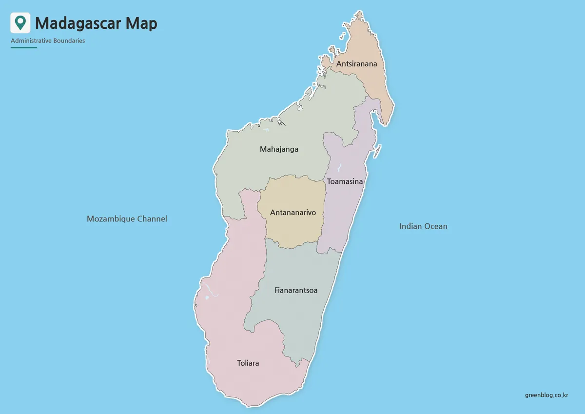
The color Madagascar Map was designed to make the island’s regional divisions easier to compare at a glance. Since Madagascar has a long vertical shape and a distinct coastline, color separation helps viewers quickly follow the structure from the northern tip to the southern end of the island.
This version is especially useful for blog posts, country profile pages, social media graphics, school presentations, and travel information pages. The design keeps the focus on the regional layout rather than crowding the map with too many extra details. Korean and English labels were included in the original design process, and the names were checked with reference map materials to improve clarity.
For users creating a visual explanation of Madagascar, the color map gives enough structure to show regional differences while still leaving the overall design clean. It also works well as a main image for a country introduction page or a presentation slide about African island nations.
Black and White Printable Version
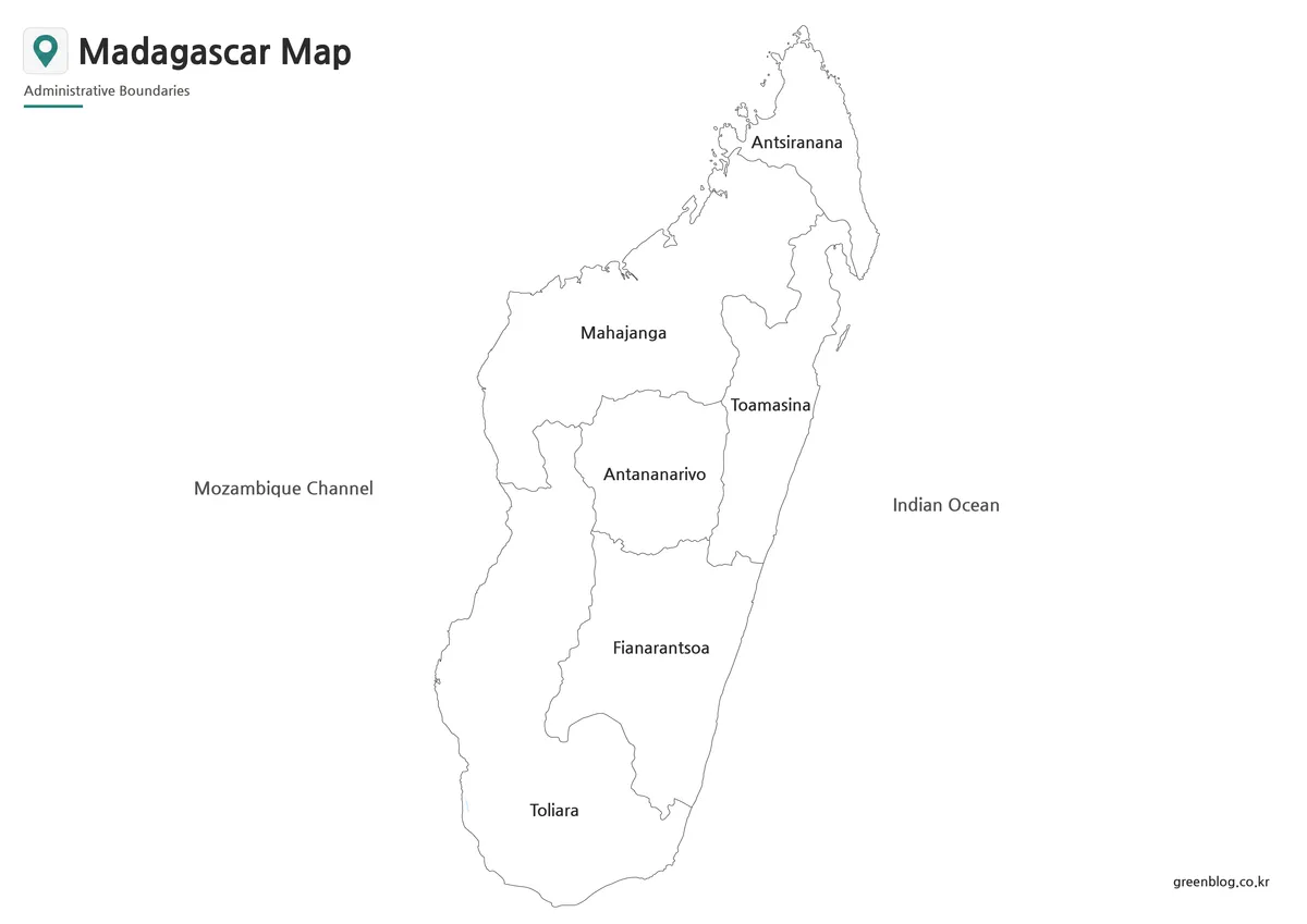
For printed materials, the black and white Madagascar map provides a cleaner option. The color background was removed so the boundary lines and labels remain easier to read when printed on regular paper. This also helps reduce ink usage compared with a full-color map.
Because Madagascar is a large island with a long coastline, a simplified black and white layout can be useful in classroom worksheets, report pages, geography assignments, and reference handouts. Students can mark regions, add notes, or compare Madagascar with nearby parts of eastern Africa without the distraction of background color.
This version is also suitable for document editing. Users can place it in a report, presentation file, or study material and keep the page visually clean. If additional colors or labels are needed later, the simple base makes editing easier in graphic programs.
Blank Outline Map for Editing
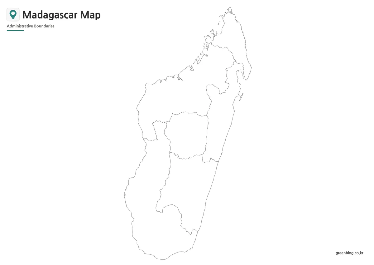
The blank outline version removes both color and text, leaving only the boundary structure. This makes it the best option for users who want to build their own custom Madagascar map.
The outline map works well for:
- coloring activities
- regional comparison charts
- classroom map exercises
- tourism point marking
- infographic annotations
- custom labels
- population or industry data overlays
- presentation highlights
For example, a teacher could use the blank map as a worksheet and ask students to mark the capital or identify coastal areas. A designer could use it as a base for an infographic about vanilla production, biodiversity, travel routes, or regional comparison. A blogger could add markers for cities, beaches, or nature destinations without having to remove existing labels first.
Because the outline version has only the essential border and regional line structure, it gives users more freedom than the labeled versions.
Madagascar Flag Image
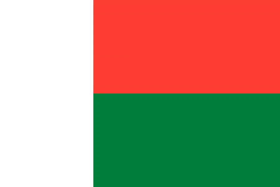
A Madagascar flag image is also included with the map set. This can be useful when creating a country profile, travel guide, educational slide, or comparison page about African countries.
When placed next to the Madagascar Map, the flag helps complete the visual presentation. It can be used in classroom materials, blog sections, presentation covers, or simple country information blocks.
Practical Uses for This Map Set
This map collection is designed for people who need a clean and flexible visual reference. It is not intended to replace a detailed road map or navigation map. Instead, it works best as a regional reference map for printed and digital projects.
Good use cases include:
- geography lessons about island countries
- African country comparison materials
- printable study sheets
- blog posts about Madagascar
- travel planning visuals
- presentation slides
- infographic backgrounds
- classroom coloring activities
- country profile pages
- regional layout explanations
Madagascar’s island shape makes it visually distinct, but its internal regional structure can still be difficult to explain with text alone. These printable map versions help show the country’s outline, regional layout, and overall scale in a clearer way.
Frequently Asked Questions
What is included in this Madagascar Map collection?
The collection includes a color map, a black and white map, a blank outline map, and a Madagascar flag image.
Can I print the Madagascar Map in A3 size?
Yes. The map was prepared for A3-size use, making it suitable for classroom materials, posters, presentation sheets, and printed reference pages.
Is the outline map editable?
Yes. The blank outline version is useful for adding custom colors, labels, travel routes, regional data, or infographic elements.
What file format is included?
The confirmed file format is JPG.
Is this map suitable for classroom use?
Yes. The black and white map and blank outline map are especially useful for worksheets, geography lessons, and student activities.
Madagascar Map Download
Download the Madagascar map collection for printing, classroom use, presentation slides, infographic projects, and graphic editing work. The set includes color, black and white, outline, and flag image versions.
- File Format: JPG
- Print Layout: A3
- Color Mode: CMYK
- Included Versions: Color map, black and white map, outline map, flag image
- Intended Use: Printing, education, presentations, blog graphics, and editing projects
Related Maps
- Kenya Map with Regional Boundaries – A3 Printable Resource
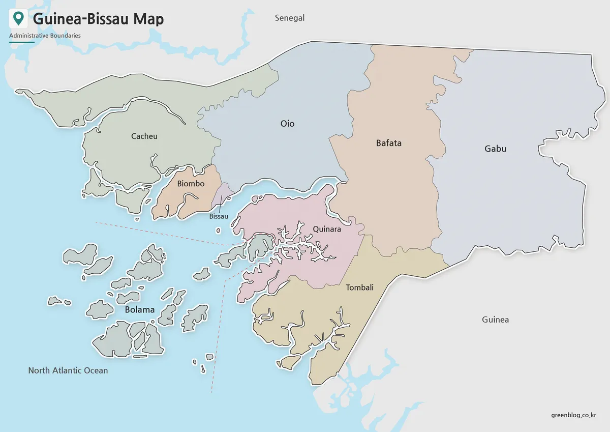
- Guinea Map Download – Printable Regional Map Set
- Guinea-Bissau Map Download – Printable Regional Map Set
- Ghana Map Download – Printable Ghana Map in 3 Versions
Additional Resources
- Humanitarian Data Exchange – Madagascar Administrative Boundary Data A useful reference for checking Madagascar administrative boundary data and regional map structure.
Green Map creates custom-edited map images using open geographic data sources such as geoBoundaries, Natural Earth, OpenStreetMap, and government open data.
These maps are edited visual materials, not raw data files, and are provided for education, documents, presentations, and graphic reference.