A Korean version of this map page is available. View Korean Page
A Burkina Faso Map can be useful when explaining the location of this West African inland country, comparing neighboring regions, or preparing visual materials for education and presentations. Burkina Faso is bordered by Mali, Niger, Benin, Togo, Ghana, and Côte d’Ivoire, so a clear regional map helps show how the country sits within the wider West African landscape. For students, teachers, bloggers, designers, and infographic creators, a simple printable map is often easier to use than a detailed online map filled with roads and extra labels.
This Burkina Faso Map collection includes three versions: a color administrative map, a black and white printable map, and a blank outline map. The files were prepared for A3-size output and saved in JPG format, making them suitable for classroom handouts, presentation slides, blog graphics, regional comparison materials, and editable design projects. Each version has a different purpose, so users can choose the map style that fits their project instead of editing one complicated map from scratch.
While preparing this map collection, the main goal was to keep the layout clean and readable. Burkina Faso is divided into 13 regions, and the color version was designed around that structure so users can quickly identify regional divisions without making the map visually crowded. Neighboring countries are shown in a simple way to provide geographic context while keeping the focus on Burkina Faso itself. The result is a practical Burkina Faso Map resource for both print and digital use.
Table of Contents
Printable Burkina Faso Map Collection
The collection was designed for people who need a clean map rather than a complex geographic reference. It works well for school projects, classroom geography lessons, travel-related presentations, regional comparison graphics, blog posts, and infographic layouts. The map does not try to include every road, landmark, or local detail. Instead, it focuses on administrative boundaries, readable labels, and a layout that remains clear when enlarged.
Color Administrative Map
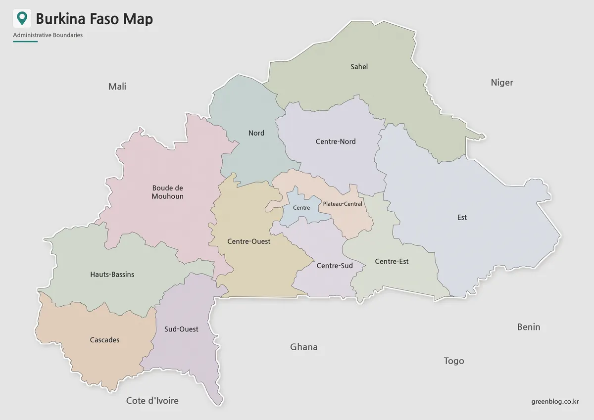
The color version is the most useful option when you need to explain regional divisions quickly. Each region is separated with different colors, making it easier to compare the overall shape and location of Burkina Faso’s administrative areas. This version works especially well for country profiles, educational slides, blog illustrations, and visual reference pages.
During the design process, the surrounding countries were kept simple. Instead of adding extra boundary details that could make the map harder to read, neighboring country names were included mainly for orientation. This keeps the Burkina Faso Map focused and easier to understand at a glance.
Black and White Printable Version
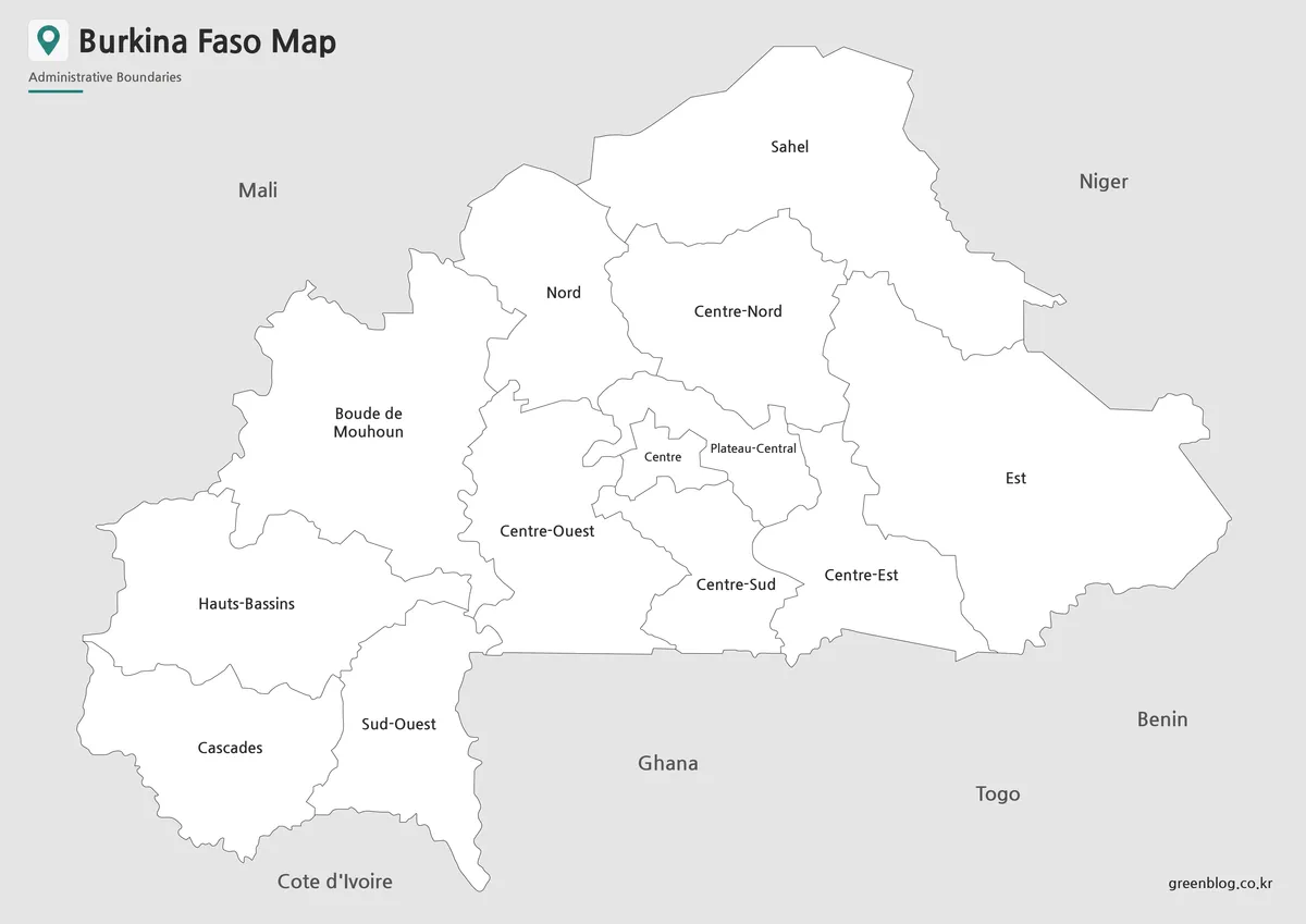
The black and white version is designed for printing. Color maps can look attractive on screen, but they are not always ideal for classroom handouts or printed worksheets. When printed in grayscale, colored backgrounds may reduce label readability or use more ink than necessary.
For that reason, this version removes the color fill and keeps the map clean. It is a good choice for school materials, printed reports, document inserts, and presentation handouts. Users can also add marks, notes, arrows, or highlights directly on the page.
Blank Outline Map for Editing
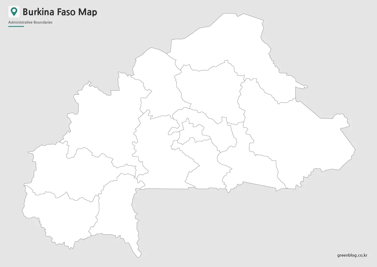
The outline version removes both labels and colors, leaving only the boundary structure. This makes it useful for graphic editing, custom infographics, educational worksheets, and map-labeling activities. Designers can add their own colors, data points, text, or icons without first deleting existing labels.
This Burkina Faso Map outline version is especially helpful when creating regional statistics graphics, classroom exercises, or custom visual materials. Because the map is simplified, it can serve as a base layer for different types of projects.
Practical Uses
This map collection can be used in several situations, including classroom handouts, printable study resources, geography lessons, blog graphics, country profile pages, infographic projects, travel presentations, and regional comparison materials. The color version is best for quick visual explanation, the black and white version is better for printing, and the outline version is the most flexible for editing.
Frequently Asked Questions
What map versions are included?
The collection includes a color administrative map, a black and white printable map, and a blank outline map.
Is this Burkina Faso Map suitable for classroom use?
Yes. The black and white version is especially useful for classroom printing, worksheets, and geography lessons.
Can I edit the outline version?
Yes. The outline map is designed for editing, labeling activities, infographics, and custom design work.
What is the best version for presentations?
The color administrative map is usually the best choice for presentation slides because the regional divisions are easier to see.
Burkina Faso Map Download
This Burkina Faso Map collection includes color, black and white, and outline versions for printing, classroom use, presentations, and graphic editing projects.
- File Format: JPG
- Included Versions: Color Map, Black and White Map, Outline Map
- Intended Use: Printing, education, presentations, blog graphics, and editing
Related Maps
- Free Albania Map Download – Color, Black and White, and Outline Versions
- Tunisia Map Download – Printable Color, Black and White, and Outline Maps
- Printable Angola Map Set for Classroom, Presentation and Editing Projects
- Free Mali Map Download – Color, Labeled and Outline Editions
Additional Resources
- OpenStreetMap – Burkina Faso : Interactive map of Burkina Faso for exploring cities, roads, and geographic features.
Green Map creates custom-edited map images using open geographic data sources such as geoBoundaries, Natural Earth, OpenStreetMap, and government open data.
These maps are edited visual materials, not raw data files, and are provided for education, documents, presentations, and graphic reference.