A Korean version of this map page is available. View Korean Page
A printable Tunisia map can be useful in more situations than many people expect. Whether you are preparing a classroom presentation, creating travel content, comparing North African countries, or building an infographic, a clear Tunisia map often explains regional structure faster than several paragraphs of text.
Located on the northern edge of Africa, Tunisia sits along the Mediterranean Sea between Algeria and Libya. Although the country is not especially large compared to many African nations, its long coastline, distinct regional divisions, and varied landscapes make maps particularly helpful for educational and visual reference purposes. Tunis, the capital city, is located in the northern part of the country and serves as the country’s main population and economic center.
This printable Tunisia map collection was created for users looking for practical map resources rather than lengthy country descriptions. The collection includes three different versions: a color administrative map, a black and white labeled map, and a blank outline map. Each version was prepared with printing, presentation work, and editing projects in mind.
During the map design process, special attention was given to maintaining readability at larger print sizes. Administrative boundaries, place names, and overall layout were reviewed to ensure the maps remain clear when printed on A3 paper or enlarged for presentations.
Table of Contents
Map Versions Included
The collection contains three map styles designed for different purposes:
- Color administrative map
- Black and white labeled map
- Blank outline map
Each version serves a different role depending on how the map will be used.
Color Administrative Map for Regional Comparison
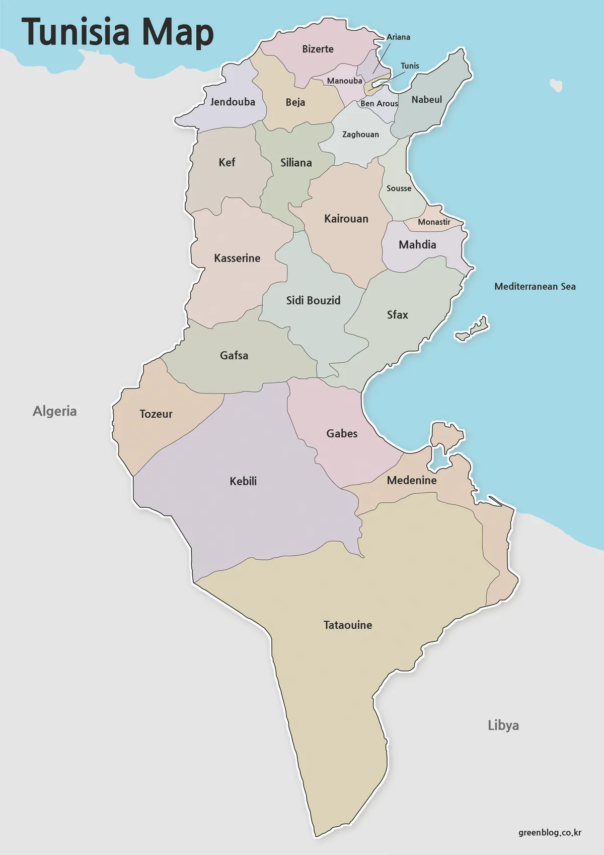
The color version is designed for users who want to quickly understand Tunisia’s regional structure. Administrative areas are separated using contrasting colors, making boundaries easier to identify at a glance.
Bilingual labeling was added to improve usability when comparing information from different sources. Neighboring countries are displayed in a simplified way so the focus remains on Tunisia itself.
This version works particularly well for:
- Travel presentations
- Geography lessons
- Blog graphics
- Regional comparison materials
- Educational handouts
The vertical layout was chosen to match Tunisia’s overall shape and improve readability when viewed on screens or printed documents.
Clean Black and White Version for Printing
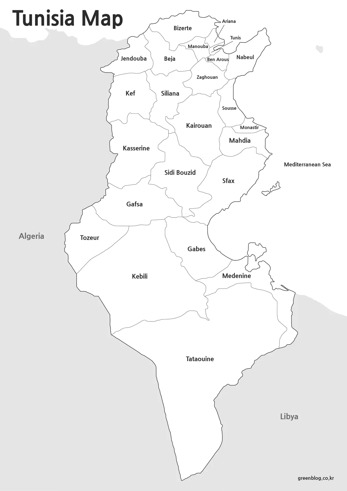
Some projects require a simpler visual style. The black and white map removes color while preserving labels and administrative boundaries.
When reviewing the map for printing, extra attention was given to line visibility and text clarity. This makes the map easier to annotate by hand and more economical to print in large quantities.
Common uses include:
- Classroom worksheets
- Study materials
- Printed reports
- Geographic reference sheets
- Meeting documents
Because the design is less visually busy, labels often remain easier to read when printed at smaller sizes.
Blank Outline Map for Editing Projects
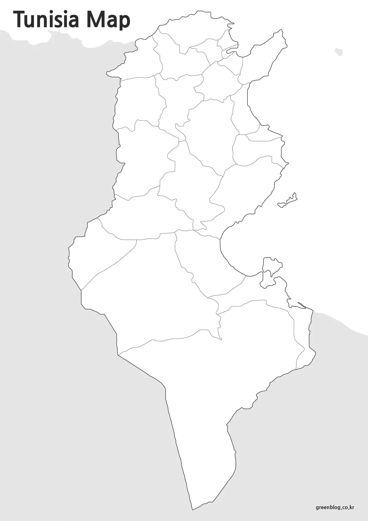
The outline version removes both labels and color fills, leaving only clean boundary lines.
This format is often preferred by designers, educators, and researchers who need a blank base map. Statistical information, travel routes, demographic data, and custom color schemes can be added without first removing existing map elements.
While preparing this version, boundary lines were checked individually to ensure they remained connected and suitable for editing work.
The outline map is useful for:
- Infographics
- Graphic design projects
- Educational exercises
- Presentation slides
- Regional data visualization
Designed for Printing and Presentation Use
One thing that became clear while organizing the Tunisia map collection was how often users need different map styles for different projects. A colorful version may work best in a travel presentation, while an outline map is often more useful for infographic design.
To improve flexibility, the maps were prepared at high resolution and reviewed for readability when enlarged. Labels, borders, and regional divisions remain clear when used in larger formats such as classroom displays, conference materials, or printed educational resources.
Practical Uses for a Tunisia Map
A printable Tunisia map can support a variety of projects:
- Geography classroom activities
- North Africa regional studies
- Travel planning presentations
- Blog and website graphics
- Educational worksheets
- Historical or cultural reference materials
- Editable infographic projects
Because Tunisia has a relatively simple national outline but distinct internal regions, maps often provide a clearer overview than text alone.
Frequently Asked Questions
Can I print the map in large formats?
Yes. The maps were prepared with high-resolution printing in mind and remain readable at larger sizes.
Which version is best for editing?
The outline map is the best choice for graphic editing, custom labeling, and infographic creation.
Does the map include regional boundaries?
Yes. Both the color and black and white versions include administrative boundaries.
Is the map useful for classroom projects?
Yes. The collection was designed for educational use, presentations, worksheets, and visual reference materials.
Tunisia Map Download
The Tunisia map files are available below. Choose the version you need, including the color map, black and white map, and outline map.
- File Format: JPG / ZIP
- Usage: Printing · Presentation · Editing
- Size: High-resolution A3 format
Files are provided in ZIP format. Extract the archive after downloading to access the map images.
Additional Resources
- Natural Earth Maps – Free geographic datasets and reference maps useful for regional map comparison and educational projects.
Related Maps
- Liberia Map Collection: Color, Black and White, and Outline Maps
- Senegal Map Bundle Featuring Color, Labeled and Blank Outline Maps
- Free Mali Map Download – Color, Labeled and Outline Editions
- Printable Angola Map Set for Classroom, Presentation and Editing Projects
Green Map creates custom-edited map images using open geographic data sources such as geoBoundaries, Natural Earth, OpenStreetMap, and government open data.
These maps are edited visual materials, not raw data files, and are provided for education, documents, presentations, and graphic reference.