A Korean version of this map page is available. View Korean Page
Mali is one of the largest countries in West Africa, occupying a vast inland area between several neighboring nations, including Algeria, Niger, Senegal, Mauritania, and Burkina Faso. Because of its large geographic footprint and relatively dispersed population centers, a Mali map often provides a clearer understanding of the country’s layout than text descriptions alone.
A printable Mali map is often one of the easiest ways to understand how the country’s regions are organized across such a large geographic area.
This printable Mali map collection was created for users who need a practical visual reference rather than a lengthy country overview. Whether you are preparing classroom materials, creating presentation slides, designing infographics, producing travel content, or comparing regions across Africa, having multiple map styles available can make the process significantly easier.
This Mali map collection was created to support those different educational, presentation, and design needs.
The collection includes three versions: a color administrative map, a black and white labeled map, and a blank outline map. All maps were prepared in high-resolution A3 format and reviewed for readability at larger print sizes.
During the design process, special attention was given to administrative boundaries, label placement, and visual clarity so the Mali map files remain easy to use in both digital and printed formats.
Large countries such as Mali often benefit from multiple map styles because users have different goals. Some need a quick visual overview, others require a clean printable version, while designers and educators may prefer a blank template for customization. This Mali map collection was created with those different needs in mind.
Table of Contents
Map Collection Overview
Included in this Mali map set:
The mali map collection includes several versions designed for printing, editing, and visual reference purposes.
- Color administrative map
- Black and white labeled map
- Blank outline map
- High-resolution A3 layout
- JPG and PNG image formats
- Suitable for printing and digital use
The maps work well for classroom handouts, regional studies, blog graphics, travel presentations, educational worksheets, and infographic projects.
Printable Mali Color Map
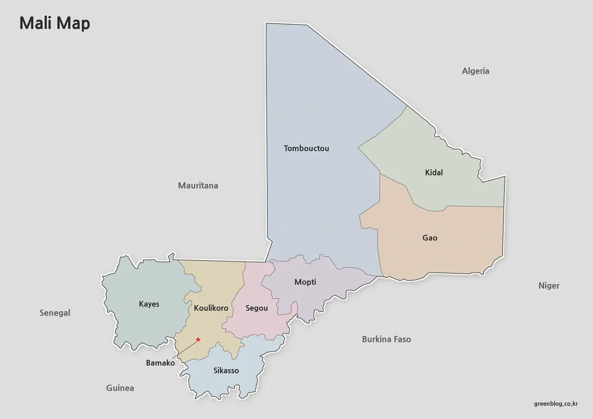
The color version was designed to make administrative regions easier to distinguish at a glance. Different color tones help separate neighboring areas while keeping the overall appearance clean and readable.
During preparation, lower-saturation colors were selected to avoid overwhelming the map while still maintaining clear regional distinctions. The capital city, Bamako, is highlighted for quick identification, making the map useful for educational presentations and geographic reference materials.
Because Mali covers a large area with widely distributed regions, color separation improves visual understanding when comparing different parts of the country. This version is particularly useful for classroom instruction, presentation slides, and online publications.
Best Uses
- Regional comparison projects
- Educational presentations
- Geography lessons
- Blog and website graphics
- Visual reference materials
Black and White Printable Version
For users who need a cleaner layout, the black and white version removes color while preserving regional boundaries and labels. This creates a simplified design that prints efficiently and remains highly readable.
While preparing the map collection, the layout was reviewed specifically for black and white printing. Boundary lines were adjusted to remain visible even when printed on standard office printers, helping maintain clarity without relying on color.
This version works especially well for reports, handouts, worksheets, and educational documents where simplicity and readability are more important than visual styling.
Ideal For
- Classroom handouts
- Printed reports
- Educational worksheets
- Study materials
- Annotated reference maps
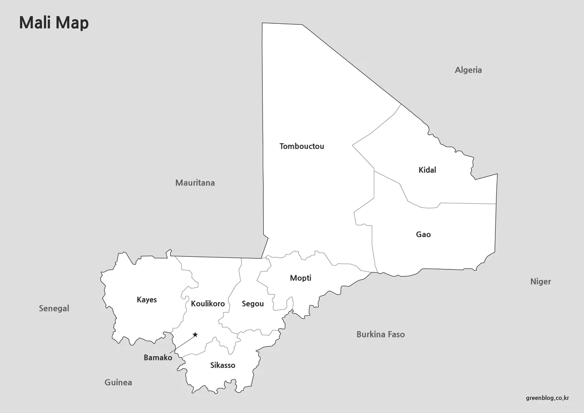
Blank Outline Map for Editing
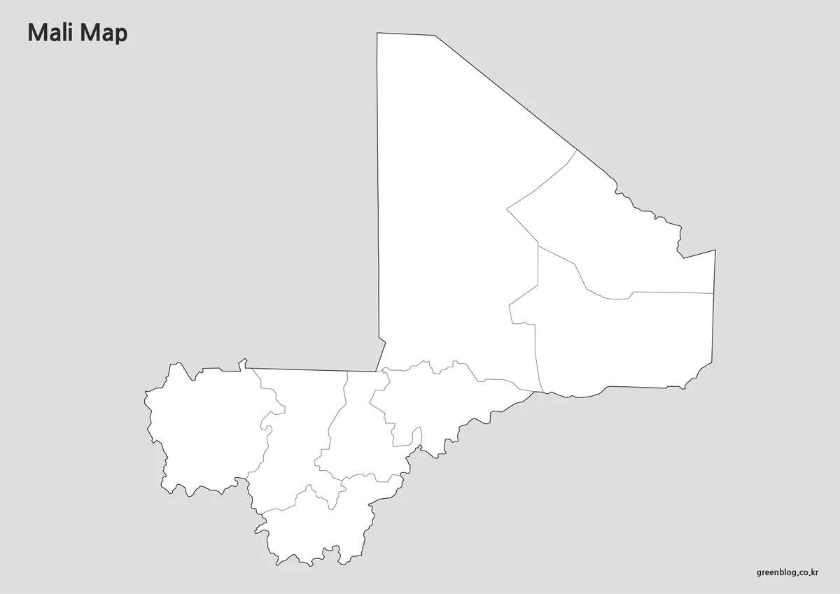
The outline version removes labels and color elements, leaving only the administrative boundary framework. This provides a flexible base for users who want to customize the map with their own information.
Designers often prefer a blank version because it eliminates the need to remove existing text or graphics before beginning a project. Teachers may use it for geography exercises, while researchers can add statistical information, transportation routes, or regional highlights.
Extra attention was given to keeping boundary lines clean and continuous so the map can be edited without additional preparation work.
Useful For
- Infographic design
- Graphic editing projects
- Educational activities
- Regional data visualization
- Custom map creation
Designed for Printing and Presentation Use
Every map in this collection was created with both digital viewing and physical printing in mind. Large-format readability was checked during production, and the layout was adjusted to keep labels clear when enlarged.
The A3 format makes the maps suitable for classroom displays, conference presentations, educational posters, and reference materials. Users who prefer smaller print sizes can also scale the files while retaining clear boundary visibility.
Frequently Asked Questions
What map types are included in the collection?
The collection includes a color administrative map, a black and white labeled map, and a blank outline map.
Is the outline version editable?
Yes. The outline map is designed for editing, annotation, infographic creation, and custom geographic projects.
Which version is best for printing?
The black and white map is often the most practical choice for printing because it maintains readability while reducing ink usage.
Can these maps be used for educational projects?
Yes. The maps are suitable for classroom activities, presentations, worksheets, and regional geography studies.
Mali Map Download
Select the map version that fits your project. Printable and editable formats are available for different use cases.
- File Format: JPG / PNG / ZIP
- Image Size: A3 High Resolution
- Color Mode: Color, Black & White, Outline
- Intended Use: Printing, Education, Presentation, Editing
Related Maps
- Senegal Map Bundle Featuring Color, Labeled and Blank Outline Maps
- Liberia Map Collection: Color, Black and White, and Outline Maps
- Greece Map Download Pack – Printable Regional and Outline Maps
- United Kingdom Maps Download – 4 Printable Map Collection
Additional Resources
- Political Map of Mali – A useful reference map showing Mali’s administrative regions and major cities, making it easier for English-speaking users to understand geographic locations and regional divisions.
Green Map creates custom-edited map images using open geographic data sources such as geoBoundaries, Natural Earth, OpenStreetMap, and government open data.
These maps are edited visual materials, not raw data files, and are provided for education, documents, presentations, and graphic reference.