A United Kingdom Map needs a clear explanation of what its internal lines mean. The UK contains four countries—England, Scotland, Wales, and Northern Ireland—but the same boundary level is not used everywhere in these images. The first map combines the four countries with England’s nine regions, while the second uses a much older mixture of county and regional names.
The collection includes three geographic previews and one companion flag image. The general map labels Scotland, Wales, Northern Ireland, and the nine English regions. The detailed map adds many smaller names but contains historical units such as Strathclyde, Grampian, Dyfed, Gwent, and Humberside. The outline retains the broad boundaries without labels, and the fourth content image is the Union Flag.
All three map previews use a 1200 × 848 landscape canvas with a pale blue sea. Orkney and Shetland appear in an inset so their island shapes remain readable; the inset is a layout device and does not preserve their true distance from mainland Scotland.
Table of Contents
Production Process and Design Direction
The visual design emphasizes coastlines, islands, and regional shapes rather than roads or terrain. White land areas stand against the blue water, while dark coastlines and lighter internal lines establish hierarchy. The horizontal page also leaves space for a large title without compressing the long north-to-south form of Great Britain.
The general United Kingdom Map and outline version share the same simplified geometry. England’s regional divisions are visible, but Scotland, Wales, and Northern Ireland are not subdivided into equivalent local-government units. That is intentional in the first map: it offers a high-level geographic overview rather than a uniform administrative dataset.
The detailed image must be read differently. Its red, green, and purple labels separate groups visually, but color does not create a single official boundary level. Scotland is labeled with former regions, Wales with former county names, Northern Ireland with traditional counties, and England with a combination that includes historic or abolished units.
United Kingdom Basic Information
The official name is the United Kingdom of Great Britain and Northern Ireland. Great Britain refers to the island containing England, Scotland, and Wales; it does not include Northern Ireland. The United Kingdom includes all four countries. The Republic of Ireland is a separate state and is not drawn on these map previews.
London is the UK capital and also one of England’s nine regions. The other English regions shown on the general United Kingdom Map are the North East, North West, Yorkshire and the Humber, East Midlands, West Midlands, East of England, South East, and South West. Scotland, Wales, and Northern Ireland are labeled as countries rather than being divided into English-style regions.
The surrounding waters visible on the detailed map include the North Atlantic Ocean, North Sea, Irish Sea, English Channel, Bristol Channel, Saint George’s Channel, Strait of Dover, and North Channel. These labels help establish coastal position, but the map is not intended for marine navigation or distance measurement.
United Kingdom Map Collection Overview
The four displayed resources consist of a general regional map, a historical detailed reference, an unlabeled outline, and a flag image. The source material describes the archive as an A3 JPG collection with a maximum working resolution of 13193 × 9320 pixels. The published web previews are smaller, so keep the archive originals unchanged before editing or printing.
- Map previews: three geographic versions at 1200 × 848 pixels
- Companion visual: Union Flag at 900 × 450 pixels
- Collection specification: A3 JPG, up to 13193 × 9320 pixels
- Important limitation: the detailed labels do not represent one current UK administrative level
1️⃣ General Regional Map
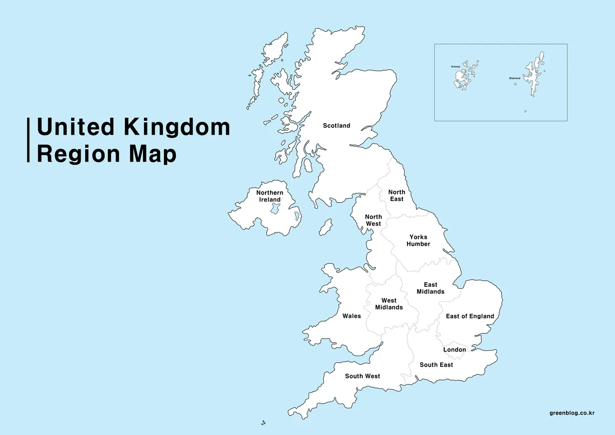
The general United Kingdom Map provides the cleanest high-level reference. Scotland, Wales, and Northern Ireland are labeled as countries, while England is divided into nine regions. Yorkshire and the Humber is shortened on the artwork to “Yorks Humber,” but its position between the North East, North West, and East Midlands remains clear.
Orkney and Shetland are enlarged in a separate box at the upper right. The inset prevents small island groups from disappearing at page scale, but it also means their plotted position cannot be used to judge direction or distance. The many islands along western Scotland remain in the main composition.
This version works well for explaining the four countries, comparing England’s regions, or introducing the relative position of London, Wales, and Northern Ireland. It does not show counties, council areas, parliamentary constituencies, or detailed city locations. Use the outline for exercises that should not reveal the names.
2️⃣ Detailed Regional Map
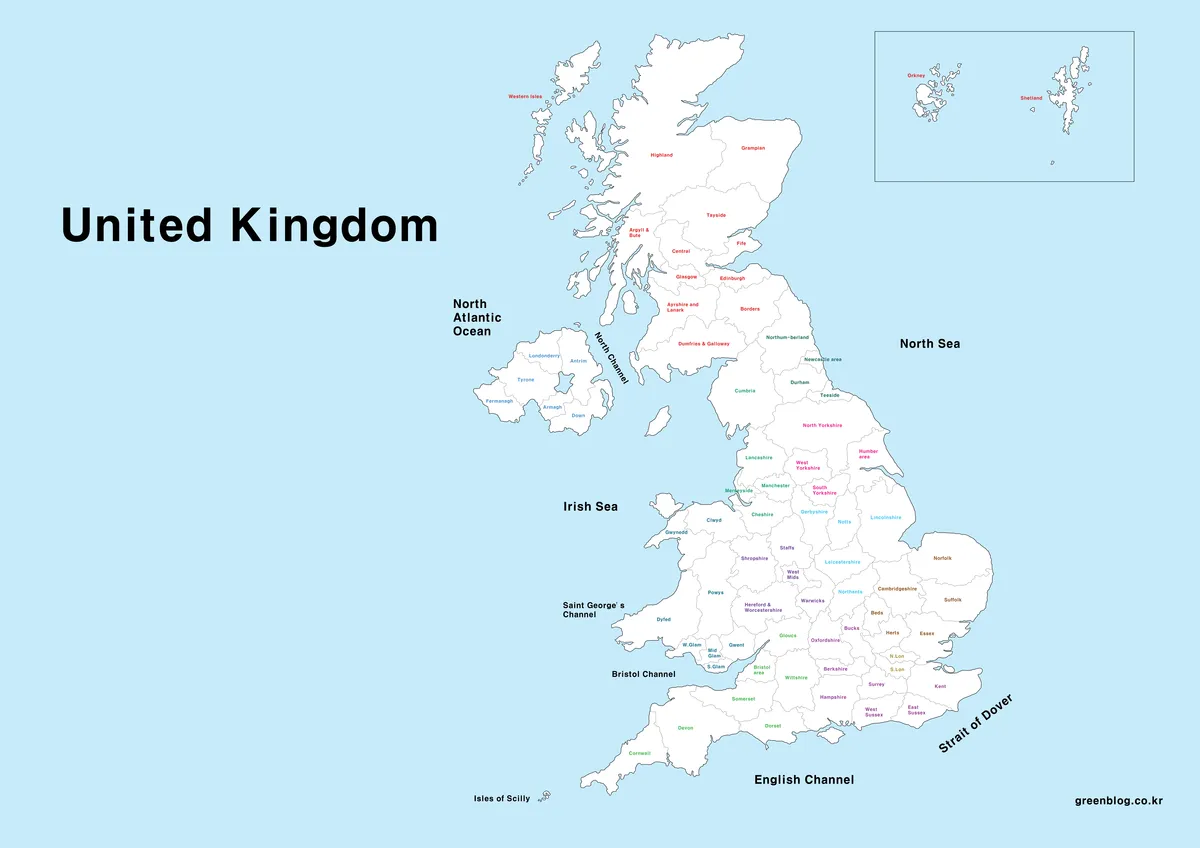
The detailed United Kingdom Map is best treated as a historical mixed-geography reference. Scotland uses former regional names including Highland, Grampian, Tayside, Central, Strathclyde, Lothian, Borders, and Dumfries and Galloway. Those regions were replaced by the current council-area structure in the 1990s.
Wales includes names such as Dyfed, Gwent, Gwynedd, Powys, South Glamorgan, and West Glamorgan, while Northern Ireland is organized around its six traditional counties. England contains many familiar county names but also Humberside, an administrative county abolished on April 1, 1996. The colored text therefore distinguishes label groups, not a consistent present-day legal geography.
This map can support historical research, archive-based statistics, or a lesson on changing UK boundaries. It should not be used as a current local-authority, ceremonial-county, or statistical-area map. Before adding modern data, match every value to the same geographic date and definition instead of assuming that a familiar name still has the same boundary.
3️⃣ Outline Map
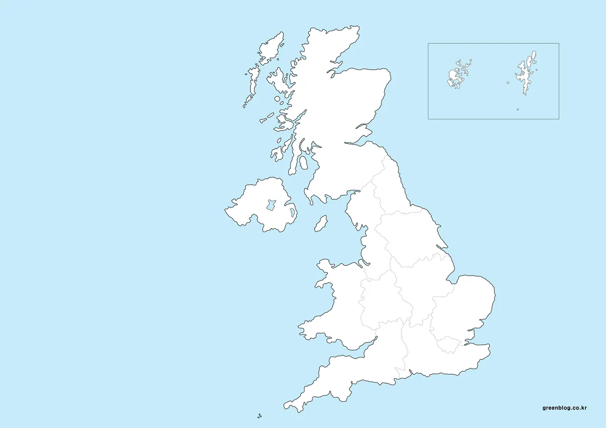
The outline United Kingdom Map removes all place labels and the large title while retaining the coastline, country divisions, English regional lines, and the Orkney–Shetland inset. The pale blue sea remains, so it is not a strictly black-on-white outline, but the empty land areas provide room for custom labels and fills.
Use it for four-country labeling, English-region recall, route sketches, or simple presentation overlays. Do not fill every internal polygon as if it represented the same kind of administrative area across the UK. Scotland, Wales, and Northern Ireland each have their own local-government geography, which is not drawn here.
The file is a raster image rather than an editable vector boundary dataset. Preserve an untouched original and work on duplicates when adding colors or erasing lines. For current local-authority analysis, obtain dated boundary data for the specific UK country and geography required by the project.
4️⃣ United Kingdom Flag Image
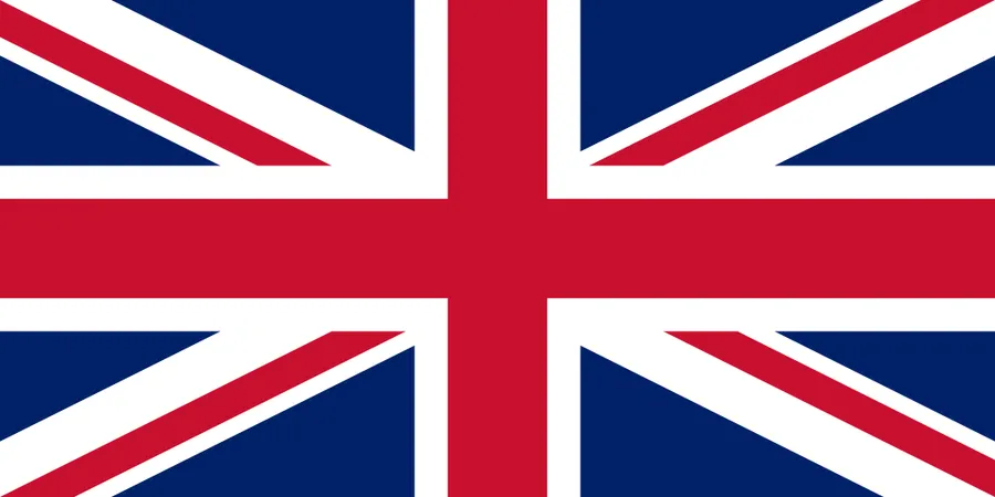
The fourth content image is the Union Flag, shown at a 2:1 ratio. It is a national identifier rather than another map type. Keeping the flag separate from the geography prevents its red, white, and blue pattern from being mistaken for regional categories or data classes.
The flag can accompany a country title, presentation cover, or comparison panel. It does not add boundary information, so map captions should still identify whether the general, detailed historical, or outline version is being shown. Avoid calling the entire set four maps when one of the four resources is a flag.
Common Use Cases
For a basic geography lesson, use the general map as the reference and the outline as the activity sheet. For historical boundary discussion, use the detailed map and point out former names such as Humberside and Strathclyde. For presentations, pair the flag with one map rather than placing it behind the boundaries. For data graphics, verify the geographic date before applying values.
Choosing a United Kingdom Map by Boundary Level
Choose the general version for the four countries and nine English regions, the detailed version only when its historical mixed units are relevant, and the outline for custom high-level labeling. None of the three provides a uniform current local-government map of the entire UK, so precise administrative work requires a separate boundary source.
Frequently Asked Questions — Common questions about this United Kingdom maps download
Is the detailed United Kingdom Map current?
No. It contains historical names and boundaries from different systems, including Humberside in England and former Scottish regions such as Strathclyde and Grampian. Use it for historical comparison, not current local-government work. The general map is better for the four countries and England’s nine regions.
Is this United Kingdom maps download free to use?
Yes. The maps can be used freely for personal blogs, educational materials, and non-commercial reference content.
Can the maps be used for commercial projects?
Limited use within explanatory or supporting materials is acceptable. Redistribution or resale of the map files themselves is not permitted.
Are these maps suitable for printing?
Yes. All maps were created at A3 size with high resolution. The outline and simplified maps are particularly suitable for print use.
What software was used to create the maps?
All maps were produced in Adobe Illustrator, ensuring consistent quality when scaled or edited.
Download Information
The protected ZIP link below provides the displayed collection. Download and extract the archive, then keep original copies before making labels or color changes. When reusing the detailed file, include a note that its smaller-area names represent historical and mixed geographies.
Map File Information
Map versions: general regional · detailed historical · unlabeled outline
- Included Files: Use only the versions confirmed in the article and supplied images
- File Type: Use the confirmed download contents
- Intended Use: Printing, education, presentations, and map-based projects
Related Maps
Additional Resources
For an official explanation of changing UK administrative areas, see the Office for National Statistics guide to local-government restructuring.
Green Map creates custom-edited map images using open geographic data sources such as geoBoundaries, Natural Earth, OpenStreetMap, and government open data.
These maps are edited visual materials, not raw data files, and are provided for education, documents, presentations, and graphic reference.