A Belarus Map makes the country’s position between the Baltic region, Central Europe, Russia, and Ukraine much easier to read than a list of borders alone. Belarus is landlocked, yet its outline touches five countries: Latvia and Lithuania to the northwest, Poland to the west, Ukraine to the south, and Russia along the east and northeast. That setting gives the national boundary a clear directional context and makes the surrounding-country labels especially valuable in a classroom or presentation.
This collection provides three JPG map styles arranged for high-resolution A3 use: a color administrative map, a labeled black-and-white map, and an unlabeled outline map. Each image shows the same first-level regional framework, so readers can move from identification to comparison and then to their own annotation without learning a different layout. Teachers, students, editors, and designers can select the amount of information that fits their task instead of forcing one crowded image into every project.
The regional pattern is distinctive. Six large regions surround Minsk, and the capital is indicated near the center of the country. The map labels Brest, Gomel, Hrodna, Minsk, Mogilev, and Vitebsk regions, while a star gives users a fast visual anchor for the capital area. Because the files focus on this broad structure rather than districts, roads, or terrain, they are most effective for national orientation and first-level administrative study.
Table of Contents
Belarus Map Versions Included
The three versions share a consistent national silhouette and internal boundaries, but they answer different questions. The color file helps a viewer separate adjacent regions at a glance. The monochrome file retains names for reference work, while the outline removes names and surrounding-country labels so that the page can become a base for exercises, custom keys, or data overlays.
All three images are raster JPG resources rather than vector source files. They can be placed in common document, presentation, and image-editing software, but users who need independently selectable boundary paths should not treat the outline image as an SVG or layered design file. This distinction matters when planning recoloring or detailed production work.
Administrative Color Map
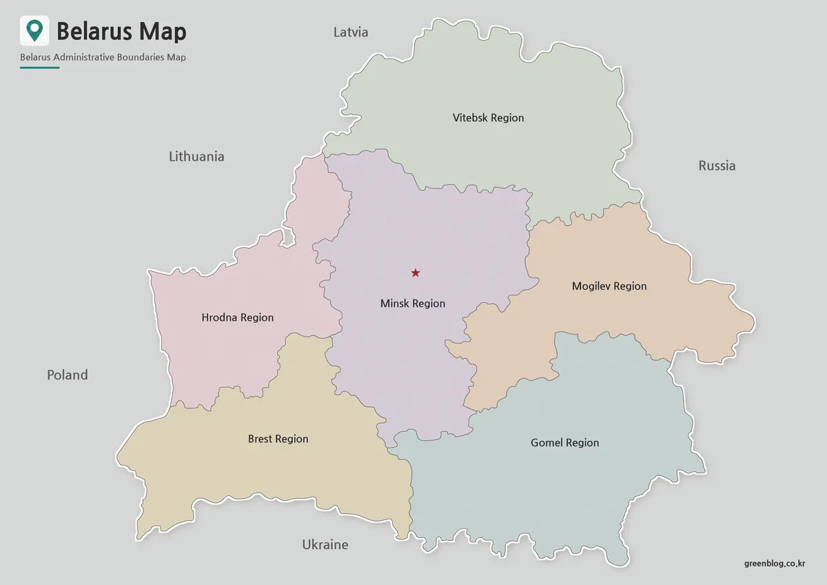
The color Belarus Map assigns a soft tone to each region, making the meeting points between Minsk Region and its neighbors easier to follow. Vitebsk occupies the north, Hrodna the west, Brest the southwest, Gomel the southeast, and Mogilev the east, with Minsk Region forming the large central area. A star near the center distinguishes the capital location without introducing a dense city layer.
Color separation is most helpful when the image must be understood quickly, such as on a presentation slide or a regional-comparison page. Neighboring countries appear in the gray margin, allowing the audience to connect Poland with the western side, Ukraine with the southern edge, and Russia with the eastern side. The subdued palette keeps those contextual labels secondary to the six colored regions.
Black and White Printable Map
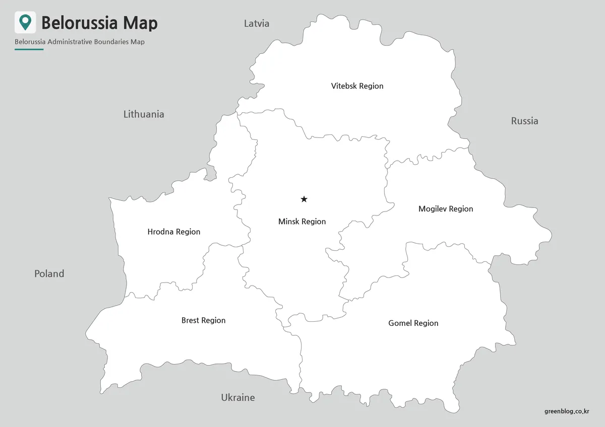
The labeled monochrome version replaces color differences with fine boundary lines and open white areas. Region names remain centered in their respective shapes, the capital star stays visible, and the five neighboring countries provide orientation around the outside. This arrangement suits reports and worksheets where colored fills would compete with notes, arrows, or a document’s existing visual style.
Readers should note that the heading printed inside this image uses the historical English name “Belorussia.” The country is now commonly called Belarus, which is the terminology used throughout this article. The administrative labels remain readable as map labels, but the title treatment should be considered when the image is used in a modern educational publication.
Blank Outline Map for Editing
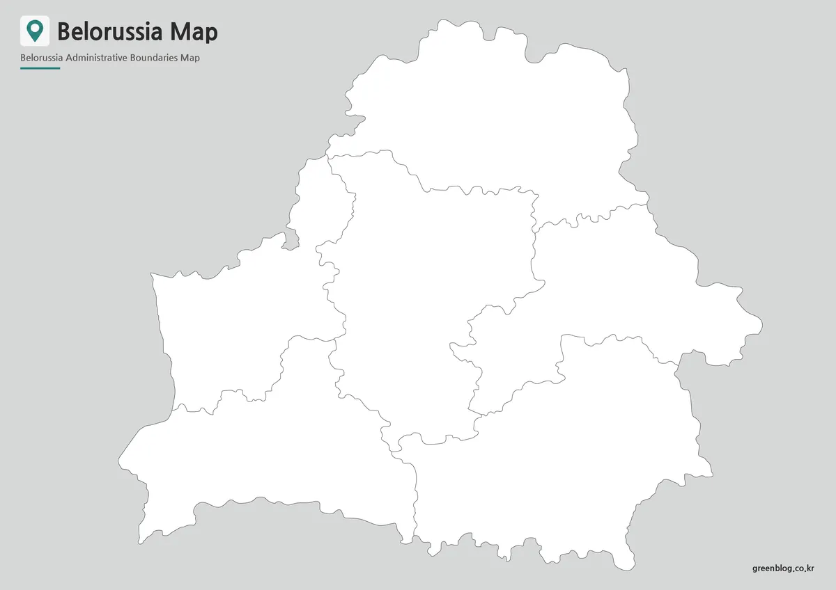
The outline file keeps the national border and the six regional boundaries while removing region names, the capital star, and neighboring-country text. Its empty areas invite active use: students can label each region, add Minsk, shade the regions that touch Poland or Russia, or create a north-to-south comparison from Vitebsk to Gomel. A designer can also place statistics or category colors over the broad regional shapes.
This version is best understood as a clean raster annotation base. It does not show district-level divisions, highways, rivers, elevation, or city networks, so those elements must be added separately if a project requires them. Like the labeled monochrome image, its printed heading uses “Belorussia,” a detail worth checking before the finished graphic is shared.
Belarus Map Regional Structure
Belarus is divided into six oblasts, commonly described in English as regions: Brest, Vitebsk, Gomel, Grodno, Minsk, and Mogilev. Minsk city is the national capital and is administered separately from the surrounding Minsk Region. The star on the labeled maps is therefore more than a general city marker; it helps explain why the capital and the similarly named region should not be treated as the same administrative unit.
The central placement of Minsk Region also creates a useful map-reading exercise. It is the only oblast without an international boundary, while every other region reaches at least one neighboring country. Brest and Hrodna face Poland in the west, Vitebsk reaches toward Latvia, Lithuania, and Russia in the north, Mogilev and Gomel meet Russia in the east, and the long southern edge of Brest and Gomel follows Ukraine.
English spellings vary between sources and map traditions. The supplied images use “Hrodna Region,” whereas “Grodno Oblast” is also common in English; they refer to the same first-level area. “Gomel” may likewise appear as “Homiel,” and “Mogilev” as “Mahilyow.” Keeping the image’s visible spellings in mind will prevent confusion when comparing the files with atlases or official reference pages.
Designed for Printing and Educational Use
The Belarus Map set is arranged for high-resolution A3 output, giving the broad regional labels enough space to remain legible on a full page. When printing at a smaller size, the color version is usually the fastest to interpret, while the black-and-white version is easier to integrate into a text-heavy handout. Check the printer’s scale setting before output so the map is fitted to the sheet without clipping the title or outer labels.
For a geography lesson, the three files can form a sequence rather than three interchangeable illustrations. Begin with the color map to introduce the six regions and border countries, move to the labeled monochrome map for review, and finish with the outline as a recall activity. A presentation creator might instead use the color image as an overview and the blank file for highlighting one cross-border relationship at a time.
Before publication, match the version to the reader’s task. Choose color when rapid visual separation matters, monochrome when names must remain visible in a restrained document, and outline when the audience will add its own labels or categories. None of the files is intended to replace a road atlas, terrain map, or detailed district map; their strength is a clear view of Belarus at the regional level.
Frequently Asked Questions
Can I print the Belarus Map in A3 size?
Yes. The files were prepared in high resolution and are suitable for A3 printing.
Which Belarus Map version is best for presentations?
The color administrative version is generally the easiest to read on presentation slides.
Is the Belarus Map outline version editable?
Yes. The outline version was designed specifically for editing, annotation, and graphic design projects.
Can I modify the map in graphic editing software?
Yes. The files can be used in common graphic editing applications for adding colors, labels, or additional information.
Map File Information
The archive contains three JPG maps of Belarus for regional reference, monochrome documents, and custom annotation.
- Included Versions: Color administrative, labeled black and white, blank outline
- Printable Size: A3 High Resolution
- File Type: JPG
- Intended Use: Lessons, worksheets, presentations, and image-based editing
Related Maps
Additional Resources
- Key Facts about Belarus — Review the six oblasts, Minsk’s separate status, and other national reference facts on the official state portal.
Green Map creates custom-edited map images using open geographic data sources such as geoBoundaries, Natural Earth, OpenStreetMap, and government open data.
These maps are edited visual materials, not raw data files, and are provided for education, documents, presentations, and graphic reference.