A Switzerland Map needs to explain more than the outline of a compact Central European country. Switzerland contains 26 cantons with sharply different sizes and shapes, from Geneva at the southwestern end to Graubünden across the east. Numerous lakes interrupt the land boundaries, and several very small cantons are concentrated around the north and center, making a clear administrative image especially valuable.
Three versions show the same canton framework: a labeled color map, a labeled black-and-white map, and an unlabeled outline. Each landscape image is arranged for A3 output and keeps major lake shapes in blue. The set suits classroom handouts, canton-labeling exercises, presentation slides, travel annotations, regional statistics, and document graphics.
These maps leave out roads, railways, mountain relief, elevations, and city networks. Bern appears as a canton name rather than a separate marker for the federal city, and the lakes are drawn but not labeled. Germany, France, and Italy are named around the country; Austria and Liechtenstein, which also border Switzerland, do not appear as text in this layout.
Table of Contents
Why Canton Boundaries and Lakes Belong on the Same Page
Switzerland lies between Germany, France, Italy, Austria, and Liechtenstein. Its physical geography is commonly described through the Jura in the northwest, the Central Plateau, and the Alps across the center and south. Those terrain regions are relevant when interpreting the canton pattern, although mountain ranges and shaded relief are not drawn on these administrative images.
Water is more than a decorative feature in this layout. Lake Geneva forms part of the southwestern edge beside Geneva, Vaud, and France, while Lake Constance helps define the northeastern border near Thurgau and St. Gallen. Lake Maggiore and Lake Lugano interrupt the southern outline around Ticino, and Lake Neuchâtel, Lake Zurich, Lake Lucerne, and several smaller lakes create recognizable spaces among inland cantons.
Switzerland has around 1,500 lakes, but an A3 national map cannot show each small water body at equal prominence. The Switzerland Map retains the larger, readily visible lake shapes that help readers orient themselves without turning the page into a hydrographic chart. Rivers are not included; the blue areas represent lakes rather than a complete water network.
Reading the 26 Cantons by Region
The western side begins with Geneva, Vaud, Neuchâtel, Jura, and Fribourg. Valais stretches across much of the southwest and south, while Bern occupies a large central-western area. These broader polygons contrast with the narrow or compact cantons farther north, and the lake outlines make the separation among Geneva, Vaud, Neuchâtel, Fribourg, Bern, and Valais easier to follow.
Northern Switzerland contains Basel-Stadt, Basel-Landschaft, Solothurn, Aargau, Zürich, Schaffhausen, and Thurgau. Basel-Stadt is particularly small, so its name is placed outside the polygon with a leader line. Schaffhausen also requires an external callout because its main area and border position leave limited room for a readable label.
The central group includes Lucerne, Zug, Schwyz, Uri, Obwalden, Nidwalden, and Glarus. Several lake arms pass among these cantons, producing a denser visual pattern than the broad shape of Bern or Valais. Keeping water blue and administrative boundaries gray prevents Lake Lucerne and nearby lakes from being mistaken for additional canton divisions.
St. Gallen surrounds the two Appenzell cantons in the northeast. Appenzell Ausserrhoden and Appenzell Innerrhoden are small enough that both labeled maps use leader lines to identify them. Ticino extends south toward Italy, while Graubünden forms the largest canton by area across the east. The label Graubünden is appropriate for this English page; Grisons is a valid French and traditional English name for the same canton, but mixing the two would make the naming style less consistent.
Switzerland Map Versions Included
All three versions share the same external outline, internal canton divisions, and selected lake geometry. Their purposes differ: one prioritizes immediate separation, another emphasizes names and linework, and the last leaves space for reader annotations.
Color Map for Fast Canton Recognition
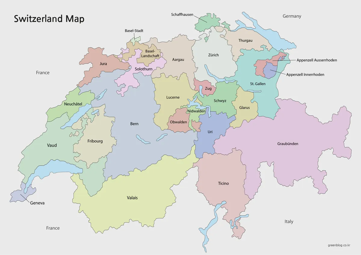
Pastel colors distinguish neighboring cantons without overpowering their labels. The treatment is particularly effective in the north around Basel-Stadt and Basel-Landschaft, in central Switzerland around Zug and Nidwalden, and in the northeast around the two Appenzell cantons. Large areas such as Bern, Valais, Ticino, and Graubünden remain easy to compare with the compact units.
The color version of the Switzerland Map is the strongest choice for a projected lesson, introductory regional graphic, or presentation in which viewers must recognize separate cantons quickly. The blue lakes supply geographic anchors while the neutral background keeps the Swiss boundary separate from the surrounding countries.
Labeled Black-and-White Map for Reference
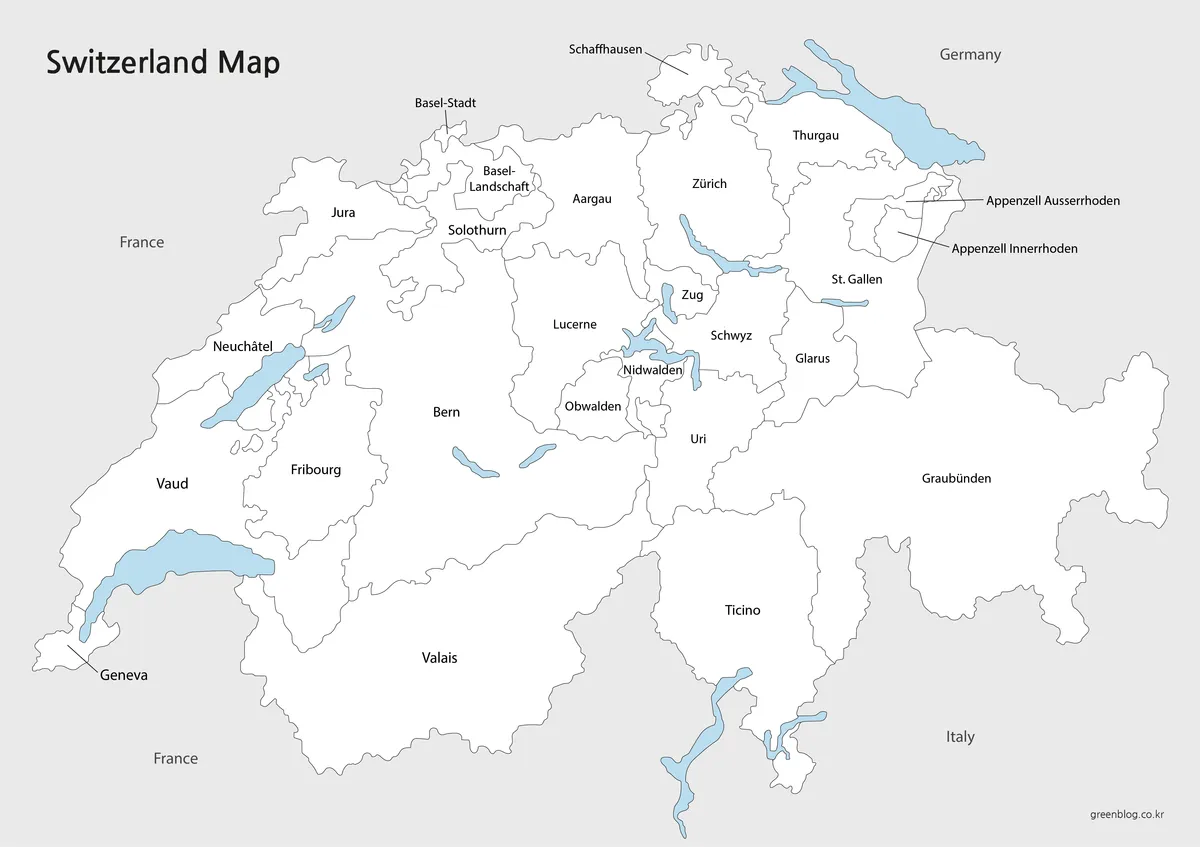
Removing the canton fills shifts attention to spelling, boundary placement, and the contrast between land and water. All 26 canton names remain visible, including the externally placed labels for Geneva, Basel-Stadt, Schaffhausen, Appenzell Ausserrhoden, and Appenzell Innerrhoden. The surrounding labels identify Germany, France, and Italy without adding a dense international background.
This Switzerland Map version fits monochrome documents, reference sheets, and exercises that require names to remain available. A reader can circle selected cantons, add language-region notes, or highlight a travel area without first reconstructing the administrative labels. Because the lakes remain blue, the image is not completely grayscale, but that limited color preserves an important distinction between water and canton territory.
Blank Outline for Labels and Thematic Data
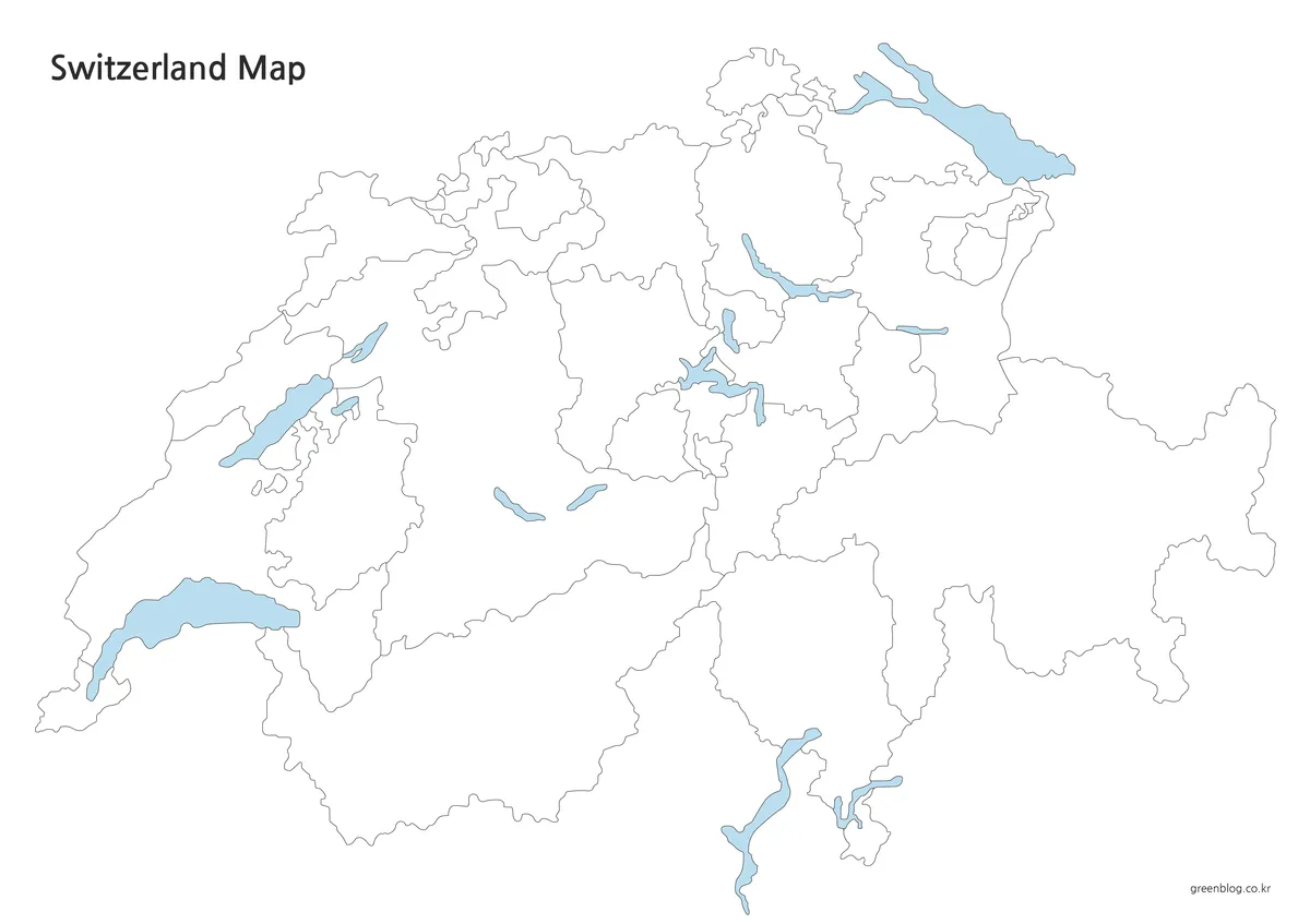
The outline removes canton and neighboring-country names as well as the pastel fills. It keeps the national boundary, 26 canton divisions, and selected lakes, creating open areas for handwriting or digital annotation. Small polygons around Basel, central Switzerland, and Appenzell are still present, so users can practice locating them rather than working from an oversimplified national silhouette.
An outline Switzerland Map works as a language-region exercise, a canton population graphic, a tourism-night comparison, or a route-planning base. Bern, Zürich, Geneva, Basel, Lugano, and the five bordering countries can be added as annotations. The source is a raster image rather than a confirmed vector file.
Choosing a Version for Print or Screen
The color image emphasizes separation between adjacent cantons. The labeled black-and-white image emphasizes names and works well beside report text. The outline version leaves space for recall exercises, an original legend, statistics, or route annotations.
A3 provides enough room for long names and external callouts, while smaller paper reduces label space. At A4, compact areas such as Basel-Stadt, Zug, Nidwalden, Obwalden, and the two Appenzell cantons lose readability before large labels such as Bern, Valais, or Graubünden.
The three images also form a useful learning sequence: color for initial structure, the labeled basic map for canton names, and the blank outline for recall. This progression separates recognition from recall and lets lakes act as location clues.
Classroom, Travel, and Data Projects
For a federalism lesson, students can compare large cantons such as Graubünden, Bern, and Valais with compact Basel-Stadt, Zug, and Geneva. A second activity can identify the paired names Basel-Stadt and Basel-Landschaft or distinguish Appenzell Ausserrhoden from Appenzell Innerrhoden. These comparisons are specific to Switzerland’s administrative structure and are clearer when boundaries remain visible.
Language geography provides another practical use. A blank copy can be colored for predominantly German-, French-, Italian-, and Romansh-speaking areas, while multilingual cantons can receive a separate pattern. The Switzerland Map does not contain a language legend. Any added language classification benefits from a clearly stated reference year and source.
Travel planning can begin by marking cities and lake areas rather than drawing nonexistent roads from the source image. A user might add Geneva, Lausanne, Bern, Basel, Zürich, Lucerne, Lugano, or St. Moritz and then sketch a proposed route. Statistical projects can assign one value to each canton, but the map itself does not provide population totals, tourism counts, or economic data.
Frequently Asked Questions
How many cantons are displayed?
The maps show Switzerland’s 26 cantons. The two Basel cantons and the two Appenzell cantons are represented separately, as are Obwalden and Nidwalden. Bern is labeled as a canton, while the city of Bern is not marked with a separate federal-seat symbol.
Does the Switzerland Map name every neighboring country?
No. Germany, France, and Italy are printed around the labeled versions. Switzerland also borders Austria and Liechtenstein, but their names are outside the visible labeling scheme. The outline leaves room for those two additional country labels.
Are the lakes labeled by name?
The larger lake shapes are shown in blue, but their names are not printed. The blank areas leave room for labels such as Lake Geneva, Lake Constance, Lake Neuchâtel, Lake Zurich, Lake Lucerne, Lake Lugano, and Lake Maggiore.
Which spelling should be used for Graubünden?
Graubünden is the German name and the form shown on these English map images. Grisons is the French name and also appears in some English references, while Grigioni and Grischun are used in Italian and Romansh. A single naming system keeps the canton list consistent.
Which file is best for a canton-labeling worksheet?
The blank outline fits full canton-labeling exercises. The labeled black-and-white version provides a reference when only selected areas need identification, while the color version works well as an introductory display because adjacent cantons are easy to separate.
Switzerland Map Files
Color, black-and-white, and outline versions showing the 26 cantons and selected major lakes are available in one ZIP archive.
Switzerland maps (ZIP)Related Maps
- Italy Map with Regional Boundaries
- France Map in Color, Black and White, and Outline
- Germany Map with Federal States
Additional Resources
- Lakes and Rivers — About Switzerland: The Swiss Federal Department of Foreign Affairs explains the country’s major lakes, shared border lakes, and wider water network.
Green Map creates custom-edited map images using open geographic data sources such as geoBoundaries, Natural Earth, OpenStreetMap, and government open data. These maps are edited visual materials, not raw data files, and are provided for education, documents, presentations, and graphic reference.