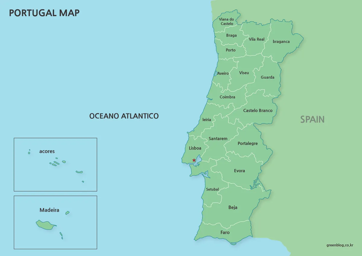
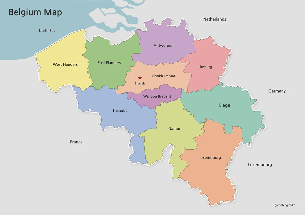
A France Map can represent more than one administrative period, and the date matters on this page. The supplied images show the 22-region system used in metropolitan France before the regional reform that took effect on January 1, 2016. Names such as Nord-Pas-de-Calais, Picardie, Aquitaine, Limousin, and Rhône-Alpes identify this as a historical regional layout, not the current 13-region metropolitan structure.
The collection contains three matching map versions: a green labeled reference, a black-and-white labeled reference, and an unlabeled outline. A separate French tricolor image is included as a companion visual. All four published previews are inspected here according to what they actually show, while the small legacy download-button image is replaced by one accessible HTML download box.
These maps are useful for historical comparison, lessons about the 2016 reform, archive-based regional statistics, and projects that specifically require the former boundaries. They should not be presented as a current administrative-region base. For contemporary data or current regional labeling, use an official post-2016 source instead.
Table of Contents
Map Creation Background
The three map images share one landscape composition. Metropolitan mainland France occupies the center and right of the page, Brittany projects toward the Atlantic on the west, and Corsica appears separately in the lower-right corner. Water labels identify the English Channel, Atlantic Ocean, Bay of Biscay, and Mediterranean Sea, providing coastal orientation without adding roads or city symbols.
The administrative lines divide the map into the former 22 metropolitan regions. This is visible in several pairs that are separate on the artwork but combined today: Haute-Normandie and Basse-Normandie, Auvergne and Rhône-Alpes, Bourgogne and Franche-Comté, and Nord-Pas-de-Calais and Picardie. The France Map therefore works best when its historical reference date is stated beside it.
All three published map previews measure 1200 × 849 pixels and use identical boundary geometry. That consistency allows the labeled image to serve as an answer key for the outline version. It also makes side-by-side comparison straightforward because regional shapes do not move between the green, monochrome, and blank editions.
Country Info
France’s regional organization changed substantially in 2016. The 22 former metropolitan regions were reorganized into 13 metropolitan regions. In addition, France has five overseas regions, which are not displayed in these images. This France Map covers metropolitan France only, including Corsica, and should not be interpreted as a map of every French region worldwide.
Several mergers explain the difference between this historical base and a current one. Alsace, Champagne-Ardenne, and Lorraine became Grand Est. Aquitaine, Limousin, and Poitou-Charentes became Nouvelle-Aquitaine. Languedoc-Roussillon and Midi-Pyrénées became Occitanie, while Nord-Pas-de-Calais and Picardie became Hauts-de-France.
Other combinations produced Normandie, Auvergne-Rhône-Alpes, and Bourgogne-Franche-Comté. Bretagne, Île-de-France, Pays de la Loire, Provence-Alpes-Côte d’Azur, and Centre-Val de Loire remained geographically recognizable in the new arrangement, although administrative naming and status require current references. Corsica is shown separately from the mainland in all three map versions.
Map Type Sections
Each France Map version has a distinct purpose. The labeled green map is the primary reference for former regional names and coastal position. The monochrome file retains the same labels while improving low-ink reproduction. The outline removes all text and fill, leaving the former regional framework for annotation, recall practice, or historical data graphics.
1️⃣ Base Map
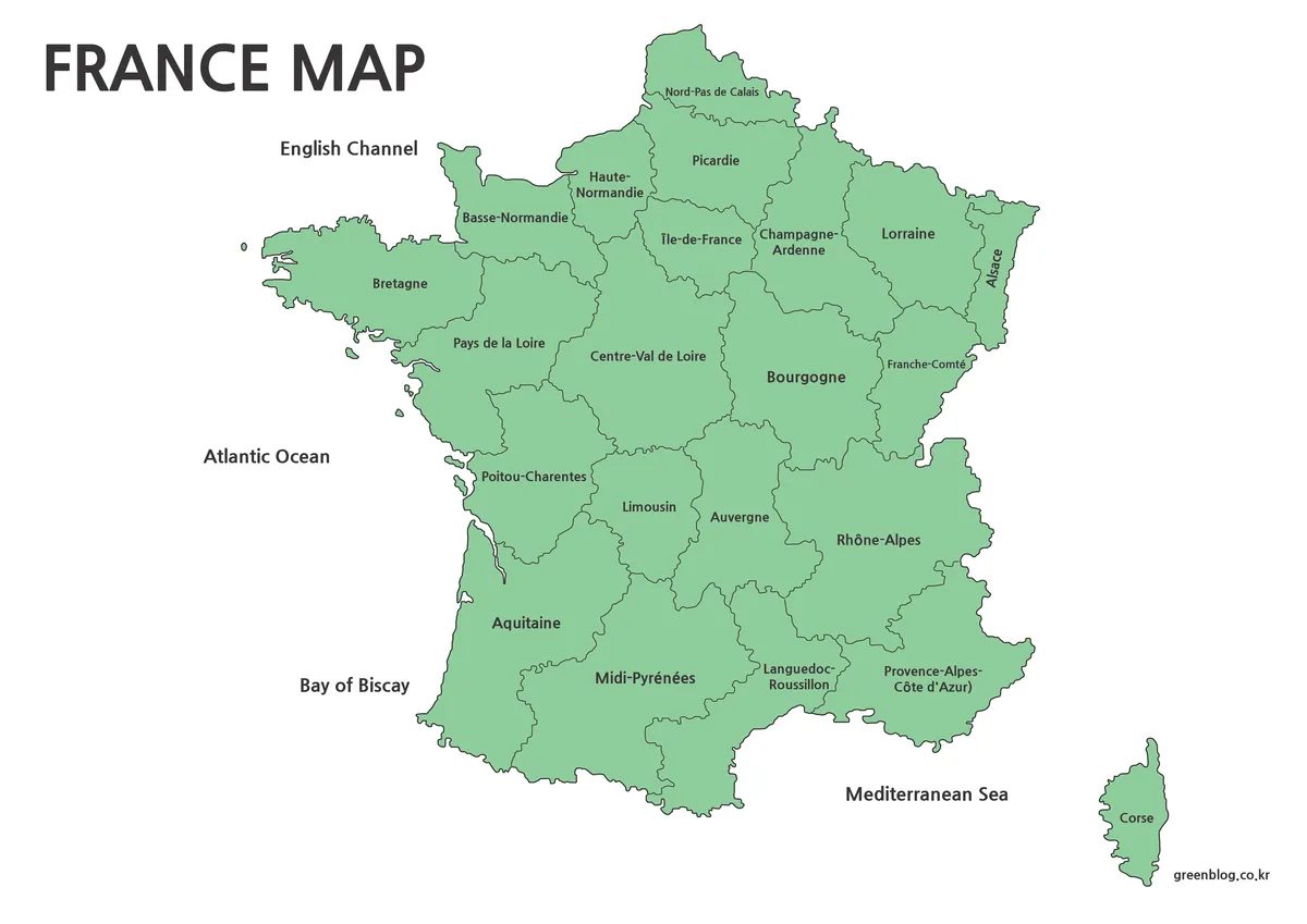
The base France Map uses one pale green fill for the entire country rather than assigning a different color to every region. Dark internal lines and centered names carry the administrative information. There are no city labels, department boundaries, roads, terrain layers, or statistical values, so the visual hierarchy stays focused on the former regions.
The northern half preserves Nord-Pas-de-Calais, Picardie, Haute-Normandie, Basse-Normandie, Champagne-Ardenne, Lorraine, and Alsace as separate units. Farther south, Aquitaine, Limousin, Poitou-Charentes, Auvergne, Rhône-Alpes, Midi-Pyrénées, and Languedoc-Roussillon also remain separate. Those labels are the clearest evidence of the map’s pre-2016 reference period.
Use this version when the names must remain visible, such as a lesson comparing old and new boundaries or a report using data collected under the former regional system. If current statistics are overlaid, first convert them to matching historical units; otherwise the values and boundary scheme may describe different geographies.
2️⃣ Printable Map (Black and White)
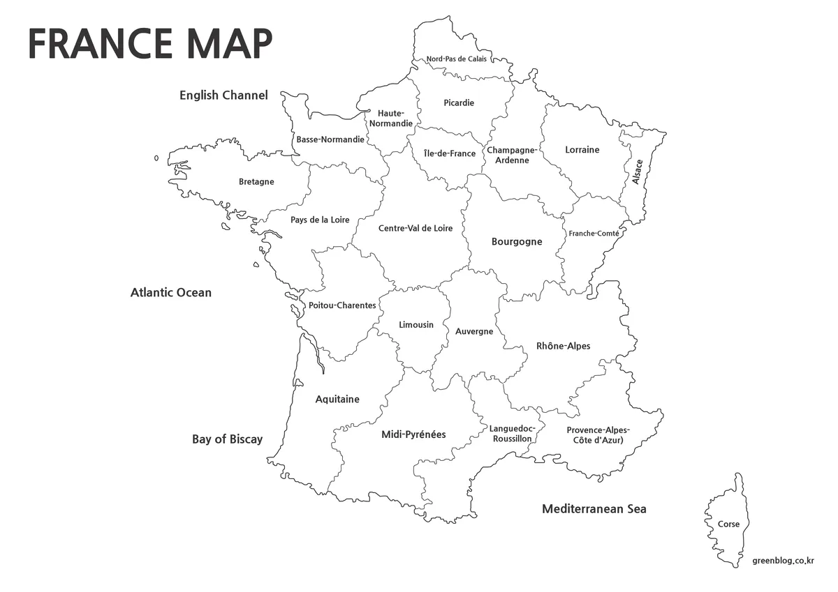
The black-and-white France Map removes the green fill while retaining former region names, internal boundaries, the national outline, Corsica, and surrounding water labels. It is the practical choice for photocopies, workbook pages, and reports where a colored background would consume ink or compete with handwritten marks.
Because every label remains present, this is a reference sheet rather than a blank quiz. It can be paired with the outline as an answer key. Before printing a classroom set, test the labels for compact regions such as Alsace and the two Norman regions at the intended page size, and preserve the image’s original aspect ratio.
The white interior also makes arrows, dates, and short notes easier to see. For a reform lesson, one approach is to draw brackets around the historical regions that later merged, then write the current region name in the margin. Work on a duplicate so the unmarked reference remains available.
3️⃣ Outline Map
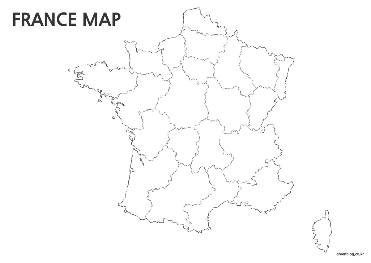
The outline version removes the region names and water labels as well as the green fill. Only the coastline, Corsica, and former internal region boundaries remain. It can support recall exercises, custom historical labels, or a thematic graphic based on the pre-2016 geography without requiring the user to erase existing text.
When turning this blank France Map into a data graphic, document the year and geographic standard next to the legend. A value reported for Nouvelle-Aquitaine cannot be assigned directly to one old region without additional source data, because that current region combines Aquitaine, Limousin, and Poitou-Charentes. Similar caution applies to every merged area.
The file is a raster image, not a vector boundary dataset. Keep an untouched original before applying fills or erasing lines. If clean current boundaries, scalable vectors, or official administrative analysis are required, use a current national mapping resource rather than redrawing the 2016 mergers by hand on this outline.
4️⃣ Flag Map
The fourth content image is the French vertical tricolor: blue at the hoist, white in the center, and red at the fly. It is a companion national identifier, not a fourth map type. Keeping it separate from the geographic images prevents decorative color from being mistaken for a regional classification.
The 900 × 600 preview can accompany a country title, comparison panel, or introductory slide. It does not supply administrative information and should not replace the labeled reference. When the flag and map appear together, a short caption should still identify the map as showing the historical 22-region metropolitan layout.
Use Cases
The collection is most defensible in historical or comparative contexts. It can illustrate how regions were grouped before 2016, support older datasets, provide a labeling exercise, or help explain why familiar former names still appear in archives and cultural references. It is not suitable as an unlabeled current-region template unless the old internal lines are replaced with verified modern boundaries.
Choosing a France Map for the Correct Period
Choose the labeled green version for historical orientation, the black-and-white version for economical reference printing, and the outline for custom work using the former regions. If the project concerns present-day administration, elections, regional statistics, or current government services, use a post-2016 map and confirm whether overseas regions must also be included.
FAQ
Is this France Map current?
No. The labels and boundaries show metropolitan France’s 22-region system from before January 1, 2016. It is appropriate for historical comparison and older regional data, but not for current administrative work. France now uses 13 metropolitan regions, and five overseas regions are outside the coverage of these images.
Can I print these maps for offline use?
Yes. The printable and simplified versions were prepared to remain clear when printed, especially in black and white.
Are these maps suitable for graphic or editing software?
Yes. The outline map works well as a base image in programs like Photoshop or Illustrator, allowing users to add custom elements.
Can I highlight only specific regions or cities?
Yes. Using the no-city or outline versions makes it easier to emphasize selected areas without interference from existing labels.
Download Section
The protected ZIP link provides the map collection shown on this page. Download and extract the archive, then keep the original files unchanged before adding annotations or colors. Remember to identify the historical boundary date whenever the images are reused.
Map File Information
Map versions: labeled green · labeled black-and-white · blank outline
- Included Files: Use only the versions confirmed in the article and supplied images
- File Type: Use the confirmed download contents
- Intended Use: Printing, education, presentations, and map-based projects
Related Maps
Additional Resources
For an official explanation of the reform and the current regional arrangement, see France’s territorial reform and new regional map.
Green Map creates custom-edited map images using open geographic data sources such as geoBoundaries, Natural Earth, OpenStreetMap, and government open data.
These maps are edited visual materials, not raw data files, and are provided for education, documents, presentations, and graphic reference.