A Korean version of this map page is available. View Korean Page
An Albania Map can be useful in many situations beyond simply locating the country on a map of Europe. Teachers preparing geography lessons, students creating reports, bloggers writing about the Balkans, and designers building travel graphics often need a printable map that is easy to read and simple to edit. Finding a clean map that works equally well for presentations, educational materials, and visual projects can sometimes be more difficult than expected.
Located in southeastern Europe on the Balkan Peninsula, Albania shares borders with Montenegro, Kosovo, North Macedonia, and Greece. Although relatively small in size compared to many European countries, its long north-to-south shape and mountainous landscape make regional organization important when explaining geography or travel routes. Major cities such as Tirana, Durrës, and Shkodër are distributed across different parts of the country, making visual references especially helpful.
This printable Albania Map collection includes three map styles: a color administrative map, a black and white labeled map, and a blank outline map. The files were prepared in high resolution and arranged for A3 printing, making them suitable for classroom handouts, presentation slides, travel resources, infographic projects, and graphic editing work.
While organizing the map collection, extra attention was given to readability at larger print sizes. Administrative boundaries were simplified where appropriate, neighboring countries were displayed without excessive detail, and labels were reviewed to remain readable when enlarged. The goal was to create a practical visual resource rather than a complex GIS-style reference map.
Table of Contents
Albania Map Collection Overview
Included in this Albania map package:
- Color administrative map
- Black and white labeled map
- Outline map for editing
- High-resolution image files
- A3 printable layout
- Bilingual place names
- Presentation-ready design
Each version serves a different purpose depending on whether the project requires visual distinction, printing efficiency, or editing flexibility.
Color Administrative Map
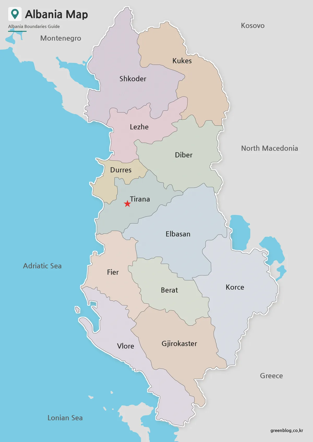
The color version was designed to make Albania’s regional structure easier to understand at a glance.
Administrative regions are displayed using separate colors, helping users quickly distinguish neighboring areas. Tirana is highlighted for easy identification, while surrounding countries are shown in a simplified format to keep the overall layout clean and uncluttered.
Because Albania stretches vertically across the western Balkans, the map uses a portrait-oriented layout that improves readability and makes better use of printable page space.
Useful For
- Geography lessons
- Travel presentations
- Regional comparison projects
- Educational posters
- Blog graphics
Black and White Printable Version
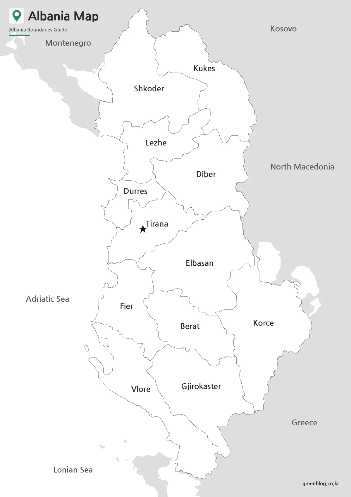
A black and white map often becomes the preferred option when printing is the primary goal.
Removing color allows labels and boundary lines to stand out more clearly on paper. It also works well for note-taking, classroom exercises, and worksheet preparation. During the review process, boundary visibility and label clarity were checked to ensure the map remains easy to read after printing.
The simplified appearance makes it especially useful when users want to add handwritten notes, highlight regions, or mark travel routes.
Common Uses
- Classroom handouts
- Study worksheets
- Printed reports
- Educational activities
- Regional reference materials
Blank Outline Map for Editing
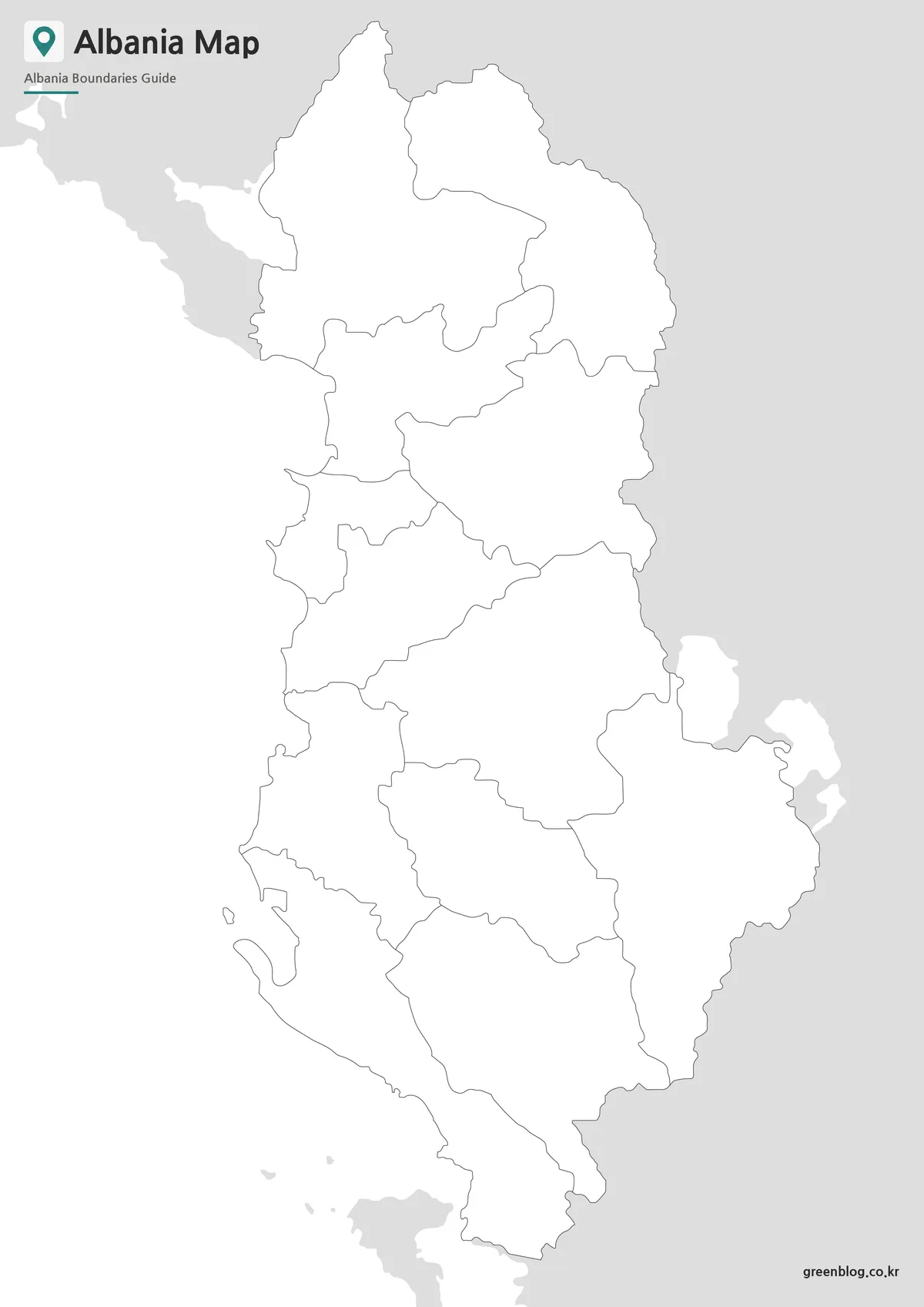
The outline version removes both colors and labels, leaving only the administrative boundary framework.
Designers and content creators often need a clean base layer for custom projects. Instead of removing labels manually, users can begin editing immediately by adding colors, icons, data points, or custom annotations.
Because the map was prepared in high resolution, boundaries remain clear even when enlarged for presentation slides, posters, or infographic layouts.
Works Well For
- Infographic design
- Graphic editing projects
- Data visualization
- Travel route planning
- Educational worksheets
- Presentation graphics
Designed for Printing and Visual Projects
One challenge when creating a map of Albania is balancing geographic detail with readability. Including every administrative subdivision can make the layout difficult to interpret, particularly on standard-sized printouts. For this reason, the collection focuses on major regional divisions while maintaining a clean visual structure.
The maps are suitable for a variety of practical applications:
- Classroom reference materials
- Travel planning presentations
- Balkan regional studies
- Blog illustrations
- Educational posters
- Printable study resources
- Graphic editing projects
The combination of color, labeled, and outline formats allows users to select the most appropriate version for each project rather than relying on a single map style.
Frequently Asked Questions
Can I print the Albania Map in A3 size?
Yes. The collection was prepared for high-resolution A3 printing.
Which version is best for classroom activities?
The black and white map is usually the easiest for students to annotate and study.
Is the outline map editable?
Yes. The outline version was created specifically for editing and custom graphic projects.
Why does the map focus on major administrative regions?
Displaying larger regions improves readability and makes the overall structure easier to understand.
Albania Map Download
Choose the map version that best fits your project. Color, labeled, and outline maps are included for printing, education, presentations, and graphic editing.
- File Format: JPG / ZIP
- Image Size: A3 High Resolution
- Intended Usage: Printing · Education · Presentation · Editing
Files are included in a ZIP archive for convenient access and storage.
Related Maps
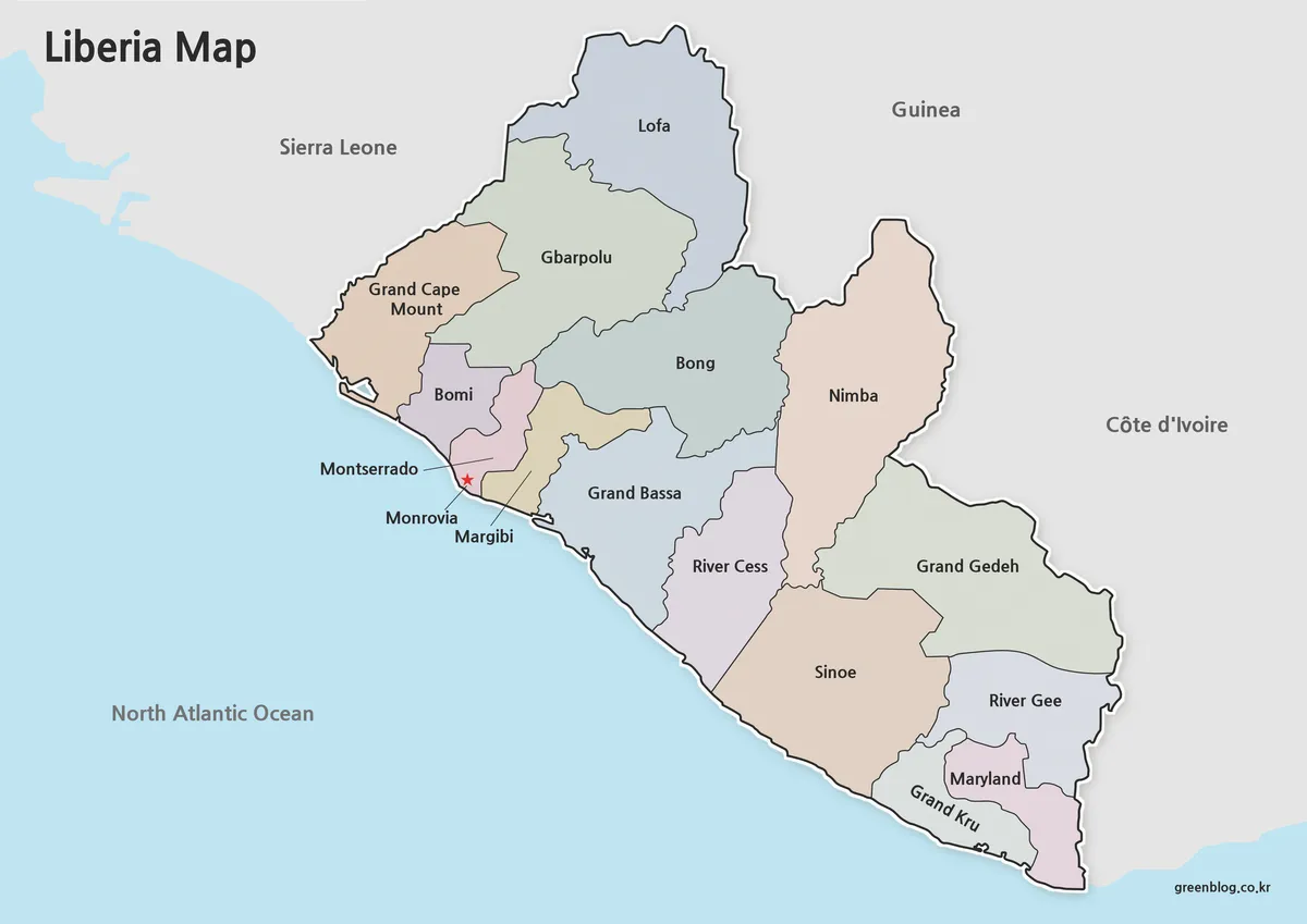
- Liberia Map Collection: Color, Black and White, and Outline Maps
- Senegal Map Bundle Featuring Color, Labeled and Blank Outline Maps
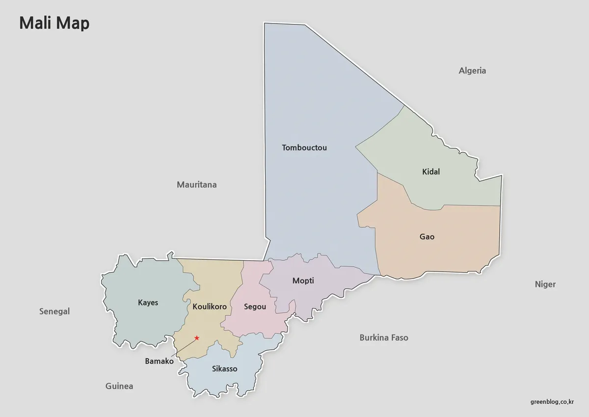
- Free Mali Map Download – Color, Labeled and Outline Editions
- Printable Angola Map Set for Classroom, Presentation and Editing Projects
Additional Resources
- OpenStreetMap Albania – Interactive map resource that allows users to explore Albania’s cities, roads, administrative boundaries, and geographic features in greater detail.
Green Map creates custom-edited map images using open geographic data sources such as geoBoundaries, Natural Earth, OpenStreetMap, and government open data.
These maps are edited visual materials, not raw data files, and are provided for education, documents, presentations, and graphic reference.