A South Africa Map provides a clear way to read the country’s nine-province structure, two-ocean coastline, and distinctive relationships with neighboring states. At Africa’s southern tip, South Africa faces the Atlantic Ocean to the west and the Indian Ocean to the east, while Namibia, Botswana, Zimbabwe, Mozambique, Eswatini, and Lesotho define much of its landward context. That combination makes a well-labeled administrative map more informative than a simple national outline.
This resource brings together three printable image styles: a color provincial reference map, a black-and-white labeled map, and a blank outline. They are intended for readers who need to compare provinces, prepare classroom materials, add a geographic visual to a report, or create an annotated slide. The supplied layouts emphasize province boundaries and the position of Lesotho and Eswatini rather than roads, terrain, or detailed local mapping.
South Africa’s internal pattern is especially useful to study visually. Northern Cape occupies much of the west, while the compact Gauteng province sits inland near Pretoria; KwaZulu-Natal follows part of the east coast, and Lesotho appears fully enclosed within South African territory. Capital markers for Pretoria, Cape Town, and Bloemfontein help explain the country’s administrative, legislative, and judicial capital functions without crowding the page.
Table of Contents
South Africa Map Overview
The Republic of South Africa is divided into nine provinces: Eastern Cape, Free State, Gauteng, KwaZulu-Natal, Limpopo, Mpumalanga, Northern Cape, North West, and Western Cape. Their shapes and sizes vary markedly, from the broad Northern Cape to small Gauteng, so provincial boundaries are central to understanding the national layout. The map also places the country within southern Africa by showing the surrounding states and both ocean labels.
A South Africa Map is particularly valuable for explaining features that can be awkward to describe in text. Lesotho is an independent country entirely surrounded by South Africa, while Eswatini lies against the country’s eastern side between Mpumalanga and KwaZulu-Natal. The map also shows how the Western Cape and Eastern Cape meet the southern coastline, while Limpopo reaches north toward Botswana, Zimbabwe, and Mozambique.
Printable Map Collection
The three included designs answer different reading needs without adding unsupported detail. The color image separates adjoining provinces at a glance. The monochrome image retains names, borders, neighboring countries, and capital stars in a restrained layout. The unlabelled outline removes those reference details so that a reader can supply a custom layer of information.
All three versions use the same recognizable national silhouette and preserve the important inset-like relationship of Lesotho within the country. This consistency makes it easy to move from a labeled reference image to a blank activity base. The page layout is prepared for A3 printing, giving the wide east-to-west extent and long southern coast enough room to remain legible.
Color South Africa Map for Provincial Comparison
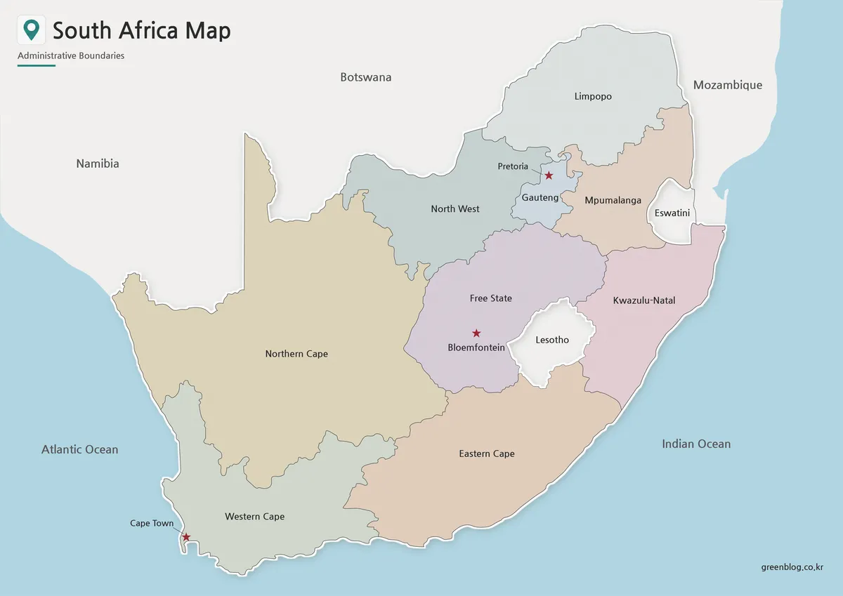
Color is most helpful where several provinces meet in the interior and northeast. Gauteng, Mpumalanga, Free State, North West, Limpopo, and KwaZulu-Natal can be distinguished more quickly when adjacent areas have separate fills. The large Northern Cape is also immediately recognizable as the expansive western province, making this image a strong starting point for an overview of national administrative geography.
On this South Africa Map, the capital stars support orientation rather than replacing provincial labels. Pretoria is shown in Gauteng, Cape Town in the Western Cape, and Bloemfontein in the Free State. For a presentation about the country’s capital functions or a regional comparison activity, the color version makes those locations easier to connect with their provinces and the surrounding national shape.
Black and White Printable South Africa Map
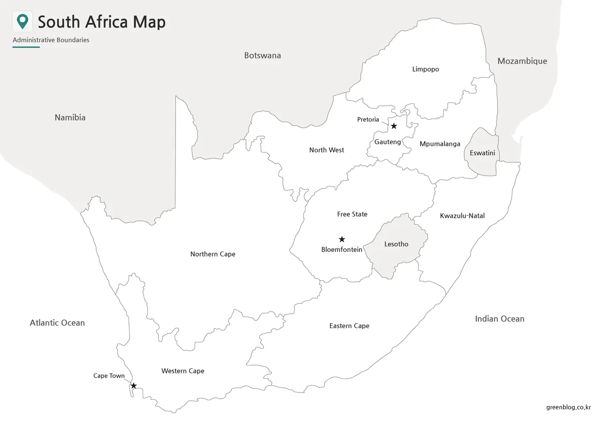
The black-and-white image keeps the reference information while reducing visual competition from colored fills. Province names remain visible, as do the outlines of Lesotho and Eswatini, the neighboring-country labels, and the three marked capitals. It is suited to a report page, a printed geography exercise, or a handout where readers may underline names or add short notes beside the map.
Its line-based treatment is useful when the task is identification rather than regional color comparison. A teacher, for example, can ask learners to locate the Free State around Lesotho, trace the two coasts, or identify which provinces meet Gauteng. The restrained design also leaves the provincial boundary network clear when reproduced alongside other text or charts.
Blank South Africa Outline Map for Editing
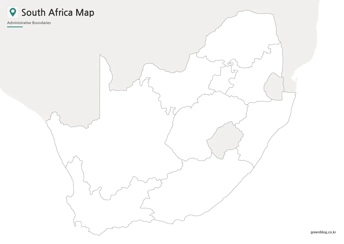
The outline version is a clean base for annotation because it retains the provincial divisions while omitting place names, colors, oceans, and capital markers. Users can label the nine provinces from memory, shade a chosen group of regions, or mark the locations of Pretoria, Cape Town, and Bloemfontein. The enclosed shape of Lesotho is still visible, making it possible to build activities around this unusual border relationship.
For custom graphics, use the blank image as an underlying map rather than as an editable source file. Add route arrows along the Atlantic or Indian Ocean coast, highlight Gauteng for an urban-region discussion, or overlay symbols for a project’s own categories. In a classroom setting, it can become a province-labeling or color-coding exercise with a clear, uncluttered boundary framework.
Practical Uses for the South Africa Map
A South Africa Map can support country-profile lessons, southern Africa comparison sheets, administrative reference pages, and presentation slides. The labeled styles make it easier to discuss the province that contains each capital marker and to show why Lesotho must be considered when reading the central and southeastern interior. They can also provide a clear geographic frame for written material that refers to the Atlantic side, Indian Ocean side, or northeastern borderlands.
Map readers preparing a visual report may place the color image beside short provincial notes. Those assembling printed exercises can use the monochrome version for identification prompts and written annotations. The blank outline is the appropriate choice when the project requires original labels, data symbols, or region shading, since none of the supplied place names need to be covered first.
Choosing the Best Version
Select the color map when the main goal is quick provincial orientation. Its separate fills help an audience follow the relationship between the large Northern Cape, the coastal Cape provinces, the central Free State, and the compact northeastern provinces. It is the clearest option for an on-screen overview where visual distinction matters.
Select the black-and-white map for a labeled reference that will sit within a document or be copied for a group. Its labels and capital symbols provide useful prompts, but the absence of color makes the page feel less busy. This is a practical fit for study sheets, report appendices, and activities that invite handwritten marking.
Select the outline when the reader must supply the information. It supports province-name quizzes, custom thematic shading, route sketches, and infographic overlays while preserving the administrative shapes. Before printing or placing any version in a layout, check that the planned paper size and margins leave enough space around the coastline and the labels near Gauteng, Eswatini, and Lesotho.
Frequently Asked Questions
What is included in this South Africa Map collection?
The collection includes a color map, a black and white map, and an outline map. Each version is prepared for a different use, such as printing, presentations, classroom materials, or editing.
Is this South Africa Map useful for classroom projects?
Yes. The black and white and outline versions are especially useful for worksheets, geography activities, country reports, and southern Africa comparison assignments.
Can I edit the outline map?
Yes. The outline version is a blank base map, so users can add labels, colors, route lines, city markers, province highlights, or regional data.
Why are Lesotho and Eswatini important on a South Africa Map?
Lesotho is surrounded by South Africa, and Eswatini is located along the eastern side of the country. Showing them helps readers understand the regional layout more clearly.
Map File Information
This download provides three A3-ready South Africa administrative map images for provincial reference, annotation, classroom work, and document layouts.
- Included Versions: Color map, black and white map, outline map
- Printable Size: A3 layout
- File Type: Image files
- Intended Use: Provincial reference, classroom handouts, presentations, labeling activities, and map annotation
Related Maps
Additional Resources
- South African Government: South Africa’s Provinces — Read official background on the nine provinces, the three capital functions, and the country’s neighboring states.
Green Map creates custom-edited map images using open geographic data sources such as geoBoundaries, Natural Earth, OpenStreetMap, and government open data. These maps are edited visual materials, not raw data files, and are provided for education, documents, presentations, and graphic reference.