A Zimbabwe map download is useful when you need a clear visual reference for southern Africa, inland country geography, province divisions, or neighboring country relationships. Zimbabwe is a landlocked country located between Mozambique and Botswana, with Zambia to the northwest and South Africa to the south. It sits between the Zambezi River and the Limpopo River, which makes its regional position easier to understand when viewed on a map rather than described only in text.
This printable Zimbabwe map collection includes color, black and white, and outline versions prepared for classroom handouts, presentation slides, blog graphics, infographic projects, and basic editing work. The files are arranged around Zimbabwe’s administrative structure, including 8 provinces and 2 major cities with provincial status. Harare, the capital, and Bulawayo are marked as important city reference points, helping users quickly identify the country’s main urban centers.
Zimbabwe is also a practical subject for map-based explanation because its land use and regional character vary across the country. The northeast is often associated with agricultural areas, while the southwest is more closely connected with grazing land and wider rural landscapes. A labeled map helps users compare these regional differences, understand the country’s inland position, and place Zimbabwe within the larger southern African region.
During the map preparation process, the layout was kept visually simple so that the national shape, province structure, and neighboring country labels would remain easy to read. The color version was designed for quick regional separation, the black and white version was reviewed for clearer printing and document use, and the outline version was cleaned so users can add their own information without fighting against existing labels or colors.
Table of Contents
Zimbabwe Map Download Overview
This Zimbabwe map download provides three map styles for different project needs. The color map is designed for fast visual recognition, the black and white map works well in printed materials, and the outline map gives users a clean base for editing, coloring, labeling, or infographic work.
Because Zimbabwe is bordered by several countries and has a clear province-based administrative layout, a map is useful for more than simple location checking. Teachers, students, bloggers, and presentation creators can use the files to explain southern Africa, compare neighboring countries, mark major cities, or build regional study materials.
Included Map Versions
The collection includes three practical versions:
- Color Zimbabwe map
- Black and white Zimbabwe map
- Blank outline Zimbabwe map
Each version is prepared for a different type of use. The color map supports quick visual comparison, the black and white map keeps printing clean, and the outline map is suited for custom editing and classroom activities.
Color Zimbabwe Province Map
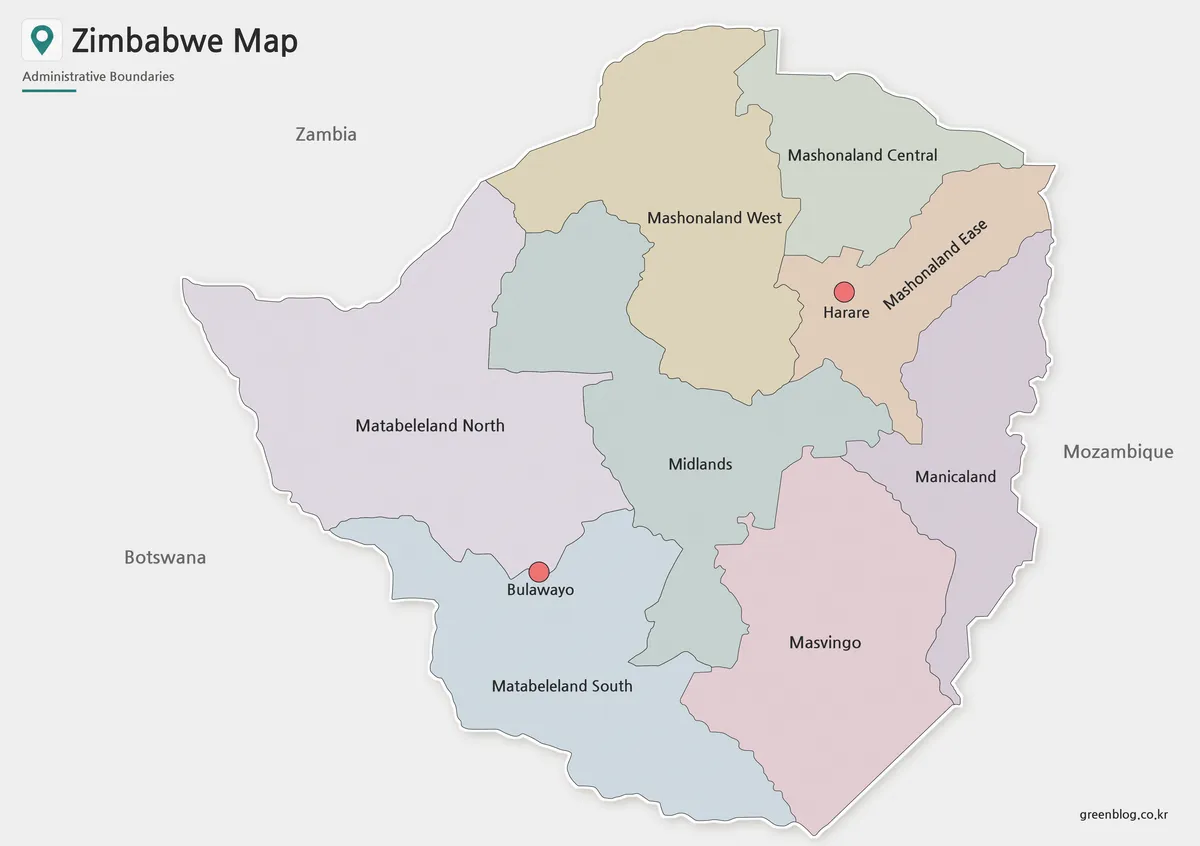
The color version separates Zimbabwe’s 8 provinces and 2 city-level areas so the administrative structure can be understood quickly. Since Harare and Bulawayo play an important role as major urban reference points, they are marked clearly without making the map feel crowded. Neighboring countries are shown in a simplified way, using labels rather than overly complex boundary emphasis.
This version works well for educational slides, blog images, country overview pages, and regional comparison graphics. When explaining Zimbabwe’s location between Mozambique, Botswana, Zambia, and South Africa, the color layout gives readers a faster way to understand both the country’s position and its internal divisions.
Black and White Zimbabwe Map for Printing
For printed materials, the black and white version provides a cleaner layout. Removing color helps province names, city markers, and boundary lines remain readable in worksheets, handouts, reports, and presentation notes. This is especially useful when the map needs to be printed in grayscale or placed inside a document with other text and images.
Zimbabwe’s shape is fairly compact compared with some larger African countries, but its province labels and major city markers still need enough visual space. The basic version was prepared to keep the map readable without relying on color contrast, making it practical for classroom packets, reference sheets, and document printing.
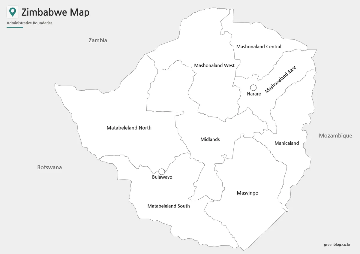
Blank Zimbabwe Outline Map for Editing
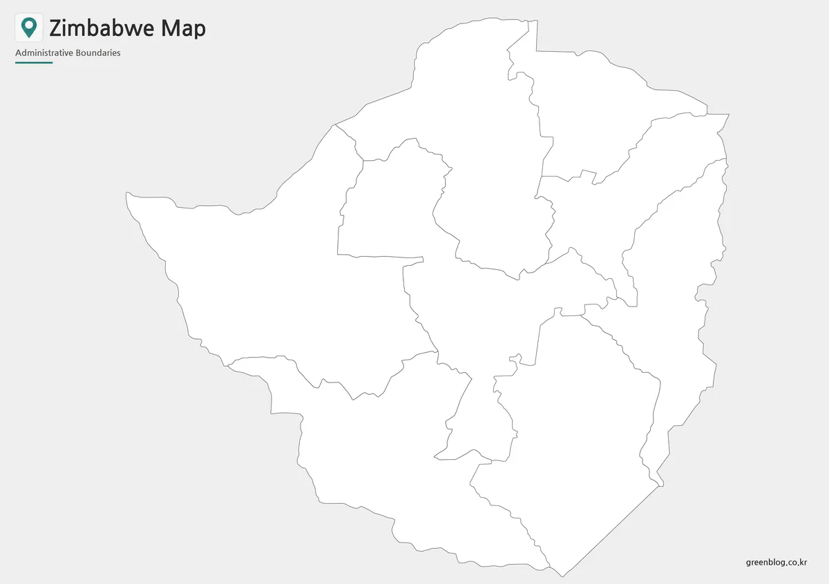
The outline version removes color and text, leaving a clean boundary-based layout. This format is useful when users want to add custom information, such as city markers, province labels, travel routes, agricultural notes, mining regions, classroom coloring, or infographic annotations.
For Zimbabwe, the blank outline map works especially well when creating materials about regional industries, neighboring country comparisons, or southern African geography. Instead of editing over a fully labeled map, users can start with a simple base and build the content they need for a specific lesson, article, or presentation.
Why a Zimbabwe Map Is Useful
Zimbabwe’s position in southern Africa is easier to explain visually because it connects with several neighboring countries while remaining fully inland. A map helps users see how Mozambique, Botswana, Zambia, and South Africa relate to Zimbabwe’s borders. It also makes the country’s placement between the Zambezi and Limpopo river regions easier to understand.
The administrative structure is another reason the map is useful. Zimbabwe is commonly organized around 8 provinces and 2 city-level areas, so a province map gives users a practical framework for explaining regional differences without becoming too detailed. This balance makes the map suitable for education, presentation design, blog content, and visual reference materials.
Practical Uses for the Zimbabwe Map Collection
Teachers can use the black and white map for geography worksheets, while students can include the color version in reports or presentation slides. Bloggers and content creators may use the labeled map when explaining African countries, regional borders, landlocked geography, or country profiles.
The outline map is helpful for projects that need custom information. Possible uses include marking Harare and Bulawayo, adding travel routes, highlighting neighboring countries, showing province-level comparisons, preparing classroom coloring activities, or building simple infographic layouts. Because the map is not overloaded with extra elements, it can be adapted to many types of visual content.
Basic Zimbabwe Information for Map Users
Zimbabwe is located in southern Africa and does not have a coastline. Its capital is Harare, and Bulawayo is another major city often used as a reference point on national maps. The country borders Mozambique, Botswana, Zambia, and South Africa, giving it an important inland position in the region.
Key reference points:
- Location: Southern Africa
- Capital: Harare
- Major city: Bulawayo
- Area: About 390,757 square kilometers
- Population: About 14.86 million
- Administrative structure: 8 provinces and 2 city-level areas
- Neighboring countries: Mozambique, Botswana, Zambia, South Africa
- Map value: Landlocked position, province structure, major city placement, and regional border context
Frequently Asked Questions
What is included in this Zimbabwe map download?
The Zimbabwe map download includes color, black and white, and outline versions. Each version is designed for a different use, such as visual reference, printing, or editing.
Can I use the Zimbabwe map for classroom materials?
Yes. The map works well for geography worksheets, classroom handouts, student reports, and presentation slides.
Which version is best for printing?
The black and white version is usually the best choice for printing because it keeps province labels and boundary lines clean without relying on color.
Is the outline map useful for editing?
Yes. The blank outline map can be used to add city markers, province names, route lines, industry notes, or infographic labels.
Are major cities included?
Yes. Harare and Bulawayo are marked as key city reference points in the labeled map versions.
Map File Information
This download includes printable Zimbabwe map versions for educational use, presentation design, document printing, and editable graphic projects.
- Included Versions: Color map, black and white map, outline map
- Printable Size: A3 layout
- File Type: Image files
- Intended Use: Classroom handouts, presentations, blog graphics, infographic editing, and printable reference materials
Related Maps
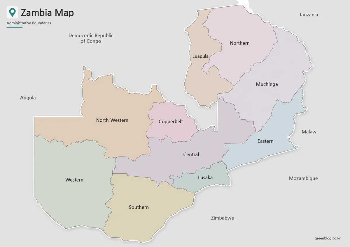
- Printable Zambia Map Collection for Classrooms and Presentations
- Cameroon Map Download | Printable Administrative Map Collection
- Free Albania Map Download – Color, Black and White, and Outline Versions
- Tunisia Map Download – Printable Color, Black and White, and Outline Maps
Additional Resources
- Zimbabwe Geoportal – Zimbabwe Administrative Boundaries : This resource provides administrative boundary data for Zimbabwe, including provincial and local-level divisions. It can be useful for checking Zimbabwe’s regional structure and boundary reference when working with map materials.
Green Map creates custom-edited map images using open geographic data sources such as geoBoundaries, Natural Earth, OpenStreetMap, and government open data.
These maps are edited visual materials, not raw data files, and are provided for education, documents, presentations, and graphic reference.