A Nantou County map download is useful when explaining central Taiwan, inland county geography, mountain-side administrative areas, or travel routes around places such as Sun Moon Lake, Puli, Yuchi, and Cingjing Farm. Nantou County sits near the center of Taiwan’s main island and is known as an inland county without direct access to the sea. It connects with Taichung City to the north, Changhua County and Yunlin County to the west, Chiayi County to the southwest, Kaohsiung City to the south, and Hualien County to the east. Because of this central location, a map is often clearer than a short written description.
This printable Nantou County map collection includes color, black and white, and outline versions designed for classroom reference, travel presentations, blog graphics, document printing, and simple graphic editing. The map focuses on Nantou County’s 13 administrative areas, including Nantou City, Puli Township, Caotun Township, Zhushan Township, Jiji Township, Yuchi Township, Xinyi Township, and Ren’ai Township. The files are prepared for A3 layout use, making them easier to place in larger printed materials or presentation slides.
Nantou County is also a good example of why regional maps need more than a simple location marker. The western side connects more closely with Taiwan’s central-western urban and rural areas, while the eastern and southern sections include large mountain-side townships such as Ren’ai and Xinyi. A labeled map helps readers compare compact western areas with the wider inland and mountain regions. For teachers, students, travel writers, and infographic creators, this gives the county a clearer structure.
While preparing this map set, readability at larger print sizes was considered, especially because some township names are longer in English. The color version helps separate the 13 areas quickly, the black and white version keeps labels and boundaries clean for printing, and the outline version gives users a blank base for adding routes, labels, color fills, or study notes.
Table of Contents
Nantou County Map Download Overview
This Nantou County map download includes three practical versions for different kinds of work. The color map is designed for quick regional comparison, the black and white map works well in printed documents, and the outline map is useful when users need a blank boundary map for editing or educational activities.
Because Nantou County is located in central Taiwan and does not touch the coastline, it is often used to explain inland geography and mountain-region relationships. A full Taiwan map may show where the county sits, but a focused Nantou County map makes it much easier to understand the 13 administrative areas and their connection to nearby counties and cities.
What the Nantou County Map Shows
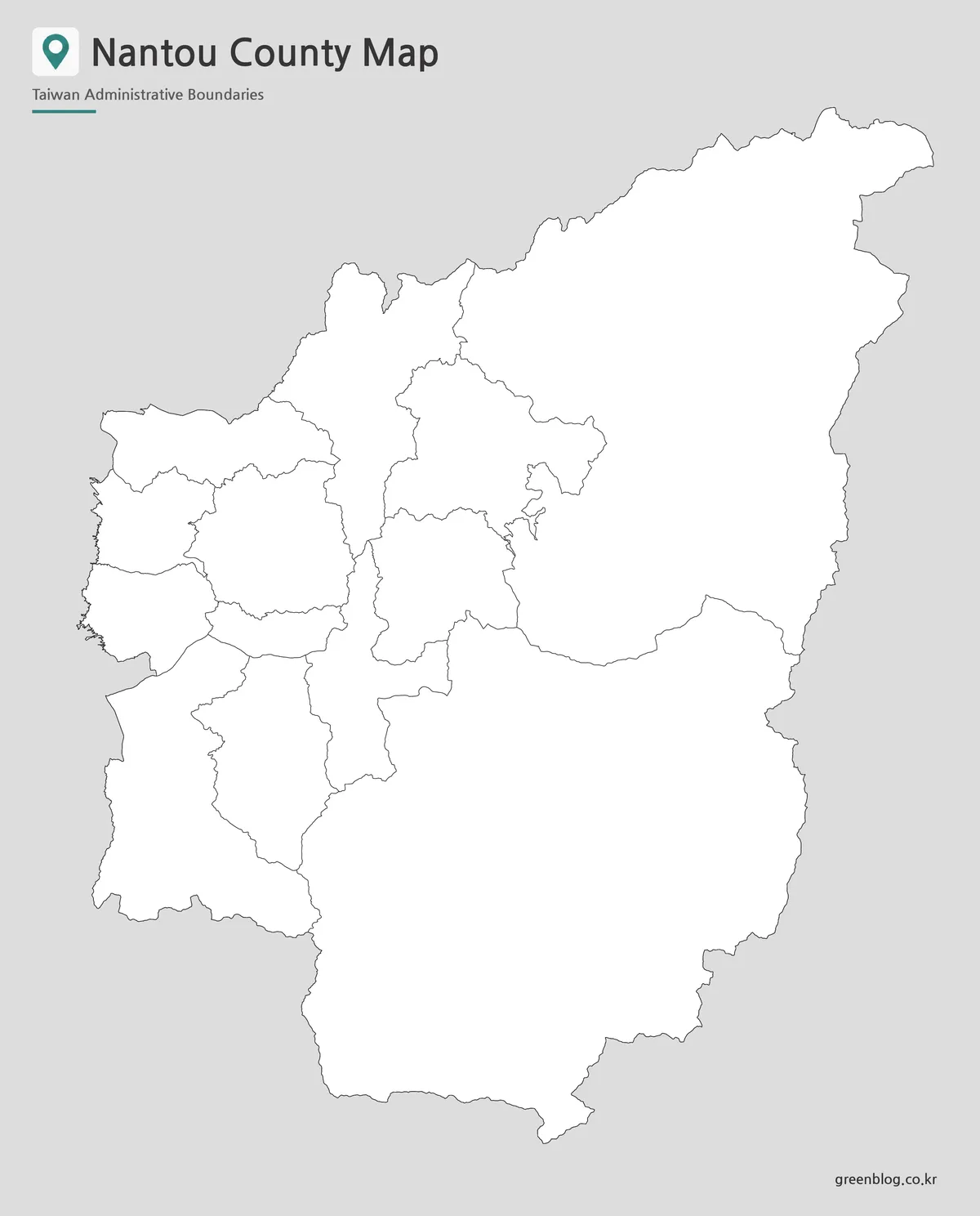
Nantou County is divided into 13 administrative areas: 1 city, 4 townships commonly translated as township-level towns, and 8 townships. The county includes compact western areas such as Nantou City, Caotun, and Mingjian, as well as larger inland areas such as Ren’ai and Xinyi. This difference in area size is one reason a county-level map is more useful than a simple list of names.
The map also helps show Nantou County’s position among nearby regions. Taichung City is located to the north, Changhua and Yunlin sit toward the west, Chiayi lies to the southwest, Kaohsiung is to the south, and Hualien is to the east. This surrounding-region context is helpful for classroom lessons, travel planning, and central Taiwan comparison materials.
Color Nantou County Administrative Map
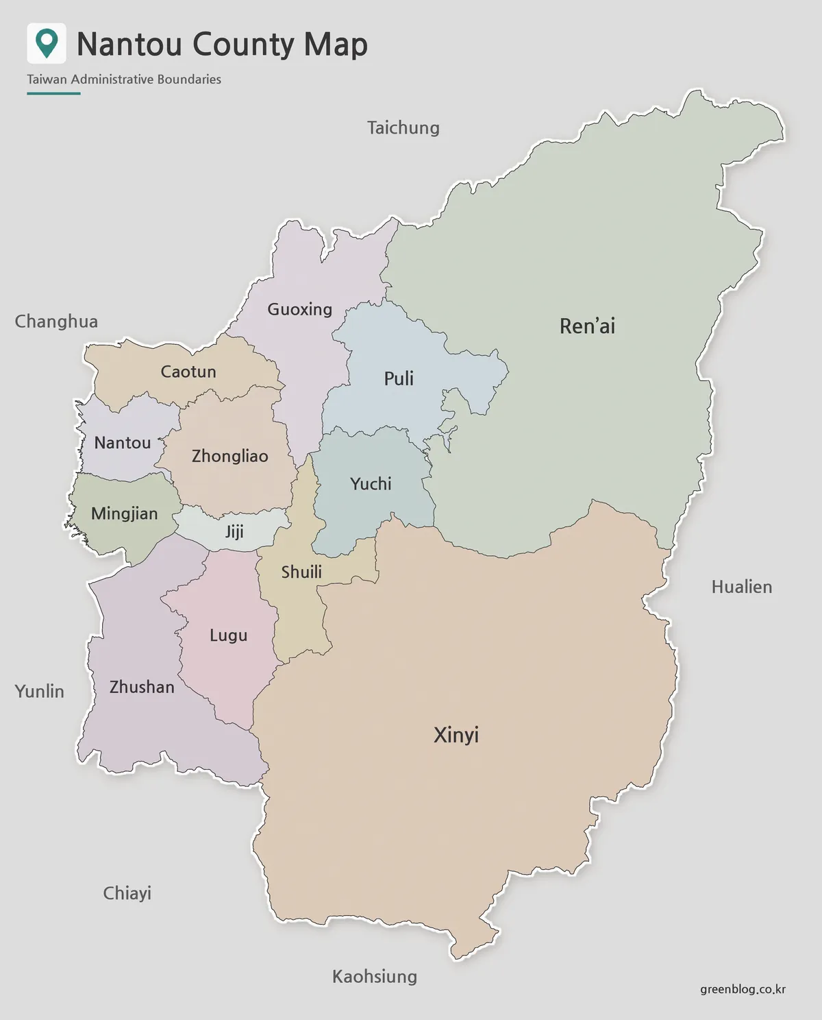
The color version separates Nantou County’s 13 administrative areas so the county structure can be read quickly. This is especially helpful because the county includes both smaller western areas and much larger mountain-side townships. Ren’ai Township and Xinyi Township cover wide areas, while Nantou City, Caotun Township, and Mingjian Township appear more compact near the western side.
For travel content, the color map works well when introducing routes around Sun Moon Lake, Puli, Yuchi, or Cingjing Farm. For educational materials, it gives students a fast way to see how central Taiwan’s inland county is organized. The surrounding county relationship also becomes easier to explain when Nantou County is shown as a color-coded administrative map rather than as a single point on a Taiwan map.
Black and White Nantou County Map for Printing
For printed documents, the black and white version keeps the focus on labels and boundary lines. This layout is easier to insert into worksheets, reports, handouts, and presentation notes because it does not depend on color blocks. When a map will be printed in grayscale, a clean line-based version usually reads better than a full color graphic.
Nantou County has a manageable number of administrative areas, but the English names can take more space than the Chinese or Korean labels. A simple black and white layout helps keep the map readable when placed in school materials or printed reference sheets. It is also convenient when users want to write notes directly on the page or mark a specific township by hand.
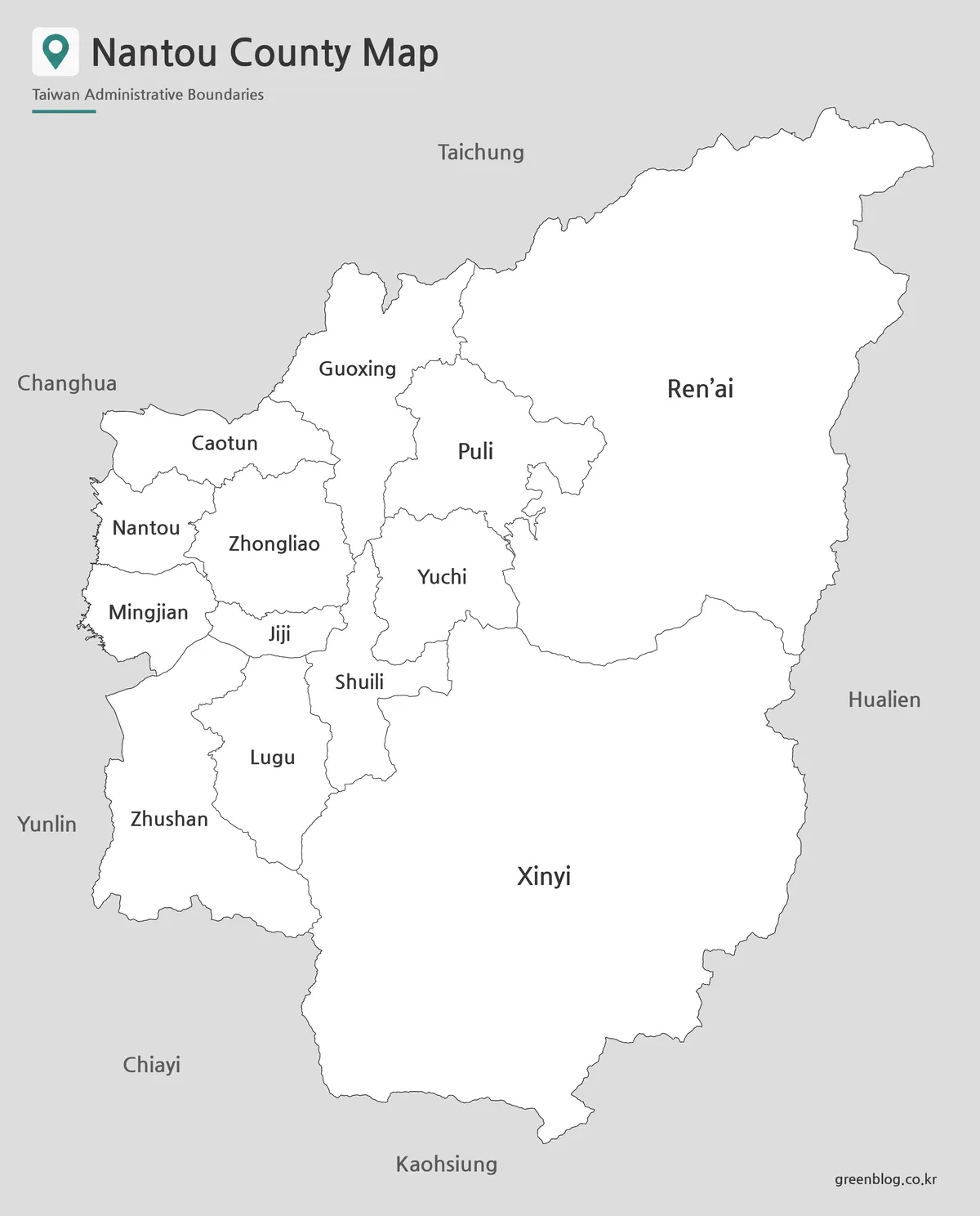
Blank Nantou County Outline Map for Editing
The outline version removes colors and labels, leaving a clean boundary map. This format works well for editing projects, classroom coloring activities, infographic design, travel route marking, and custom labeling. Users can add Sun Moon Lake, tourism points, township names, road routes, statistical notes, or highlighted areas without removing existing visual elements first.
For Nantou County, the outline map is especially helpful when comparing the larger mountain townships with smaller western administrative areas. Teachers can use it as a worksheet base, while designers can add custom color fills or icons for a specific project. Travel bloggers may also use the blank version to mark routes between Puli, Yuchi, Nantou City, and nearby regions.
Practical Uses for the Nantou County Map Collection
The map files are useful for travel articles, classroom worksheets, regional comparison slides, blog graphics, and infographic layouts. A teacher may use the black and white map for a Taiwan geography handout, while a travel writer may use the color version to introduce Sun Moon Lake and nearby townships. A designer may start with the outline version and add custom labels, icons, or color fills.
For presentation work, the map helps explain how Nantou County connects with Taichung, Hualien, Chiayi, and Kaohsiung. For study materials, it gives students a clear view of the county’s 13 administrative areas. For travel planning, it can serve as a simple visual reference before adding route lines or destination markers.
Frequently Asked Questions
What is included in this Nantou County map download?
The Nantou County map download includes color, black and white, and outline versions. Each version is prepared for a different purpose, such as presentation use, printing, or editing.
Can I print the Nantou County map in A3 size?
Yes. The files are arranged for A3 layout use, which makes them suitable for larger printed materials, classroom handouts, and presentation graphics.
Is the outline version good for editing?
Yes. The blank outline map works well for adding township names, travel routes, tourism points, classroom notes, or infographic data.
How many administrative areas are shown?
The map shows 13 administrative areas in Nantou County, including Nantou City, Puli, Caotun, Zhushan, Jiji, Yuchi, Xinyi, and Ren’ai.
Map File Information
This download includes printable Nantou County map versions for educational use, presentation design, document printing, and editable graphic projects.
- Included Versions: Color map, black and white map, outline map
- Printable Size: A3 layout
- File Type: Image files
- Intended Use: Classroom handouts, presentations, blog graphics, infographic editing, and printable reference materials
Additional Resources
- National Land Surveying and Mapping Center – Administrative Districts Boundaries Maps : This official Taiwan mapping resource provides administrative boundary map information and related geographic map services. It can be useful when checking Taiwan county and township boundary references.
Related Maps
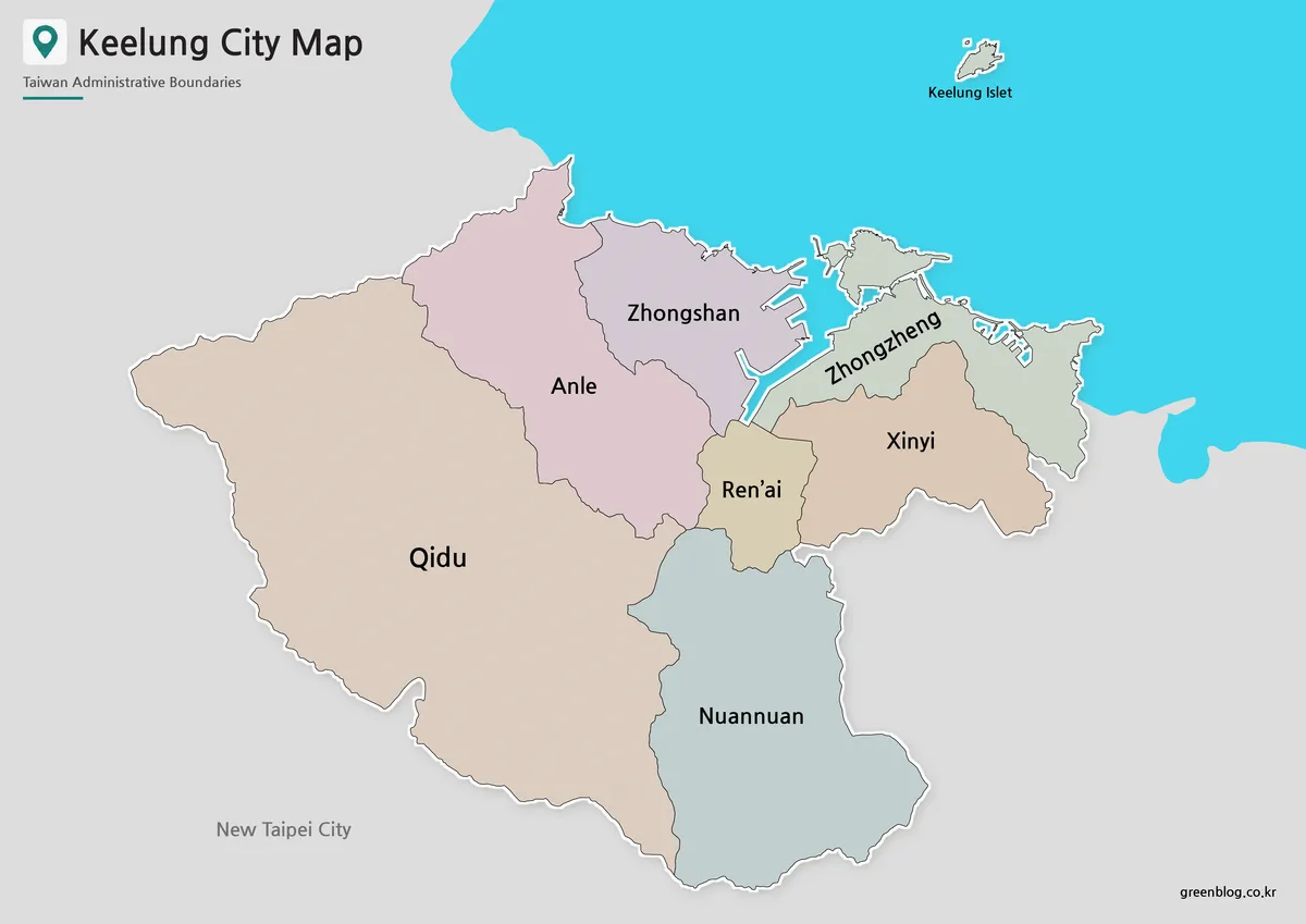
- Printable Miaoli County Map for Education and Design Projects
- Hsinchu County Map – Printable Taiwan Administrative Map Collection
- Printable Yilan County Map with Administrative Boundaries
- High Resolution Tainan City Map for Printing and Editing
Green Map creates custom-edited map images using open geographic data sources such as geoBoundaries, Natural Earth, OpenStreetMap, and government open data.
These maps are edited visual materials, not raw data files, and are provided for education, documents, presentations, and graphic reference.