A Kyrgyzstan Map becomes especially useful in the west, where the national edge bends around a complicated border zone and several regional boundaries meet within a small space. Farther east, the country broadens into the large Naryn and Issyk Kul areas. This collection places both patterns on the same landscape page in a color reference, a black-and-white labeled edition, and a blank regional outline.
The labeled maps name seven regions—Batken, Chuy, Issyk Kul, Jalal-Abad, Naryn, Osh, and Talas—and mark Bishkek with a red star. They also position Kyrgyzstan among Kazakhstan, Uzbekistan, Tajikistan, and China. That combination supports lessons about Central Asian location, regional comparison, capital placement, presentation graphics, and labeling practice without crowding the page with district or transport detail.
Readers should understand the map’s scope before using it. Kyrgyzstan’s first-level administrative picture also distinguishes Bishkek and Osh as cities of republican significance, but the graphics do not isolate either city as its own polygon; Bishkek is only marked by a star. Roads, rivers, terrain, coordinates, scale information, district subdivisions, and major lakes are not drawn in the visible previews.
The color preview measures 1,200 × 848 pixels, while the monochrome and outline previews measure 1,200 × 849 pixels. The protected download is described as containing 4,956 × 3,508-pixel JPG maps arranged for A3 output. Use the archive files for final printing and treat the smaller WebP images on the page as previews.
Table of Contents
Reading the Seven-Region Layout
Kyrgyzstan is landlocked in Central Asia. Kazakhstan runs along the north, China borders the east and southeast, Tajikistan lies to the south, and Uzbekistan meets much of the western edge. The labeled versions place all four names outside the national outline, so readers can orient the long east–west form without consulting a second locator map.
The northern Chuy region contains the Bishkek marker and reaches the Kazakhstan border. Talas occupies the upper western projection, separated from Chuy by a narrow change in the national outline. On a Kyrgyzstan Map, that northern pair helps establish a simple starting direction before the more irregular central and southwestern boundaries are examined.
Jalal-Abad spans much of the central-western portion. Batken forms the low western extension, while Osh lies immediately to its east and south of Jalal-Abad. The outer edge in this area contains deep bends and small enclosed or indented spaces. Because the artwork does not name enclaves or explain sovereignty, it should be used for regional orientation rather than detailed border adjudication.
Naryn occupies a broad central and southeastern position, connecting the western cluster visually with Issyk Kul in the east. Issyk Kul is the largest displayed region by horizontal span and meets both Kazakhstan and China. The region name refers to the area, but the famous lake itself is not visibly drawn or labeled in any of the three previews.
Label spelling also needs a quick check. The artwork uses Chuy and Issyk Kul, while other English references may use Chüy or Chui and Issyk-Kul or Ysyk-Köl. The surrounding labels appear as “Kazakstan” and “Tajikstan” rather than the standard English forms Kazakhstan and Tajikistan. These variations should be corrected or disclosed when the map serves as a spelling reference.
Color Administrative Kyrgyzstan Map
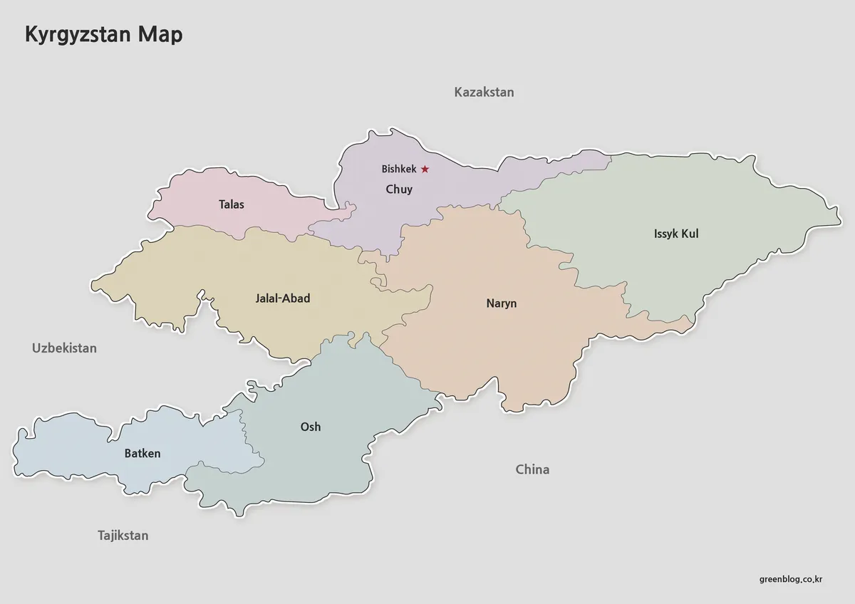
Pastel blue, green, violet, pink, and tan fills separate adjacent regions in the color Kyrgyzstan Map. The treatment is most helpful around Chuy, Jalal-Abad, Naryn, and Osh, where multiple internal lines approach one another. It also prevents Batken from blending visually into Osh and makes the compact Talas shape easy to distinguish from the larger western region below it.
The colors are identifiers, not a thematic scale. They do not encode population, elevation, rainfall, ethnicity, land cover, or political categories. If a teacher or designer adds statistics, the new values need their own legend and source date so readers do not mistake the existing pastel palette for a data classification.
This edition works best as an opening slide, a regional comparison guide, or an answer sheet. An audience can follow a west-to-east explanation from Talas and Batken through Jalal-Abad, Osh, Chuy, and Naryn to Issyk Kul. The red capital marker remains visible against the Chuy fill, while the gray exterior keeps neighboring-country names separate from the colored territory.
Black and White Kyrgyzstan Map for Printing
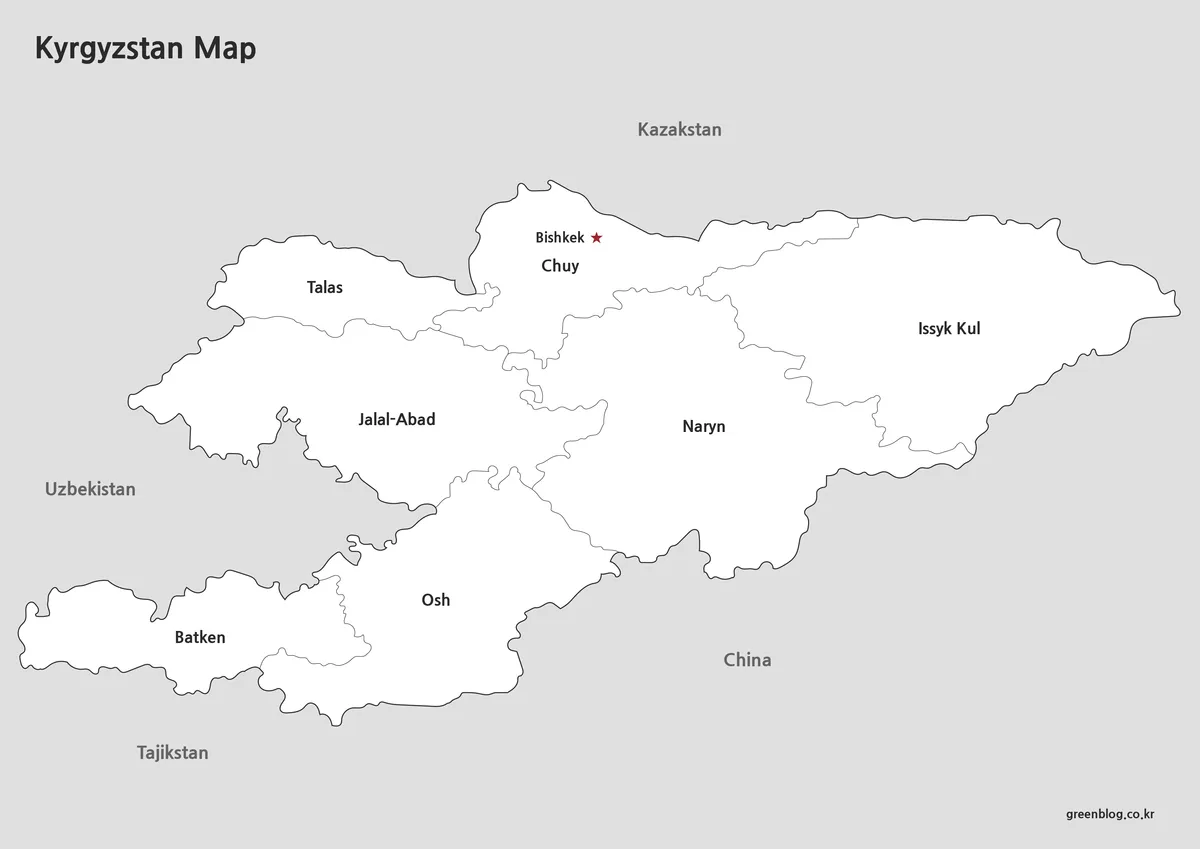
The monochrome edition keeps the same names, borders, and Bishkek star but removes the regional fills. White interiors shift attention toward the boundary lines and text, which makes this version a practical reference in reports, worksheets, or presentation notes where color would compete with nearby charts. It also pairs naturally with the blank outline as a checking sheet.
Because every answer remains visible, this Kyrgyzstan Map is better for guided study than unaided recall. Students can identify the regions touching China, locate the capital relative to Kazakhstan, or compare the shapes at the far eastern and far western ends. For a test that requires learners to supply names, use the outline rather than covering labels manually.
Line reproduction matters more here than color contrast. Before printing a full set, check the narrow internal boundaries near the center and southwest, the small star beside Bishkek, and the thin white gaps along the western border. Preserve the landscape aspect ratio and keep the outside margin if the four-country context is part of the exercise.
Editable Kyrgyzstan Outline Map
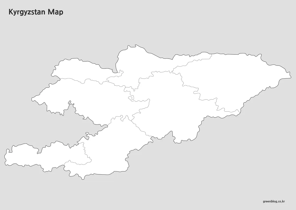
The blank version removes region names, neighboring-country text, the capital star, and pastel fills while retaining the national silhouette and seven internal divisions. Its heading describes its role as an annotation base; the supplied preview is still a raster image, not a confirmed vector or layered source. Large enlargements beyond the native preview dimensions may soften its fine lines.
A learner can turn the outline Kyrgyzstan Map into a staged exercise: first add the four neighboring countries, then label the seven regions, and finally place Bishkek within the Chuy area. Another task can ask students to shade regions that touch China, distinguish the northern border regions, or trace the route of a west-to-east regional comparison without implying a real road.
Designers may add city points, sourced data, routes, or custom groupings, but each new symbol needs a legend and citation. The base does not identify the physical Tian Shan landscape, Lake Issyk-Kul, rivers, highways, districts, or enclave names. Projects focused on those subjects require a dedicated physical, transport, hydrographic, or detailed border source.
Choosing a View for Lessons, Print, or Slides
Select color when rapid regional separation matters, monochrome when labels should dominate a restrained page, and outline when the reader must contribute information. A three-step lesson can begin with the color reference, move to the black-and-white sheet for name checking, and finish with the outline for recall. Using matching geometry makes differences in student answers easier to compare.
For a presentation about Central Asia, a labeled Kyrgyzstan Map provides a clean locator with four international neighbors. For an administrative lesson, explain that the polygons represent the seven regions while Bishkek and Osh also have separate city status outside this polygon count. That wording prevents the visible seven shapes from being misread as a complete count of all first-level administrative units.
For a printed Kyrgyzstan Map, use the archive’s larger JPG files and run one proof at the intended size. Confirm that Talas remains distinct, Batken and Osh do not merge visually, and central boundaries stay clear. For slides, retain enough gray margin to keep the country names readable; a tighter crop is reasonable only when the blank outline is being used without international context.
Keep an untouched original before adding annotations. The maps are suitable for general orientation, classroom work, document illustration, and simple design projects, but not for distance measurement, legal boundary decisions, route planning, or current local administration below the region level. The absence of projection and scale information also makes them unsuitable for precise spatial analysis.
Frequently Asked Questions
One clarification applies throughout this Kyrgyzstan Map FAQ: the visible previews do not show a major lake, even though Issyk Kul appears as a regional name. The answers should otherwise be read as guidance for the supplied collection rather than a description of a physical or road map.
Can I print the Kyrgyzstan map in A3 size?
Yes. Every kyrgyzstan map in this collection was prepared for high-resolution A3 printing.
Are neighboring countries included?
Yes. Kazakhstan, Uzbekistan, Tajikistan, and China are shown to help users understand regional positioning.
Is the outline version editable?
Yes. The outline kyrgyzstan map was created specifically for editing, annotation, and custom graphic projects.
Does the map include major lakes?
Yes. Important lakes are included to provide additional geographic context.
Map File Information
The protected ZIP contains three coordinated regional map images for reference, printing, and annotation.
- Included Versions: Color labeled, black-and-white labeled, and blank outline maps
- Printable Size: 4,956 × 3,508 pixels · A3 layout
- File Type: JPG map files
- Intended Use: Lessons, reports, presentations, labeling, and custom graphics
Related Maps
Additional Resources
- National Statistical Committee: Regional Population — Compare the seven regions with the separately listed cities of Bishkek and Osh in official statistical tables.
Green Map creates custom-edited map images using open geographic data sources such as geoBoundaries, Natural Earth, OpenStreetMap, and government open data. These maps are edited visual materials, not raw data files, and are provided for education, documents, presentations, and graphic reference.