A Korean version of this map page is available. View Korean Page
A Kazakhstan Map is especially useful when you need more than a simple country location image. Kazakhstan covers a very large area across Central Asia, with part of its territory extending toward Eastern Europe, so understanding its regional layout is easier with a printable map that shows boundaries, labels, nearby countries, and major geographic reference points. Because the country is located north of Uzbekistan and shares borders with Russia, China, Kyrgyzstan, Uzbekistan, and other neighboring areas, it often appears in classroom lessons, regional comparison graphics, travel presentations, and educational materials about Central Asia.
This printable Kazakhstan Map collection includes three versions: a color map, a black and white map, and a blank outline map. The files were prepared for A3-size use, making them suitable for enlarged viewing, printed reference sheets, blog graphics, presentation slides, school assignments, and visual editing work. The color version is helpful for quickly comparing regions across Kazakhstan’s broad territory, while the black and white version is easier to print in reports or classroom handouts. The outline map works as a clean base for adding routes, city markers, regional data, or custom colors.
While preparing this map set, the wide shape of Kazakhstan was an important design consideration. A large inland country can look simple at first glance, but regional labels, border placement, lake areas, and neighboring country names still need enough spacing to remain readable. The layout was adjusted so users can identify the capital area, surrounding countries, and major water features without the page feeling crowded. This makes the collection useful not only as a downloadable map resource but also as a practical visual reference for anyone explaining Kazakhstan’s position in Central Asia.
Table of Contents
Kazakhstan Map Overview
Kazakhstan is the largest country in Central Asia and one of the largest countries in the world by land area. Its broad steppe landscape and long international borders make a map useful for understanding how the country connects with nearby regions. A simple country outline may show the national shape, but it does not always explain how wide the territory is or where neighboring countries sit around it.
The map collection focuses on usability rather than long background information. It is designed for readers who need a clean visual resource for printing, teaching, writing, or editing. Students can use it for geography assignments, teachers can include it in handouts, bloggers can place it in country guide articles, and designers can use the outline version as a base for custom graphics.
Printable Map Versions Included
This Kazakhstan Map download includes three practical styles:
- Color regional map
- Black and white printable map
- Blank outline map
Each version serves a different purpose. The color map is best for visual comparison, the black and white version is better for simple printing, and the outline version is intended for editing, labeling, and custom project work.
Color Kazakhstan Map
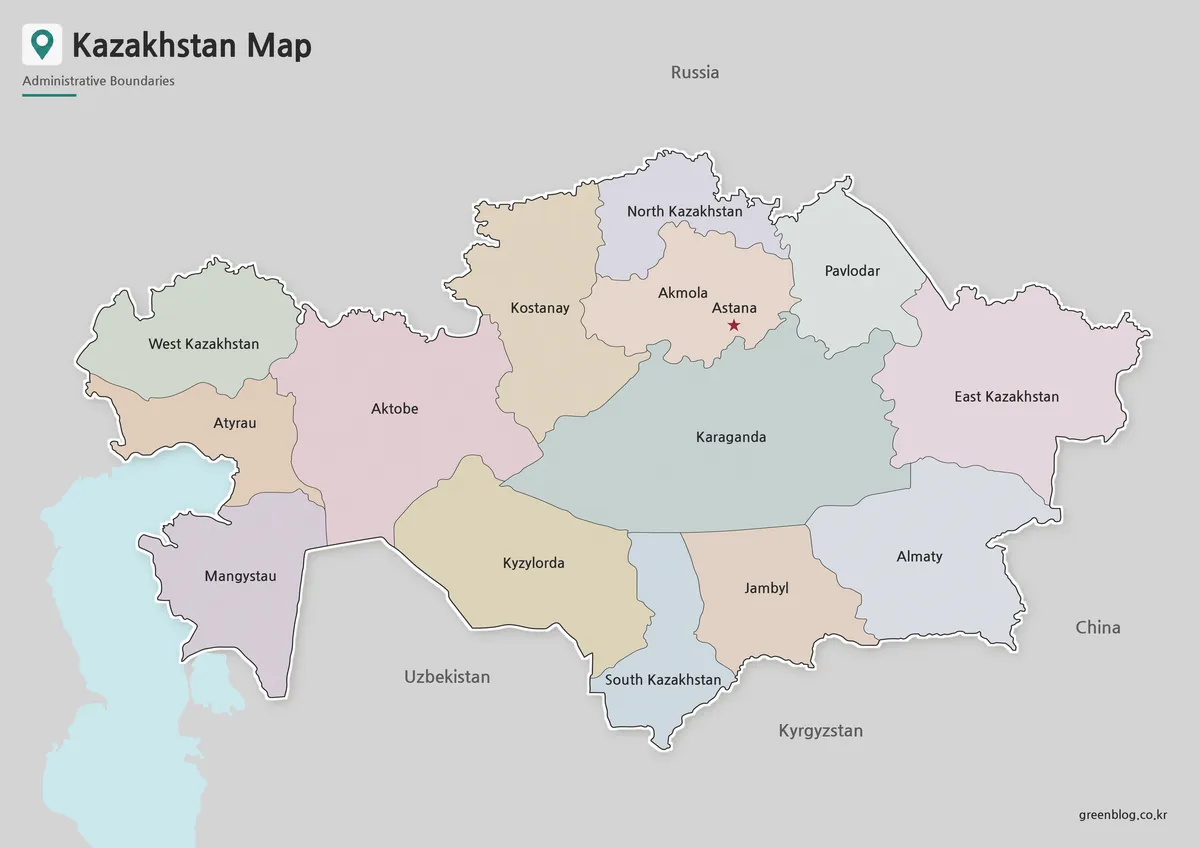
The color version separates Kazakhstan’s regional areas with different tones, which helps readers compare the country’s wide administrative layout more quickly. Because Kazakhstan stretches across a large inland area, color separation makes it easier to follow the map from the western side near the Caspian region toward the eastern border with China.
Neighboring countries are also included to support regional understanding. This is helpful when creating Central Asia comparison materials or explaining Kazakhstan’s position in relation to Uzbekistan, Russia, China, and Kyrgyzstan. Major water features are also shown as reference points, giving the map more geographic context than a plain boundary image.
The color map works well for blog posts, presentation slides, classroom displays, and visual introductions to Central Asia. It is also useful when readers need a labeled map that can be understood quickly without adding extra explanation.
Black and White Printable Version
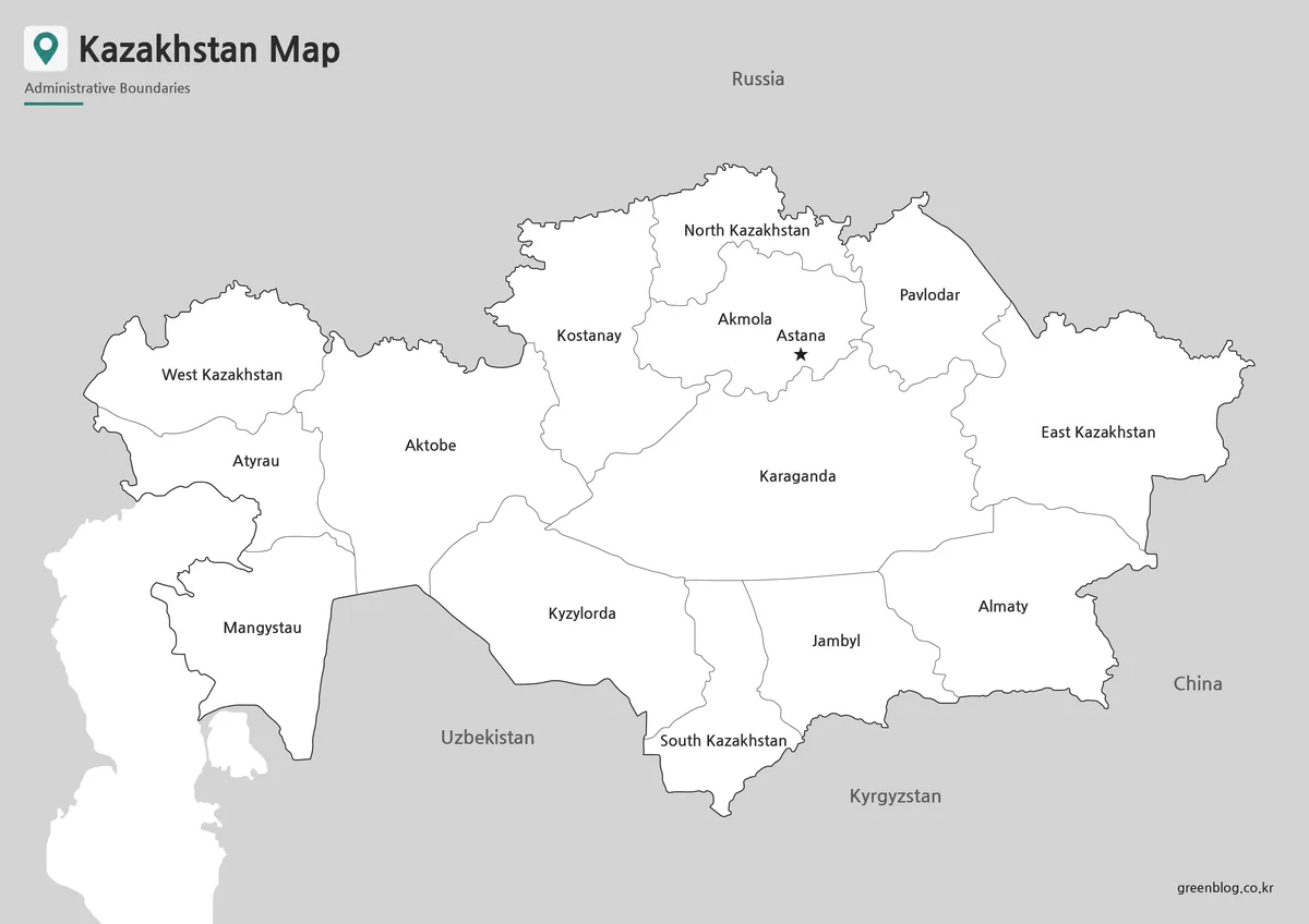
For printed documents, the black and white Kazakhstan Map provides a cleaner layout with less visual weight. Color maps can look attractive on screen, but they may use more ink or lose clarity depending on the printer. The simplified version keeps the focus on borders, labels, and overall shape, making it easier to use in worksheets, reports, or reference sheets.
This version is especially practical for A3 printing because Kazakhstan’s wide horizontal layout benefits from a clear line structure. Labels and boundary lines were arranged to remain readable when enlarged, while unnecessary color contrast was removed to make the map more suitable for document use.
Teachers can use the black and white map as a handout, students can mark important locations directly on it, and presentation creators can place it into slides where a clean, neutral map style is preferred.
Blank Outline Map for Editing
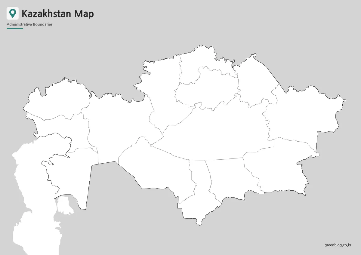
The outline version removes colors and text, leaving the main boundary structure as a flexible working base. This style is useful when you want to create your own Kazakhstan infographic, mark travel routes, add city points, highlight regional data, or build a classroom coloring activity.
Because Kazakhstan is large and bordered by several countries, the blank map is helpful for projects that compare regions or explain movement across Central Asia. Users can add labels for Astana, Almaty, border areas, lakes, transport routes, or custom study notes depending on the purpose of the project.
The outline map is also suitable for graphic editing work. Designers can add colors, icons, arrows, or data layers without first removing existing labels. It is a practical base map for educational worksheets, blog illustrations, presentation graphics, and regional comparison materials.
Built for Classroom, Blog, and Presentation Use
This map set was created with practical use in mind. A3-size preparation makes it easier to print or enlarge the files, while the three-version structure gives users more flexibility depending on the final project. A classroom worksheet may need a blank outline map, while a travel article may work better with the color version. A printed report may look cleaner with the black and white version.
The Kazakhstan Map collection can be used for:
- Printable reference materials
- Geography lessons about Central Asia
- Classroom handouts and study sheets
- Blog posts about Kazakhstan or regional travel
- Presentation slides about neighboring countries
- Infographic projects and visual comparisons
- Custom map labeling and annotation work
Frequently Asked Questions
What versions are included in this Kazakhstan Map collection?
The collection includes a color map, a black and white map, and a blank outline map.
Can I print the Kazakhstan Map in A3 size?
Yes. The map was prepared with A3-size use in mind, so it works well for enlarged printing and classroom reference.
Which version is best for editing?
The blank outline map is the best choice for editing. You can add labels, colors, routes, markers, or regional data.
Is the black and white version useful for school materials?
Yes. The black and white map is suitable for worksheets, reports, printed assignments, and handouts.
What can I add to the outline map?
You can add city names, travel routes, population data, regional colors, border notes, or infographic labels.
Kazakhstan Map Download
Download the printable Kazakhstan Map collection with color, black and white, and outline versions for education, presentations, blog graphics, and editing projects.
Included Versions: Color map, black and white map, outline map
Print Size: A3
Intended Use: Classroom materials, printable reference sheets, presentations, blog images, and graphic editing projects
Related Maps
- New Taipei City Map Download with District Boundarie
- Mactan Island Map Download – Printable Travel Map for Cebu Trips
- Bahrain Map Collection – Printable Color, Black and White, and Outline Maps
- Printable Kyrgyzstan Map Resource for Education, Travel, and Design
Additional Resources
- UN Geospatial – Kazakhstan Map : A United Nations map reference showing Kazakhstan’s national location and geographic layout for general map verification.
Green Map creates custom-edited map images using open geographic data sources such as geoBoundaries, Natural Earth, OpenStreetMap, and government open data.
These maps are edited visual materials, not raw data files, and are provided for education, documents, presentations, and graphic reference.