This Changhua County Map fits 26 administrative districts into a long north–south shape on Taiwan’s central-western coast. Shengang forms the upper tip, Ershui reaches the southeastern end, and broad coastal districts contrast with the tightly interlocking shapes around Yuanlin, Yongjing, Tianwei, and Beidou. The three supplied images preserve the same geometry while changing how much guidance the reader receives.
The labeled color view uses muted fills to separate adjoining districts. The black-and-white view keeps all district names and outside orientation labels while removing the pastel fills. The outline view removes every geographic label but retains the county silhouette, internal boundaries, neighboring land shapes, and western water space. Each image measures 1200 × 849 pixels and uses a landscape composition arranged around A3 use.
These sheets are administrative references rather than road or terrain maps. They contain no highways, railway lines, rivers, elevation shading, scale bar, north arrow, settlement symbols, or coordinates. Taichung City, Nantou County, Yunlin County, and the Taiwan Strait appear only to orient the labeled versions. Understanding those limits makes it easier to select the right sheet and avoids treating the outline as a navigation base.
Table of Contents
Changhua County Map Overview
Changhua County faces the Taiwan Strait to the west. On these images, Taichung City occupies the pale surrounding area to the north and northeast, Nantou County lies east of the projecting Fenyuan district, and Yunlin County follows the southern outside edge. The artwork does not display the whole island of Taiwan, but those three adjacent jurisdictions establish the county’s position clearly.
The county government lists 26 local administrative districts: two cities, six towns, and eighteen townships. Changhua and Yuanlin are the two cities. Hemei, Lukang, Erlin, Xihu, Beidou, and Tianzhong are the six towns. The remaining eighteen are Shengang, Xianxi, Xiushui, Fuxing, Puyan, Fangyuan, Huatan, Fenyuan, Dacun, Puxin, Yongjing, Shetou, Tianwei, Dacheng, Zhutang, Xizhou, Pitou, and Ershui.
On the Changhua County Map, the two city names are printed in the same basic style as the other district names. Changhua City is a district within Changhua County, not a second name for the entire county. Yuanlin is likewise one city-level division inside the larger county. No star, dot, built-up footprint, or county-seat symbol distinguishes either city, so readers must rely on boundaries and labels.
The outer form is asymmetrical. Coastal and southwestern districts tend to occupy larger shapes, while the middle and eastern corridor contains more compact units. Fenyuan projects toward Nantou; Ershui extends at the lower-right corner; Lukang and Xianxi have angular coastal edges. These irregularities are more useful for orientation than the rectangular canvas around the map.
Included Map Versions
All three views share the same 1200 × 849 landscape frame and district network. This consistency allows a teacher or designer to switch versions without changing orientation. The differences are straightforward:
- Color view with 26 named districts and outside orientation labels
- Black-and-white view retaining the same names and surrounding context
- Outline view retaining administrative geometry but removing all place names
The color image is best for first recognition, the monochrome sheet for a neutral labeled reference, and the outline for recall or a custom thematic layer. The files are image-based resources rather than selectable vector polygons. Adding statistics or symbols does not make the underlying artwork an authoritative geographic information system, so any new data should be sourced and dated separately.
Color Map for Regional Comparison
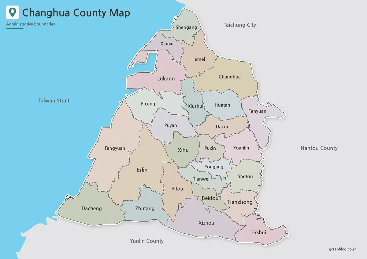
Pastel fills help the eye follow district borders through the dense center. Puxin, Yuanlin, Yongjing, Tianwei, and Beidou meet within a relatively small area, while Xiushui, Huatan, Dacun, Puyan, and Xihu form another close group farther north and west. Alternating colors reduce the chance of tracing a line into the wrong neighboring shape.
The Changhua County Map also uses color to separate context from subject. Blue marks the Taiwan Strait, pale gray identifies surrounding land outside the county, and a thin white edge lifts the county silhouette from that background. Inside the county, however, the colors are decorative categories only. They do not represent population, land cover, elevation, politics, transport zones, or any official regional classification.
Several broad districts offer generous label space. Fangyuan and Erlin dominate much of the southwest, Dacheng spans the lower coast, and Changhua occupies a large northeastern area. By contrast, names such as Xiushui, Puxin, Tianwei, and Beidou sit inside smaller polygons. Keeping the original aspect ratio matters because horizontal or vertical stretching would distort these comparisons.
Use this view as an opening reference or an answer key. A lesson can begin by locating Changhua, Yuanlin, Lukang, Xihu, Erlin, and Tianzhong, then place surrounding districts through adjacency. A presentation can use the colors to guide attention, but any highlighted theme should receive its own legend so viewers do not mistake the existing palette for data.
Black and White Printable Map
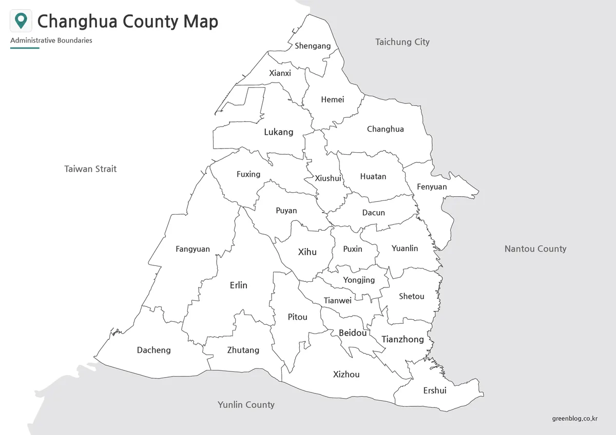
The monochrome Changhua County Map removes district fills but preserves every administrative name, the Taiwan Strait label, and the three neighboring-jurisdiction labels. White county polygons sit against a light-gray exterior. With hue removed, the viewer follows the county outline first, then the internal lines, and finally the type. This hierarchy suits reports and study notes where a restrained appearance is useful.
Black and white does not mean blank. Students can still read every district answer directly from the page, so this version works better for identification, review, or guided coloring than for an unprompted quiz. It can be paired with the outline: learners complete the blank sheet, then use the labeled monochrome image to check spelling and placement.
Test one copy before printing a large set. Automatic page fitting, toner density, and paper quality can affect the smallest labels around the central cluster. If the image is reduced far below its intended landscape layout, the silhouette may remain recognizable while thin borders and short district names become difficult to separate.
Outline Map for Editing and Worksheets
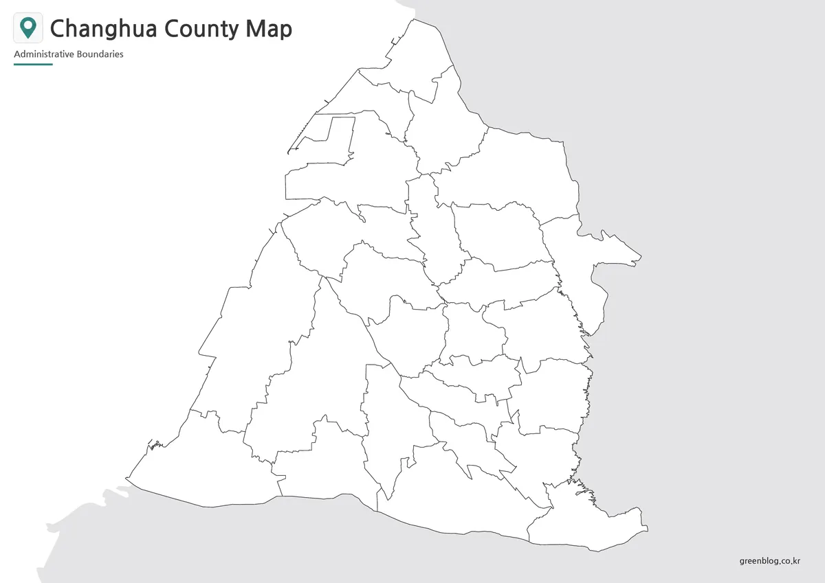
The outline image keeps all 26 district shapes but removes their names and every outside geographic label. It also retains pale neighboring land along the north, east, and south, plus empty water space to the west. The built-in title and “Administrative Boundaries” subtitle remain, so the sheet is unlabeled geographically rather than completely empty.
A blank Changhua County Map can support several controlled tasks. Learners can label the two cities, distinguish urban and rural townships, identify coastal districts, or reconstruct all 26 names. Designers can group selected areas with a limited palette or add verified point symbols. Use the labeled color sheet as an answer reference rather than guessing from shape alone.
For digital editing, duplicate the source before adding marks. Place labels away from narrow boundary junctions, use a separate legend for new colors, and export at a size that keeps the central lines clear. The outline supplies no roads or coordinates, so route drawing and exact point placement require a different verified base.
Useful Places to Notice on the Map
One way to read the Changhua County Map follows the outer edge. Begin at Shengang, then move down the northwestern side through Xianxi and Lukang. Fuxing, Fangyuan, and Dacheng continue along the western half. The southern rim then passes Zhutang and Xizhou before reaching Ershui at the southeastern end. This perimeter provides a frame for the more complicated interior.
On the east, Changhua lies beside Taichung, and Fenyuan projects toward Nantou. Yuanlin, Shetou, and Tianzhong create a readable east-central sequence before Ershui. Inside that outer route, Xiushui, Huatan, Puyan, Dacun, Xihu, Puxin, Yongjing, Tianwei, Pitou, and Beidou occupy interlocking positions that require closer boundary tracing.
Coastal appearance needs careful interpretation. The blue field clearly identifies the Taiwan Strait, but the images do not mark ports, tidal flats, rivers, seawalls, or precise shoreline measurements. Small notches and projections help recognize district shapes; they are not a substitute for a nautical chart, cadastral survey, or current coastal engineering plan.
Built for Printing, Presentations, and Graphic Use
The Changhua County Map collection is arranged around an A3 landscape page, but printable quality still depends on output settings. Preserve the 1200 × 849 aspect ratio, select landscape orientation, and use proportional “fit to page” scaling. Do not stretch width and height independently. A test print should confirm that Puxin, Yongjing, Tianwei, and Beidou remain readable.
For slides, the color image communicates the whole pattern fastest. The monochrome sheet fits a neutral report, and the outline works when custom information must take visual priority. Crop only genuinely empty margins; removing too much gray context may also remove Taichung, Nantou, or Yunlin labels that explain orientation.
Before publishing an adapted graphic, state the administrative level, explain every added symbol, and cite the data source and date. If the task concerns legal boundaries, parcels, emergency response, routing, or detailed planning, consult an authoritative current system. These educational images are designed for district-level reading and annotation, not operational decisions.
Frequently Asked Questions
What is included in this Changhua County map collection?
The collection includes a color map, a black and white map, and an outline map of Changhua County.
Can I print the Changhua County map in A3 size?
Yes. The map files are prepared for A3 layout use, making them suitable for classroom handouts, reports, and presentation materials.
Which version should I use for a presentation?
The color map is usually best for presentation slides because it makes the administrative areas easier to compare visually.
Is the outline map good for editing?
Yes. The outline version works well for adding labels, coloring specific areas, marking travel routes, or creating infographic-style graphics.
Can the black and white map be used for school worksheets?
Yes. The black and white version is designed for clean printing and is suitable for worksheets, study materials, and document inserts.
Map File Information
The download contains three image-based maps using the same 26-district administrative framework.
- Included Versions: Color labeled, black-and-white labeled, and outline
Additional Resources
- Changhua County Government: Townships and Cities — Check the official English list of the county’s two cities, six towns, and eighteen townships.
Related Maps
Green Map creates custom-edited map images using open geographic data sources such as geoBoundaries, Natural Earth, OpenStreetMap, and government open data. These maps are edited visual materials, not raw data files, and are provided for education, documents, presentations, and graphic reference.