A Wyoming map download can be useful in more situations than it first seems. Wyoming may not be the most visually crowded state on a full United States map, but it becomes much more important when preparing materials about the American West, national parks, wide rural landscapes, or regional state comparisons. The state is located in the western interior of the United States and connects with Montana, Idaho, South Dakota, Nebraska, Colorado, and Utah. Because of that position, it often appears in travel routes, classroom geography lessons, outdoor recreation guides, and presentation slides about the Rocky Mountain region.
This printable Wyoming map collection includes three versions: a color map, a black and white map, and a blank outline map. The files are prepared as high-resolution image resources for A3 layout use, making them suitable for classroom handouts, blog graphics, presentation materials, infographic projects, and basic editing work. Users can choose the version that best matches their purpose instead of using one fixed map style for every project.
Wyoming is also a state where a map explains the region better than a short text description. Its outer shape is close to a rectangle, which can make the state look simple at first glance. In reality, its wide land area contains national parks, mountain regions, ranching areas, mineral resource zones, and small population centers spread across a large space. Yellowstone National Park and Grand Teton National Park are especially important for travel-related materials, and a labeled visual reference makes it easier to explain where those destinations sit in relation to nearby states.
While preparing this map set, attention was given to print readability and label clarity. Wide states can look empty if the layout is too plain, but they can also become difficult to read if labels and boundary lines are too heavy. The map versions were organized so that users can print them, place them in slides, or use them as a clean base for visual editing.
Table of Contents
Wyoming Map Download Overview
This Wyoming map download includes three practical map styles for different types of work. The color version is designed for quick visual reading, the black and white version works well in printed documents, and the outline version gives teachers, designers, and content creators a flexible base map for adding their own information.
Because Wyoming covers a large inland area with relatively low population density, the map is especially helpful for comparing distance, direction, and surrounding state relationships. It can be used to explain western U.S. geography, national park locations, travel planning, or regional differences between neighboring states.
Included Wyoming Map Files
The collection is organized around three common use cases: visual explanation, clean printing, and editable reference work. Instead of relying on a single map style, users can select a version based on whether they need color separation, simple document readability, or a blank working layout.
Included versions:
- Color Wyoming map
- Black and white Wyoming map
- Blank outline Wyoming map
The files are intended for educational use, presentation design, document printing, blog images, printable study materials, and infographic editing.
Color Wyoming Map for Regional Reference
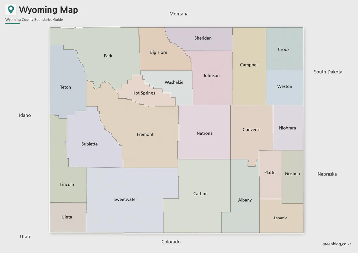
The color version is the easiest map to use when a reader needs to understand Wyoming’s position quickly. Since the state is bordered by several other western and central states, color separation helps viewers compare Wyoming with Montana to the north, Idaho and Utah to the west, South Dakota and Nebraska to the east, and Colorado to the south.
This version is especially useful for presentation slides or travel-related content. For example, when explaining a Yellowstone or Grand Teton travel route, a color map gives the audience a clearer sense of where Wyoming sits within the broader western United States. It also works well for blog graphics because the regional boundaries are easier to distinguish at a glance.
Black and White Wyoming Map for Printing
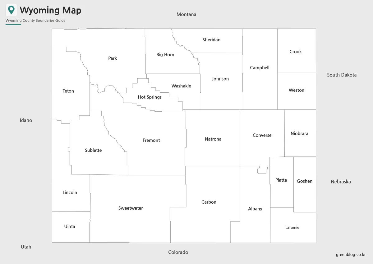
For printed materials, the black and white version provides a cleaner layout. It removes color blocks and keeps the focus on boundaries, labels, and overall state structure. This is useful for classroom handouts, worksheets, reports, or documents where users may want to write notes directly on the page.
Wyoming’s wide open layout makes line weight important. If the boundary lines are too thin, they may disappear in printed form. If they are too heavy, the map can feel crowded even though the state itself has a relatively simple shape. The black and white version was prepared with this kind of print use in mind, so it can fit educational materials and presentation reference sheets without relying on color.
Blank Wyoming Outline Map for Editing
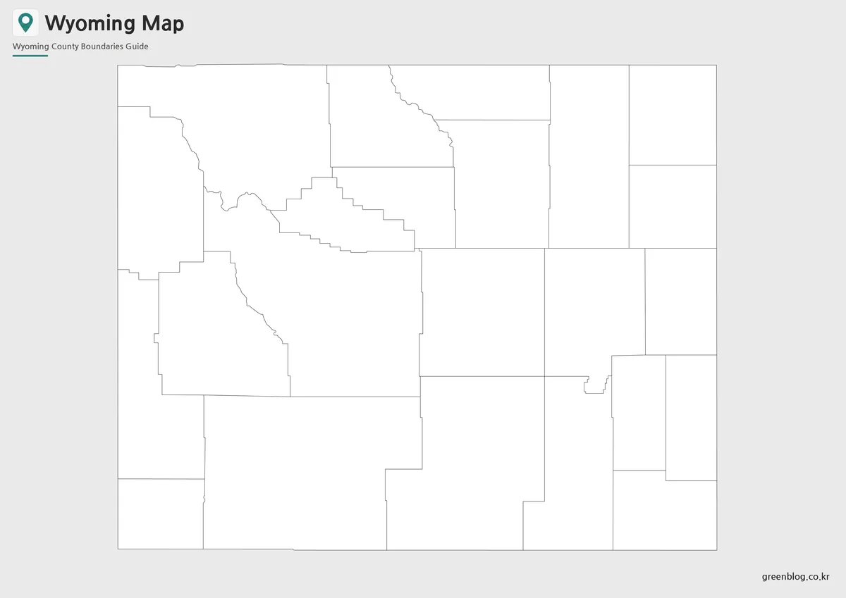
The outline version works as a flexible base map. It leaves room for users to add their own information, such as travel routes, city markers, national park labels, classroom coloring activities, resource distribution notes, or regional comparison data.
Designers can use the blank layout for infographic projects, while teachers can use it for geography worksheets or student activities. Travel content creators may also find it useful when marking routes between Yellowstone, Grand Teton, Cheyenne, Casper, and neighboring states. Because the outline version does not include heavy visual styling, it is easier to customize for different project types.
Why Wyoming Is Easier to Understand with a Map
Wyoming’s simple outer shape can be misleading. On a full U.S. map, it may appear as a quiet rectangular state, but a more focused map makes its geography easier to understand. The state covers about 253,348 square kilometers, while its population is only around 580,000. This creates a very different visual pattern from densely populated states where cities and administrative areas are packed closely together.
For geography lessons, the map helps show how large western states are organized across broad rural and mountain areas. For travel planning, it helps explain the relationship between national parks, major cities, and surrounding states. For presentations, it provides a quick visual reference when discussing the Rocky Mountain region, western tourism, or the contrast between land area and population density.
Practical Uses for the Wyoming Map Collection
This Wyoming map set can be used in many different projects. Teachers may use the printable versions for classroom geography activities, while students can include them in reports or state research assignments. Bloggers and presentation creators can use the color map for visual explanations of the American West.
The outline map is helpful when users need to add custom information. Possible uses include travel route marking, national park location notes, regional comparison graphics, tourism presentations, educational worksheets, and infographic layouts. The black and white map is better suited for printed packets, reference sheets, and documents where clean readability is more important than color.
Basic Wyoming Information for Map Users
Wyoming is located in the western interior of the United States. Its capital is Cheyenne, and Casper is one of the state’s major cities. The state is known for its large land area, low population density, mountain scenery, ranching regions, mineral resources, and major natural attractions.
Key reference points:
- Map value: Wide land area, low density, and important national park locations
- Location: Western United States
- Capital: Cheyenne
- Major city: Casper
- Area: About 253,348 square kilometers
- Population: About 580,000
- Major industries: Mining, agriculture, tourism, services
- Notable places: Yellowstone National Park, Grand Teton National Park, Devils Tower
Frequently Asked Questions
What is included in this Wyoming map download?
The download includes color, black and white, and outline versions of the Wyoming map. Each version is designed for a different use, such as visual reference, printing, or editing.
Can I use the map for classroom materials?
Yes. The printable Wyoming map versions work well for classroom handouts, geography worksheets, student reports, and presentation slides.
Which version is best for travel presentations?
The color map is usually the easiest option for travel presentations because it makes Wyoming and nearby states easier to compare visually.
Is the outline map useful for editing?
Yes. The blank outline version can be used to add travel routes, city markers, national park notes, infographic labels, or classroom activity details.
Is this Wyoming map download suitable for A3 printing?
Yes. The map files are prepared for an A3 layout, making them suitable for larger printed reference materials and presentation graphics.
Map File Information
This download includes printable Wyoming map versions for educational use, presentation design, document printing, and editable graphic projects.
- Included Versions: Color map, black and white map, outline map
- Printable Size: A3 layout
- File Type: JPG / PNG / ZIP
- Intended Use: Classroom handouts, presentations, blog graphics, infographic editing, and printable reference materials
Additional Resources
- Wyoming GIS Maps – State of Wyoming : A useful official GIS resource for users who want to explore public map data, spatial information, and government map services related to Wyoming.
Related Maps
- Oregon Map Collection for Printing, Editing, and Classroom Use
- Oklahoma Map Download with County Boundaries for Printing
- Printable New Mexico Map – Color, Black and White, and Outline Versions
- Printable Nebraska Map Collection with County Outline Version
Green Map creates custom-edited map images using open geographic data sources such as geoBoundaries, Natural Earth, OpenStreetMap, and government open data.
These maps are edited visual materials, not raw data files, and are provided for education, documents, presentations, and graphic reference.