Idaho County Map resources are often used when comparing western U.S. states, preparing geography lessons, organizing travel routes, or creating regional reference materials. Idaho is frequently associated with neighboring states such as Washington and Oregon, but a closer look at the map reveals connections to Montana, Wyoming, Utah, Nevada, and Canada. Because of its distinctive north-to-south shape, understanding Idaho’s regional layout is much easier with a county-level map than with a simple state outline.
This printable Idaho County Map collection includes three versions designed for different purposes: a color county map, a black and white labeled map, and a blank outline map for editing. All files were prepared as high-resolution JPG resources suitable for A3 printing. The collection was created for classroom reference, presentation slides, infographic projects, educational worksheets, and graphic editing work.
Located in the northwestern United States, Idaho covers more than 216,000 square kilometers and has a population of roughly 1.7 million people. The state is known for its mountains, forests, rivers, agricultural regions, and large open landscapes. Major population centers are concentrated around Boise and the Treasure Valley, while many other areas remain sparsely populated. Because counties are distributed across a long geographic corridor, a detailed Idaho County Map can provide a much clearer visual reference when studying regional relationships.
While preparing the map collection, extra attention was given to Idaho’s unusual vertical shape. A standard horizontal layout often makes the state appear smaller than it actually is, so the design was adjusted to improve visibility and readability. County labels, boundary lines, and overall map proportions were reviewed during print testing to ensure that important details remain visible when enlarged.
Table of Contents
Idaho County Map Overview
Included in the collection:
- Color county map
- Black and white labeled map
- Blank outline map
- High-resolution JPG format
- A3 printable layout
Suitable for:
- Infographic design
- Geography education
- Travel planning
- Classroom worksheets
- Presentation graphics
- Regional comparison projects
Color-Coded County Map
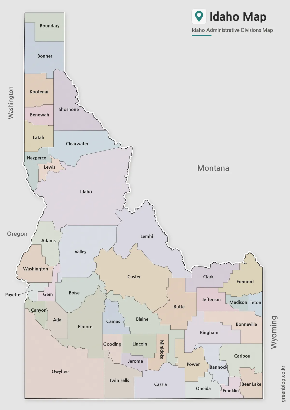
The color version highlights county boundaries using contrasting colors to make regional divisions easier to understand. Idaho’s counties are spread across a large north-south area, and color separation helps users identify neighboring counties more quickly.
Designed for presentations, travel content, and educational projects, this version works particularly well when explaining regional differences or comparing Idaho with surrounding western states. During the design process, county colors were adjusted to improve contrast and maintain readability after printing.
Black and White Idaho County Map
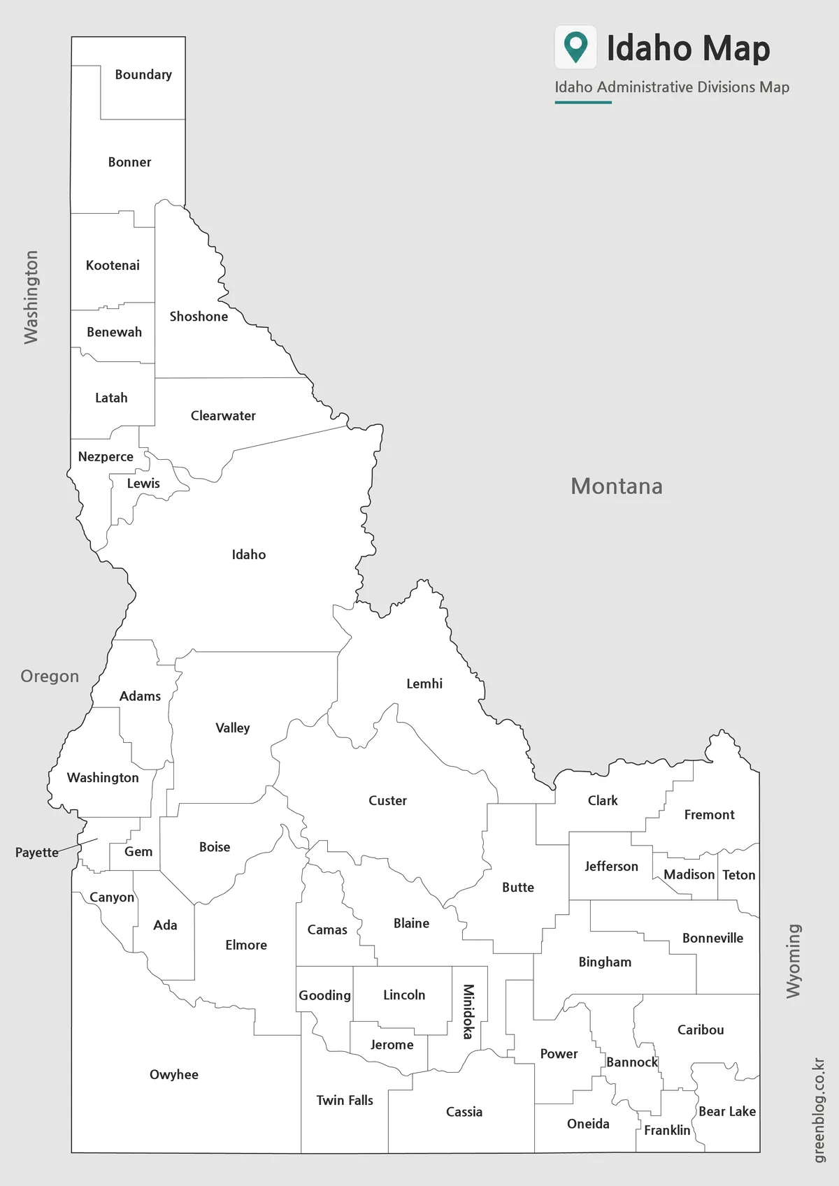
The labeled black and white version focuses on county names and administrative boundaries rather than color. This creates a cleaner appearance for printed reports, classroom handouts, and research materials.
County labels were reviewed at multiple print sizes to ensure readability. The simplified layout also makes it easier to add routes, notes, statistics, or custom highlights without overwhelming the page.
Blank Outline Map for Editing
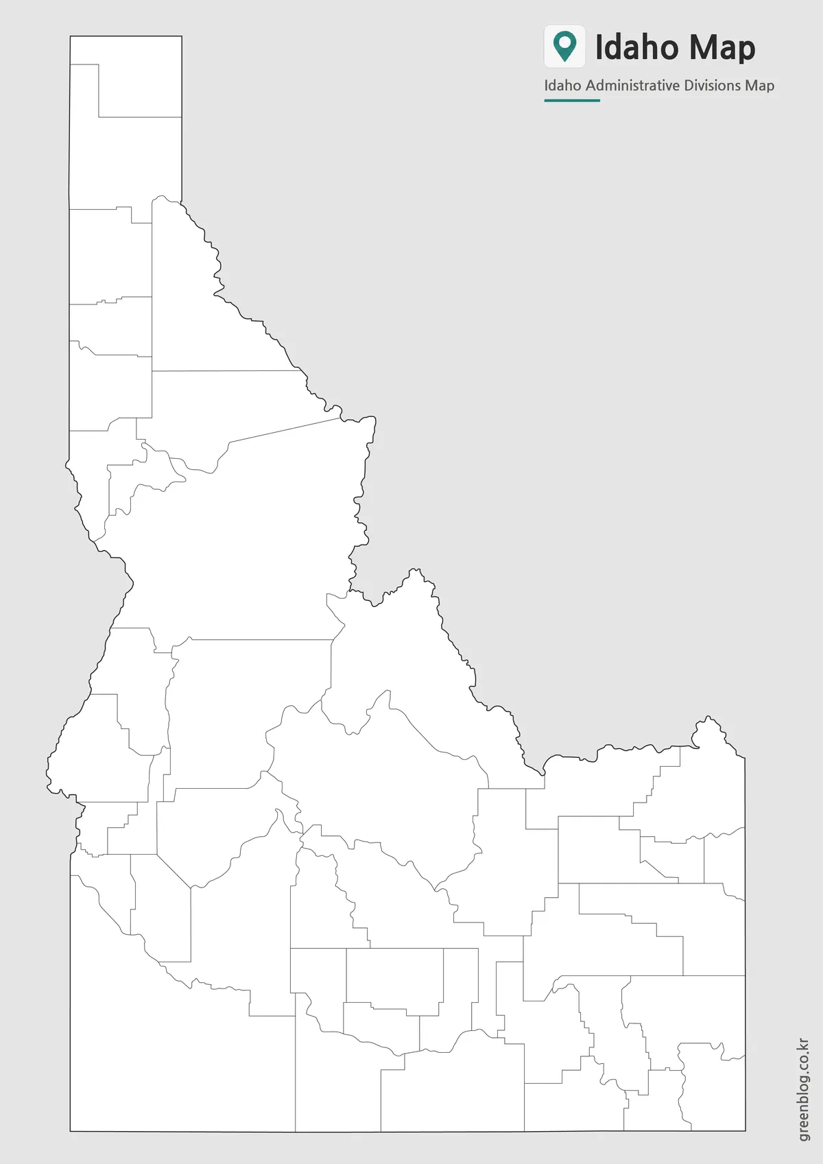
The outline version removes county labels and color while preserving county boundary lines. This format is useful for infographic creation, educational exercises, tourism projects, and custom graphic design work.
Many users prefer an editable outline map when highlighting specific counties, adding data visualization layers, or creating regional comparison materials. The clean structure provides maximum flexibility for customization.
Common Uses for an Idaho County Map
A detailed Idaho County Map is frequently used for:
- Classroom geography lessons
- Travel route planning
- National park reference materials
- Agricultural region visualization
- Presentation slides
- County-based statistics projects
- Blog graphics and educational content
Because Idaho stretches across a long geographic area, county-level detail often provides more useful context than a standard state map.
Frequently Asked Questions
What does the Idaho County Map include?
The Idaho County Map collection includes color, labeled, and outline versions showing county boundaries across the state.
Can I print the maps in A3 size?
Yes. The files were prepared as high-resolution resources and reviewed for large-format printing.
Is the outline version editable?
Yes. The outline version is designed for annotations, custom coloring, infographic work, and educational activities.
Why was the map designed in a vertical layout?
Idaho has a long north-to-south shape, and a vertical layout provides a more accurate and readable representation of the state.
Additional Resources
- Idaho Transportation Department Maps – Official state maps, transportation maps, and geographic reference materials.
- Idaho Geospatial Office (IGO) – Official Idaho geographic information and county boundary resources.
Related Maps
- New York County Map Collection (Printable Color, Labeled & Outline Maps)
- Free Florida Map Download – High Resolution Printable Maps
- Free Printable Texas Map Set for Education, Presentations and Editing
- 5 United States Maps for Download (Color, Black & White, Outline)
Green Map creates custom-edited map images using open geographic data sources such as geoBoundaries, Natural Earth, OpenStreetMap, and government open data.
These maps are edited visual materials, not raw data files, and are provided for education, documents, presentations, and graphic reference.