A Korean version of this map page is available. View Korean Page
A Nevada Map is often more useful than many people expect. Although the state is widely recognized because of Las Vegas, understanding Nevada’s overall layout becomes much more important when planning travel routes, comparing western U.S. states, preparing classroom materials, or creating regional graphics. A well-designed administrative map makes it much easier to see how Nevada connects with California, Oregon, Idaho, Utah, and Arizona while also showing the county structure that is often missing from general road maps.
This printable Nevada Map collection includes three versions: a full-color county map, a black and white labeled map, and a blank outline map. Each file was created in high resolution for A3 printing, making the collection suitable for presentation slides, geography lessons, printable worksheets, infographic projects, blog graphics, and editing work. Rather than focusing on highways or tourist attractions, the maps emphasize county boundaries and the overall shape of the state so users can quickly understand Nevada’s regional organization.
Located in the western United States, Nevada covers approximately 286,367 square kilometers while having a population of just over three million people. Much of the state consists of deserts, mountain ranges, and wide open landscapes, with most residents living around the Las Vegas and Reno metropolitan areas. Because population centers are widely separated, maps showing county boundaries and neighboring states provide a clearer understanding of the region than city-only maps.
While preparing this collection, special attention was given to Nevada’s long north-to-south shape. A portrait-oriented layout made the state easier to read and reduced unnecessary empty space when printed on A3 paper. Labels were adjusted for readability at larger sizes, and county boundaries were reviewed to ensure they remain clear when the map is enlarged for classroom displays or presentation screens. The result is a practical reference that works equally well for educators, bloggers, designers, students, and anyone needing a clean administrative map of Nevada.
Table of Contents
Map Collection Overview
Each version of the Nevada Map serves a different purpose, allowing users to choose the format that best fits their project instead of relying on a single design.
The color map is intended for presentations and visual comparison, where county boundaries need to stand out immediately. The black and white version is better suited for printing, note-taking, and classroom worksheets. The outline map removes labels and colors completely, providing a clean foundation for graphic editing, custom annotations, statistical visualization, or infographic design.
Because every version shares the same administrative layout, switching between map styles is simple while maintaining visual consistency across reports, educational materials, and presentations.
Color Nevada Map for Regional Comparison
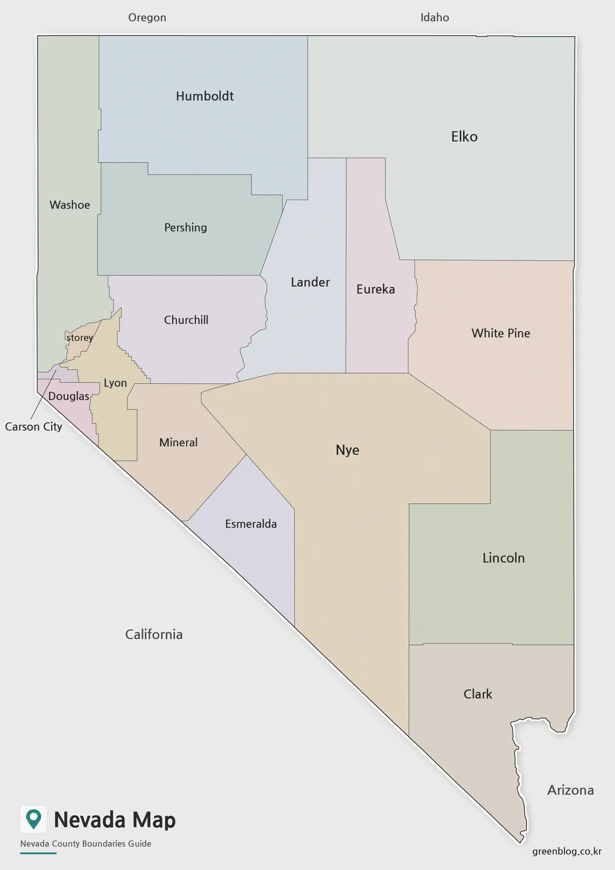
Among the three versions, the color Nevada Map is the easiest to interpret at a glance. Counties are distinguished using carefully balanced colors that improve visual separation without making the map appear overly busy. This layout works especially well for regional comparisons, geography lessons, travel presentations, and blog articles explaining Nevada’s relationship with neighboring western states.
During the design process, neighboring counties were reviewed to avoid similar colors touching each other whenever possible. This small adjustment significantly improves readability, especially when the map is displayed on presentation slides or viewed from a distance in classrooms.
County names remain clearly visible while preserving a clean overall appearance. The map can also be used as a base image for tourism guides, regional planning materials, educational handouts, or infographic illustrations where readers need to recognize county boundaries quickly.
Compared with monochrome versions, the color map makes it much easier to distinguish different regions immediately, which is why it is often the preferred option for digital content and presentation graphics.
Black and White Nevada Map for Printing
The black and white Nevada Map was designed for users who prefer a cleaner layout for printing or annotation. Instead of using color to separate counties, this version relies on clearly defined boundary lines and readable labels, making it a practical choice for reports, classroom activities, and study materials.
During the preparation process, the line thickness was reviewed to ensure that county boundaries remain visible even on standard black and white printers. Labels were also checked at larger print sizes so that names remain easy to read without requiring additional editing.
Because the design is intentionally simple, this version also fits well into research papers, planning documents, and presentation handouts where colorful graphics might distract from the surrounding content. It provides enough detail to understand Nevada’s county structure while leaving plenty of room for handwritten notes or highlighted regions.
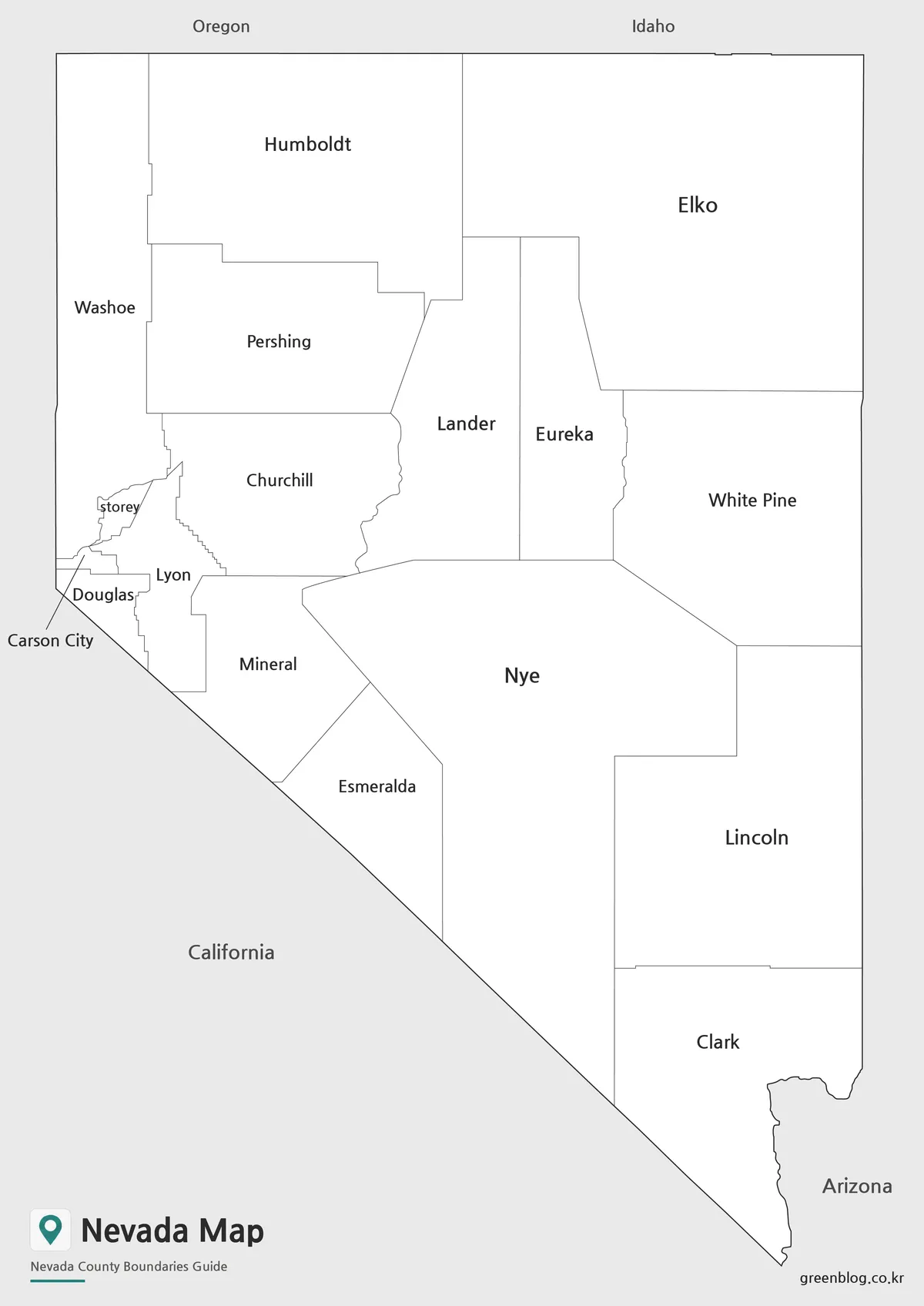
Blank Nevada Outline Map for Editing
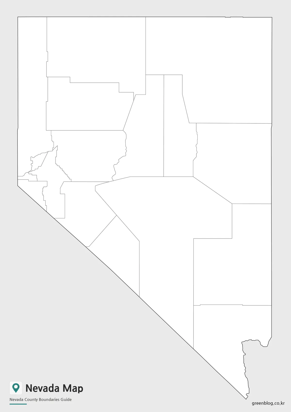
The outline Nevada Map is the most flexible version in the collection. By removing colors and labels, it provides a clean county boundary layout that can easily be customized for different projects.
This format works well for infographic design, educational worksheets, travel route planning, election maps, statistical visualization, and regional comparison graphics. Designers can apply their own color schemes, add symbols, or highlight selected counties without first removing existing map elements.
One advantage of preparing the outline version from the beginning is that editing becomes much faster. Instead of deleting labels or color fills from another map, users can immediately start building their own project using a clean administrative framework.
Common Uses for a Nevada Map
Because Nevada combines vast desert landscapes with major tourism and mining regions, county maps are frequently used in educational and professional settings.
Some common applications include:
- Travel planning around Las Vegas, Reno, and northern Nevada
- Classroom geography lessons and printable worksheets
- Presentation slides explaining the western United States
- County comparison projects
- Mining and natural resource illustrations
- Regional demographic graphics
- Blog articles covering Nevada travel or geography
- Infographic and editorial design projects
The availability of three different map styles allows the same base map to support many different types of visual content.
Frequently Asked Questions
Can I print this Nevada Map in A3 size?
Yes. The collection was prepared in high resolution and reviewed for large-format printing, including A3 paper.
Which Nevada Map version is best for presentations?
The color version is usually the best option because county boundaries are easier to distinguish during presentations.
Is the outline Nevada Map editable?
Yes. The outline version removes colors and labels, making it suitable for graphic editing, annotations, and infographic projects.
Why doesn’t the map include highways or tourist attractions?
The collection focuses on county boundaries and administrative organization rather than road navigation. This keeps the layout clean and makes it easier to adapt for educational and presentation purposes.
Nevada Map Download
Choose the version that best matches your project. The collection includes printable and editable map files prepared for classroom materials, presentations, reports, and graphic design.
- File Format: JPG / PNG / ZIP
- Print Size: High-resolution A3
- Included Versions: Color Map, Black and White Map, Outline Map
- Recommended Use: Printing, presentations, education, editing and infographic projects
Additional Resources
- Nevada Department of Transportation (NDOT) State Maps – Official state highway and transportation maps published by the Nevada Department of Transportation.
Related Maps
- Arkansas Map Collection: Printable County Maps in Color, Labeled, and Outline Formats
- Arizona State Map Download Collection (Color, Labeled & Outline Maps)
- Virginia Map Collection | Printable County and Independent City Maps
- Maine Map Collection | Printable County Maps in High Resolution
Green Map creates custom-edited map images using open geographic data sources such as geoBoundaries, Natural Earth, OpenStreetMap, and government open data.
These maps are edited visual materials, not raw data files, and are provided for education, documents, presentations, and graphic reference.