A Utah Map is useful for much more than simply locating the state in the western United States. Teachers often need regional maps for geography lessons, travel planners use them to understand route options, and presentation creators rely on maps when explaining landscapes, population centers, and state boundaries. Utah covers a large geographic area with dramatically different environments, ranging from mountain ranges and high plateaus to desert valleys and canyon systems. Because these regions are spread across a wide area, visual references are often easier to understand than written descriptions alone.
Located in the interior West, Utah borders Idaho and Wyoming to the north, Colorado to the east, Arizona to the south, and Nevada to the west. Salt Lake City forms the state’s primary metropolitan area, while much of southern Utah consists of open desert landscapes, national parks, and remote recreation regions. One thing that became clear while organizing this map collection was how widely separated many of Utah’s major destinations are. A map helps connect those locations visually, whether the goal is planning a trip, preparing a classroom presentation, or comparing western states.
This printable Utah Map collection includes three versions: a color map, a black and white labeled map, and a blank outline map. Files were prepared in high-resolution A3 format and reviewed for printing, digital presentations, classroom reference, infographic design, and editing projects. Boundary visibility and label placement were checked at larger print sizes to help maintain readability when enlarged.
Table of Contents
Quick Overview of Included Maps
This collection includes:
- Color Utah map
- Black and white labeled map
- Blank outline map
- High-resolution A3 format
- JPG image files
- Printable and editable versions
Each version serves a different purpose. Some users need a visually clear map for presentations, while others prefer a simplified layout for worksheets, reports, or graphic design projects.
Regional Color Map
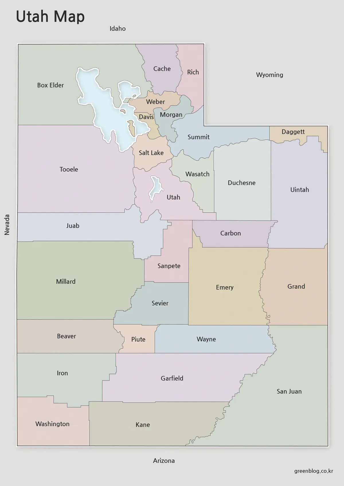
The color Utah Map was designed for users who want to understand regional relationships quickly. Different areas are separated using balanced colors that improve visibility without overwhelming labels or boundaries.
Utah’s long north-to-south layout makes visual comparison particularly important. During preparation, color choices were adjusted to help neighboring regions remain distinguishable on both screens and printed pages. Large-print checks were reviewed to ensure labels remained readable at A3 size.
This version works especially well for:
- Classroom presentations
- Blog graphics
- Educational materials
- Travel planning discussions
- Regional comparison projects
Clean Black and White Version
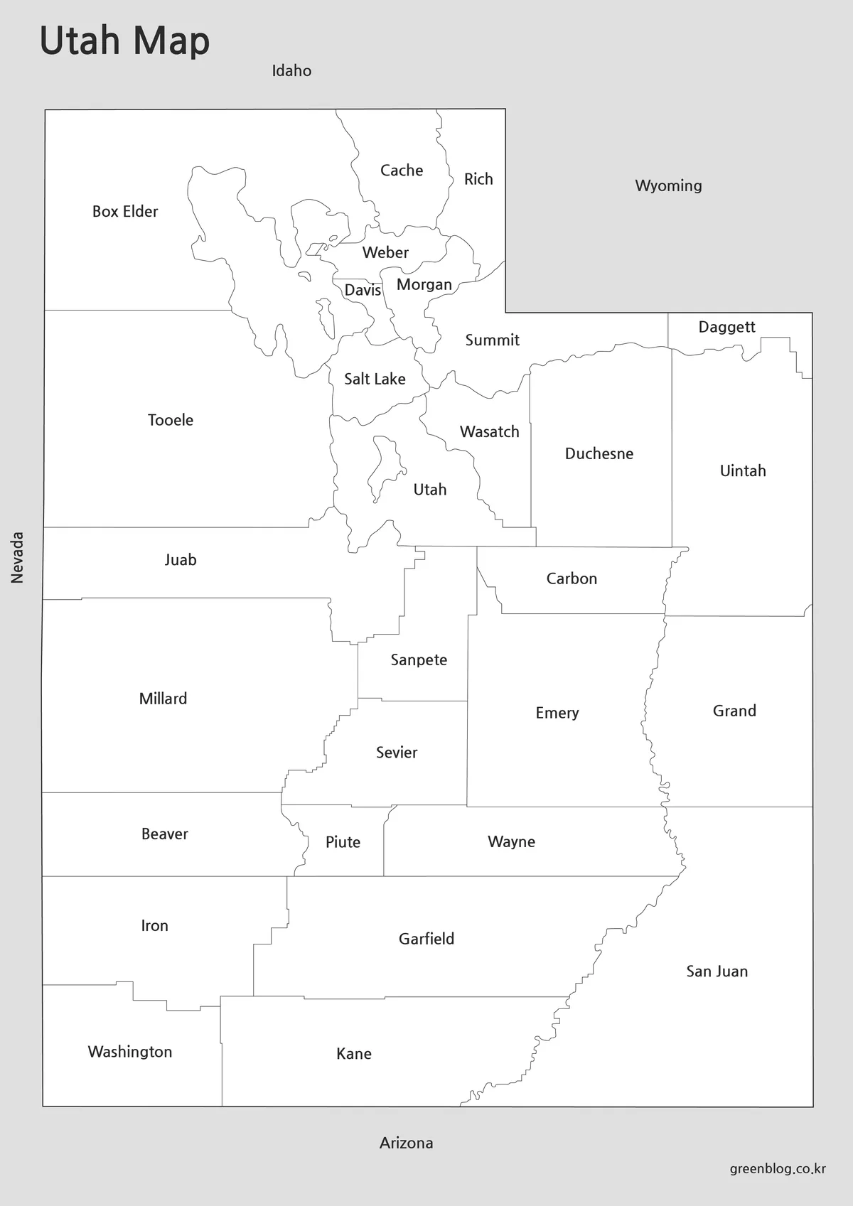
Not every project requires color. For reports, worksheets, and printed reference materials, a cleaner appearance is often easier to work with.
The black and white Utah Map focuses on readability. Labels and boundary lines remain visible without depending on color differences. During preparation, line thickness and text placement were reviewed to improve performance in grayscale printing environments.
This version is often chosen for:
- Geography assignments
- Educational handouts
- Research documents
- Regional studies
- Printed travel notes
Blank Outline Map for Editing Projects
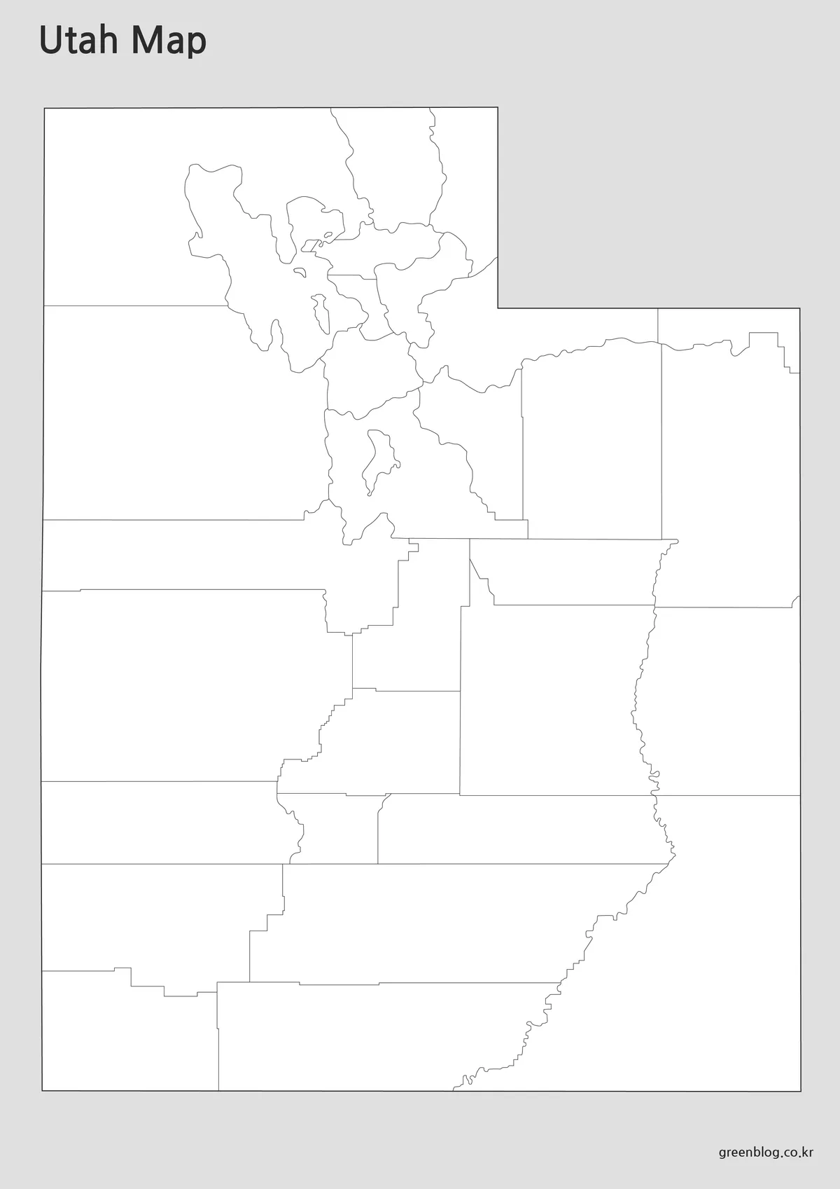
The outline Utah Map removes labels and color while preserving boundary lines. This creates a flexible base layer for users who need to customize the map with their own information.
Graphic designers, teachers, researchers, and content creators often prefer blank maps because they provide complete control over visual elements. Users can add routes, icons, labels, statistics, or highlighted regions without first removing existing content.
Boundary lines were reviewed at larger zoom levels to help maintain clarity when used in posters, presentations, or infographic projects.
Common uses include:
- Infographic design
- Educational worksheets
- Data visualization
- Travel route planning
- Custom presentation graphics
Built for Printing and Presentation Use
A Utah Map may be used in a variety of practical situations:
- Classroom geography lessons
- Educational worksheets
- State comparison projects
- Travel presentations
- Blog graphics
- Regional planning materials
- Printable study resources
- Video production reference images
- Infographic projects
Because Utah contains large areas of public land, national parks, and geographically distinct regions, maps often become one of the easiest ways to explain how different parts of the state connect together.
Frequently Asked Questions
Can I print the Utah Map in A3 size?
Yes. The files were prepared and reviewed for high-resolution A3 printing.
Which Utah Map version is best for editing?
The outline version is the best choice for custom editing, annotations, coloring, and infographic work.
Does the collection include printable versions?
Yes. Every version was reviewed with both digital viewing and printed output in mind.
Is the Utah Map useful for travel planning?
Yes. The Utah Map provides a clear view of major regions, neighboring states, and geographic relationships that can help with route planning.
Utah Map Download
Utah map files are available below. Choose between the color map, black and white map, and outline map versions depending on your project needs.
- File Format: JPG / PNG / ZIP
- Purpose: Printing · Education · Presentations · Editing
- Size: A3 High-Resolution
Printable and editable versions are included in the archive.
Additional Resources
- Utah Automated Geographic Reference Center (AGRC) — Official Utah mapping and geographic information resource.
Related Maps
- Printable Indiana State Map Collection | County, Labeled & Outline Maps
- Printable Wisconsin Map Collection | County, Labeled & Outline Maps
- North Carolina State Map Collection (Printable County, Labeled & Outline Maps)
- Georgia State Map Download | Printable County Maps in 3 Styles
Green Map creates custom-edited map images using open geographic data sources such as geoBoundaries, Natural Earth, OpenStreetMap, and government open data.
These maps are edited visual materials, not raw data files, and are provided for education, documents, presentations, and graphic reference.