A Korean version of this map page is available. View Korean Page
A Printable Oregon Map is useful when you need to explain the layout of the Pacific Northwest, compare Oregon with nearby states, or prepare a clear visual reference for classroom and presentation work. Oregon is located on the U.S. West Coast, between Washington to the north and California to the south. Idaho borders the state to the east, while the Pacific Ocean forms its western edge. Because of this position, Oregon often appears in materials about the western United States, coastal geography, regional travel, and state-by-state comparison.
This Oregon map collection includes three practical versions: a color county map, a black and white printable map, and a blank outline map. The files are prepared in an A3 high-resolution layout and are provided as JPG, PNG, and ZIP files. The set is designed for classroom handouts, geography worksheets, blog graphics, travel planning notes, presentation slides, regional comparison materials, and editable infographic projects.
Oregon may look simple on a general U.S. map, but the state has clear regional differences. The western side is shaped by the Pacific coast and the Portland metropolitan area, the central region includes broad mountain and highland areas, and eastern Oregon has a more open rural character. A county-level map helps users understand these differences more clearly than a plain state outline.
During the map preparation process, the county boundaries and labels were reviewed carefully because Oregon has enough administrative divisions to require a clean layout. The color version was adjusted so neighboring counties could be separated visually, the black and white version was checked for print readability, and the outline version was reviewed so the boundary lines remain connected when users add colors or custom markings.
Table of Contents
Printable Oregon Map Overview
This map set was created for users who need a practical Oregon county map rather than a navigation-style road map. The focus is on administrative boundaries, readable labels, printable quality, and flexible use across educational, design, and presentation projects.
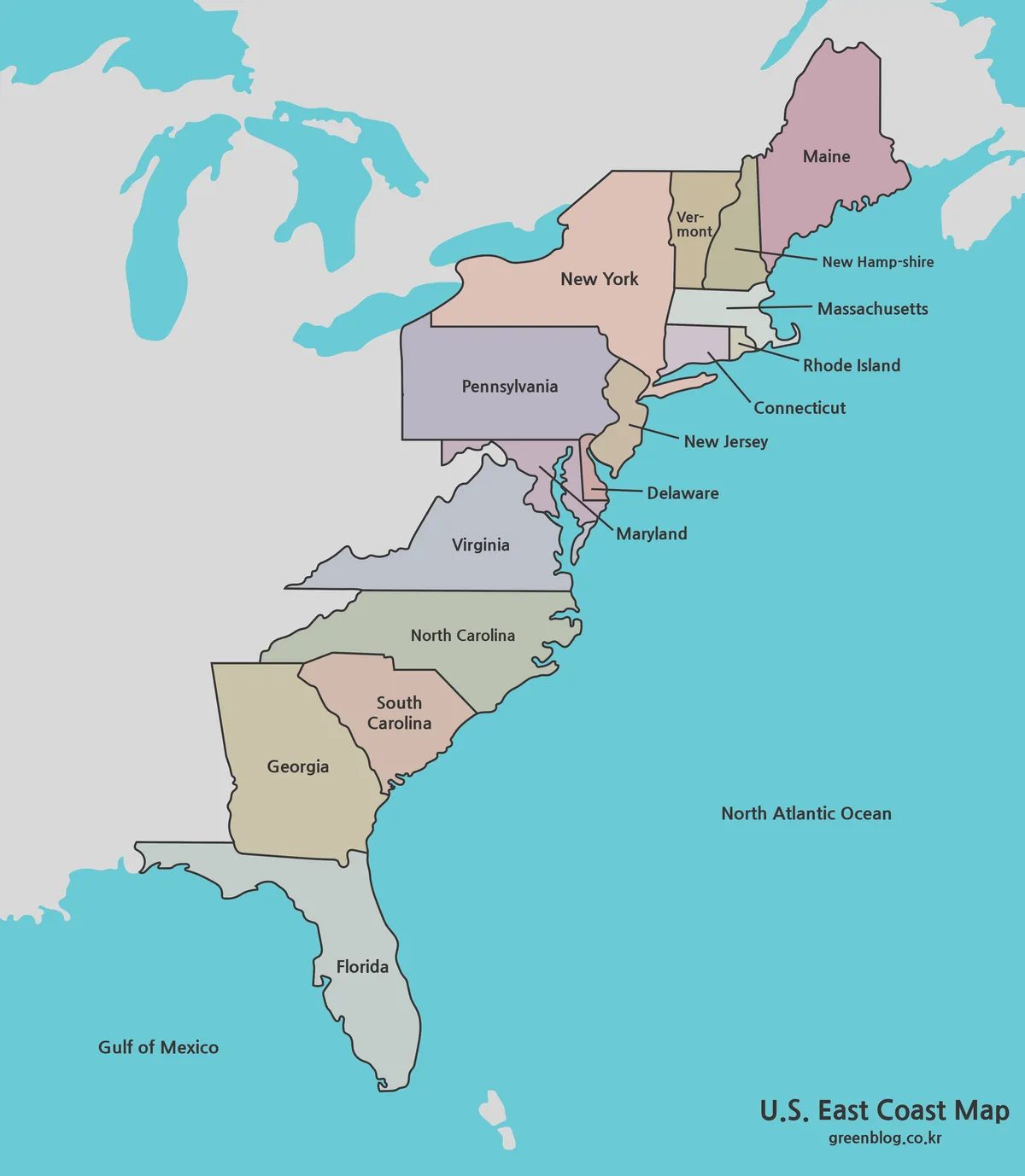
Oregon’s location makes the map helpful for explaining the Pacific Northwest and the wider West Coast. It can be used alongside Washington, California, Idaho, and a full United States map when showing regional connections. The presence of both coastal and inland areas also makes Oregon a good subject for geography lessons, travel content, and environmental comparison materials.
The collection includes:
- printable and editable use cases
- color Oregon county map
- black and white Oregon map
- blank Oregon outline map
- A3 high-resolution layout
- JPG, PNG, and ZIP file support
Oregon Map Styles Included
Each version serves a different purpose. The color map is best for quick visual comparison, the black and white map is better for printing and note-taking, and the outline map works well when users want to add their own information.
Color Oregon County Map
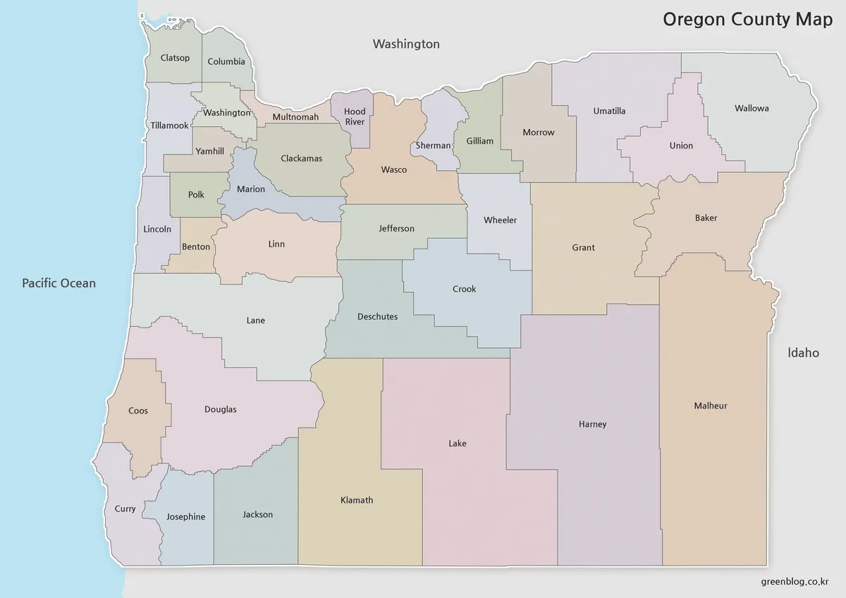
Designed with color-coded county divisions, the color map helps readers compare Oregon’s regional structure at a glance. This is useful because Oregon includes a mix of coastal counties, populated western areas, central mountain regions, and wide eastern counties. Color separation makes it easier to explain how these areas sit within the same state.
For blog posts, classroom slides, and regional comparison graphics, the color version gives the page a stronger visual structure. It works well when introducing Oregon’s location between Washington and California or when comparing the Portland area with more rural parts of the state.
While preparing this version, color contrast was adjusted so neighboring counties would not blend together. This helps the county boundaries remain readable when the map is enlarged or inserted into a presentation.
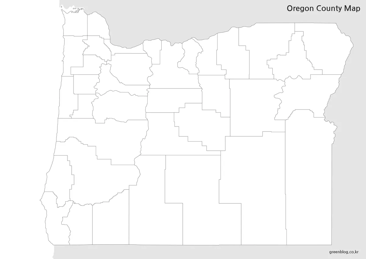
Black and White Printable Oregon Map
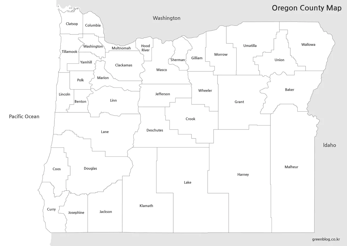
For printed materials, the black and white version offers a cleaner layout focused on names and boundaries. Removing the color makes the map easier to use in reports, worksheets, classroom packets, and grayscale printing.
This version is especially useful when users want to write directly on the map. Travel routes, planned stops, county notes, regional labels, or simple comparison marks can be added without competing against background colors. It is also a practical choice for teachers who need multiple copies for students.
Because Oregon covers a large area from the Pacific coast to the Idaho border, the simplified layout helps keep the full state readable on one printed page. The line balance was reviewed so county boundaries remain visible without making the map feel crowded.
Blank Oregon Outline Map for Editing
The blank outline map removes labels and colors, leaving only the county boundary structure. This gives users a flexible base for editing, coloring, data visualization, and custom presentation graphics.
The outline version works well for marking Portland, Salem, coastal travel routes, agricultural areas, forest regions, or county-level data. It can also be used for classroom coloring activities, geography worksheets, infographic layouts, and video background graphics.
During the final check, the boundary lines were reviewed so users can fill counties with color or add custom highlights more easily. For projects that require a personalized map rather than a finished reference image, this is the most flexible version in the set.
Why an Oregon County Map Is Helpful
Oregon is often used in materials about the Pacific Northwest, U.S. West Coast geography, natural environments, and regional industry. A simple state outline can show where Oregon is, but it does not show how the state is organized internally. County boundaries give users a clearer way to compare the coast, the Willamette Valley area, central Oregon, and the eastern side of the state.
For travel planning, the map can support route notes between Portland, Salem, coastal destinations, and inland areas. For classroom use, students can compare Oregon with Washington, California, and Idaho. For blog or video content, the color map can add a clean location reference without requiring a complex road map.
The three-version format also helps different users choose the most suitable file. Use the color map for quick visual explanation, the black and white map for printing and note-taking, and the outline map for custom editing or data-based graphics.
Practical Uses for Oregon Map Files
An Oregon map can be useful in many types of projects, including:
- Pacific Northwest comparison materials
- Portland and Salem regional explanation pages
- classroom geography handouts
- travel route planning notes
- blog graphics and article images
- county-level data visualization
- infographic design projects
- video editing background maps
- printable study resources
Because Oregon includes coast, forest, mountain, agricultural, and inland regions, a county map can support a wide range of visual explanations. It is especially helpful when the goal is to show regional differences rather than only the state’s location.
FAQ
Does the Printable Oregon Map show county boundaries?
Yes. The map collection is designed around Oregon’s county-level administrative layout.
What size is the map prepared for?
The map files are prepared in an A3 high-resolution layout.
Which version is best for travel planning?
The black and white map is convenient for marking routes and planned stops. The color map is better when visual separation between counties is important.
Can I use the outline map for editing?
Yes. The outline version works well for adding colors, labels, routes, data points, and custom infographic elements.
What file formats are included?
The original download information mentions JPG, PNG, and ZIP files.
Map File Information
This download includes printable Oregon map versions for educational use, presentation design, document printing, and editable graphic projects.
- Included Versions: Color map, black and white map, outline map
- Printable Size: A3 layout
- File Type: JPG, PNG, ZIP
- Intended Use: Classroom handouts, presentations, blog graphics, infographic editing, and printable reference materials
Additional Resources
- USGS National Map : Provides official U.S. map layers and geographic reference data that can help users compare Oregon’s terrain, boundaries, and regional map context.
Related Maps
- Oklahoma Map Download with County Boundaries for Printing
- Printable New Mexico Map – Color, Black and White, and Outline Versions
- Nevada Map Download | Printable County Maps in Color, Black and White & Outline
- Arizona State Map Download Collection (Color, Labeled & Outline Maps)
Green Map creates custom-edited map images using open geographic data sources such as geoBoundaries, Natural Earth, OpenStreetMap, and government open data.
These maps are edited visual materials, not raw data files, and are provided for education, documents, presentations, and graphic reference.