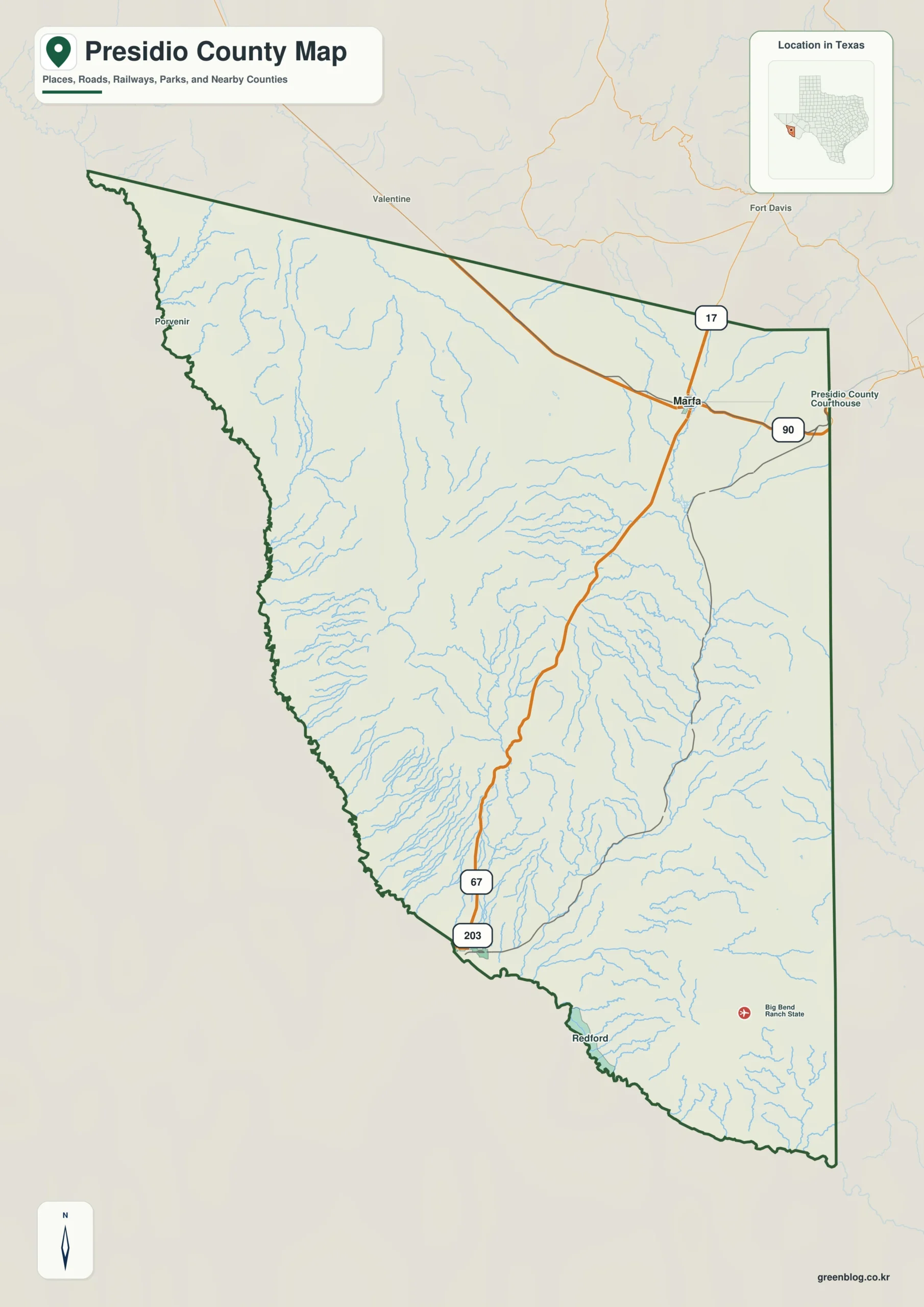
Presidio County Texas map — Presidio County links the Marfa Plateau with the Rio Grande border through the Chinati Mountains.
Download the Presidio County map
- Map file: County reference map
- File format: ZIP
Table of Contents
Quick Facts
- State: Texas
- County: Presidio County
- County seat: Marfa
- Mapped places: Marfa, Presidio, Valentine, Redford
- Natural features: Chinati Mountains, Rio Grande, Marfa Plateau
- Main routes: U.S. 67, U.S. 90
What the Map Shows
Marfa lies north-central, Valentine northwest, Presidio south on the river, and Redford southeast along the border.
County Layout and Location
U.S. 90 connects Marfa and Valentine. U.S. 67 descends through mountain country to Presidio, while the Rio Grande defines the south.
Local Context
Marfa is the county, arts, and tourism center. Presidio focuses more on border trade, farming, and local services; relief strongly separates the two.
Ways to Use This Map
- Compare plateau and border towns
- Trace U.S. 67 through the mountains
- Use the Rio Grande to orient the south
Frequently Asked Questions
Which direction is Presidio from Marfa?
It lies south beyond the Chinati Mountains on the Rio Grande.
What does Valentine identify?
It marks the northwestern plateau and rail corridor.
Green Map creates custom-edited map images using open geographic data sources such as geoBoundaries, Natural Earth, OpenStreetMap, and government open data.
These maps are edited visual materials, not raw data files, and are provided for education, documents, presentations, and graphic reference.