A Korean version of this map page is available. View Korean Page
A Printable Oklahoma Map is useful when you need to explain the county layout of a U.S. state rather than simply show where Oklahoma is located. Oklahoma sits in the south-central United States, between Kansas to the north and Texas to the south, with nearby connections to Arkansas, Missouri, Colorado, and New Mexico. Because the state is often discussed as part of the Great Plains, the South, and the central U.S. at the same time, a clear county map helps readers understand its position more quickly.
This Oklahoma map collection includes three practical versions: a color county map, a black and white printable map, and a blank outline map. The files are prepared in an A3 high-resolution layout and are provided as JPG, PNG, and ZIP files. The set is designed for classroom handouts, geography worksheets, presentation slides, blog graphics, regional comparison materials, and editable design projects.
Oklahoma has a clearly divided county structure, and that makes the map especially helpful for educational or visual reference work. Major areas such as Oklahoma City, Tulsa, the Texas border region, and the Kansas side of the state can be easier to explain when the county boundaries are visible. A simple state outline may be enough for a location overview, but a county-level map gives users more detail for assignments, reports, and infographic layouts.
During the map preparation process, extra attention was given to boundary readability and place-name checking. Since many U.S. county maps rely on English source material, the labels were reviewed carefully so the final map would remain clear when used in print or enlarged on screen. The outline version was also checked so the boundary lines remain connected, making it easier to add colors or highlight selected counties.
Table of Contents
Printable Oklahoma Map Overview
This map set was created for users who need a practical Oklahoma county map for printing, editing, and presentation work. It is not a road map or a travel navigation map. Instead, the focus is on county boundaries, label clarity, clean layout, and flexible use across different types of materials.
Oklahoma’s inland location makes it a useful state to include in regional comparison content. It connects the Great Plains with the southern U.S., and it is often compared with Kansas, Texas, Arkansas, and Missouri. When preparing location explanation materials, a county map helps show how the state is organized internally instead of leaving readers with only a general state shape.
The collection includes:
- printable and editable use cases
- color Oklahoma county map
- black and white Oklahoma map
- blank Oklahoma outline map
- A3 high-resolution layout
- JPG, PNG, and ZIP file support
Available Oklahoma Map Versions
The three versions are designed for different situations. The color map is better for quick visual reading, the black and white map works well for printing and documents, and the outline map is best when users want to add their own colors, labels, or data.
Color Oklahoma County Map
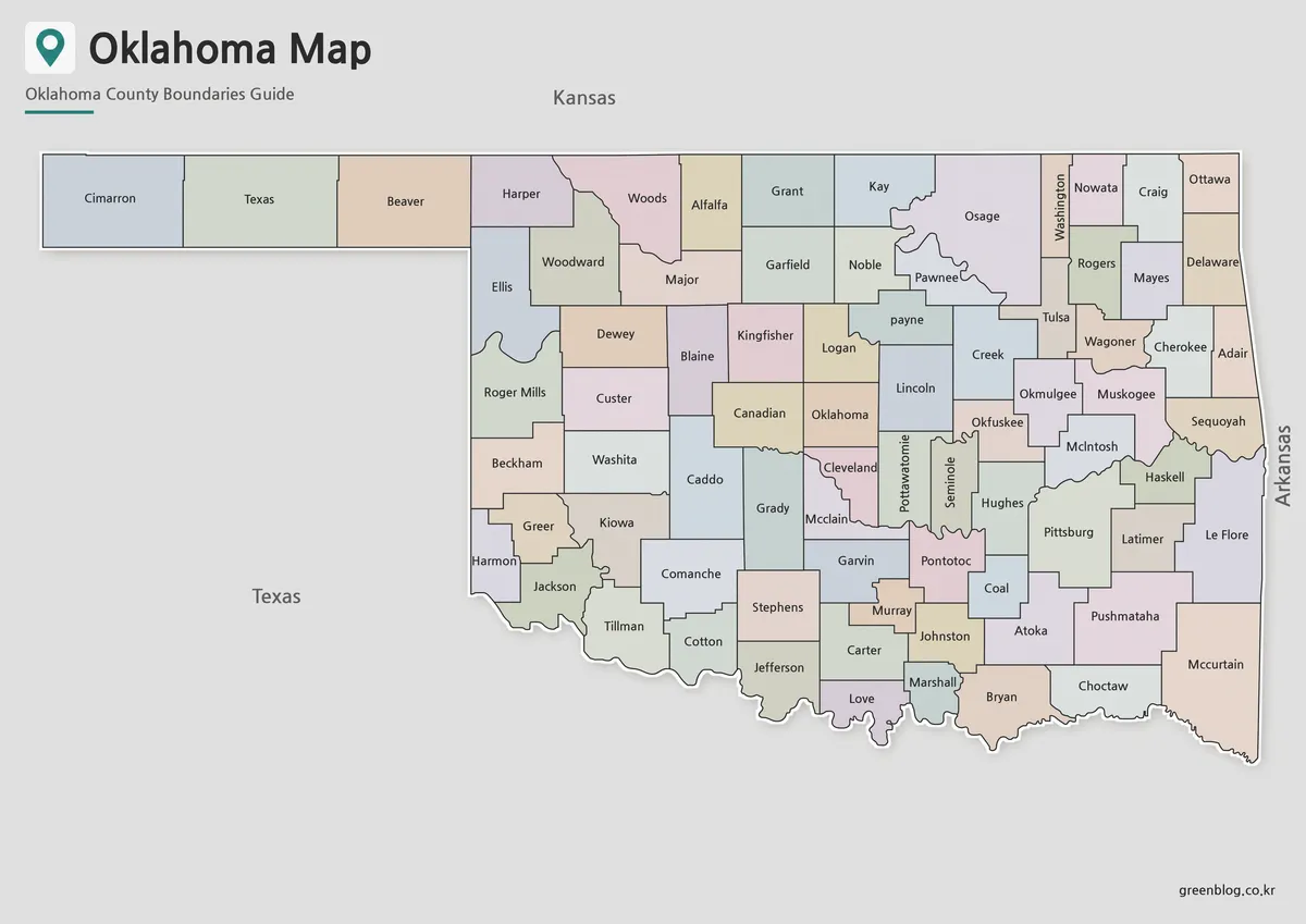
Designed with color-coded county divisions, this version helps users understand Oklahoma’s regional structure at a glance. Since the state contains many county boundaries, color separation makes it easier to compare areas around Oklahoma City, Tulsa, the northern border near Kansas, and the southern side facing Texas.
This version works well for blog images, classroom slides, regional comparison graphics, and general reference pages. It is also a good first map to use when introducing Oklahoma to readers who are not familiar with its county layout.
The color version is especially helpful when the goal is fast recognition. Instead of reading every label one by one, users can visually separate county areas and follow the overall administrative pattern more easily.
Black and White Printable Oklahoma Map
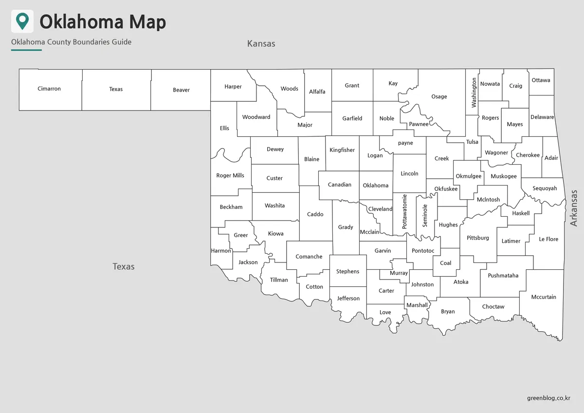
For reports, worksheets, and classroom printing, the black and white version gives the map a cleaner document-friendly appearance. County names and boundaries remain visible, while the removal of color keeps the page simple and easy to print in grayscale.
This is the most practical option when printing several copies or inserting the map into a school assignment, geography handout, or presentation document. The line balance was checked so the county divisions remain readable without becoming too heavy on the page.
Because Oklahoma’s counties are spread across a wide inland area, the black and white layout also works well as a reference sheet. Users can add notes, underline selected regions, or mark border relationships with nearby states without the map feeling visually crowded.
Blank Oklahoma Outline Map for Editing
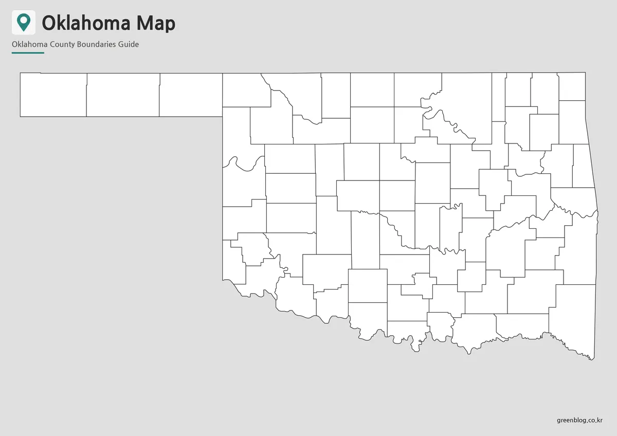
The blank outline version removes colors and labels, leaving only the county boundary structure. This makes it a useful base map for graphic editing, coloring activities, infographic projects, and custom classroom materials.
Users can add city markers for Oklahoma City or Tulsa, highlight specific counties, mark travel routes, show regional data, or create their own county grouping system. For educational use, the outline map can also be used as a worksheet where students fill in names, shade regions, or compare Oklahoma with neighboring states.
While preparing this version, the county lines were checked carefully so the boundaries would not break during coloring or editing. That makes it easier to use the map as a working file rather than only as a reference image.
Best Uses for This Oklahoma Map Collection
An Oklahoma county map can be used in more situations than many people expect. Teachers may use it for U.S. geography lessons, while students can use the black and white or outline version for assignments. Bloggers and content creators can use the color map when writing about Oklahoma, the south-central United States, regional travel, agriculture, energy, or state comparisons.
For presentation creators, the map is useful when explaining Oklahoma’s position between Kansas and Texas. It also works well when comparing Oklahoma with nearby states such as Arkansas, Missouri, and Nebraska. The county boundaries provide more structure than a simple state outline, which helps when the topic involves regional data or location explanation.
Designers and infographic creators may prefer the outline version because it allows custom colors, icons, labels, and arrows to be added directly. The A3 layout also gives enough room for enlarged use in printed materials and presentation graphics.
Choosing the Right Version
Choose the color map when the goal is quick visual understanding. It is the best option for blog posts, presentation slides, and general reference images.
Choose the black and white map when the project is print-heavy. It is better for reports, classroom handouts, study sheets, and materials where ink use or label clarity matters.
Choose the outline map when you need a flexible base. It is the right choice for editing, custom labeling, data visualization, coloring activities, and infographic design.
FAQ
Does the Printable Oklahoma Map show county boundaries?
Yes. The map collection is designed around Oklahoma’s county-level administrative layout.
Which version should I use first?
The color map is the easiest version to view first because the counties are separated visually.
Is the black and white map good for printing?
Yes. The black and white version is designed for clean printing, worksheets, reports, and classroom handouts.
Can I edit the outline map?
Yes. The outline map is suitable for adding colors, labels, markers, data, and custom regional highlights.
What file formats are included?
The original download information mentions JPG, PNG, and ZIP files.
Map File Information
This download includes printable Oklahoma map versions for educational use, presentation design, document printing, and editable graphic projects.
- Included Versions: Color map, black and white map, outline map
- Printable Size: A3 layout
- File Type: JPG, PNG, ZIP
- Intended Use: Classroom handouts, presentations, blog graphics, infographic editing, and printable reference materials
Additional Resources
- Oklahoma Tourism and Recreation Department : Official Oklahoma tourism resource for checking major destinations, travel regions, and local area information that may help users add travel-related context to the map.
Related Maps
- Printable New Mexico Map – Color, Black and White, and Outline Versions
- Montana State Map Download – Printable County Boundary Map
- Kansas Map Download – Printable County Map Collection
- High Resolution North Dakota Map for Classroom, Presentation and Design Projects
Green Map creates custom-edited map images using open geographic data sources such as geoBoundaries, Natural Earth, OpenStreetMap, and government open data.
These maps are edited visual materials, not raw data files, and are provided for education, documents, presentations, and graphic reference.