A Korean version of this map page is available. View Korean Page
A Printable Nigeria Map is useful when you need more than a simple country outline. Nigeria is one of the largest and most populated countries in Africa, and its administrative layout includes 36 states and the Federal Capital Territory, Abuja. Because the country stretches across West Africa and borders Niger, Cameroon, Benin, and the Atlantic coast, a clear map helps readers understand both its location and internal regional structure more quickly.
This Nigeria map collection includes three practical versions: a color map, a black and white map, and a blank outline map. The files are prepared as image files in an A3 layout, making them suitable for classroom materials, presentation slides, blog graphics, printable study resources, and infographic design. Each version has a different purpose, so users can choose the map style that best fits their project.
Nigeria’s size and state structure make a labeled map especially helpful for educational and visual work. Major states, coastal areas, inland regions, and the capital area can be difficult to explain with text alone. A printable map gives students, teachers, bloggers, and designers a clear base for comparing regions, marking important locations, or adding custom information.
While preparing this map set, the layout was arranged to keep the state boundaries readable without making the labels feel too crowded. The color version focuses on quick regional separation, the black and white version supports clean printing, and the outline version works as a flexible base for editing or classroom activities.
Table of Contents
Printable Nigeria Map Overview
This map set was created for users who need a simple but practical visual reference of Nigeria. It is not intended to be a detailed road map or satellite-style map. Instead, the focus is on administrative boundaries, regional readability, and flexible use across printed and digital materials.
Nigeria is located in West Africa, with the Gulf of Guinea along its southern coast. Its neighboring countries help define the map’s reading direction: Benin to the west, Niger to the north, and Cameroon to the east. Abuja is positioned inland and is marked as the capital, making it easier to identify the Federal Capital Territory in relation to the surrounding states.
The map is useful for:
- classroom geography lessons
- country comparison materials
- blog posts about Africa or West Africa
- presentation slides
- infographic projects
- printable handouts
- editable study worksheets
Color Nigeria State Map
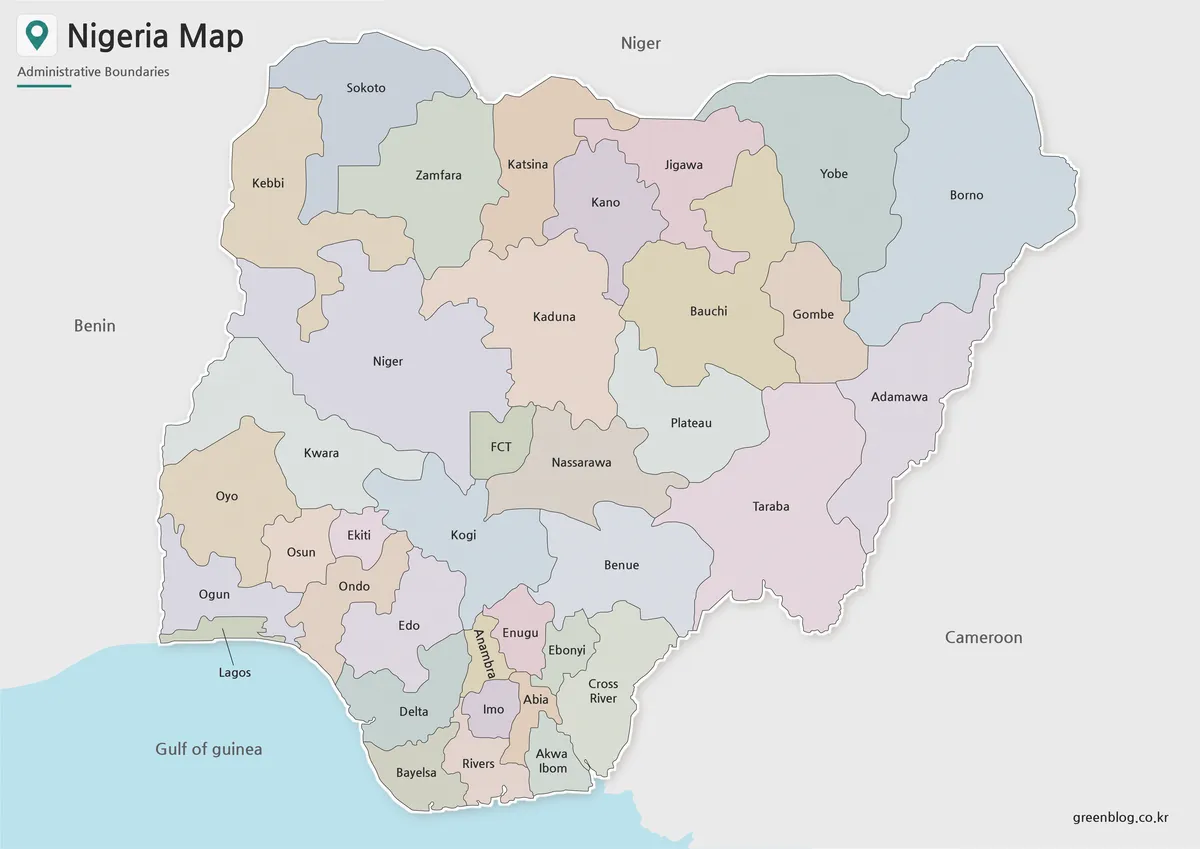
The color map is designed for quick visual reading. Since Nigeria has many administrative divisions, color separation helps users distinguish the 36 states and the Federal Capital Territory more easily. This is especially useful when comparing northern, central, coastal, and eastern areas in a presentation or classroom setting.
The surrounding countries are kept simple so the focus remains on Nigeria’s state layout. Abuja is also highlighted clearly, allowing readers to understand the capital’s inland position without searching through dense labels.
This version works well for blog images, presentation graphics, regional comparison pages, and educational materials where visual separation is important.
Black and White Printable Nigeria Map
For printed handouts, the black and white version gives users a cleaner layout. Removing the colors makes the state labels and boundary lines easier to read on paper, especially when printing in grayscale or using the map inside a report, worksheet, or classroom packet.
Because Nigeria has a wide land area and many state names, the map was kept simple enough to avoid unnecessary visual noise. This version is useful when users want to add notes, underline specific areas, or print multiple copies without using heavy color ink.
Teachers, students, and presentation creators may find this version easier to use when the map needs to support written information rather than act as a colorful visual image.
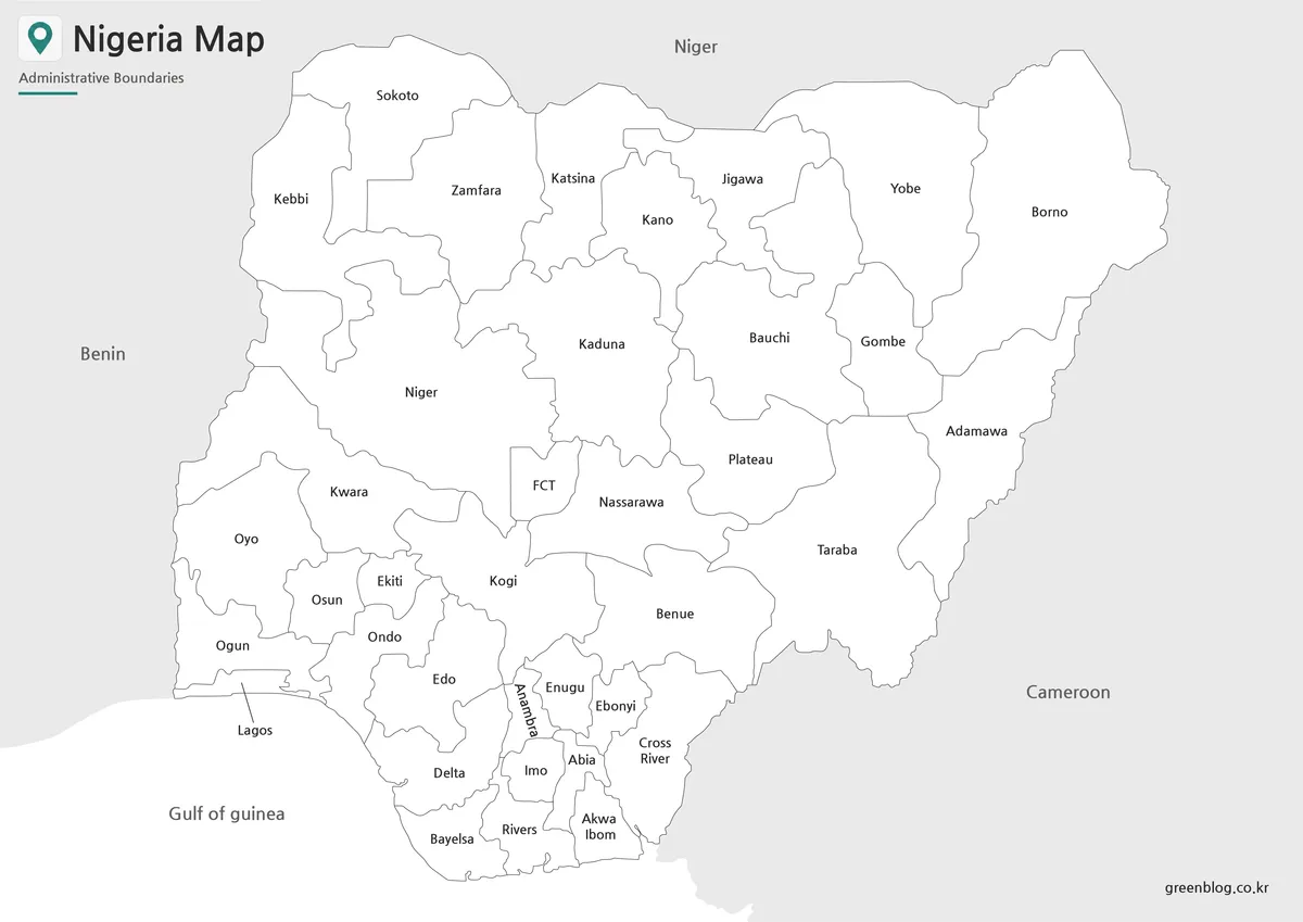
Blank Nigeria Outline Map for Editing
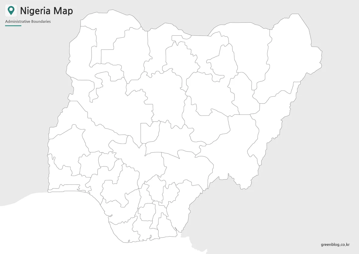
The outline map removes colors and labels, leaving only the boundary structure. This makes it a flexible working base for graphic editing, classroom coloring activities, custom regional grouping, and infographic design.
Users can add city markers, travel routes, population data, resource locations, presentation highlights, or their own labels. For example, the blank version can be used to mark Abuja, Lagos, coastal regions, northern states, or neighboring country directions depending on the topic.
This outline version is especially useful when the goal is not just to view the map, but to build a new visual resource from it.
Why This Nigeria Map Is Useful
Nigeria is often discussed in relation to West Africa, population size, natural resources, regional development, and major cities. However, those topics are easier to understand when readers can see where the states are located and how the country connects to surrounding regions.
A simple location map can show where Nigeria is, but it does not explain the internal structure very well. A state-level map is more useful for comparing regions, preparing educational visuals, or building presentation materials. The coastline, inland capital, and surrounding borders all become easier to understand when the country is shown with administrative boundaries.
The three-version format also gives users more flexibility. The color map is best for quick viewing, the black and white map works better for printing, and the outline map is better for editing or custom labeling.
Practical Uses for Students, Teachers, and Designers
This Printable Nigeria Map can be used in many types of projects. Teachers may use the labeled version when introducing West African geography, while students can use the blank outline map for assignments or coloring activities. Bloggers and content creators can use the color version when writing about Nigeria, Africa, travel, resources, or regional comparisons.
For presentation slides, the map can help explain Nigeria’s position between Benin, Niger, Cameroon, and the Gulf of Guinea. For infographic projects, the outline map provides a clean base where users can add data, icons, arrows, or regional highlights.
The A3 layout also makes the files suitable for larger printed materials. When enlarged for classroom display or document use, the state boundaries remain easier to follow than a small web image.
Frequently Asked Questions
Does the Printable Nigeria Map include all states?
Yes. The map is designed to show Nigeria’s 36 states and the Federal Capital Territory, Abuja, in a clear visual layout.
Is Abuja shown on the map?
Yes. Abuja is marked so users can identify the capital area more easily.
Which version is best for printing?
The black and white version is usually best for printing because it keeps the layout clean and avoids heavy color use.
Can I use the outline map for editing?
Yes. The outline version is useful for adding custom labels, colors, routes, data points, or classroom worksheet elements.
Is this map suitable for classroom use?
Yes. The map collection works well for geography lessons, student handouts, printable assignments, and regional comparison activities.
Map File Information
This download includes printable Nigeria map versions for educational use, presentation design, document printing, and editable graphic projects.
- Included Versions: Color map, black and white map, outline map
- Printable Size: A3 layout
- File Type: Image files
- Intended Use: Classroom handouts, presentations, blog graphics, infographic editing, and printable reference materials
Additional Resources
- Humanitarian Data Exchange – Nigeria Administrative Boundary Data : Provides administrative boundary datasets for Nigeria that can be useful for users who need GIS-based reference data or boundary information for mapping projects.
Related Maps
- Mozambique Map Download – Labeled, Basic, and Blank Outline Maps
- Madagascar Map Resource for Presentations, Infographics, and Study Materials
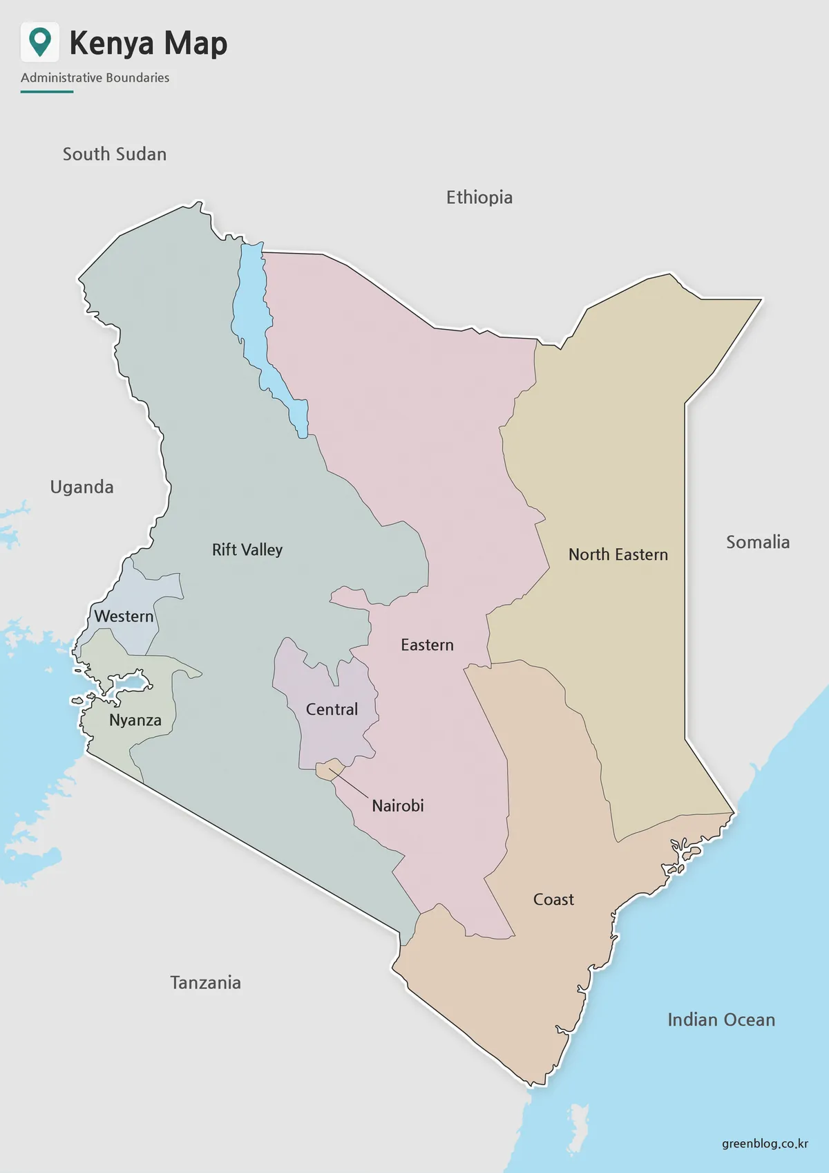
- Kenya Map with Regional Boundaries – A3 Printable Resource
- Guinea Map Download – Printable Regional Map Set
Green Map creates custom-edited map images using open geographic data sources such as geoBoundaries, Natural Earth, OpenStreetMap, and government open data.
These maps are edited visual materials, not raw data files, and are provided for education, documents, presentations, and graphic reference.