A Korean version of this map page is available. View Korean Page
A Kaohsiung City Map is useful when you need to understand more than the city’s location in southern Taiwan. Kaohsiung sits along the southwestern coast of Taiwan, facing the Taiwan Strait, with Tainan City to the north and Pingtung County to the east and south. Because the city includes a major urban center, port districts, coastal areas, rural communities, and mountain-side districts, a district-based map gives a much clearer view of how the region is arranged.
This printable Kaohsiung City map collection includes color, black and white, and outline versions prepared for classroom reference, travel planning, blog graphics, presentation slides, and editable infographic projects. The maps are provided as image files and arranged for A3-size printing, making them suitable for both printed materials and digital layouts. Instead of relying on one general map, users can choose the version that fits their project: a color map for quick comparison, a cleaner black and white map for printing, or a blank outline map for editing and custom marking.
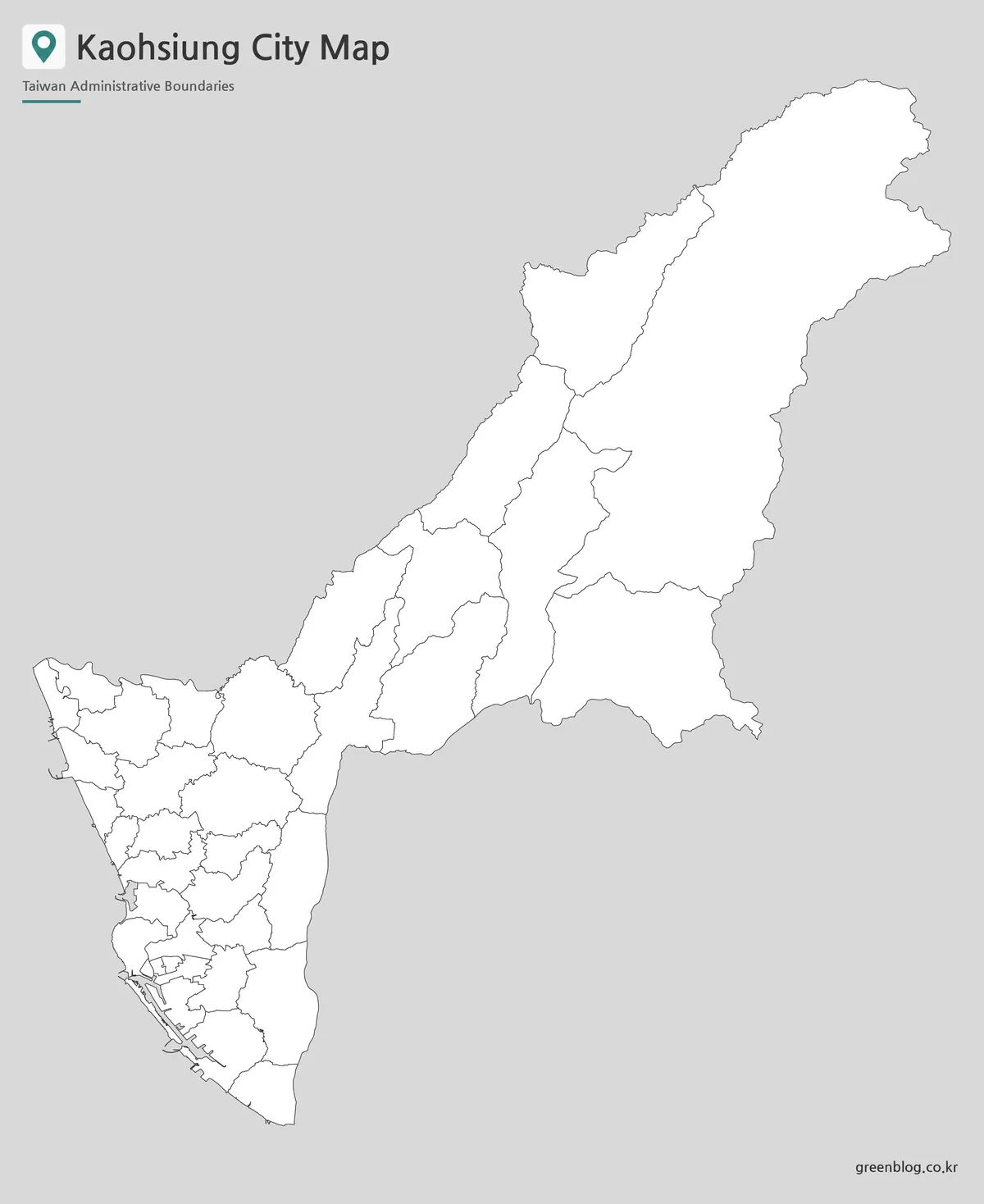
Kaohsiung is divided into 38 districts. Central and urban districts such as Yancheng, Gushan, Zuoying, Sanmin, Lingya, Cianjhen, and Fengshan are closely connected to the city’s main living and commercial areas. Coastal and port-related districts such as Cijin and Siaogang help show the city’s relationship with the sea, while eastern districts such as Meinong, Liugui, Maolin, Taoyuan, and Namaxia extend into much wider inland and mountain areas. This contrast makes the administrative layout difficult to explain with words alone.
During the map preparation process, extra attention was given to the balance between the compact western districts and the large eastern districts. Some urban labels sit close together, while the mountain-side districts occupy much broader spaces. The layout was checked so that boundary lines, labels, and spacing remain readable when the map is enlarged for presentation use or printed as a large reference sheet.
Table of Contents
Kaohsiung City Map Overview
The main value of a Kaohsiung City Map comes from the city’s unusual regional spread. Kaohsiung is not only a dense urban area around the port. It also includes coastal districts, inland towns, agricultural areas, and wide mountain-side districts.
A simple Taiwan location map can show where Kaohsiung is, but it does not explain how the city changes from west to east. A Kaohsiung City Map with district boundaries gives more useful context for travel planning, classroom projects, district comparison, and design work. the administrative boundary layout gives much more useful context.
The collection includes three map styles:
- Color map for quick district comparison
- Black and white map for printing and document use
- Outline map for editing, coloring, and custom data marking
Each version supports a different purpose, so the map can work as a travel reference, a teaching resource, a presentation graphic, or a base layer for infographic editing.
Color-Coded District Map
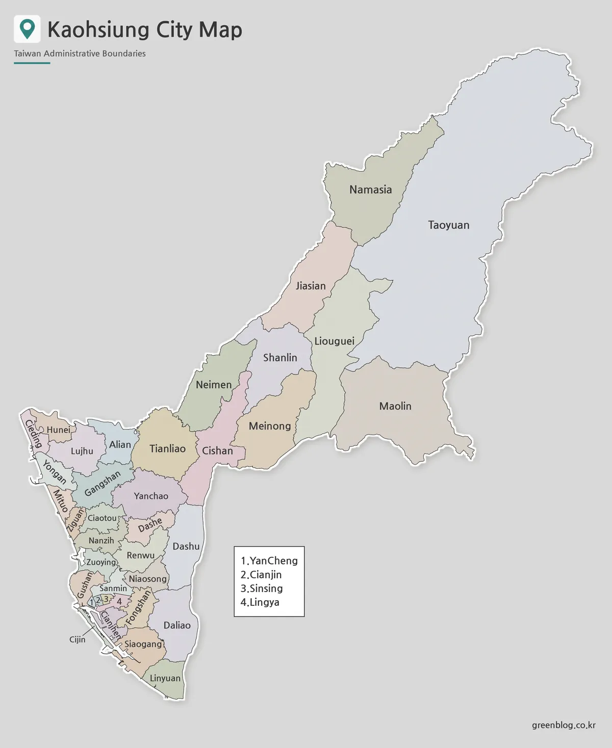
Designed for fast visual comparison, the color version helps separate Kaohsiung’s 38 districts across a wide and varied city area. This is especially helpful because the western urban districts are packed more closely together, while eastern districts such as Maolin, Taoyuan, and Namaxia cover much larger areas.
Color separation makes it easier to compare the port and coastal side of Kaohsiung with the inland and mountain-side districts. It also helps when explaining the relationship between central districts such as Sanmin, Lingya, and Fengshan and coastal districts such as Cijin and Siaogang.
For classroom slides, blog graphics, travel explainers, and regional comparison materials, the color version of the Kaohsiung City Map gives readers a quick way to understand the city’s structure. It works well when the goal is to show how Kaohsiung extends beyond its downtown core.
Black and White Printable Version
For printed documents, worksheets, reports, and handouts, the black and white Kaohsiung City Map gives the page a cleaner and more neutral appearance. The focus stays on district names and boundary lines rather than color.
This matters for Kaohsiung because the map includes many labels and a clear contrast between dense urban districts and wider outer districts. The simplified style helps prevent the page from looking crowded when placed inside a report, school assignment, or travel document.
The black and white version is also useful for presentation materials where the map should support the text rather than dominate the page. Boundary line weight and label spacing were reviewed so the district layout remains readable without relying on color.
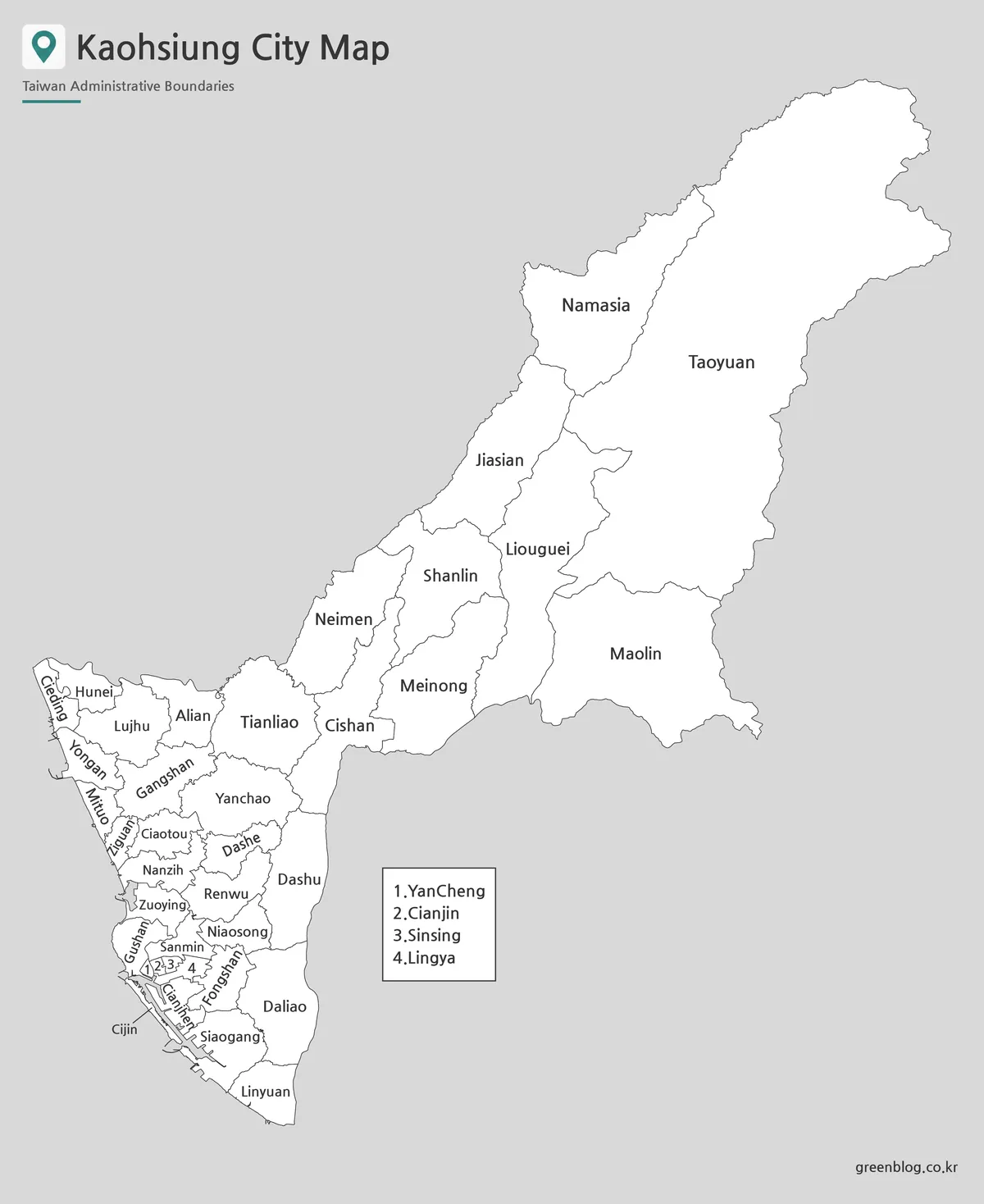
Blank Outline Map for Editing
The outline version of the Kaohsiung City Map works as a flexible base map for users who need to add their own information. It keeps the district boundaries while removing color and most visual distractions.
This blank Kaohsiung map can be used to mark travel routes, highlight coastal districts, compare western urban areas with eastern mountain districts, add tourism points, or create classroom coloring activities. Designers can also use it for infographic annotations, regional data displays, or presentation highlights.
Because Kaohsiung has both compact city districts and broad inland districts, the outline map is especially useful when only certain regions need to be emphasized. For example, a travel graphic may focus on Cijin, Zuoying, Sanmin, and Cianjhen, while a nature or regional study project may highlight Meinong, Liugui, Maolin, Taoyuan, and Namaxia.
Built for Printing, Teaching, and Visual Projects
This map collection was prepared for practical use rather than simple viewing. A3-size layout support makes the files useful for classroom handouts, large reference sheets, presentation graphics, and printable study materials.
The maps also work well for travel-related content. Kaohsiung’s port districts, central districts, coastal areas, and eastern mountain-side districts are not all close together, so a district map helps explain movement, distance, and regional differences more clearly.
For bloggers and designers, the three map styles offer different visual options. The color version gives quick recognition, the black and white version fits clean document layouts, and the outline version provides a flexible base for custom editing.
Frequently Asked Questions
How many districts are shown on the Kaohsiung City Map?
The map shows Kaohsiung City’s 38 districts, including central urban districts, coastal districts, port-side areas, and eastern mountain-side districts.
Which version is best for travel planning?
The color map is usually the easiest choice for travel planning because it separates districts quickly. It works well for explaining central Kaohsiung, the port area, Cijin, and outer districts.
Can I print the black and white version?
Yes. The black and white map is designed for clean printing, classroom handouts, worksheets, reports, and document layouts.
What is the outline map best for?
The outline map is best for editing, coloring, labeling, and adding custom information. It can be used for route marking, infographic projects, classroom exercises, or district comparison work.
Is this map useful for classroom projects?
Yes. The collection works well for Taiwan geography lessons, city comparison materials, printable worksheets, and student assignments.
Map File Information
This download includes printable Kaohsiung City map versions for educational use, presentation design, document printing, and editable graphic projects.
- Included Versions: Color map, black and white map, outline map
- Printable Size: A3 layout
- File Type: Image files
- Intended Use: Classroom handouts, presentations, blog graphics, infographic editing, and printable reference materials
Related Maps
- High Resolution Tainan City Map for Printing and Editing
- Taichung City Map for Printing, Editing, and Classroom Use
- High Resolution Taoyuan City Map for Classroom and Presentation Use
- New Taipei City Map Download with District Boundarie
Additional Resources
- Kaohsiung City Government Geographic Information System : A useful official map-based resource for checking Kaohsiung’s district layout and administrative geography.
Green Map creates custom-edited map images using open geographic data sources such as geoBoundaries, Natural Earth, OpenStreetMap, and government open data.
These maps are edited visual materials, not raw data files, and are provided for education, documents, presentations, and graphic reference.