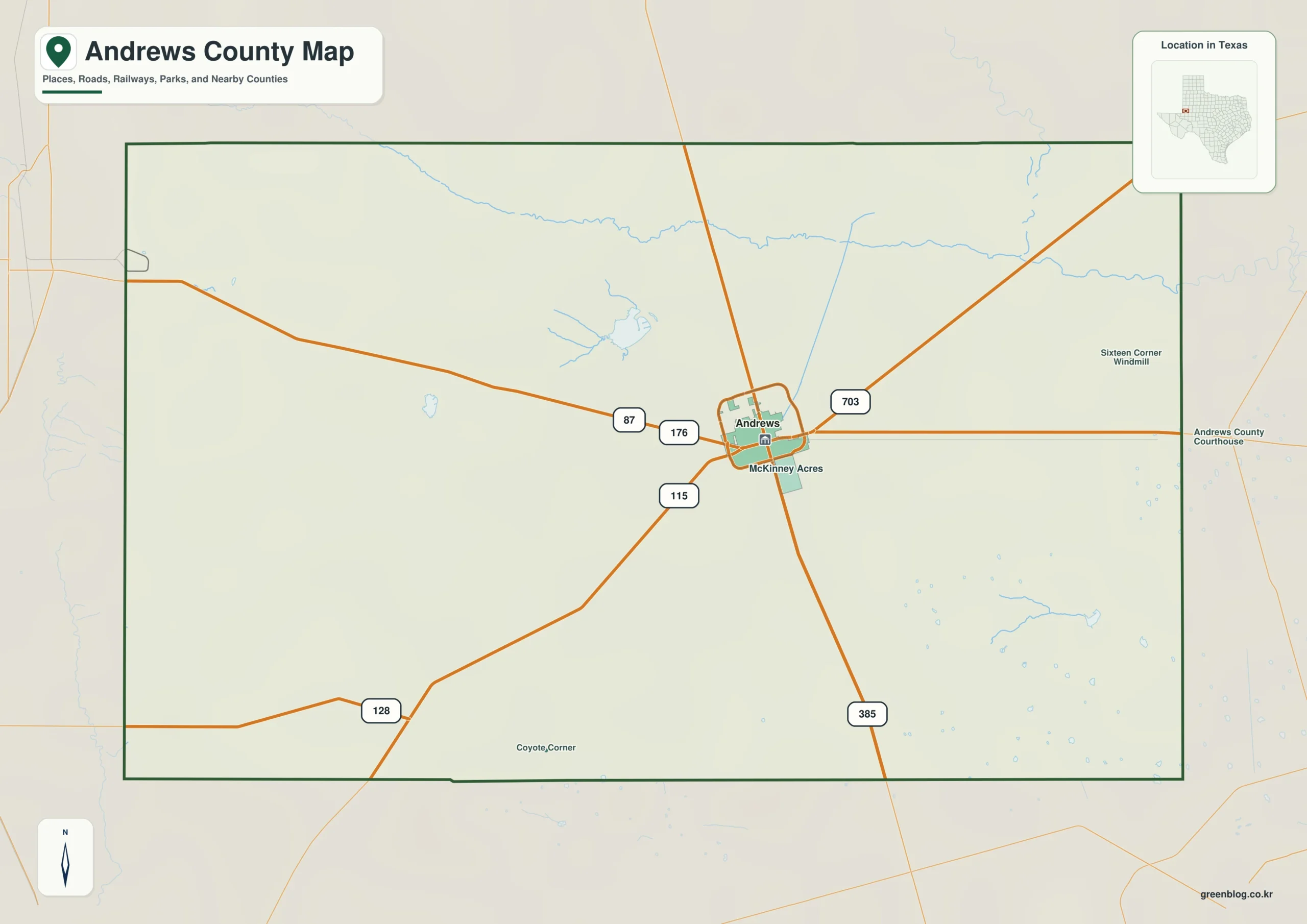
This Andrews County Texas map page introduces a West Texas county that meets the New Mexico state line. Andrews, the county seat, sits at the junction of U.S. Highway 385 and State Highways 115 and 176. The surrounding Southern High Plains are broad, dry, and mostly level, with sandy soils and few surface streams. Ranching shaped the early settlement pattern, while petroleum development later became the county’s defining economic force.
Table of Contents
A county on the New Mexico line
Andrews County occupies the southern High Plains along the western edge of Texas. Its open prairie, limited rainfall, and lack of permanent surface streams distinguish it from river-oriented counties farther east. Andrews functions as the county’s road and service center, connecting north–south and east–west travel across the area.
From large ranches to the energy economy
Large ranch holdings dominated the county before formal organization in 1910. The dry environment made settlement difficult, but it also created a landscape suited to extensive grazing. Oil development later transformed the county, tying Andrews to the broader Permian Basin and giving energy production a central role in local employment and identity.
Using color to separate boundaries
Color is most helpful when the reader needs to find the county quickly. The map distinguishes the full boundary while retaining Andrews as a useful administrative reference. It is a practical choice for web content, slides, or any page where the location must be understood at a glance.

Print-friendly map details
The print-friendly map focuses on boundary and label clarity. It shows the county and Andrews without depending on color, making it suitable for reports, photocopies, and worksheets. Additional notes can still be written or drawn on the printed page.

Custom mapping on a clean outline
A blank boundary is more efficient when the final map needs a specific set of labels. The outline edition can be used to place Andrews, route numbers, study zones, or a custom legend. It avoids the awkward step of deleting information from an already completed map.

Download the ZIP map set
The ZIP below contains one color, one black-and-white, and one outline A3 JPG map of Andrews County. Select color for screen reference, monochrome for routine printing, or the outline when adding Andrews and project information. The three JPG files remain independent once the ZIP is unpacked.
Andrews County, Texas Map Download
The ZIP package includes color, black-and-white, and outline maps. Use the descriptions below to match each map format with the needs of your document or presentation.
- Map set: Color, black-and-white, and outline maps
- File format: Three high-resolution A3 JPG files in one ZIP
- Suggested uses: Screen reference, printing, worksheets, and custom editing
- Coverage: The complete boundary of Andrews County, Texas
The download is provided as a ZIP archive. After extraction, the color, black-and-white, and outline maps are available individually.
Frequently Asked Questions
Where is the county seat?
The files use the official county boundary for Andrews County and are intended to show the county as one administrative area within Texas. The county seat and other communities are mapped as locations inside the county rather than as parts of the boundary.
Which map works best for a printed report?
For paper reports and photocopies, the black-and-white version offers a practical balance of clarity and low color dependence. Use the color edition for visual displays and the outline edition when custom labels or thematic information must be added.
What is included in the ZIP package?
Yes. Each of the three map styles is supplied as a separate JPG inside the download. Because the formats are independent, one can be used immediately and the remaining files retained for future projects.
What can be added to the outline map?
Andrews is the county seat and is the clearest first reference for an administrative map. Once the base is marked, place names, routes, project sites, and data symbols can be added as needed.
References
- U.S. Census Bureau
- 2024 Gazetteer Files
- Texas State Library: Counties and County Seats
- Texas Counties: Year Created and Organized
- Handbook of Texas: county history, geography, and economy
Related Maps
- Wilson County Texas map|Floresville, La Vernia, Poth, and Stockdale
- Ochiltree County Texas map|Perryton, High Plains farming, and the Oklahoma line
- Waller County Texas map|Hempstead, Prairie View, and the Brazos River
- Stephens County Texas map|Breckenridge Oil Boom, Hubbard Creek Lake, and Brazos Headwaters
- Free Printable Texas Map Set for Education, Presentations and Editing
Green Map creates custom-edited map images using open geographic data sources such as geoBoundaries, Natural Earth, OpenStreetMap, and government open data.
These maps are edited visual materials, not raw data files, and are provided for education, documents, presentations, and graphic reference.