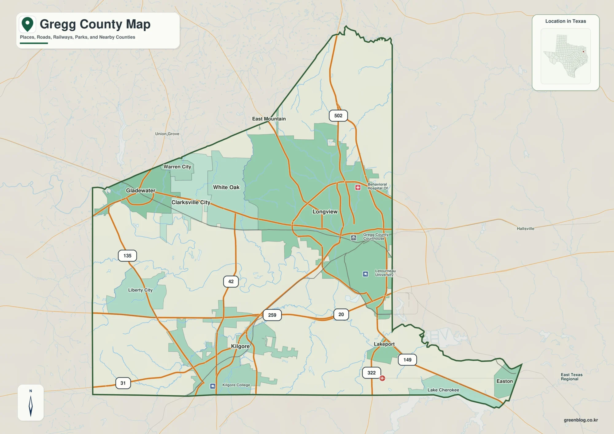
Anderson County sits in East Texas between the Trinity and Neches river systems, and Palestine gives the county map an immediately useful center. Major roads spread away from the county seat in several directions, Frankston is near the northeastern end of the county, and Elkhart sits to the south. This page also includes a downloadable ZIP with four separate high-resolution A3 JPG maps, so readers can move from the on-page WebP previews to larger files for printing, classroom work, presentations, or their own local reference material without searching for each map separately.
The four views are intentionally different. The county map keeps the boundary and major highways visible, the city-connections map simplifies the geography around Palestine, Elkhart, and Frankston, the terrain-and-water map emphasizes creeks and small lakes, and the elevation map reveals the contrast between the lower western side and stronger north-central and eastern ridges. Reading them together is useful because roads, drainage lines, and higher ground do not follow the same pattern. A place that looks like empty countryside on the highway map can become a dense network of short tributaries on the water map or a sequence of ridges and valleys on the elevation surface.
Table of Contents
Palestine gives the boundary map a practical center
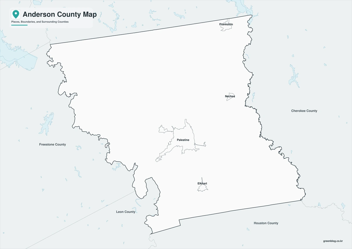
Palestine is the first place to find on the county map. It is not simply a label placed near the middle of the outline; it is where several of the map’s most useful routes come together. U.S. 79 approaches from the southwest, U.S. 84 continues across the county toward the east, and U.S. 287 provides an important southward connection. State Highway 19 also passes through the Palestine area, while State Highway 155 leads toward Frankston in the northeast. Because the roads leave the city in multiple directions, Palestine works as a geographic hinge: once it is located, the rest of the county becomes much easier to orient.
The county outline deserves attention as well. The long northern edge is comparatively simple, but the west, south, and southeast contain irregular bends, narrow projections, and recessed segments. That matters when a road or water feature lies close to the county line. A nearby town can appear geographically close to Palestine while actually sitting outside Anderson County, so the heavy boundary line should remain part of any location check. The muted background labels around the map—including communities toward Fairfield and Jacksonville—provide extra orientation without competing with the county itself.

Authoritative county descriptions support what the map shows. Palestine is the county seat and largest town, and U.S. highways 79, 84, and 287 are identified as major transportation routes through Anderson County. The county also lies between the Trinity and Neches river systems, which becomes more important later when the water and elevation maps are compared. For a reader who only needs a fast answer to “Where is this place in the county, and which major road reaches it?”, the boundary-and-road map is the best starting point.
Frankston and Elkhart show how far the county stretches north and south
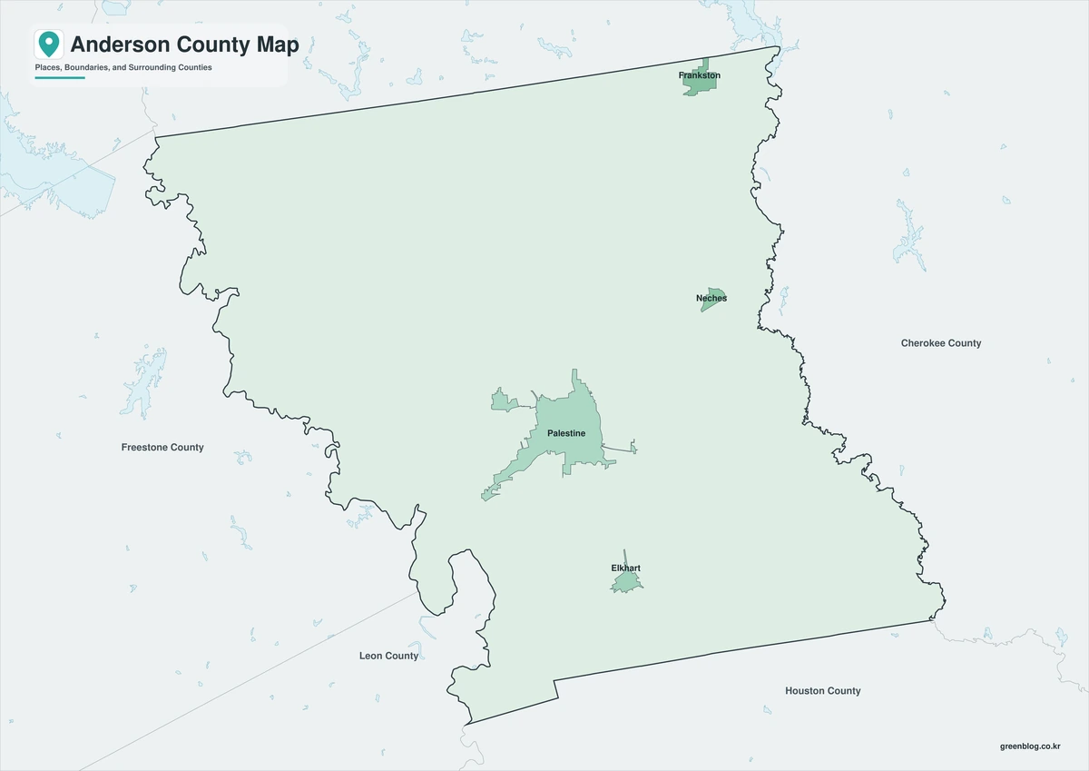
The city-connections map removes much of the highway detail and keeps three reference points: Palestine, Elkhart, and Frankston. Palestine remains the hub, Elkhart lies to the south, and Frankston sits much farther away near the northeastern edge. The map reports approximate direct distances of about 9 miles from Palestine to Elkhart and about 23 miles from Palestine to Frankston. Those numbers are straight-line distances, not road mileage. A practical driving route can be longer because highways curve, intersections change direction, and the most efficient road rarely follows a perfect line between two towns.
Even with that limitation, the distance labels are useful because they communicate scale. Elkhart is close enough to Palestine to read as part of the southern central portion of the county, and it sits near the U.S. 287 and State Highway 294 corridor. Frankston is a clearly separate northern reference point, associated with State Highway 155 and 175. The uneven spacing between the three communities helps explain why Anderson County should not be imagined as a compact circle around Palestine. Its settled places are distributed across a substantial north-south span, with the county seat occupying a central role without being equally close to every edge.

This simplified map is especially effective for orientation, not navigation. It can explain the order of the three communities at a glance, after which the road map can supply the actual highway context. County labels around the frame also show the broader setting toward Henderson, Cherokee, Houston, Leon, and Freestone counties. Someone unfamiliar with East Texas can therefore learn the internal pattern first and then connect Anderson County to the surrounding region without having to interpret every local road at the same time.
Creeks and small lakes fill the spaces between the highways
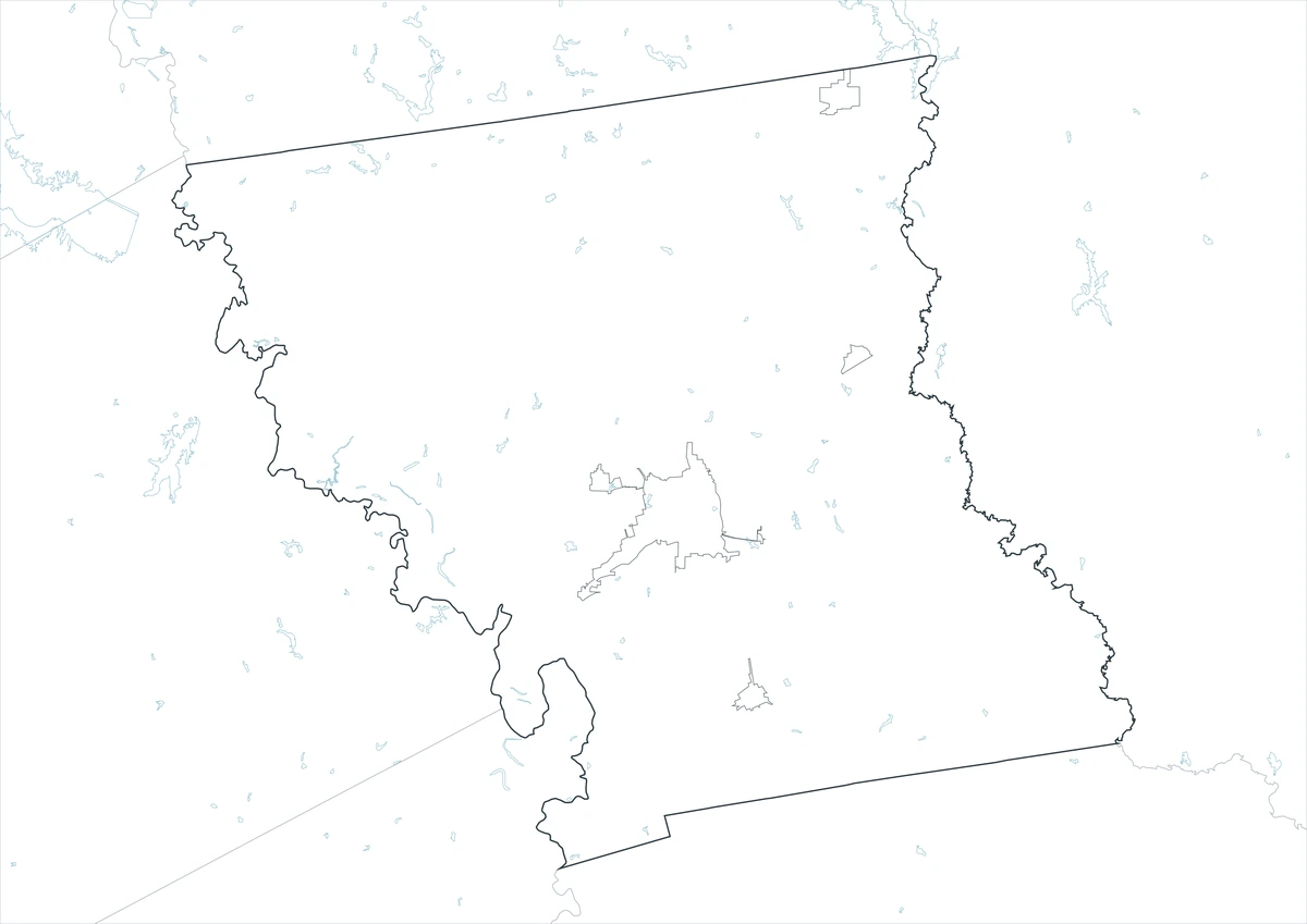
The terrain-and-water map changes the visual character of Anderson County. Instead of a few bold roads, thin blue channels appear across nearly the entire interior. Gums Creek is prominent on the western side, while Lake Frankston and Brushy Creek form useful reference points near the northeastern community of Frankston. Ioni Creek crosses the southeastern portion of the county and is associated with Lake Ioni farther south, while Box Creek is visible near the southern edge. The map does not present one dominant river running through the middle of the county. Its defining impression is a dense collection of shorter drainages spreading through rolling country.
Small lakes are scattered through several parts of the map rather than concentrated in one reservoir district. Gator Lake appears in the northwest, Lake J D M farther east along the northern interior, and Lake Creek No 2 and Big Lake on the western side. Duggeys Lake, Lost Prairie Lake, and Crystal Lake add reference points through the center and east. This distribution is useful when a reader wants to connect a named water feature with a town or road. Lake Frankston, for example, makes more sense when the water map is compared with the city map, while Ioni Creek can be located relative to Elkhart and the southern highway network.

The map is a geographic reference, not a flood-hazard, navigation, parcel, or legal shoreline product. A blue channel indicates the mapped location of a water feature; it does not tell the reader how deep the water is, whether a crossing is safe, how high floodwater could rise, or where a property boundary lies. Those questions require current agency and site-specific information. The value of this map is context: it shows how frequently roads and communities in Anderson County are interrupted by small drainage lines that may be easy to miss on a conventional road map.
The elevation surface rises more strongly on the north-central and eastern side
The supplied elevation image is the Anderson County, Texas map already associated with this package; it does not need to be regenerated. Its outline matches the county map in the long upper boundary, the irregular northwest edge, the southwest indentations and projections, and the extended southeastern side. Inside that boundary, dark green low terrain covers much of the west and southwest. Stronger tan and brown relief appears north of Palestine, through the north-central interior, and again on several eastern and southeastern ridges. The visual message is therefore the opposite of a “high west, low east” description: the western side is broadly lower, while pronounced hills are more common farther north and east.
The legend gives an actual mapped surface range of roughly 52 to 233 meters with a mean near 116 meters. The color bands simplify continuous elevation values so broad differences can be recognized quickly, and multidirectional hillshade makes ridge edges and small valleys easier to see. A boundary between green and tan is not a literal step in the ground, and the map should not be treated as a survey-grade surface. Its purpose is to show relative terrain across the county at a useful regional scale.

Historical and geographic descriptions of Anderson County point in the same direction. The county lies between the Trinity and Neches systems, with a drainage divide near the center, and published natural-setting material describes the eastern half as generally higher than the western half. That background helps explain why the water map and elevation map complement one another. Short streams fall away from ridges into lower corridors on opposite sides of the divide, producing a closely textured landscape rather than a single broad slope. For engineering, construction, or parcel-level slope work, however, a current project-specific elevation dataset and survey remain necessary.
Each map answers a different question about Anderson County
Using the four maps as a set is more informative than trying to force every layer onto one image. The county map answers boundary and highway questions. The city-connections map explains the relative spacing of Palestine, Elkhart, and Frankston. The water map exposes a dense network of creeks and scattered lakes between those roads, and the elevation map gives the channels a physical setting of lower western land and more pronounced ridges to the north and east. A reader can start with the simplest map for the question at hand and then add one other view when more context is needed.
- County map: best for the county boundary, Palestine, U.S. 79, U.S. 84, U.S. 287, and the major state-highway directions.
- City-connections map: best for comparing Palestine with Elkhart and Frankston and understanding the 9-mile versus 23-mile straight-line spacing.
- Terrain-and-water map: best for locating creeks, small lakes, and the fine drainage network that is subdued on the road map.
- Elevation map: best for comparing the broad western lowlands with stronger north-central and eastern ridges.
The WebP versions above are convenient for browser viewing, but larger JPG files are more practical when the maps need to be printed, inserted into a report, or kept as separate source images. The download below contains all four maps as individual high-resolution A3 JPG files in one archive. The elevation file is the verified Anderson County, Texas asset shown above, not an elevation map borrowed from another state.
Frequently Asked Questions
Which part of Anderson County appears higher on the elevation map?
The map shows broad lower green terrain across much of the west and southwest, while stronger tan and brown ridges appear more often north of Palestine and through the eastern half. The legend reports a mapped range of about 52–233 meters with a mean near 116 meters. For this map, the clearest comparison is lower western terrain versus higher north-central and eastern ridges.
Are the 9-mile and 23-mile city distances the same as driving mileage?
No. The city-connections map uses approximate straight-line distances from Palestine: about 9 miles to Elkhart and about 23 miles to Frankston. A road trip can be longer because the practical route follows the highway network rather than a direct line. Use a current routing service when travel distance or driving time matters.
Can the water map be used to judge flooding around Lake Frankston or Ioni Creek?
No. The terrain-and-water map is designed to locate mapped water features and compare them with the county boundary and surrounding terrain. It does not provide flood zones, forecast water levels, channel depth, dam-safety information, or legal shoreline boundaries. Those decisions require current data from the appropriate federal, state, or local agency.
Map File Information
Download the Anderson County county-and-road map, city-connections map, terrain-and-water map, and elevation map together as separate high-resolution A3 JPG files.
- Included Files: Use only the versions confirmed in the article and supplied images
- File Type: Use the confirmed download contents
- Intended Use: Printing, education, presentations, and map-based projects
Related Maps
- Wood County Texas map|Quitman, Mineola, Winnsboro, and Lake Fork
- Runnels County Texas map|Ballinger, farm country, and the Colorado River corridor
- Rains County Texas map|Emory between Lake Tawakoni and Lake Fork
- Reeves County Texas map|Permian Basin Oil, Pecos, and Desert Springs
- San Patricio County Texas map|Rail Towns, Ship Channel Industry, and Coastal Bend Growth
References
The sources below provide authoritative context for Anderson County boundaries and transportation, mapped hydrography, elevation, and the county’s East Texas setting. These maps are general geographic references; surveying, flood determination, engineering, or other high-precision work should use the latest project-specific data and agency guidance.
- U.S. Census Bureau TIGER/Line program – county boundaries, roads, and geographic reference data
- USGS National Hydrography – mapped streams, lakes, and hydrographic reference data
- USGS 3D Elevation Program – elevation and terrain resources
- Handbook of Texas: Anderson County – county seat, highways, river-basin setting, and terrain background
- Texas Historical Commission natural-setting documentation for Palestine and Anderson County – background on the central drainage divide and east-west elevation difference
Green Map creates custom-edited map images using open geographic data sources such as geoBoundaries, Natural Earth, OpenStreetMap, and government open data.
These maps are edited visual materials, not raw data files, and are provided for education, documents, presentations, and graphic reference.