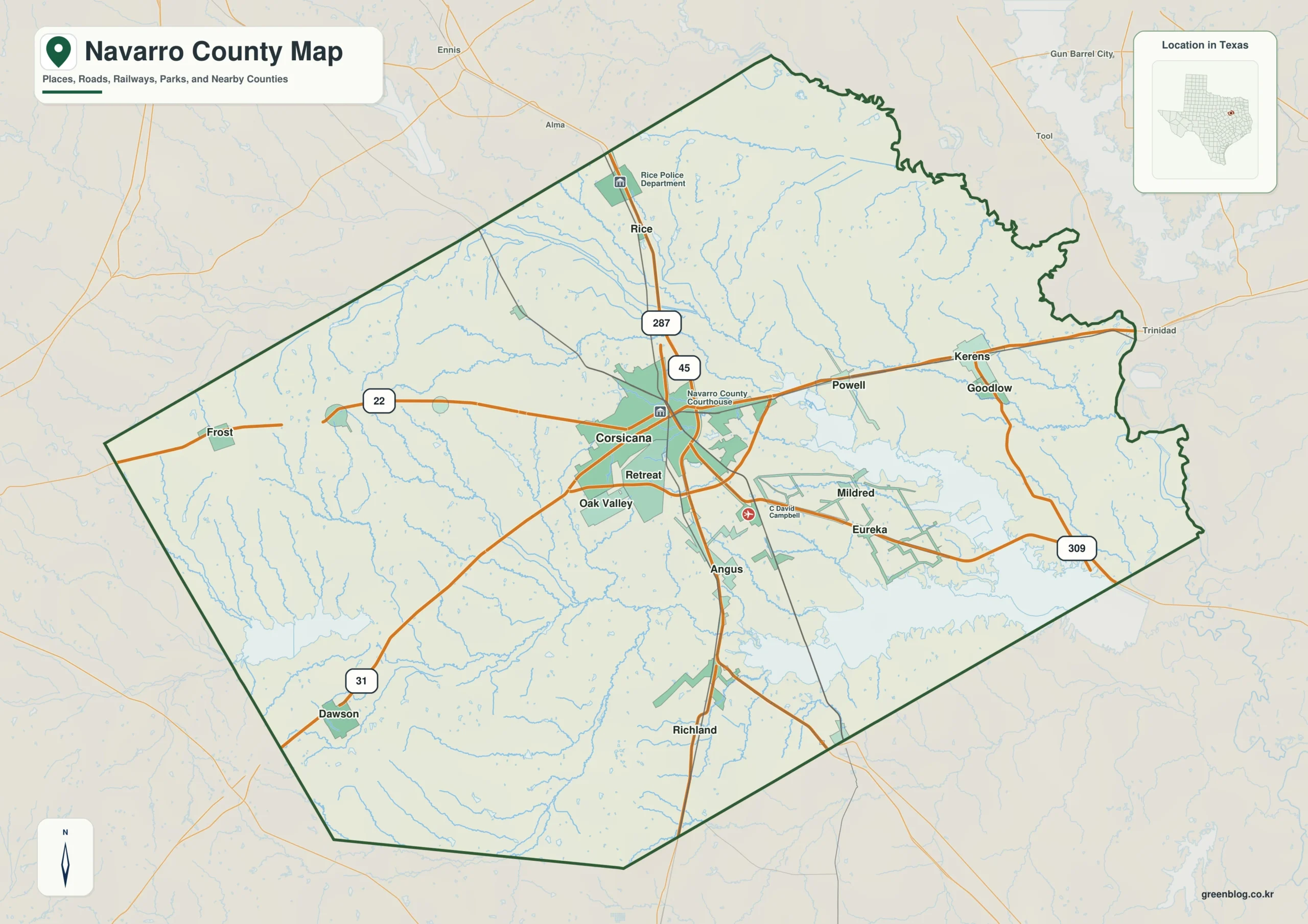
The Navarro County Texas map brings together a county shaped by a regional city, long transportation corridors, working farmland, and one of the largest reservoirs in this part of the state. Corsicana anchors the center, Interstate 45 runs through the county, and the landscape opens toward Richland-Chambers Reservoir in the east. The three map versions below support local orientation, printing, classroom work, and custom annotation.
Table of Contents
A county on the Dallas–Houston corridor
Navarro County lies south of the Dallas area along Interstate 45, the major highway linking Dallas and Houston. Corsicana, the county seat and largest city, serves as the main commercial and institutional center. U.S. Highways 75 and 287 add important north–south and cross-county connections, while smaller communities such as Rice, Blooming Grove, Frost, Dawson, and Kerens form distinct local centers beyond the city.
The county covers about 1,009.7 square miles of land. Its settlement pattern is spacious rather than metropolitan: incorporated towns, farms, ranchland, and lake-oriented development are separated by broad rural areas. This makes a county-scale map especially useful because a street map of Corsicana alone does not explain the relationships among the western farming towns, the I-45 corridor, and the reservoir country to the east.
Population change and regional reach
The U.S. Census Bureau estimated 56,533 residents in 2024, up from 52,861 in 2020. That increase of 3,672 people represents growth of about 6.9 percent over the period. The county remains much less urban than the core Dallas–Fort Worth counties, yet its highway access and position south of the metro area give it a growing regional connection.
Corsicana concentrates many public services, schools, medical facilities, and retail destinations used by residents from across the county. Rice is positioned closer to Ellis County and the Dallas approach, while Dawson and Frost serve the western and southwestern side. Kerens faces toward the lake region and eastern county line, creating a different orientation from communities tied more directly to Interstate 45.
Oil history, agriculture, and Corsicana identity
Navarro County was organized in 1846 and named for José Antonio Navarro, a Tejano statesman who supported Texas independence and participated in the Republic of Texas. Corsicana became the county seat during the county’s formation. The city later gained national recognition through the Corsicana oil field, one of the early commercial oil discoveries in Texas, which helped expand local industry and technical experience before the larger Spindletop era.
Agriculture has remained an important part of the county landscape, including cattle, hay, grain, and other field production. The result is a visual contrast between Corsicana’s urban grid, smaller town centers, and large rural tracts. A map that keeps town labels and boundaries together is useful for interpreting school districts, service areas, agricultural reports, and countywide travel.
Water shapes the eastern edge
Navarro County contains about 76.3 square miles of water, roughly 7.0 percent of its combined land-and-water area. Much of that presence is associated with Richland-Chambers Reservoir, which extends across the eastern part of the county and into Freestone County. Richland Creek and Chambers Creek are part of the drainage system connected with the reservoir.
The lake supports regional water supply and also draws boating, fishing, shoreline housing, and recreation. Its broad arms make the eastern side of the county look more irregular than the land boundaries toward Hill and Ellis counties. That difference is important when comparing property, emergency-planning, tourism, or environmental information across the county.
Color Map for county and lake orientation
The color version separates Navarro County from Ellis, Henderson, Freestone, Limestone, and Hill counties, so the surrounding frame is easy to read. Kerens and Corsicana provide two useful anchors across the eastern and central parts of the county, while Blooming Grove marks the western side. Richland-Chambers Reservoir stands out as a large water feature rather than blending into the county fill, helping readers understand why the eastern boundary has a different shape from the north and west.

Black-and-White Map for documents
This version removes the area colors but retains county lines, place labels, and water outlines. Frost and Dawson remain readable on the western side, with Corsicana positioned as the central reference point. The simplified treatment works well in reports, photocopies, and worksheets where users may need to circle towns or trace travel routes.

Outline Map for custom projects
The outline file strips away the fill colors and printed place names, leaving the county and neighboring boundary framework. Users can add Corsicana and Rice, sketch the Interstate 45 corridor, or draw the shoreline of Richland-Chambers Reservoir for a focused exercise. Kerens, Frost, and local connections can also be plotted to build a transportation, history, or service-area map from a clean base.

Download details
- Coverage: Navarro County and adjacent county context
- Included views: color, black-and-white, and outline
- Named places: Corsicana, Kerens, Frost, Blooming Grove, Dawson, and Rice
- Major water feature: Richland-Chambers Reservoir
- Suggested uses: county reports, classroom materials, local planning, and print reference
Navarro County map download
The download set keeps the three visual treatments together so readers can select a finished reference or a blank working base. Use the Navarro County Texas map for countywide place orientation, reservoir context, document design, or hand-labeled projects.
Frequently Asked Questions
Why is Corsicana important on a county map?
Corsicana is both the county seat and the largest city. It is the primary reference point for county government, services, highway access, and travel to the smaller communities.
How much of Navarro County is water?
The official 2024 Gazetteer figures list about 76.3 square miles of water, or approximately 7.0 percent of the county’s total land-and-water area. Richland-Chambers Reservoir accounts for much of the visible water area.
Which map is best for black-and-white printing?
The monochrome version is designed for standard printing because it keeps labels and boundaries without relying on fill colors. The outline version is better when users need a completely blank base for their own labels.
Sources and further reading
| Source | Use in this page |
|---|---|
| U.S. Census Bureau 2024 National Counties Gazetteer | Land area, water area, and representative location |
| U.S. Census Bureau Vintage 2024 Estimates | Population and recent change |
| Navarro County government | County administration and local context |
| Texas State Historical Association | County formation, namesake, and historical background |
Related Maps
- Yoakum County Texas map|Plains, Denver City, and the Permian Basin
- Sabine County Texas map|Hemphill, Toledo Bend Shoreline, and Pine Forest Communities
- Ochiltree County Texas map|Perryton, High Plains farming, and the Oklahoma line
- Shelby County Texas map|Center, Sabine River, and the East Texas Borderlands
- Terrell County Texas map|Sanderson, Dryden, Border Canyons, and Desert Rail History
Green Map creates custom-edited map images using open geographic data sources such as geoBoundaries, Natural Earth, OpenStreetMap, and government open data.
These maps are edited visual materials, not raw data files, and are provided for education, documents, presentations, and graphic reference.