A Keelung City map is useful when you need more than a simple location marker for northern Taiwan. Keelung sits on the island’s northeastern coast, opening toward the sea while New Taipei City surrounds it on the east, south, and west. The city is compact, but its boundaries are visually distinctive because steep hills, narrow valleys, and the deeply indented Keelung Harbor divide the urban area into several closely connected districts.
This printable collection includes color, black and white, and outline versions. The files are designed for A3 printing and can be used in classroom handouts, presentation slides, regional comparison materials, blog graphics, and infographic projects. The labeled versions help readers identify all seven districts, while the blank outline version gives designers and students a clean base for adding statistics, routes, symbols, or custom color groups.
Keelung covers about 132.76 square kilometers and has a population of roughly 360,000. Much of the city is hilly, so development is concentrated around the harbor, coastal corridors, and narrow inland valleys. The collection also includes Keelung Islet, which lies north of the main city and belongs administratively to Zhongzheng District.
More distant offshore islands—Pengjia Islet, Mianhua Islet, and Huaping Islet—are not included. Leaving them outside the main layout keeps the seven mainland districts large enough for readable labels and clear boundary lines. The Keelung City map therefore focuses on the city area most readers need for district comparison, printing, and visual projects.
Table of Contents
Keelung City Map Overview
Keelung is divided into seven districts:
- Zhongzheng District|中正區
- Xinyi District|信義區
- Ren’ai District|仁愛區
- Zhongshan District|中山區
- Anle District|安樂區
- Nuannuan District|暖暖區
- Qidu District|七堵區
Qidu District covers the largest area and extends across the southwestern part of the city. Ren’ai District is much smaller and occupies part of the central harbor area. Zhongzheng and Zhongshan sit on opposite sides of the port, while Xinyi and Ren’ai form part of the compact urban core. Nuannuan and Anle connect the center with the broader inland and western edges of Keelung.
The Keelung City map makes these differences easier to compare than a text-only district list. The harbor creates a clear east-west division, while the larger outer districts contrast sharply with the smaller administrative areas clustered around the city center.
A Harbor City Surrounded by Hills
Keelung is open to the sea in the north but enclosed by mountainous terrain in the other directions. This physical setting shapes the way the districts meet. Zhongzheng follows the eastern side of the harbor and includes both Heping Island and Keelung Islet. Zhongshan occupies the western side, while Ren’ai and Xinyi sit farther inland around the dense central area.
New Taipei City borders Keelung on nearly every landward side. Ruifang lies to the east, while other New Taipei districts connect with Qidu, Nuannuan, and Anle in the south and west. Because of this arrangement, a Keelung City map also works well as a reference when explaining how the port city fits into the wider Taipei metropolitan region.
The map does not include roads, railway lines, or tourist attractions. Its purpose is to show district names, internal boundaries, coastline, and the overall shape of the city without unrelated visual detail.
Color Map for District Comparison
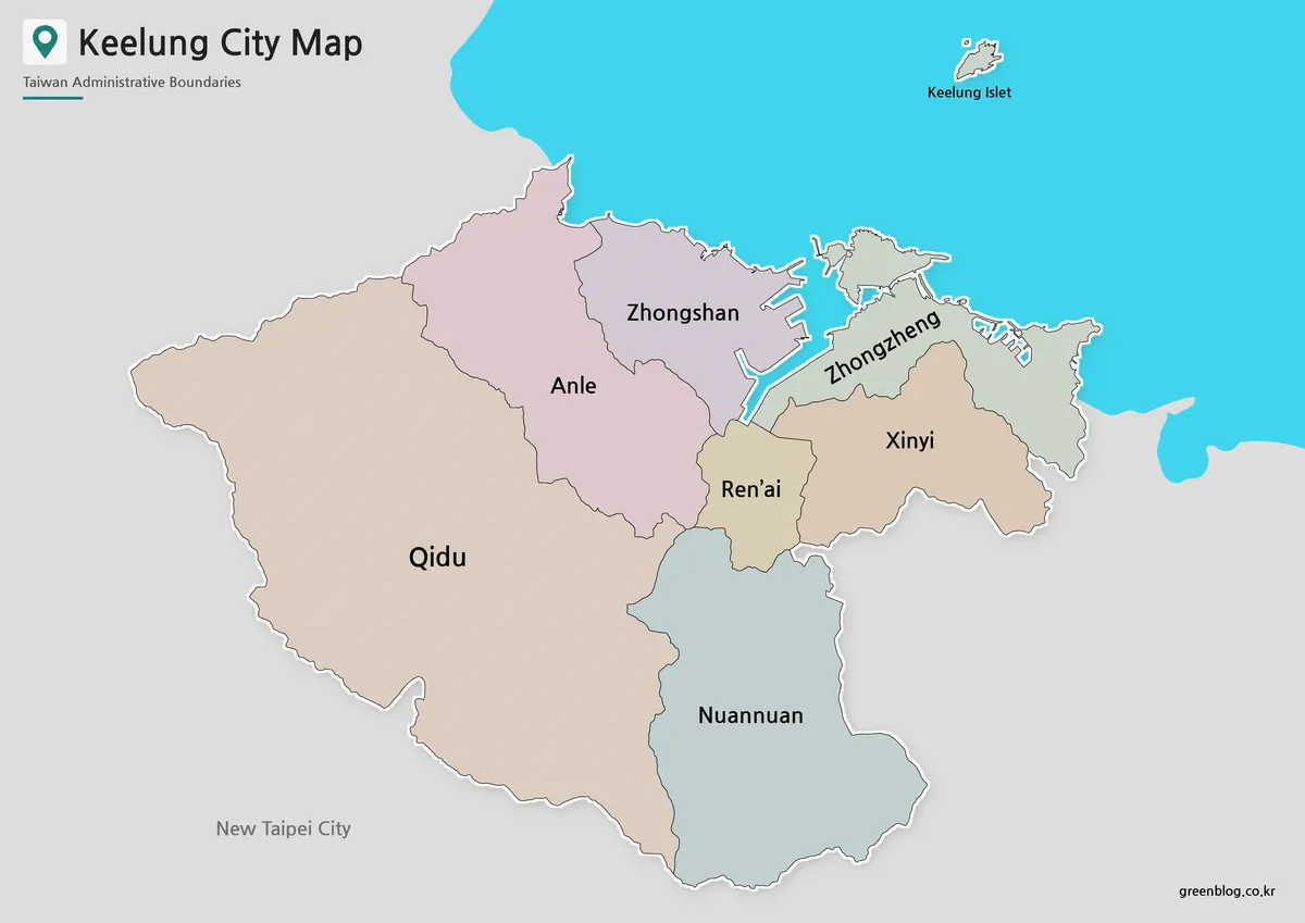
The color version separates the seven districts without adding unrelated transportation or tourism information. This makes the contrast between the compact harbor districts and the much larger Qidu area immediately visible. Color is especially helpful around Ren’ai, Xinyi, Zhongzheng, and Zhongshan, where several boundaries meet within a relatively small urban space.
For presentations about northern Taiwan, the Keelung City map provides a clear way to show how the harbor sits between the eastern and western districts. It also works well in blog graphics or regional comparison slides where each administrative area needs to be identified quickly.
The offshore outline of Keelung Islet appears north of the mainland. Because it belongs to Zhongzheng District rather than forming a separate district, it should not be interpreted as an eighth administrative area.
Black and White Map for Printing
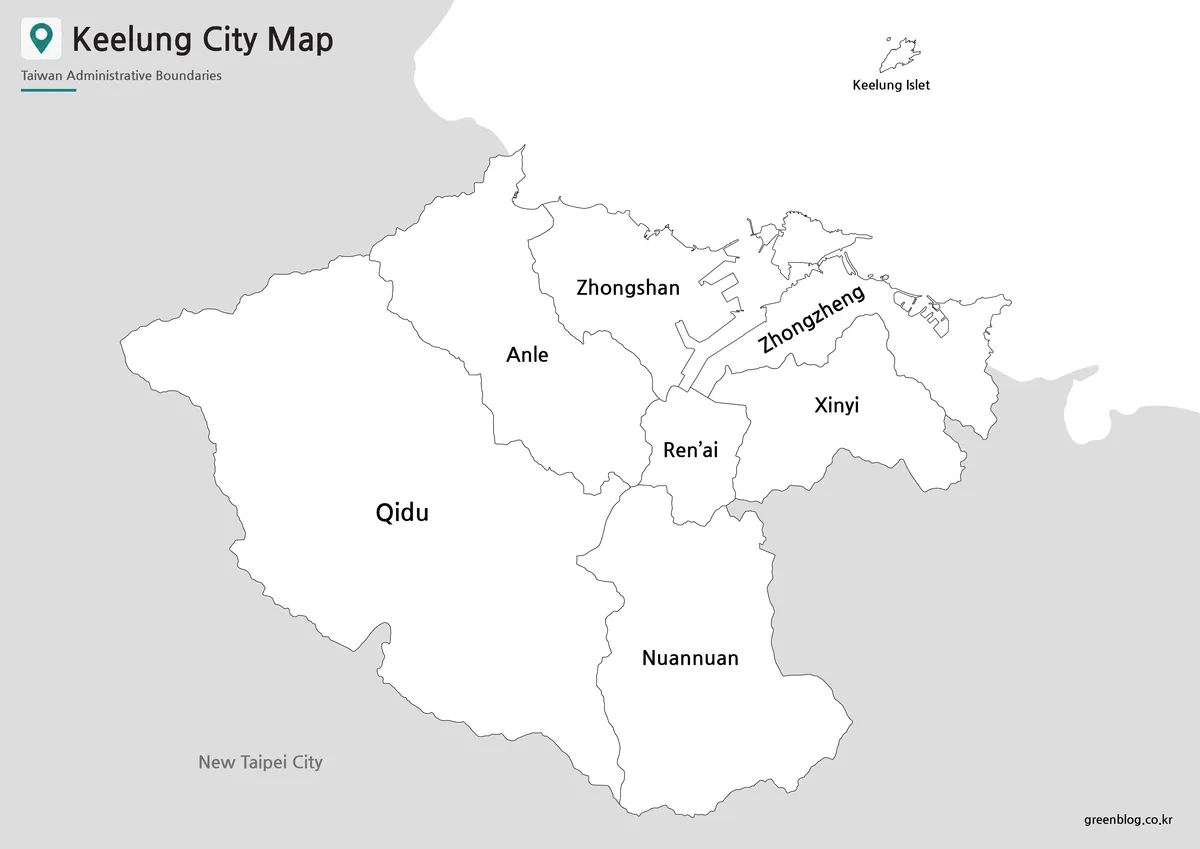
The black and white version focuses on district names, coastline, and boundary lines. Its cleaner appearance works well for classroom worksheets, printed reports, and assignment materials where readers may need to write notes directly on the page.
Because Keelung has several small districts around the harbor, label spacing matters more than decorative detail. The simplified layout keeps the central names readable while preserving the wider shapes of Qidu, Anle, and Nuannuan. The Keelung City map was also reviewed at A3 size so that the harbor-side districts remain clear when printed.
Teachers can use this version for district identification exercises or regional comparison worksheets. It also fits neatly into documents where color printing is unnecessary or where students need open space for handwritten information.
Blank Outline Map for Custom Projects
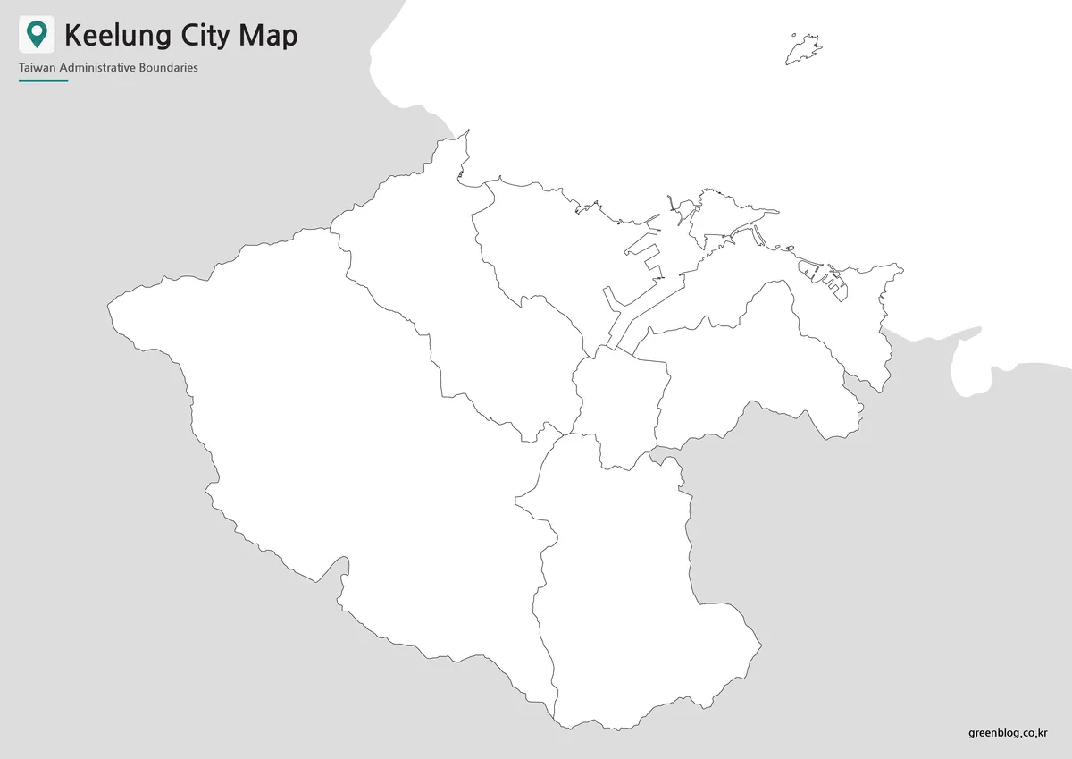
The outline version removes district colors and labels, leaving the city boundary, internal district lines, coastline, and Keelung Islet. This creates a flexible base for users who want to build their own map rather than begin with a finished visual design.
Teachers can turn the outline into a district-labeling worksheet or coloring activity. Designers can add population data, port-related information, local travel routes, presentation highlights, or infographic symbols. On this Keelung City map, Keelung Islet appears as an offshore feature of Zhongzheng District rather than an additional administrative division.
The outline version is also useful when comparing the harbor area with the larger southwestern districts. Users can apply their own color groups, mark neighboring New Taipei City areas, or create a simplified diagram showing how Keelung Harbor divides the urban center.
Which Version Should You Choose?
Use the color map when the main goal is quick district comparison. Choose the black and white version for printed reference sheets, classroom work, or documents where readers need space for notes. The outline map is the best starting point for custom graphics, regional statistics, coloring activities, and presentation overlays.
All three versions focus on administrative structure rather than tourism or transportation. They are most useful when readers need to understand the shape of Keelung, the arrangement of its seven districts, and the city’s relationship with New Taipei City.
A color version usually works best for slides and blog graphics. The cleaner black and white layout is better suited to printed assignments, while the blank map offers the most flexibility for editing and annotation.
Frequently Asked Questions
How many districts are shown on the Keelung City map?
The map includes all seven districts: Zhongzheng, Xinyi, Ren’ai, Zhongshan, Anle, Nuannuan, and Qidu.
Which district does Keelung Islet belong to?
Keelung Islet belongs to Zhongzheng District. It is shown as an offshore island, not as a separate administrative district.
Why are the more distant islands excluded?
Pengjia Islet, Mianhua Islet, and Huaping Islet are much farther from the main city. Including them at the same scale would make the mainland districts too small for clear labels and boundary reading.
Is this a road or tourism map?
No. The collection focuses on district boundaries, names, coastline, and the overall city shape. Roads, transit lines, and individual attractions are not included.
Can the maps be printed at A3 size?
Yes. The collection is prepared around an A3 layout, making it suitable for classroom sheets, presentation boards, and printed reference materials.
Map File Information
This download includes printable Keelung City map versions for educational use, presentation design, document printing, and editable graphic projects.
- Included Versions: Color map, black and white map, outline map
- Printable Size: A3 layout
- File Type: Image files
- Map Coverage: Seven Keelung districts and Keelung Islet
- Intended Use: Classroom handouts, presentations, blog graphics, infographic editing, and printable reference materials
Related Maps
Additional Resources
- Taiwan MAP Service : An official mapping service operated by Taiwan’s National Land Surveying and Mapping Center, useful for examining Keelung, New Taipei City, local place names, and surrounding terrain in greater detail.
Green Map creates custom-edited map images using open geographic data sources such as geoBoundaries, Natural Earth, OpenStreetMap, and government open data.
These maps are edited visual materials, not raw data files, and are provided for education, documents, presentations, and graphic reference.