The Saudi Arabia map in this collection was prepared for users who need more than a simple country location image. Saudi Arabia covers a large part of the Arabian Peninsula, with the Red Sea on the west, the Persian Gulf on the east, and borders connecting it with Jordan, Iraq, Kuwait, Qatar, the United Arab Emirates, Oman, and Yemen. Because the country is wide and its regional divisions vary greatly in size, a labeled and printable map is useful for understanding how the country is organized.
This printable Saudi Arabia map collection includes three map styles: a color regional map, a black and white map, and a blank outline map. The files are designed for A3 printing and general image-based use, making them suitable for classroom handouts, presentation slides, blog graphics, infographic layouts, and editable graphic projects. The color version helps separate Saudi Arabia’s administrative regions visually, while the black and white version works well in printed documents. The outline version is useful when users want to add their own labels, colors, data points, travel routes, or visual highlights.
Saudi Arabia is especially useful to show on a regional map because its geography is not evenly distributed. Riyadh Province sits in the central part of the country, the Eastern Province stretches toward the Gulf coast, and the western regions connect major cities such as Makkah and Al Madinah with the Red Sea side. In the north, regions such as Tabuk, Al Jawf, and Northern Borders cover broad areas, while smaller regions in the southwest need careful line and label placement to remain readable.
While preparing this map set, the main challenge was balancing the very large regions with the smaller southwestern and western areas. If the colors are too similar, smaller regions can disappear visually. If the lines are too heavy, the wider regions become visually crowded. The layout was adjusted so the map remains useful as a visual reference, not just as a decorative country shape.
Table of Contents
Included Map Versions
This Saudi Arabia map set includes three practical versions for different kinds of work. Each version is designed around a different use case, so users can choose the map that fits their project rather than editing one image repeatedly.
The color map is best for visual explanation. It works well when showing Saudi Arabia’s regional structure in a presentation, classroom lesson, article, or comparison graphic. The black and white map is better for printed documents, worksheets, and reports where simple line clarity matters more than color. The blank outline map gives users a cleaner base for editing, coloring, or adding their own information.
Color Saudi Arabia Regional Map
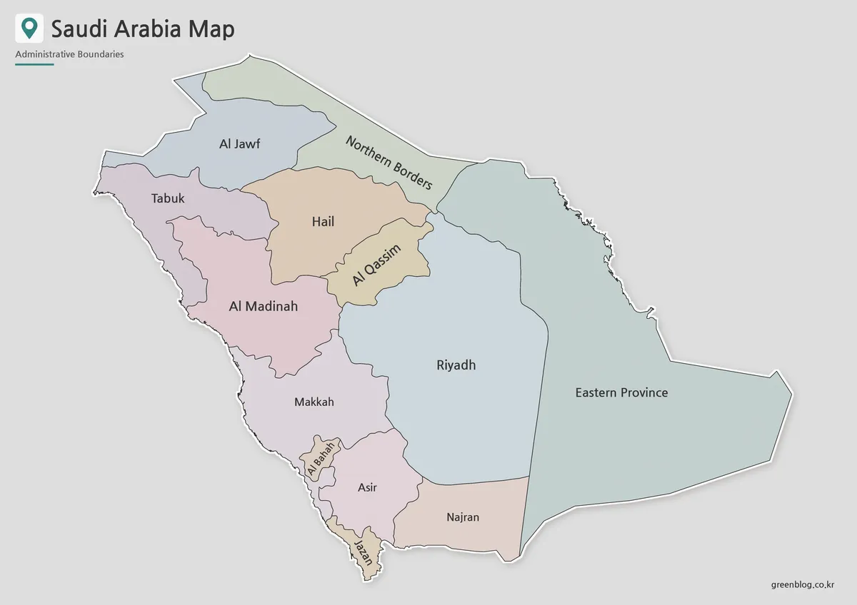
The color version is designed to make Saudi Arabia’s regional divisions easier to compare at a glance. This is helpful because the country includes very large administrative areas, such as Riyadh and Eastern Province, alongside smaller regions such as Al Bahah and Jazan. Color separation makes these differences easier to explain in a visual setting.
For classroom use, the color map can support lessons about the Arabian Peninsula, Middle East geography, Red Sea and Gulf coast locations, or regional comparison. It also works well in blog posts and presentation slides because viewers can quickly identify how the country is divided without reading a long explanation.
Extra attention was given to color balance between neighboring regions. When a large area sits beside a smaller one, weak color contrast can make the smaller region harder to notice. The final layout keeps the map readable while avoiding a heavy or overly bright appearance.
Black and White Saudi Arabia Map
For printed materials, the black and white Saudi Arabia map provides a cleaner layout. Without regional colors, the boundary lines and labels become the main focus. This makes the map easier to place inside worksheets, reports, classroom packets, and simple presentation handouts.
This version is also useful when printing in grayscale. A map with strong color blocks may not always print clearly on a standard office printer, especially when copied or resized. The black and white version keeps the structure simple, so the regional layout remains visible even when the image is placed inside a document.
Because Saudi Arabia covers such a wide area, label placement is important. The design was checked with print use in mind so that the regional names remain readable when enlarged for A3 output or reduced for document insertion.
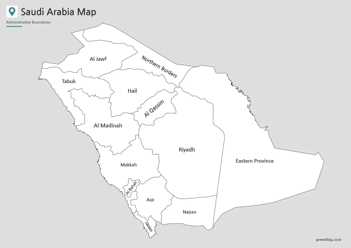
Blank Saudi Arabia Outline Map
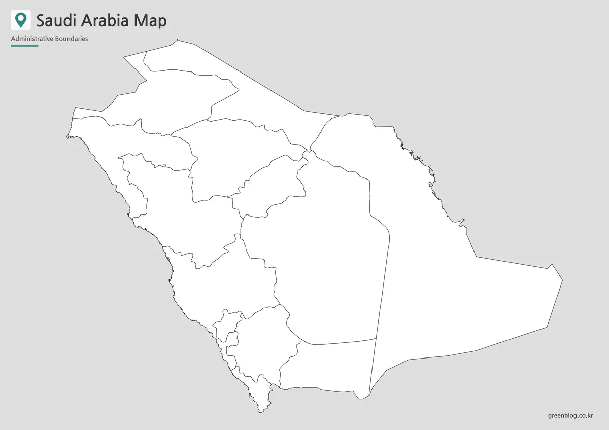
The outline version works as a base map for editing. It removes color and extra visual weight, leaving the regional boundaries available for custom use. This makes it helpful for teachers, students, bloggers, and designers who need to add their own information.
Users can mark major cities, highlight Riyadh Province, compare coastal and inland regions, show routes across the country, or add data such as population, resources, climate zones, or travel notes. For infographic projects, the blank layout gives more control because colors, icons, labels, and annotations can be added without fighting against an already finished design.
The outline map is also useful for classroom activities. Students can color each region, label the administrative divisions, or compare Saudi Arabia with neighboring countries in the Middle East. For design work, it can serve as a simple background layer for custom graphics.
Practical Uses for This Saudi Arabia Map
A printable Saudi Arabia map is useful in many situations where a plain country silhouette is not enough. Teachers can use it for geography lessons, regional identification exercises, and Middle East map worksheets. Students can include it in reports about the Arabian Peninsula, neighboring countries, or regional geography.
For presentation creators, the map can help explain the relationship between Riyadh, Makkah, Al Madinah, the Red Sea coast, and the Gulf side of the country. Bloggers and infographic designers can use the map as a visual reference when writing about Middle East geography, travel routes, regional comparisons, or educational topics.
The three-version structure also reduces extra editing work. A user who needs a finished visual can choose the color map. Someone preparing a printed worksheet can use the black and white version. A designer who wants to add custom information can start with the outline version.
Frequently Asked Questions
What is included in this Saudi Arabia map collection?
The collection includes a color map, a black and white map, and an outline map of Saudi Arabia. Each version is intended for a different use, including printing, classroom reference, presentation design, and graphic editing.
Can I print the Saudi Arabia map in A3 size?
Yes. The map set is prepared for A3 layout printing, making it suitable for classroom posters, large handouts, presentation boards, and reference sheets.
Which version is best for editing?
The outline map is the best choice for editing. It provides the regional boundary layout without color, so users can add labels, highlights, icons, routes, or data overlays.
Is the black and white map useful for worksheets?
Yes. The black and white version is useful for classroom worksheets, printed assignments, document inserts, and simple reference materials where color is not needed.
Does the map include Saudi Arabia’s regional divisions?
Yes. The map is based on Saudi Arabia’s 13 administrative regions, including Riyadh, Makkah, Al Madinah, Eastern Province, Tabuk, Al Jawf, and other regional divisions.
Map File Information
This download includes printable Saudi Arabia map versions for educational use, presentation design, document printing, and editable graphic projects.
- Included Versions: Color map, black and white map, outline map
- Printable Size: A3 layout
- File Type: Image files
- Intended Use: Classroom handouts, presentations, blog graphics, infographic editing, and printable reference materials
Additional Resources
- Geographic Information Systems|National Platform : A useful reference for exploring official geographic and map-related information for Saudi Arabia.
Related Maps
- Bhutan Map in High Resolution for Presentations and Worksheets
- Turkmenistan Map with Caspian Sea and Neighboring Countries
- Printable Sri Lanka Map Collection – Labeled, Blank, and Outline Versions
- Myanmar Map – Printable Color, Black and White & Outline Map
Green Map creates custom-edited map images using open geographic data sources such as geoBoundaries, Natural Earth, OpenStreetMap, and government open data.
These maps are edited visual materials, not raw data files, and are provided for education, documents, presentations, and graphic reference.