A Korean version of this map page is available. View Korean Page
Finding a clear Iraq map can be surprisingly difficult when preparing educational materials, presentations, blog graphics, or infographic projects. Many online maps include excessive detail, while others are too small for printing or editing. This Iraq map collection was created to provide a cleaner alternative focused on readability and practical use.
Located in Western Asia, Iraq shares borders with Iran, Turkey, Syria, Saudi Arabia, Jordan, and Kuwait. Because of its position in the Middle East, Iraq frequently appears in geography lessons, historical studies, international affairs presentations, and regional comparison projects. A well-organized map often makes these topics easier to understand than text alone.
This printable Iraq map collection includes color, black and white, and outline versions prepared for educational and design purposes. The files were designed around A3 printing standards and can be used for classroom handouts, presentation slides, visual reference materials, and graphic editing projects.
During the map preparation process, special attention was given to administrative boundaries and overall readability. Labels were arranged to remain clear when enlarged, and regional divisions were reviewed to ensure they remain easy to distinguish in both digital and printed formats.
Whether you are creating a report, building educational content, preparing travel-related materials, or designing infographics, the included map versions provide multiple options depending on the type of project.
Table of Contents
Map Collection Overview
Included in this Iraq map set:
- Color administrative map
- Black and white printable map
- Blank outline map
- High-resolution A3 format
- Baghdad capital marker
- Neighboring country labels
- English and Korean regional labeling
The collection was designed to balance visual clarity with practical usability. Whether you need an Iraq map for classroom reference, presentation slides, or infographic design, the included versions provide flexible options.
Regional Color Map
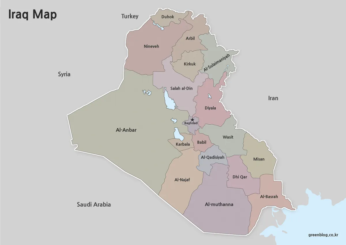
The color version highlights Iraq’s administrative divisions using contrasting regional colors. This layout makes it easier to identify governorate boundaries and compare regional locations at a glance.
Baghdad is marked separately to improve orientation, while surrounding countries are included to provide additional geographic context. The visual contrast helps users quickly understand how different parts of Iraq are arranged.
Designed for:
- Blog graphics
- Educational presentations
- Regional comparison projects
- Geography lessons
- Country overview materials
The color-coded structure works particularly well when explaining Iraq’s regional organization in a visual format.
Black and White Printable Version
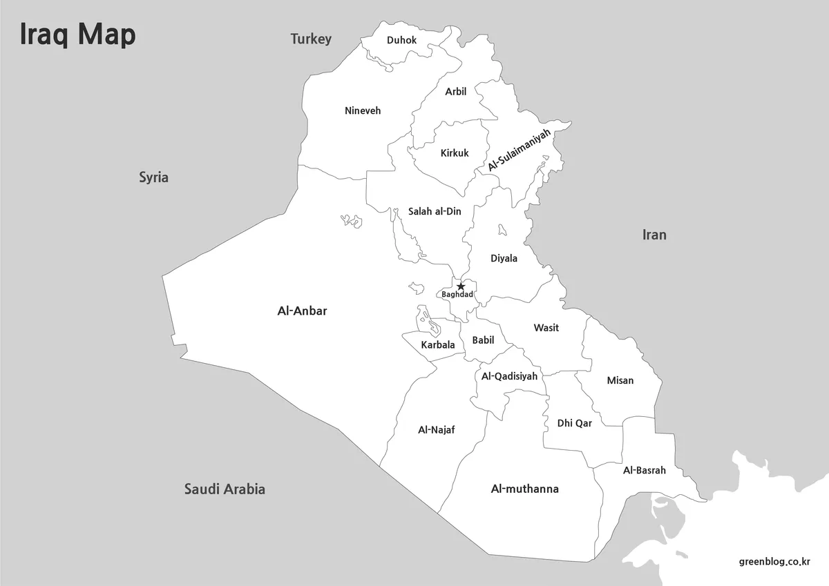
Some projects require a simpler layout without colored regions. The black and white version focuses on clear boundaries and readable labels while maintaining the overall structure of the map.
This format works especially well for:
- Classroom worksheets
- Printed handouts
- Study materials
- Report illustrations
- Annotation exercises
The simplified design also allows users to add their own color schemes or notes after printing.
While reviewing the map files, readability was checked specifically for large-format printing to ensure boundary lines remain visible without unnecessary visual clutter.
Blank Outline Map for Editing
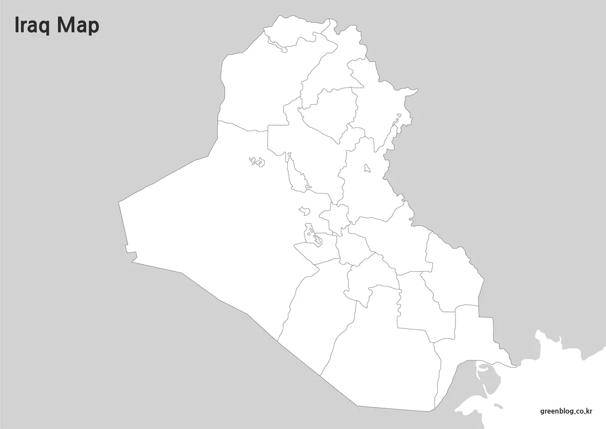
The outline version removes color fills and most visual distractions, leaving only the core boundary structure.
This style is often preferred by:
- Graphic designers
- Teachers
- Researchers
- Content creators
- Presentation designers
Because the map contains only the essential outline framework, it can easily be customized with labels, symbols, thematic coloring, routes, or highlighted regions.
Extra attention was given to boundary continuity during preparation so that editing work can be completed more smoothly inside Illustrator, Photoshop, or similar design software.
Designed for Printing and Presentation Use
A large-format country such as Iraq benefits from a map layout that remains readable when enlarged.
Common uses include:
- Geography classroom activities
- Middle East regional studies
- Historical event references
- Presentation slides
- Educational posters
- Infographic design
- Blog illustrations
- Research materials
The combination of labeled, printable, and editable versions allows users to choose the format that best matches their project.
FAQ
What map versions are included?
The collection includes color, black and white, and outline versions.
Can the maps be printed in A3 size?
Yes. The files were prepared with A3 printing in mind and remain readable when enlarged.
Is Baghdad marked on the map?
Yes. Baghdad is highlighted separately for easier identification.
When should I use the outline version?
The outline map works best for editing, annotations, educational exercises, and infographic creation.
Iraq Map Download
The Iraq map files are available through the link below. Choose the version you need, including the color map, black and white map, or outline map, and save it for your project.
- File Format: JPG / PNG / ZIP
- Usage: Printing · Education · Presentation · Editing
- Size: High-Resolution A3 Format
The files are provided in ZIP format. After downloading, extract the archive to access all map versions.
Related Maps
- India Maps Download Collection (3 Maps for Regional Reference)
- 4 Japan Maps Download Collection for Print and Design
- China Maps Download Collection – 4 Regional Map Types
- Philippines Maps Collection Download (3 Printable Maps)
Additional Resources
- Britannica – Iraq: Overview of Iraq’s geography, regions, and location in the Middle East.
Green Map creates custom-edited map images using open geographic data sources such as geoBoundaries, Natural Earth, OpenStreetMap, and government open data.
These maps are edited visual materials, not raw data files, and are provided for education, documents, presentations, and graphic reference.