A Bahrain map can be useful in more situations than many people expect. Because Bahrain is a relatively small island nation, it is often included in classroom geography materials, Middle East regional studies, travel presentations, blog graphics, and infographic projects. Understanding the country’s administrative structure is easier when regional boundaries are clearly displayed on a map rather than explained through text alone.
Located in the Persian Gulf, Bahrain consists of a group of islands connected by modern transportation infrastructure. The country is centered around the capital city of Manama and is linked to Saudi Arabia through the King Fahd Causeway. Despite its modest size, Bahrain plays an important role in the Gulf region, making it a common reference point in educational and regional comparison materials.
This printable Bahrain map collection includes three versions: a color administrative map, a black and white labeled map, and a blank outline map. The files were prepared in JPG format and organized for printing, presentation slides, classroom handouts, blog graphics, and editing projects. Each version serves a different purpose, allowing users to select the format that best matches their needs.
During the map preparation process, particular attention was given to administrative boundaries and label readability. Since Bahrain’s regions are concentrated within a relatively compact area, boundary lines and text placement were reviewed carefully to remain readable when enlarged or printed.
Table of Contents
What Is Included in the Bahrain Map Collection?
The collection contains three different map styles designed for separate use cases:
- Color administrative map
- Black and white labeled map
- Blank outline map
Together, these versions cover most common needs, from educational printing to custom graphic editing.
Easy-to-Read Administrative Color Map
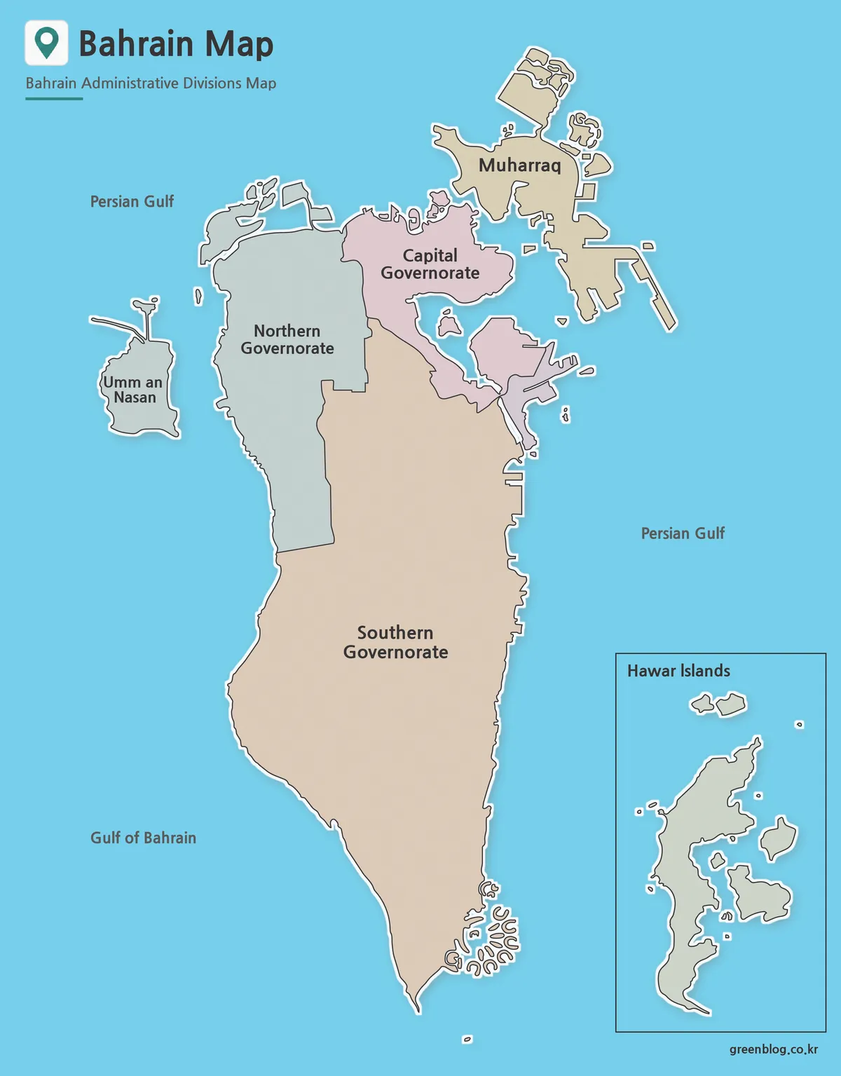
The color Bahrain map was designed to make Bahrain’s administrative divisions easier to distinguish at a glance.
Neighboring regions are separated using contrasting colors to improve visual clarity. This format works particularly well for presentations, educational materials, regional comparison projects, and country overview graphics. The color layout helps viewers understand the overall administrative structure without requiring extensive explanations.
Extra adjustments were made to ensure that regional boundaries remain visible both on screen and in printed copies.
Black and White Version for Printing
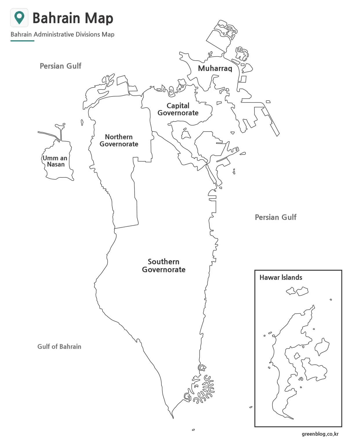
Many users prefer a simplified Bahrain map when creating worksheets, reports, or classroom materials. The black and white version focuses on labels and boundaries while removing the distraction of color.
This layout works well for printed handouts, study resources, note-taking activities, and presentation documents. Labels remain readable even when printed in grayscale, making it a practical option for schools and offices.
Readability was reviewed at larger print sizes to ensure that major regional names remain clear.
Blank Outline Map for Editing Projects
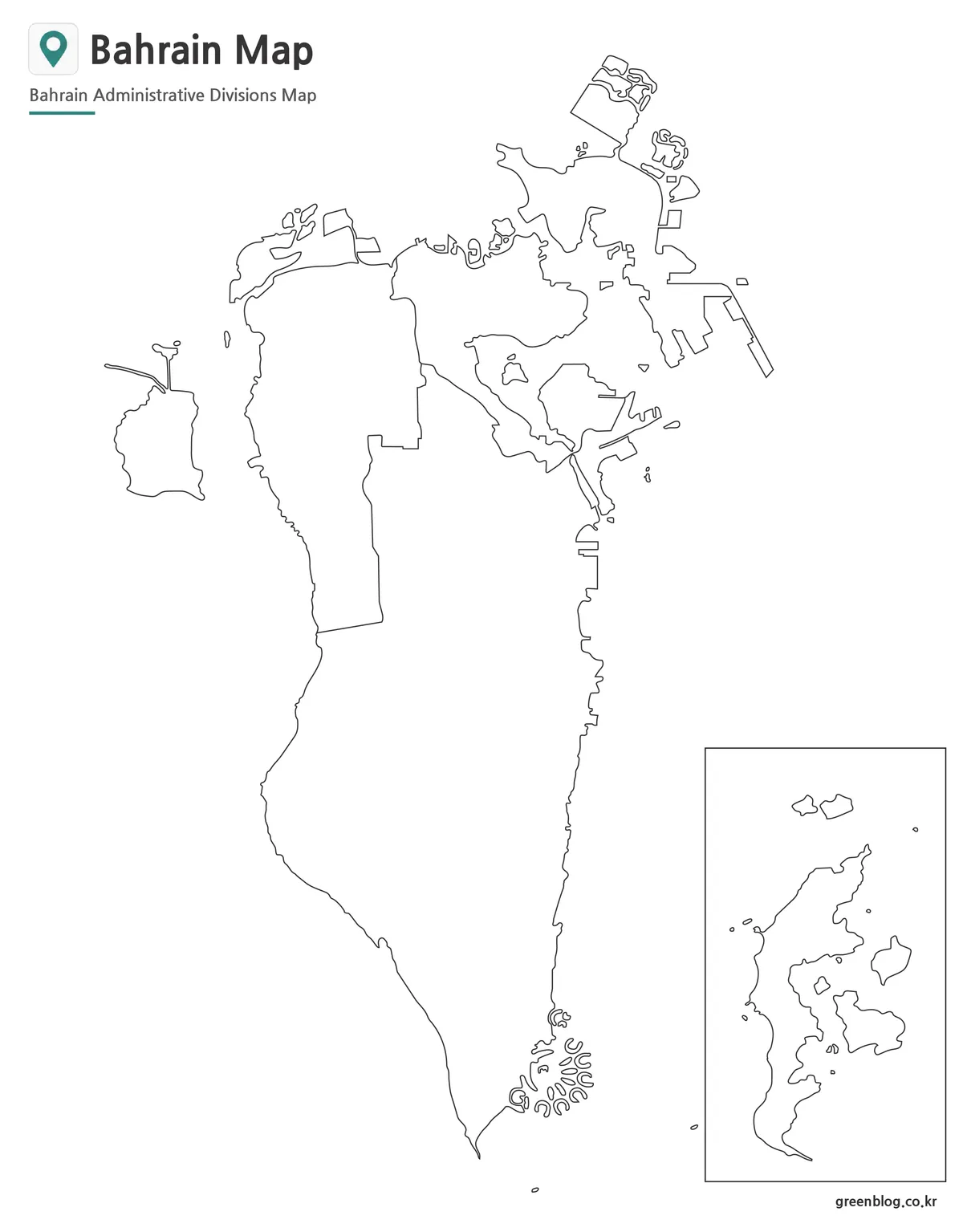
The outline version removes both labels and color fills, leaving only the regional boundary lines.
This format is often chosen for infographic design, educational exercises, custom travel planning graphics, and geographic annotation projects. Users can add their own colors, symbols, labels, or statistical information without modifying an existing design.
Because there are very few visual elements, the outline version is especially useful for graphic editors working in Photoshop, Illustrator, or presentation software.
Designed for Practical Use
Bahrain’s compact geography makes it an excellent subject for regional comparison maps and educational resources. A complete national view can fit comfortably on a single page, allowing users to understand the country’s administrative layout quickly.
The collection works well for:
- Printable reference materials
- Classroom geography lessons
- Travel presentations
- Educational worksheets
- Blog graphics
- Regional comparison projects
- Infographic design
- Presentation slides
Frequently Asked Questions
Can I print the Bahrain maps?
Yes. The maps were prepared with high-resolution printing in mind and work well for large-format output.
Which version is best for presentations?
The color administrative map is usually the easiest to read during presentations and educational talks.
Is the outline map editable?
Yes. The blank outline version is intended for editing, annotations, custom labels, and infographic projects.
Are regional boundaries included?
Yes. All versions include Bahrain’s administrative boundary structure, although labels vary by map type.
Bahrain Map Download
Choose the map version that fits your project. Color, black and white, and outline editions are included for printing, presentations, educational resources, and editing work.
- File Format: JPG
- Color Modes: Color Map / Black and White Map / Outline Map
- Intended Usage: Printing · Presentation · Education · Editing
Additional Resources
- Bahrain Open Data Portal – Official source for Bahrain geographic and administrative boundary information.
Related Maps
- Printable Kyrgyzstan Map Resource for Education, Travel, and Design
- Laos Map Download – High Resolution A3 Administrative Map Set
- Cambodia Map Resources – Color, Black and White, and Outline Editions
- Printable Iraq Map Download in A3 Size (Color, B&W, Outline)
Green Map creates custom-edited map images using open geographic data sources such as geoBoundaries, Natural Earth, OpenStreetMap, and government open data.
These maps are edited visual materials, not raw data files, and are provided for education, documents, presentations, and graphic reference.