A Chiayi City map is especially useful when comparing Chiayi City with the much larger Chiayi County that surrounds it. The two places share the same English name, but they are separate administrative areas. Chiayi City is an independent provincial city located inside the central part of Chiayi County, while the county includes a much wider collection of cities, townships, rural settlements, and mountain areas.
Chiayi City covers about 60 square kilometers and is divided into only two main districts: East District and West District. This makes the administrative layout simpler than that of many other Taiwanese cities, but it also creates a common mapping problem. Without a clearly labeled boundary map, readers may assume that the city is simply part of Chiayi County rather than a separate jurisdiction.
This Chiayi City map collection includes color, black and white, and outline versions prepared around an A3 layout. The files are prepared around an A3 layout and are intended for classroom handouts, presentation slides, regional comparison pages, blog graphics, printable reference sheets, and graphic editing projects. The color version helps readers distinguish the two districts immediately, while the cleaner basic map emphasizes names and boundary lines. The outline version works as a blank base for adding statistics, location markers, travel routes, or custom labels.
The city is surrounded by several Chiayi County municipalities. Minxiong Township lies to the north, Zhuqi Township to the northeast, and Fanlu Township along the eastern and southeastern side. Zhongpu Township borders the south, Shuishang Township lies to the southwest, and Taibao City is positioned to the west. Because Chiayi City is inland and enclosed by these neighboring areas, a map provides a much clearer explanation than a simple written location description.
Table of Contents
Chiayi City Map Overview
The Chiayi City map collection focuses on the city boundary and the division between its two districts.
| District | Chinese | Location |
|---|---|---|
| East District | 東區 | Eastern and central part of the city |
| West District | 西區 | Western urban area and outer western boundary |
East District includes the eastern side of the city and extends toward greener and more gently elevated areas. West District contains much of the flat urban area, including major commercial and transport-oriented parts of the city. Although the city has only two districts, their shape and orientation are noticeably different.
The boundary between them runs through the central urban area rather than forming a simple straight division. That makes a labeled map helpful for students, researchers, bloggers, and anyone preparing a regional comparison between Chiayi City and nearby parts of Chiayi County.
Color-Coded District Map
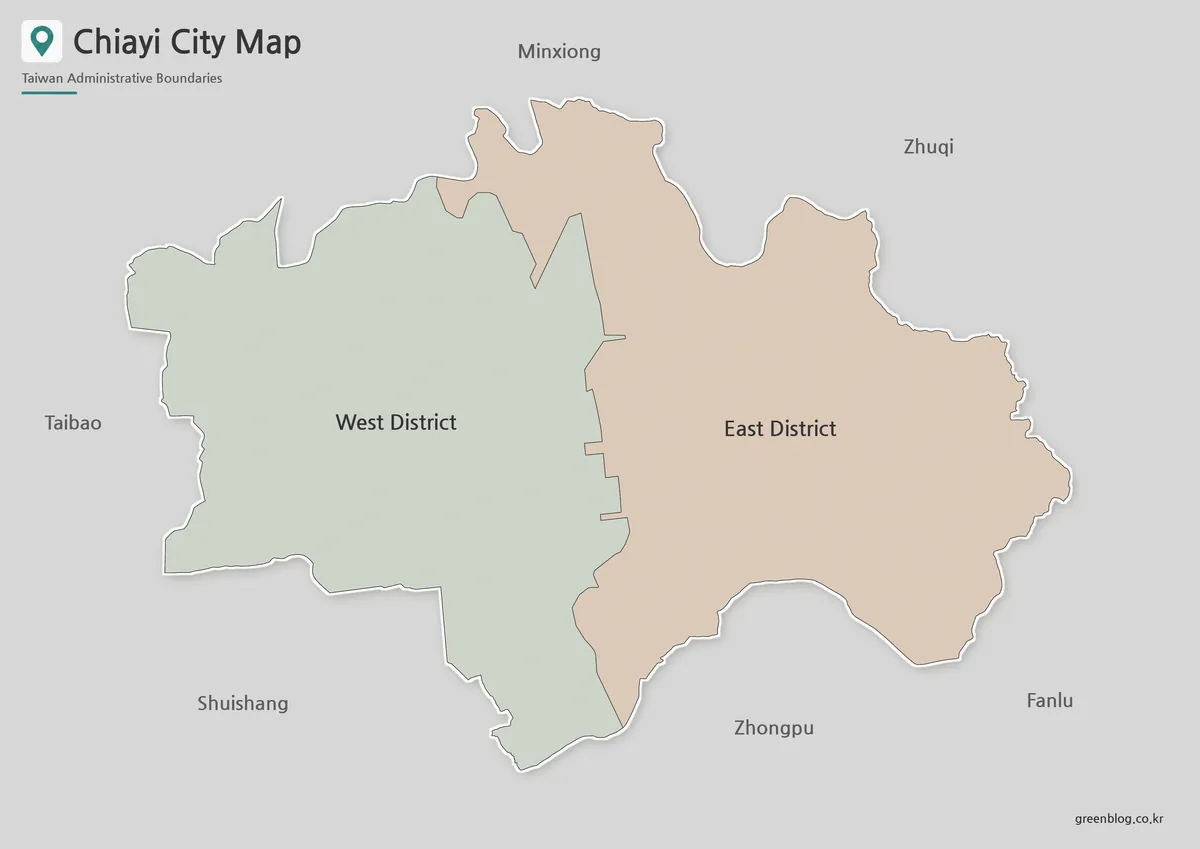
The color version of the Chiayi City map separates East District and West District with two distinct area fills. This works well because the city has a compact urban form and only one internal district boundary.
Color makes it easy to see that West District occupies most of the western side, while East District extends across the northeastern and southeastern portions of the city. The difference is immediately visible on presentation slides, classroom displays, and infographic layouts.
This version is particularly useful when Chiayi City appears alongside Chiayi County. A colored city map makes the independent municipal boundary easier to recognize among the surrounding townships and prevents the city from blending visually into the county.
For population charts, land-use comparisons, or district statistics, the two colors can also be matched with tables and labels. Since the district count is low, the map remains uncluttered even when displayed at a smaller size.
Black and White Printable Version
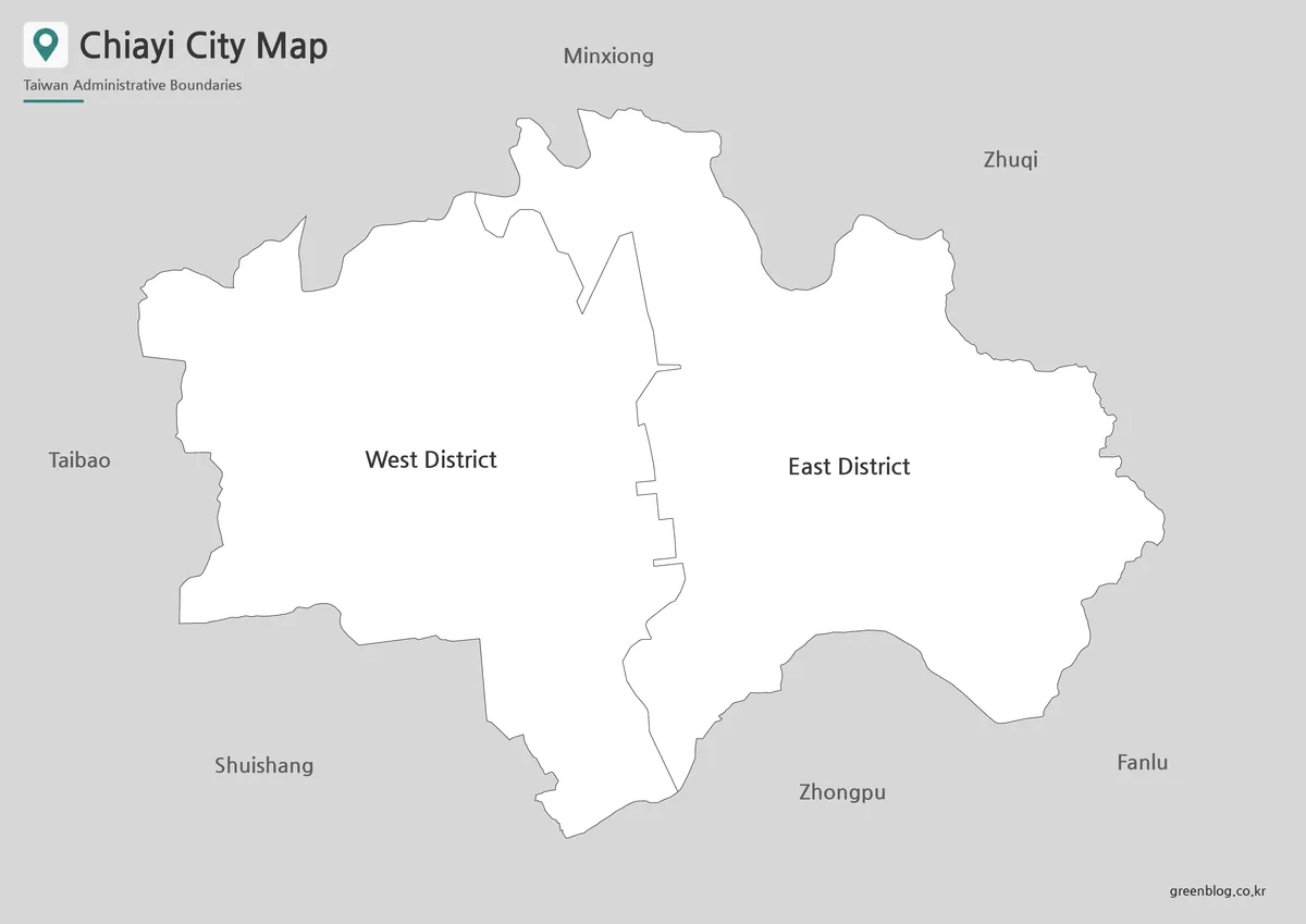
For worksheets, reports, and reference documents, the black and white version keeps attention on district names and boundary lines. The simplified presentation makes the map easier to place beside text, tables, or charts without competing with the rest of the page.
The Chiayi City map remains readable in grayscale because there are only two administrative units. Even without color fills, East District and West District can be identified from their labels, outer shape, and shared internal boundary.
This format is well suited to school assignments about Taiwan’s administrative divisions. It also fits printed regional guides where several city or county maps need to share a consistent visual style.
The layout was checked with A3 printing in mind, including the continuity of the outer boundary and the visibility of the internal district line. When reduced for document use, the cleaner design still preserves the main geographic structure.
Blank Outline Map for Editing
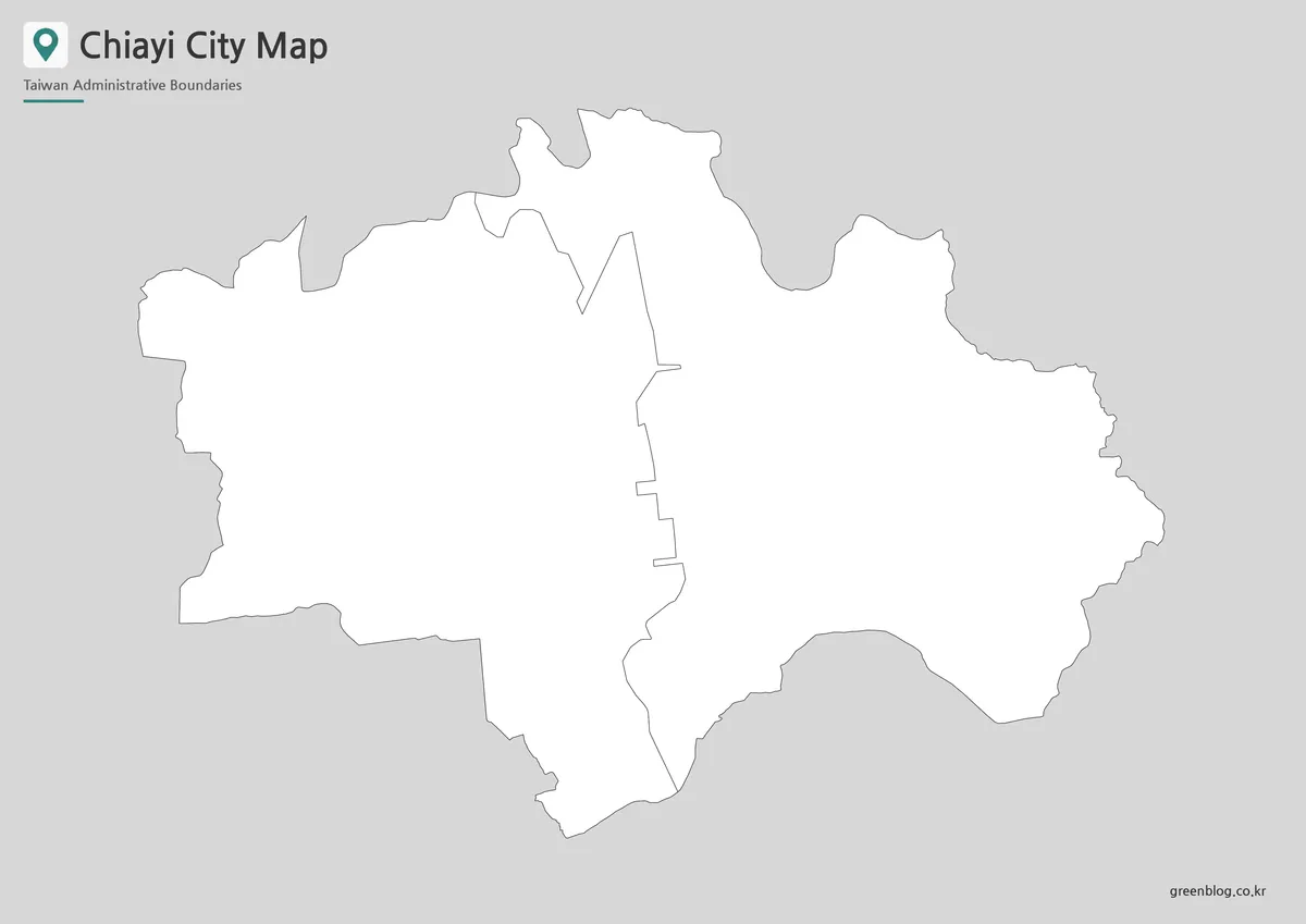
The outline version removes area fills and retains the city border together with the East–West district division. This creates a working base rather than a finished reference image.
Users can add district colors, population figures, transport routes, school locations, project labels, or presentation highlights. The blank Chiayi City map also works well for classroom coloring activities and simple administrative worksheets.
For infographic editing, the closed city outline can be filled as a single area, while the internal line continues to show the two-district structure. This is helpful when the city needs to be highlighted inside a wider Chiayi County or southwestern Taiwan graphic.
The lack of neighborhood-level boundaries keeps the page visually clean. Adding every local subdivision would create a dense network of lines and distract from the main purpose of comparing East District and West District.
Surrounding Administrative Areas
Chiayi City is fully enclosed by Chiayi County municipalities.
| Direction | Administrative Area |
|---|---|
| North | Minxiong Township |
| Northeast | Zhuqi Township |
| East and Southeast | Fanlu Township |
| South | Zhongpu Township |
| Southwest | Shuishang Township |
| West | Taibao City |
These neighboring areas help explain the city’s inland position. Minxiong forms much of the northern edge, while Zhuqi and Fanlu connect the city to the more elevated eastern side of Chiayi County. Zhongpu and Shuishang continue around the southern boundary, and Taibao City lies to the west.
This surrounding pattern is one reason a Chiayi City map is more useful than a standalone city name or point marker. The city is not on the coast and does not share a boundary with the Taiwan Strait. Reaching the western coastline requires crossing neighboring parts of Chiayi County.
Choosing the Right Map Style
Choose the color map when district separation needs to be understood quickly. It works best for presentations, online articles, statistical comparisons, and regional overview graphics.
The black and white map is the better option for printed reports, worksheets, and documents where labels and clean lines matter more than visual decoration. It can also be reproduced on office printers without losing the distinction between the two districts.
Use the outline version when the map will be edited. Teachers can turn it into a coloring page, designers can add custom data, and bloggers can place location markers or surrounding township labels over the blank boundary.
Practical Uses
The maps can support several types of projects:
- classroom lessons on Taiwan’s city and county system
- comparisons between Chiayi City and Chiayi County
- regional population or administrative infographics
- presentation slides about southwestern Taiwan
- printable worksheets and study materials
- blog graphics and local reference pages
- editable layouts with custom symbols or labels
Because the administrative structure is compact, the Chiayi City map works particularly well in projects that need a clear two-part city example. It can also be paired with maps of Chiayi County, Yunlin County, Tainan City, and Nantou County to show the wider regional setting.
Frequently Asked Questions
Are Chiayi City and Chiayi County the same place?
No. Chiayi City is an independent city divided into East District and West District. Chiayi County is a separate surrounding administrative area with its own cities and townships.
Why does Chiayi City have only two districts?
Its official district-level structure consists of East District and West District. The map is not missing any additional districts.
Does the map include neighborhood boundaries?
No. The collection focuses on the two main districts. Adding neighborhood-level divisions would make the layout much more crowded.
Is Chiayi City located on the coast?
No. It is an inland city surrounded by Chiayi County. The western coast lies farther beyond Taibao City and Shuishang Township.
Which Chiayi City map works best for editing?
The outline version is the most flexible choice for adding colors, statistics, routes, labels, or presentation annotations.
Download Information
Choose the version that matches your project. The collection includes a color map for district comparison, a black and white map for printing, and a blank outline map for custom editing.
Map File Information
This download includes printable Chiayi City map versions for educational use, presentation design, document printing, and editable graphic projects.
- Included Versions: Color map, black and white map, outline map
- Printable Size: A3 layout
- File Type: Image files
- Intended Use: Classroom handouts, presentations, blog graphics, infographic editing, and printable reference materials
Additional Resources
- Taiwan MAP Service : A government-operated map portal where users can inspect administrative boundaries around Chiayi City and neighboring parts of Chiayi County.
Related Maps
- Hsinchu City Map: Printable District Maps and Outline Versions
- Keelung City Map|Seven Districts, Harbor Layout, and Keelung Islet
- Lienchiang County Map|Printable Matsu Islands Collection
- Kinmen County Map|Color, Black and White, and Outline Versions
Green Map creates custom-edited map images using open geographic data sources such as geoBoundaries, Natural Earth, OpenStreetMap, and government open data.
These maps are edited visual materials, not raw data files, and are provided for education, documents, presentations, and graphic reference.