A Korean version of this map page is available. View Korean Page
A Nara Prefecture map is useful for more than checking where Nara is located in Japan. Nara sits in the Kansai region of Honshu and is bordered by Kyoto, Osaka, Mie, and Wakayama Prefectures, making it an important area for understanding regional connections in western Japan. For travelers, students, teachers, bloggers, and presentation creators, a clear map helps explain how Nara connects with nearby cities and prefectures.
This printable Nara Prefecture map collection includes three JPG versions: a color administrative map, a clean black and white labeled map, and a blank outline map. Each version was prepared for a different purpose, from classroom handouts and travel planning to infographic design and presentation slides. The files are designed around A3 high-resolution printing, so they work well when enlarged or inserted into documents.
Nara Prefecture has a compact northern urban area and a much wider mountainous southern region. Major places such as Nara City, Ikoma, Kashihara, Sakurai, and Yamato-Koriyama are easier to compare when the boundaries are shown clearly. While preparing the map set, extra attention was given to the northern municipal area because many boundaries and labels sit close together. The layout was also reviewed so labels remain readable when printed or enlarged.
Table of Contents
Nara Prefecture Map Overview
This map set is designed as a practical visual reference rather than a simple location image. It can help users compare municipalities, explain regional structure, mark travel routes, or create educational materials about Japan’s Kansai region.
Included versions:
- Suitable for printing, presentations, classroom use, and editing
- Color administrative map
- Black and white labeled map
- Blank outline map
- JPG file format
- A3 high-resolution print layout
Color Administrative Map
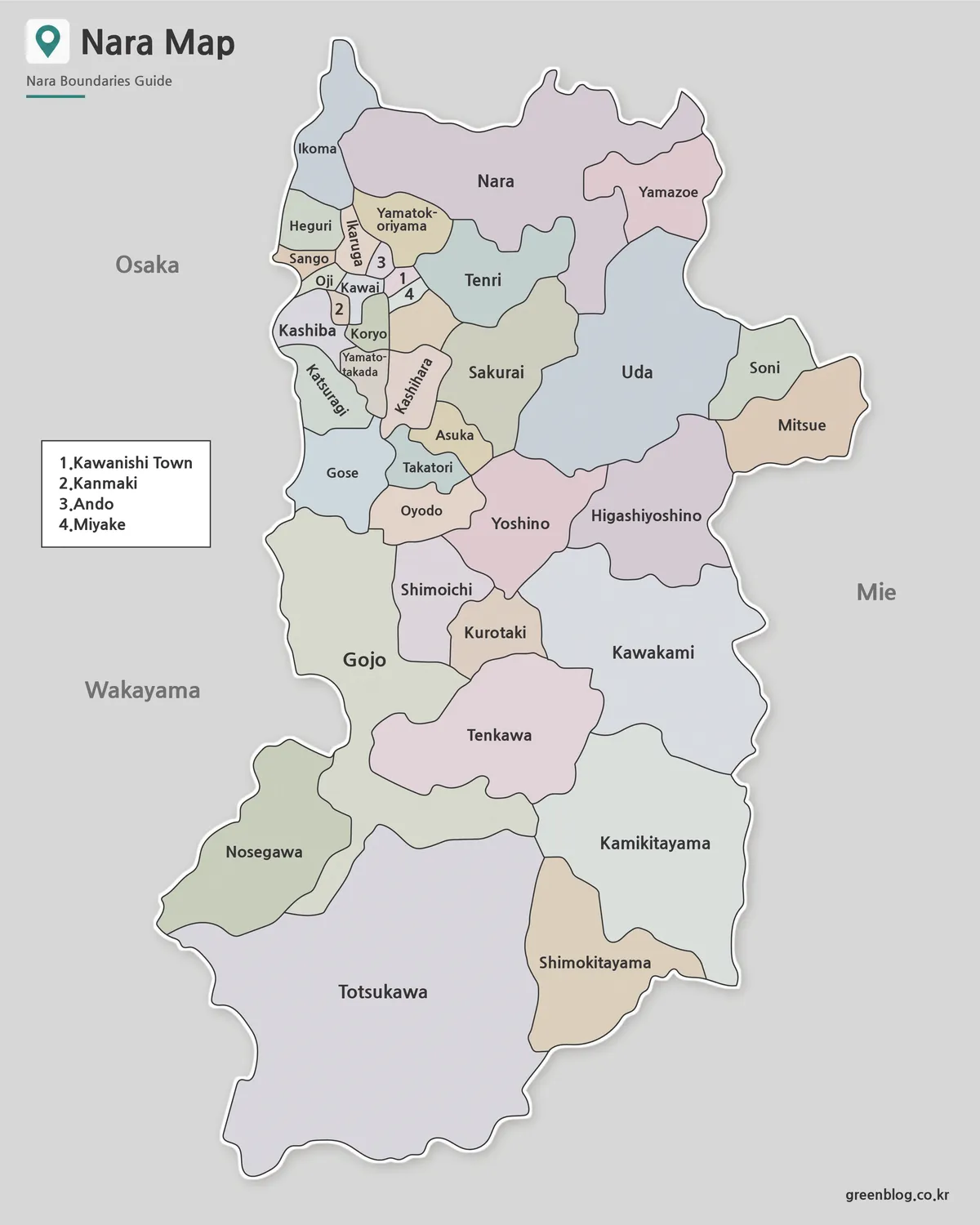
The color version separates municipal areas with different colors, making it easier to compare the northern city area with the wider southern mountain region. This version works well for regional comparison, presentation slides, blog graphics, and educational materials.
The color balance was adjusted so neighboring areas do not blend together too easily. This is especially useful around Nara City, Ikoma, Kashihara, and nearby municipalities where boundaries are relatively close.
Black and White Printable Map
The black and white Nara Prefecture map keeps the labels and boundary lines while removing strong color elements. This makes it a better choice for printed documents, reports, classroom handouts, and presentation pages where a cleaner layout is needed.
The line weight was adjusted for readability in grayscale printing. It is also useful when users want a labeled reference map without the visual weight of a full color design.
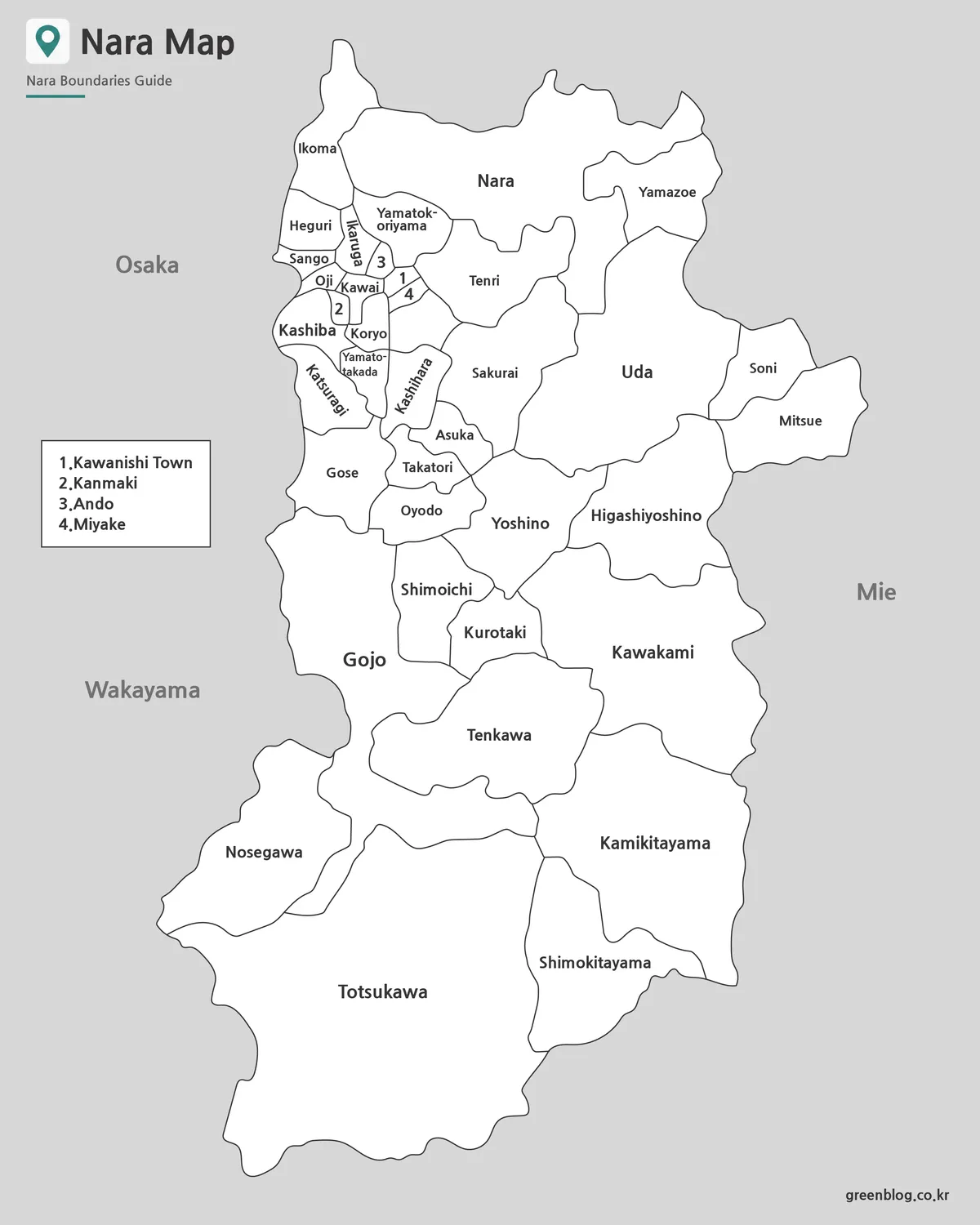
Blank Outline Map for Editing
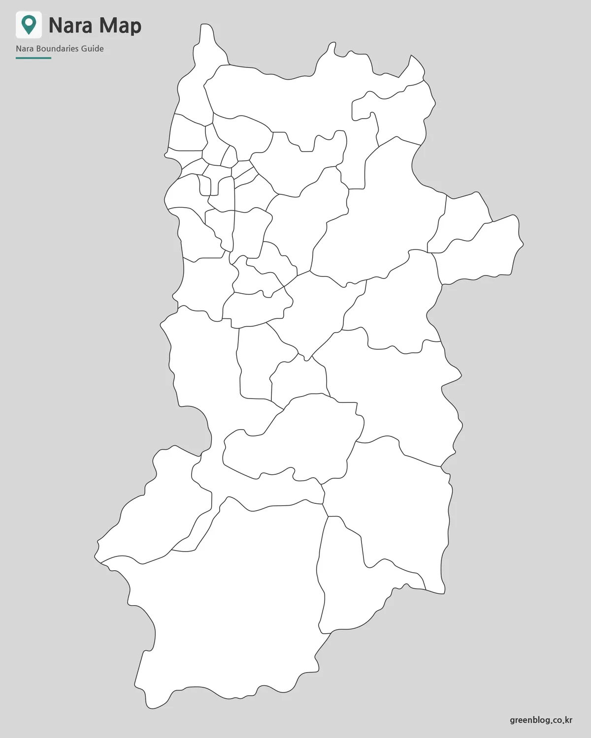
The outline version removes labels and colors, leaving only the boundary lines. This format is useful for graphic editing, worksheets, route marking, infographic projects, and custom map design.
Users can add tourist spots, population data, travel routes, transportation notes, or highlighted regions directly on top of the outline. Because the layout is simple, it works well as a background map for design projects and classroom activities.
Built for Printing and Presentation Use
The Nara Prefecture map files were prepared with practical use in mind. A map that looks fine on screen may become hard to read when printed, especially when many small municipal areas are close together. For this reason, the labels and boundary lines were checked at a large print size.
The map can be used for:
- Editable worksheet backgrounds
- Classroom handouts
- Japan geography lessons
- Travel route planning
- Blog and website graphics
- Regional comparison materials
- Presentation slides
- Infographic projects
Why This Map Is Useful
Nara has a clear contrast between its northern urban area and southern mountainous region. A single map makes that difference easier to understand. It also helps show how Nara connects with Kyoto, Osaka, Mie, and Wakayama.
For travel content, the map can support route planning around Nara City, Yoshino, Kashihara, and nearby cultural sites. For education, it provides a clean way to explain administrative divisions within a Japanese prefecture.
Frequently Asked Questions
Can I print the Nara Prefecture map?
Yes. The JPG files are designed for A3 high-resolution printing.
Which version is best for classroom use?
The black and white labeled map works well for handouts, while the outline map is better for worksheets.
Can I edit the outline map?
Yes. The blank outline version is suitable for adding labels, routes, colors, or custom data.
Does the map include municipal boundaries?
Yes. The Nara Prefecture map set includes administrative boundary lines.
Nara Prefecture Map Download
Choose the Nara Prefecture map version that fits your project. The collection includes color, black and white, and outline JPG maps for printing, classroom reference, presentations, and editing work.
- File Format: JPG
- Image Size: A3 high-resolution format
- Intended Use: Printing · Presentation · Classroom · Editing
Additional Resources
- Geospatial Information Authority of Japan – Useful for checking official Japanese map and geographic information resources.
Related Maps
- Okinawa Prefecture Map Free Download | Printable 3-Version Collection
- Bahrain Map Collection – Printable Color, Black and White, and Outline Maps
- Seoul Map Collection – Printable Color, Black and White, and Outline Maps
- 4 Japan Maps Download Collection for Print and Design
Green Map creates custom-edited map images using open geographic data sources such as geoBoundaries, Natural Earth, OpenStreetMap, and government open data.
These maps are edited visual materials, not raw data files, and are provided for education, documents, presentations, and graphic reference.