A Korean version of this map page is available. View Korean Page
A Shimane Prefecture map is often used for much more than locating a prefecture in western Japan. Teachers preparing geography lessons, students working on regional studies, bloggers creating travel content, and presentation designers frequently need a clear view of how municipalities are distributed across the prefecture. Shimane stretches across the Sea of Japan coastline and includes the remote Oki Islands, making its administrative layout more complex than many other Japanese prefectures.
Located in the western part of Honshu within the Chugoku region, Shimane borders Tottori Prefecture to the east, Hiroshima Prefecture to the south, and Yamaguchi Prefecture to the west. Major cities include Matsue, Izumo, Hamada, and Masuda. Although the population is relatively small at around 650,000 people, the prefecture covers a broad geographic area with coastal communities, mountain regions, and island settlements spread across different administrative districts.
This printable map collection was created to make those regional relationships easier to understand. The set includes a color administrative map, a labeled black and white map, and a blank outline map. All files are provided in high-resolution JPG format and prepared for A3-size printing. The collection works well for classroom handouts, travel presentations, regional comparison projects, blog graphics, and editable design materials.
While preparing the map, special attention was given to the Oki Islands and the long east-west layout of the prefecture. Municipal labels were reviewed at enlarged sizes to ensure readability, and boundary lines were adjusted to remain clear when printed. Because Shimane includes both mainland and island municipalities, balancing visual clarity across the entire prefecture required additional refinement during the design process.
Table of Contents
Map Collection Overview
The collection includes three different versions designed for different needs.
Included files:
- Color administrative map
- Black and white labeled map
- Blank outline map
- JPG format
- A3 high-resolution layout
- Printable and presentation-ready design
Each version focuses on a different type of use, from regional comparison and education to editing and graphic design projects.
Regional Color Map for Administrative Comparison
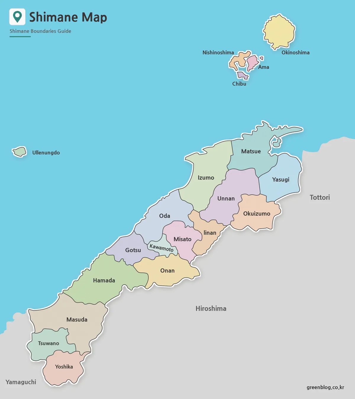
The color version highlights municipal boundaries using contrasting colors to improve visual separation between neighboring areas.
Shimane extends across a long coastal corridor, making regional comparison important when discussing local government divisions or population distribution. The color layout helps distinguish eastern, central, and western parts of the prefecture while keeping island municipalities visible and easy to identify.
During print review, additional adjustments were made to ensure that smaller towns and villages remained distinguishable even when viewed alongside larger municipalities.
Clean Labeled Version for Documents and Reports
The black and white map focuses on labels and administrative boundaries while removing most color elements.
Designed for reports, educational handouts, and presentation slides, this version provides a cleaner appearance without sacrificing geographic detail. Matsue, Izumo, Hamada, Masuda, Yasugi, Unnan, and other municipalities remain clearly labeled.
Several label positions were refined in areas where municipal boundaries are closely grouped. Readability was checked at larger print sizes to reduce overlap and improve clarity.
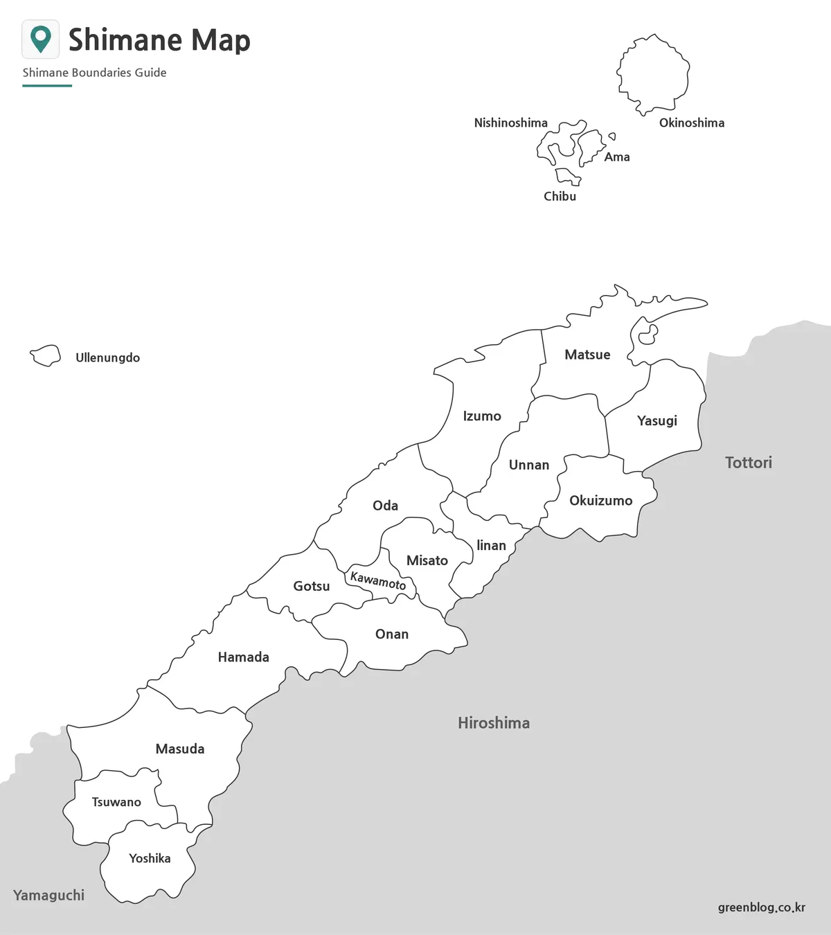
Outline Map Designed for Editing Projects
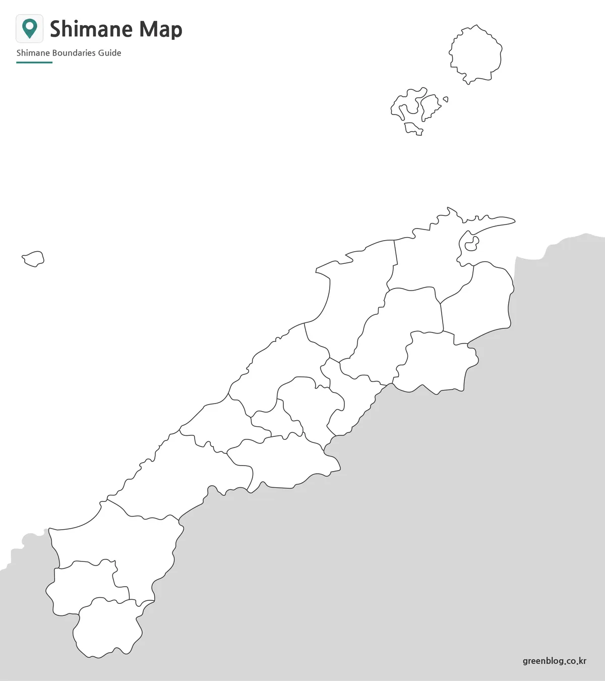
The outline version removes labels and colors, leaving only administrative boundary lines.
This format works particularly well for infographic design, custom regional analysis, educational worksheets, and tourism-related projects. Users can add routes, statistical information, highlighted districts, or custom annotations without visual distractions from existing labels.
Because Shimane includes both mainland and island regions, boundary lines were simplified where appropriate while preserving overall geographic accuracy. This approach makes the outline easier to modify in graphic editing software.
Why a Shimane Prefecture Map Can Be Useful
Shimane has several characteristics that make a dedicated map valuable.
- Explaining the Chugoku region
- Comparing municipal structures
- Classroom geography activities
- Travel route planning
- Regional research projects
- Blog and website graphics
- Educational worksheets
- Presentation materials
The inclusion of the Oki Islands makes the prefecture especially useful when discussing island-based municipalities and regional administrative layouts within Japan.
Frequently Asked Questions
Can I print the Shimane Prefecture map in A3 size?
Yes. The files were prepared in high resolution for A3 printing.
Does the Shimane Prefecture map include the Oki Islands?
Yes. Okinoshima, Nishinoshima, Ama, and Chibu are included.
Which version is best for editing?
The outline map is the best choice for graphic editing, annotations, and custom projects.
Is the labeled version suitable for classroom use?
Yes. The black and white map was designed with educational printing and document use in mind.
Shimane Prefecture Map Download
Choose the version that fits your project. The collection includes color, labeled, and outline maps prepared for printing, presentations, and editing work.
- File Format: JPG
- Image Size: A3 High Resolution
- Usage: Printing · Education · Presentation · Editing
Additional Resources
- Geospatial Information Authority of Japan (GSI) — Official Japanese mapping and geographic information service.
Related Maps
- Printable Nara Prefecture Map Collection for Education and Design
- Okinawa Prefecture Map Free Download | Printable 3-Version Collection
- Bahrain Map Collection – Printable Color, Black and White, and Outline Maps
- Printable Kyrgyzstan Map Resource for Education, Travel, and Design
Green Map creates custom-edited map images using open geographic data sources such as geoBoundaries, Natural Earth, OpenStreetMap, and government open data.
These maps are edited visual materials, not raw data files, and are provided for education, documents, presentations, and graphic reference.