A Korean version of this map page is available. View Korean Page
An Aomori Prefecture Map is useful for much more than locating Japan’s northernmost prefecture on Honshu. Because Aomori contains multiple peninsulas, extensive coastlines, and a wide distribution of cities, towns, and villages, maps are frequently used in regional studies, classroom projects, travel planning materials, and presentation slides. Understanding the relationship between the Tsugaru, Nanbu, and Shimokita regions often becomes much easier when administrative boundaries can be viewed clearly.
Located at the northern end of Japan’s Tohoku region, Aomori Prefecture covers approximately 9,645 square kilometers and has a population of around 1.18 million people. The prefectural capital is Aomori City, while Hirosaki, Hachinohe, Mutsu, and Goshogawara serve as important regional centers. To the north lies the Tsugaru Strait and Hokkaido, while both the Pacific Ocean and the Sea of Japan influence the prefecture’s long coastline and distinct local communities.
This Aomori Prefecture Map collection was created with practical use in mind. The set includes three different map styles: a color administrative map, a labeled black and white version, and a blank outline map. Each version was prepared in high resolution for printing, presentations, educational materials, infographic design, and graphic editing projects. Municipal boundaries were reviewed carefully, especially around the Shimokita Peninsula and Tsugaru Peninsula, where coastline and boundary layouts are more complex.
Table of Contents
Included in This Collection
- Suitable for editing and presentation use
- Color administrative map
- Labeled black and white map
- Blank outline map
- High-resolution printable format
- Municipal boundary coverage
- A3 printing support
Understanding the Regional Layout of Aomori
Aomori Prefecture borders Akita Prefecture and Iwate Prefecture to the south and is divided into several distinct regional areas. Tsugaru occupies the western side, Nanbu covers much of the southeast, and Shimokita extends northward into a large peninsula.
Major municipalities included on the map include Aomori City, Hirosaki City, Hachinohe City, Mutsu City, Goshogawara City, Nakadomari, Ajigasawa, Oirase, and many other towns and villages. Extra attention was given to the placement of labels so that densely grouped municipalities remain readable when enlarged.
Color Administrative Version
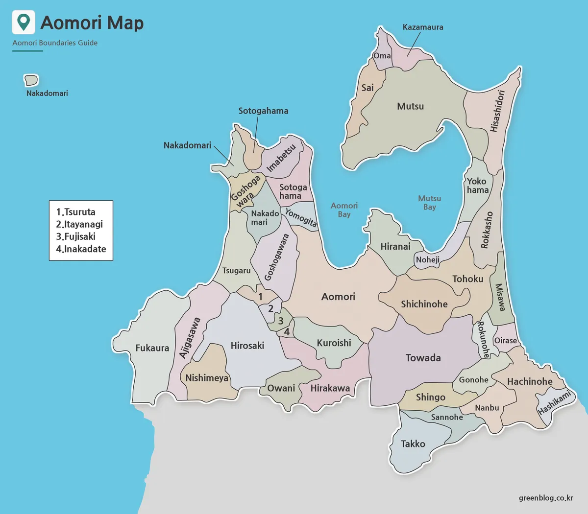
The color version of the Aomori Prefecture Map separates municipalities using contrasting colors to improve visual recognition.
This style works particularly well for regional comparison projects, classroom presentations, travel planning materials, and local government reference documents. Small municipalities were reviewed individually to ensure they remain visible even when neighboring regions occupy larger geographic areas.
During the preparation process, coastline sections around the Tsugaru and Shimokita peninsulas were checked repeatedly to maintain clear municipal separation when printed in A3 format.
Black and White Printable Version
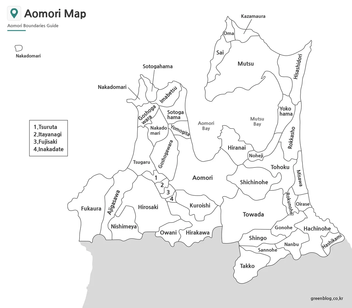
The labeled black and white Aomori Prefecture Map focuses on place names and administrative boundaries without color distractions.
This version is often preferred for reports, educational worksheets, printed handouts, and research documents. Labels remain readable when enlarged, and the simplified layout leaves additional space for notes, annotations, charts, and supporting graphics.
Municipal names were repositioned in several locations to improve readability in areas where boundaries are tightly clustered.
Blank Outline Map for Editing
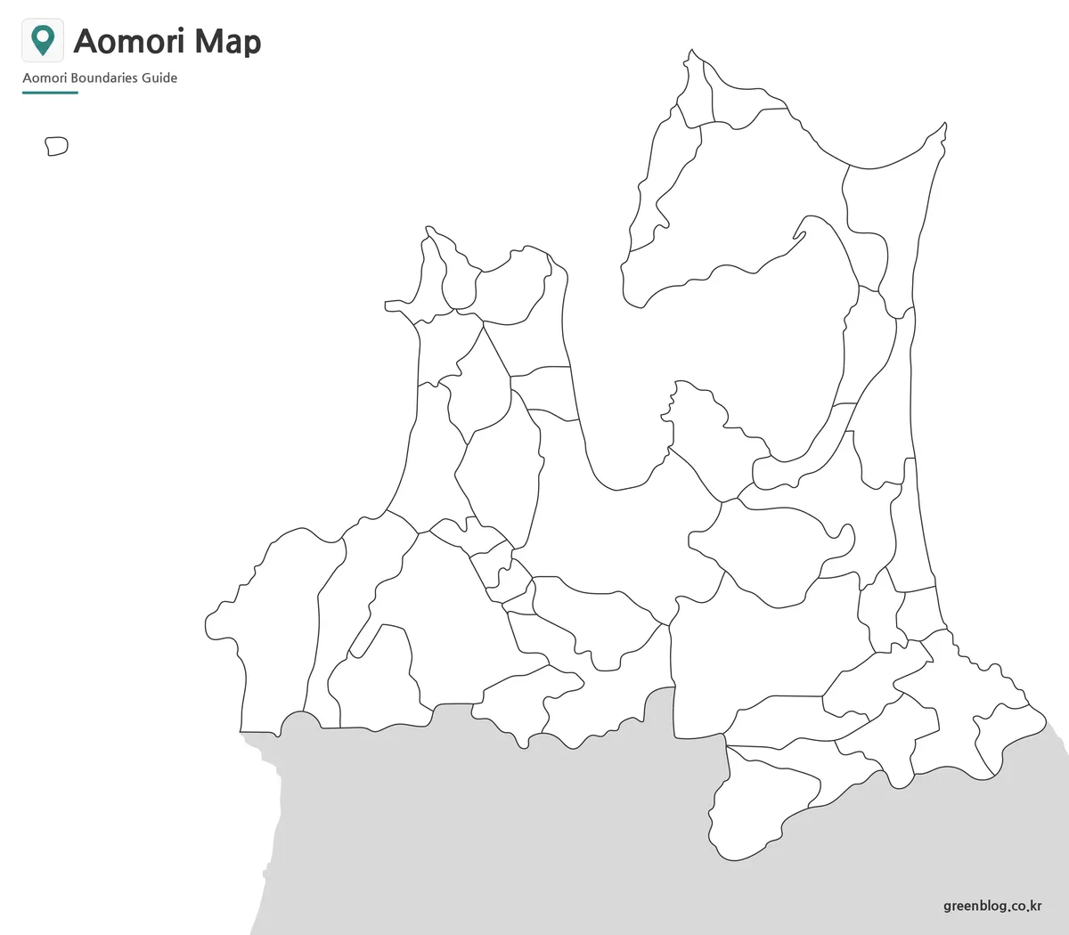
The outline version removes both colors and labels while preserving municipal boundary lines.
Many users choose this format when creating tourism maps, population studies, transportation diagrams, election maps, or infographic projects. The clean structure makes it easier to add custom information without needing to remove existing labels or design elements.
Boundary lines were reviewed at larger viewing sizes to reduce overlap and maintain clarity throughout the prefecture.
Designed for Practical Projects
An Aomori Prefecture Map is commonly used for:
- Classroom handouts
- Educational worksheets
- Travel planning presentations
- Municipal comparison studies
- Blog graphics
- Infographic design
- Regional analysis projects
- Video production reference materials
Because Aomori contains multiple peninsulas and a highly varied coastline, administrative maps often provide a clearer understanding of the region than simple location maps alone.
Frequently Asked Questions
Does the Aomori Prefecture Map include municipal boundaries?
Yes. Cities, towns, and villages are included throughout the collection.
Which version is best for editing?
The outline map is the most flexible option for graphic editing, custom labeling, and infographic projects.
Can the maps be printed in large format?
Yes. The files were prepared in high resolution and reviewed for A3 printing.
Aomori Prefecture Map Download
Choose the version that best fits your project. Color, labeled, and outline maps are included in the collection.
- File Format: JPG / ZIP
- Image Size: High Resolution
- Intended Use: Printing, Presentation, Editing
- Coverage: Municipal Boundaries
Additional Resources
- Geospatial Information Authority of Japan (GSI) — Official Japanese mapping agency providing geographic data, topographic maps, and administrative boundary information.
Related Maps
- Nagano Prefecture Map | Printable Administrative Map Collection
- Free Shimane Prefecture Map for Presentations and Classroom Use
- Printable Nara Prefecture Map Collection for Education and Design
- Okinawa Prefecture Map Free Download | Printable 3-Version Collection
Green Map creates custom-edited map images using open geographic data sources such as geoBoundaries, Natural Earth, OpenStreetMap, and government open data.
These maps are edited visual materials, not raw data files, and are provided for education, documents, presentations, and graphic reference.